43:
404:
337:
287:
329:
279:
351:
301:
372:
410:
415:
103:
880:"}},"text\/plain":{"en":{"":"heading"}}},"{\"value\":{\"amount\":\"+112\",\"unit\":\"http:\\\/\\\/www.wikidata.org\\\/entity\\\/Q28390\"},\"type\":\"quantity\"}":{"text\/html":{"en":{"P7787":"112
816:"}},"text\/plain":{"en":{"":"heading"}}},"{\"value\":{\"amount\":\"+112\",\"unit\":\"http:\\\/\\\/www.wikidata.org\\\/entity\\\/Q28390\"},\"type\":\"quantity\"}":{"text\/html":{"en":{"P7787":"112
1194:
812:
270:
69:
65:
61:
57:
53:
47:
462:– You must give appropriate credit, provide a link to the license, and indicate if changes were made. You may do so in any reasonable manner, but not in any way that suggests the licensor endorses you or your use.
82:
114:
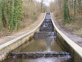
1211:== {{int:filedesc}} == {{Information |Description={{en|1=Water feature, Gnoll Park, Neath, near to Tonna, Neath Port Talbot/Castell-Nedd Port Talbot, Great Britain. }} |Source=From ; transferred by
1230:
877:
813:
181:
207:
1193:
1188:
73:
42:
714:
678:
642:
344:
294:
764:
1398:
379:
1261:
This file contains additional information, probably added from the digital camera or scanner used to create or digitize it.
1139:
469:
1248:
1204:
577:
1089:
1055:
1018:
984:
947:
918:
891:
854:
827:
727:
698:
626:
600:
585:
570:
785:
757:
742:
662:
543:
526:
1123:
366:
425:
1264:
If the file has been modified from its original state, some details may not fully reflect the modified file.
1221:
The following pages on the
English Knowledge (XXG) use this file (pages on other projects are not listed):
1451:
468:– If you remix, transform, or build upon the material, you must distribute your contributions under the
386:
on the
Geograph website for the photographer's contact details. The copyright on this image is owned by
422:
884:"}},"text\/plain":{"en":{"P7787":"112 degree"}}}}": -->
820:"}},"text\/plain":{"en":{"P7787":"112 degree"}}}}": -->
1487:
1367:
1283:
1225:
122:
239:
749:
734:
592:
223:
350:
300:
1555:
1469:
1425:
1290:
391:
109:
157:
Water feature, Gnoll Park, Neath, Neath Port Talbot/Castell-Nedd Port Talbot, Wales.
1330:
284:
1497:
166:
1310:
334:
177:
196:
1573:
1300:
1273:
371:
383:
1161:
Click on a date/time to view the file as it appeared at that time.
336:
286:
147:
Water feature, Gnoll Park, Neath - geograph.org.uk - 1744532.jpg
271:
51° 39′ 40.38″ N, 3° 47′ 16.59″ W
185:
311:
261:
97:
1231:
Registered historic parks and gardens in Neath Port Talbot
321:
51° 39′ 39″ N, 3° 47′ 11″ W
510:
Add a one-line explanation of what this file represents
87:(3,072 × 2,304 pixels, file size: 763 KB, MIME type:
214:
Creative
Commons Attribution Share-alike license 2.0
141:
121:
Commons is a freely licensed media file repository.
679:
Creative
Commons Attribution-ShareAlike 2.0 Generic
1492:Flash did not fire, compulsory flash suppression
479:https://creativecommons.org/licenses/by-sa/2.0
102:
485:Creative Commons Attribution-Share Alike 2.0
403:
8:
881:
817:
445:– to copy, distribute and transmit the work
1266:
1163:
506:
1241:The following other wikis use this file:
750:https://www.geograph.org.uk/photo/1744532
593:https://www.geograph.org.uk/profile/2455
1581:
1571:
1563:
1553:
1545:
1537:
1529:
1521:
1513:
1505:
1495:
1485:
1477:
1467:
1459:
1449:
1441:
1433:
1423:
1415:
1407:
1396:
1388:
1380:
1372:
1362:
1354:
1346:
1338:
1327:
1319:
1308:
1298:
1288:
1278:
1223:
1137:
1121:
1103:
1087:
1069:
1053:
1032:
1016:
998:
982:
961:
945:
905:
889:
841:
825:
799:
783:
712:
696:
676:
660:
640:
624:
557:
541:
524:
521:
502:
495:
314:
264:
343:View this and other nearby images on:
293:View this and other nearby images on:
1268:
7:
390:and is licensed for reuse under the
1152:
426:Attribution-Share Alike 2.0 Generic
414:
409:
394:Attribution-ShareAlike 2.0 license.
1259:
515:
509:
400:
377:
151:
134:
80:
514:
1321:Date and time of data generation
828:coordinates of the point of view
500:
456:Under the following conditions:
421:This file is licensed under the
413:
408:
402:
370:
349:
335:
327:
299:
285:
277:
254:Water feature, Gnoll Park, Neath
235:Water feature, Gnoll Park, Neath
101:
31:
21:
1206:File Upload Bot (Magnus Manske)
497:
152:
14:
715:file available on the internet
496:
378:This image was taken from the
26:
1:
892:coordinates of depicted place
843:51°39'40.378"N, 3°47'16.595"W
36:
1295:1/60 sec (0.016666666666667)
765:Geograph Britain and Ireland
571:object of statement has role
522:Items portrayed in this file
326:
276:
1523:Focal plane resolution unit
1409:Date and time of digitizing
907:51°39'38.70"N, 3°47'10.68"W
1603:
1534:One-chip color area sensor
1245:Usage on he.wikipedia.org
470:same or compatible license
1374:File change date and time
1153:
16:
1515:Focal plane Y resolution
1507:Focal plane X resolution
728:geograph.org.uk image ID
499:
436:
252:David Lewis /
233:David Lewis /
108:This is a file from the
1539:Custom image processing
1210:
963:0.01666666666666666666
224:required by the license
202:
192:
172:
165:
162:
144:
112:. Information from its
1583:Subject distance range
1417:Image compression mode
384:this photograph's page
355:51.660750; -3.786300
305:51.661216; -3.787943
115:description page there
46:Size of this preview:
1461:Maximum land aperture
1348:Horizontal resolution
1249:נית' פורט טלבוט
186:geograph_org2commons
74:3,072 × 2,304 pixels
70:2,560 × 1,920 pixels
1412:16:01, 9 March 2010
1382:Y and C positioning
1377:16:52, 9 March 2010
1368:Adobe Photoshop 7.0
1356:Vertical resolution
1324:16:01, 9 March 2010
1270:Camera manufacturer
1189:20:55, 15 July 2010
451:– to adapt the work
52:Other resolutions:
1565:Scene capture type
1560:Auto white balance
1284:FinePix S5700 S700
1226:Gnoll Country Park
601:author name string
182:User:Westwalespics
66:1,280 × 960 pixels
62:1,024 × 768 pixels
1590:
1589:
1464:3.6 APEX (f/3.48)
1237:Global file usage
1214:
883:
819:
663:copyright license
508:
399:
398:
382:collection. See
360:
359:
310:
309:
259:
258:
227:
211:
208:Reusing this file
180:; transferred by
130:
129:
110:Wikimedia Commons
32:Global file usage
1594:
1390:Exposure Program
1267:
1201:
1037:
966:
929:
928:
923:
865:
864:
859:
767:
762:
752:
747:
743:described at URL
737:
732:
627:copyright status
608:
605:
595:
590:
580:
575:
492:
489:
486:
483:
480:
472:as the original.
434:
423:Creative Commons
417:
416:
412:
411:
406:
405:
392:Creative Commons
380:Geograph project
374:
367:
356:
353:
339:
338:
332:
331:
330:
324:
323:
312:
306:
303:
289:
288:
282:
281:
280:
274:
273:
262:
221:
205:
168:
156:
148:
142:
126:
105:
104:
98:
92:
90:
77:
58:640 × 480 pixels
54:320 × 240 pixels
48:800 × 600 pixels
1602:
1601:
1597:
1596:
1595:
1593:
1592:
1591:
1443:APEX brightness
1255:
1235:
1222:
1215:
1207:
1199:
1155:
1154:
1151:
1150:
1149:
1148:
1147:
1146:
1145:
1144:
1142:
1130:
1129:
1128:
1126:
1115:
1114:
1113:
1112:
1111:
1110:
1109:
1108:
1106:
1096:
1095:
1094:
1092:
1081:
1080:
1079:
1078:
1077:
1076:
1075:
1074:
1072:
1062:
1061:
1060:
1058:
1047:
1046:
1045:
1044:
1043:
1042:
1041:
1040:
1038:
1035:
1025:
1024:
1023:
1021:
1010:
1009:
1008:
1007:
1006:
1005:
1004:
1003:
1001:
991:
990:
989:
987:
976:
975:
974:
973:
972:
971:
970:
969:
967:
964:
954:
953:
952:
950:
939:
938:
937:
936:
935:
934:
933:
932:
931:
930:
926:
924:
921:
912:
911:
910:
908:
898:
897:
896:
894:
875:
874:
873:
872:
871:
870:
869:
868:
867:
866:
862:
860:
857:
848:
847:
846:
844:
834:
833:
832:
830:
811:
810:
809:
808:
807:
806:
805:
804:
802:
792:
791:
790:
788:
777:
776:
775:
774:
773:
772:
771:
770:
769:
768:
763:
760:
754:
753:
748:
745:
739:
738:
733:
730:
721:
720:
719:
717:
705:
704:
703:
701:
690:
689:
688:
687:
686:
685:
684:
683:
681:
669:
668:
667:
665:
654:
653:
652:
651:
650:
649:
648:
647:
645:
633:
632:
631:
629:
618:
617:
616:
615:
614:
613:
612:
611:
610:
609:
606:
603:
597:
596:
591:
588:
582:
581:
576:
573:
564:
563:
562:
560:
550:
549:
548:
546:
535:
534:
533:
532:
531:
529:
513:
512:
511:
494:
493:
490:
487:
484:
481:
478:
477:
435:
432:
429:
418:
395:
365:
354:
328:
319:
318:
315:Object location
304:
278:
269:
268:
265:Camera location
260:
249:
242:
230:
178:geograph.org.uk
158:
146:
139:
132:
131:
120:
119:
118:is shown below.
94:
88:
86:
79:
78:
51:
12:
11:
5:
1600:
1598:
1588:
1587:
1584:
1580:
1579:
1576:
1570:
1569:
1566:
1562:
1561:
1558:
1552:
1551:
1548:
1544:
1543:
1542:Normal process
1540:
1536:
1535:
1532:
1531:Sensing method
1528:
1527:
1524:
1520:
1519:
1516:
1512:
1511:
1508:
1504:
1503:
1500:
1494:
1493:
1490:
1484:
1483:
1480:
1476:
1475:
1472:
1466:
1465:
1462:
1458:
1457:
1454:
1448:
1447:
1444:
1440:
1439:
1436:
1432:
1431:
1428:
1422:
1421:
1418:
1414:
1413:
1410:
1406:
1405:
1402:
1395:
1394:
1393:Normal program
1391:
1387:
1386:
1383:
1379:
1378:
1375:
1371:
1370:
1365:
1361:
1360:
1357:
1353:
1352:
1349:
1345:
1344:
1341:
1337:
1336:
1333:
1326:
1325:
1322:
1318:
1317:
1314:
1307:
1306:
1303:
1297:
1296:
1293:
1287:
1286:
1281:
1277:
1276:
1271:
1258:
1254:
1253:
1252:
1251:
1239:
1238:
1234:
1233:
1228:
1220:
1219:
1218:
1213:
1212:
1209:
1205:
1202:
1198:3,072 × 2,304
1196:
1191:
1186:
1182:
1181:
1178:
1175:
1172:
1169:
1166:
1159:
1158:
1143:
1138:
1136:
1135:
1134:
1133:
1132:
1131:
1127:
1122:
1120:
1119:
1118:
1117:
1116:
1107:
1104:
1102:
1101:
1100:
1099:
1098:
1097:
1093:
1088:
1086:
1085:
1084:
1083:
1082:
1073:
1070:
1068:
1067:
1066:
1065:
1064:
1063:
1059:
1054:
1052:
1051:
1050:
1049:
1048:
1039:
1033:
1031:
1030:
1029:
1028:
1027:
1026:
1022:
1017:
1015:
1014:
1013:
1012:
1011:
1002:
999:
997:
996:
995:
994:
993:
992:
988:
983:
981:
980:
979:
978:
977:
968:
962:
960:
959:
958:
957:
956:
955:
951:
946:
944:
943:
942:
941:
940:
917:
916:
915:
914:
913:
909:
906:
904:
903:
902:
901:
900:
899:
895:
890:
888:
887:
886:
885:
879:
853:
852:
851:
850:
849:
845:
842:
840:
839:
838:
837:
836:
835:
831:
826:
824:
823:
822:
821:
815:
803:
800:
798:
797:
796:
795:
794:
793:
789:
784:
782:
781:
780:
779:
778:
756:
755:
741:
740:
726:
725:
724:
723:
722:
718:
713:
711:
710:
709:
708:
707:
706:
702:
699:source of file
697:
695:
694:
693:
692:
691:
682:
677:
675:
674:
673:
672:
671:
670:
666:
661:
659:
658:
657:
656:
655:
646:
641:
639:
638:
637:
636:
635:
634:
630:
625:
623:
622:
621:
620:
619:
599:
598:
584:
583:
569:
568:
567:
566:
565:
561:
558:
556:
555:
554:
553:
552:
551:
547:
542:
540:
539:
538:
537:
536:
530:
525:
523:
520:
519:
518:
517:
516:
505:
504:
501:
498:
476:
475:
474:
473:
463:
454:
453:
452:
446:
439:You are free:
430:
420:
419:
401:
397:
396:
375:
364:
361:
358:
357:
347:
341:
316:
308:
307:
297:
291:
266:
257:
256:
250:
247:
244:
243:
238:
231:
228:
216:
215:
212:
200:
199:
194:
190:
189:
174:
170:
169:
164:
160:
159:
149:
140:
138:
135:
133:
128:
127:
106:
96:
95:
45:
41:
40:
39:
34:
29:
24:
19:
13:
10:
9:
6:
4:
3:
2:
1599:
1585:
1582:
1577:
1575:
1572:
1567:
1564:
1559:
1557:
1556:White balance
1554:
1550:Auto exposure
1549:
1547:Exposure mode
1546:
1541:
1538:
1533:
1530:
1525:
1522:
1517:
1514:
1509:
1506:
1501:
1499:
1496:
1491:
1489:
1486:
1481:
1478:
1473:
1471:
1470:Metering mode
1468:
1463:
1460:
1455:
1453:
1452:Exposure bias
1450:
1445:
1442:
1437:
1435:APEX aperture
1434:
1429:
1427:
1426:Shutter speed
1424:
1419:
1416:
1411:
1408:
1403:
1400:
1397:
1392:
1389:
1384:
1381:
1376:
1373:
1369:
1366:
1364:Software used
1363:
1358:
1355:
1350:
1347:
1342:
1339:
1334:
1332:
1328:
1323:
1320:
1315:
1312:
1309:
1304:
1302:
1299:
1294:
1292:
1291:Exposure time
1289:
1285:
1282:
1279:
1275:
1272:
1269:
1265:
1262:
1256:
1250:
1247:
1246:
1244:
1243:
1242:
1236:
1232:
1229:
1227:
1224:
1216:
1208:
1203:
1197:
1195:
1192:
1190:
1187:
1184:
1183:
1179:
1176:
1173:
1170:
1167:
1165:
1164:
1162:
1156:
1141:
1125:
1091:
1057:
1020:
986:
949:
948:exposure time
920:
893:
856:
829:
787:
766:
759:
751:
744:
736:
729:
716:
700:
680:
664:
644:
628:
602:
594:
587:
579:
572:
545:
528:
482:CC BY-SA 2.0
471:
467:
464:
461:
458:
457:
455:
450:
447:
444:
441:
440:
438:
437:
431:Attribution:
427:
424:
407:
393:
389:
385:
381:
376:
373:
369:
368:
362:
352:
348:
346:
345:OpenStreetMap
342:
340:
322:
317:
313:
302:
298:
296:
295:OpenStreetMap
292:
290:
272:
267:
263:
255:
251:
246:
245:
241:
237: /
236:
232:
225:
220:
218:
217:
213:
209:
204:
201:
198:
195:
191:
187:
183:
179:
175:
171:
161:
155:
150:
143:
136:
124:
117:
116:
111:
107:
100:
99:
93:
84:
83:Original file
75:
71:
67:
63:
59:
55:
49:
44:
38:
35:
33:
30:
28:
25:
23:
20:
18:
15:
1479:Light source
1331:focal length
1280:Camera model
1263:
1260:
1240:
1160:
1157:File history
1019:focal length
801:9 March 2010
578:photographer
465:
459:
448:
442:
387:
325:
275:
253:
240:CC BY-SA 2.0
234:
167:9 March 2010
153:
123:You can help
113:
81:
22:File history
1498:Color space
1340:Orientation
1124:instance of
643:copyrighted
607:David Lewis
466:share alike
460:attribution
433:David Lewis
388:David Lewis
219:Attribution
197:David Lewis
145:Description
1217:File usage
1174:Dimensions
1140:photograph
1105:image/jpeg
1090:media type
1036:millimetre
559:some value
203:Permission
89:image/jpeg
27:File usage
1574:Sharpness
1311:ISO speed
1171:Thumbnail
1168:Date/Time
1056:ISO speed
786:inception
363:Licensing
248:InfoField
229:InfoField
154:English:
1568:Standard
1385:Co-sited
1301:F-number
1274:FUJIFILM
1257:Metadata
1200:(763 KB)
985:f-number
758:operator
503:Captions
449:to remix
443:to share
428:license.
37:Metadata
1586:Unknown
1482:Unknown
1474:Pattern
1401:version
1185:current
1180:Comment
919:heading
878:heading
855:heading
814:heading
735:1744532
544:creator
527:depicts
507:English
137:Summary
85:
1578:Normal
1359:72 dpi
1351:72 dpi
1343:Normal
1335:8.5 mm
1313:rating
965:second
927:degree
882:degree
863:degree
818:degree
333:
283:
193:Author
184:using
173:Source
1518:5,376
1510:5,376
1488:Flash
1329:Lens
1305:f/3.5
176:From
1502:sRGB
1399:Exif
1177:User
1034:8.5
925:112
861:112
491:true
488:true
163:Date
17:File
1446:4.6
1438:3.6
1404:2.2
1316:100
1071:100
1000:3.5
586:URL
922::
858::
761::
746::
731::
604::
589::
574::
72:|
68:|
64:|
60:|
56:|
50:.
1526:3
1456:0
1430:6
1420:2
226:)
222:(
210:)
206:(
188:.
125:.
91:)
76:.
Text is available under the Creative Commons Attribution-ShareAlike License. Additional terms may apply.

_region:GB-ENG_heading:112.00&language=en)