295:
228:
220:
242:
263:
301:
306:
62:
537:"}},"text\/plain":{"en":{"":"heading"}}},"{\"value\":{\"amount\":\"+180\",\"unit\":\"http:\\\/\\\/www.wikidata.org\\\/entity\\\/Q28390\"},\"type\":\"quantity\"}":{"text\/html":{"en":{"P7787":"180
533:
690:{{Information |Description={{en|1=Aer Arran ATR 72-201 boarding at Waterford Airport for flight to London Luton}} |Source=http://www.geograph.org.uk/photo/1444480 |Author=Tom Nolan |Date=Sunday, 16 August, 2009 |Permission= |other_versions= }}
33:
211:
353:– You must give appropriate credit, provide a link to the license, and indicate if changes were made. You may do so in any reasonable manner, but not in any way that suggests the licensor endorses you or your use.
534:
73:
41:
486:
450:
235:
270:
360:
604:
575:
548:
434:
506:
470:
417:
257:
672:
667:
32:
316:
709:
700:
The following pages on the
English Knowledge (XXG) use this file (pages on other projects are not listed):
359:– If you remix, transform, or build upon the material, you must distribute your contributions under the
277:
on the
Geograph website for the photographer's contact details. The copyright on this image is owned by
313:
541:"}},"text\/plain":{"en":{"P7787":"180 degree"}}}}": -->
704:
81:
180:
116:
164:
241:
683:
282:
68:
225:
132:
262:
143:
120:
274:
153:
640:
Click on a date/time to view the file as it appeared at that time.
227:
212:
52° 11′ 16.06″ N, 7° 04′ 37.38″ W
202:
56:
401:
Add a one-line explanation of what this file represents
100:
80:
Commons is a freely licensed media file repository.
487:
Creative
Commons Attribution-ShareAlike 2.0 Generic
46:(640 × 480 pixels, file size: 79 KB, MIME type:
370:https://creativecommons.org/licenses/by-sa/2.0
61:
376:Creative Commons Attribution-Share Alike 2.0
294:
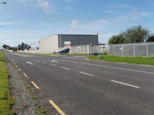
106:Waterford Airport entrance at Ballygarran.jpg
42:Waterford_Airport_entrance_at_Ballygarran.jpg
8:
538:
336:– to copy, distribute and transmit the work
642:
397:
195:Waterford Airport entrance at Ballygarran
176:Waterford Airport entrance at Ballygarran
702:
618:
602:
562:
546:
520:
504:
484:
468:
448:
432:
415:
412:
393:
386:
205:
234:View this and other nearby images on:
7:
281:and is licensed for reuse under the
631:
317:Attribution-Share Alike 2.0 Generic
305:
300:
285:Attribution-ShareAlike 2.0 license.
406:
400:
291:
268:
110:
93:
39:
405:
549:coordinates of the point of view
391:
347:Under the following conditions:
312:This file is licensed under the
304:
299:
293:
261:
240:
226:
218:
60:
21:
388:
111:
36:No higher resolution available.
14:
387:
269:This image was taken from the
26:
1:
564:52°11'16.058"N, 7°4'37.376"W
413:Items portrayed in this file
217:
726:
361:same or compatible license
193:David Hawgood /
174:David Hawgood /
632:
119:entrance at Ballygarran,
16:
390:
327:
67:This is a file from the
689:
165:required by the license
149:
138:
131:
128:
103:
71:. Information from its
710:Transport in Waterford
275:this photograph's page
246:52.187794; -7.077049
74:description page there
705:R708 road (Ireland)
342:– to adapt the work
693:
668:10:07, 2 May 2010
540:
471:copyright license
399:
290:
289:
273:collection. See
251:
250:
200:
199:
168:
117:Waterford Airport
89:
88:
69:Wikimedia Commons
717:
680:
586:
585:
580:
435:copyright status
383:
380:
377:
374:
371:
363:as the original.
325:
314:Creative Commons
308:
307:
303:
302:
297:
296:
283:Creative Commons
271:Geograph project
265:
258:
247:
244:
230:
229:
223:
222:
221:
215:
214:
203:
162:
134:
115:
107:
101:
85:
64:
63:
57:
51:
49:
725:
724:
720:
719:
718:
716:
715:
714:
701:
694:
686:
678:
634:
633:
630:
629:
628:
627:
626:
625:
624:
623:
621:
611:
610:
609:
607:
596:
595:
594:
593:
592:
591:
590:
589:
588:
587:
583:
581:
578:
569:
568:
567:
565:
555:
554:
553:
551:
532:
531:
530:
529:
528:
527:
526:
525:
523:
513:
512:
511:
509:
498:
497:
496:
495:
494:
493:
492:
491:
489:
477:
476:
475:
473:
462:
461:
460:
459:
458:
457:
456:
455:
453:
441:
440:
439:
437:
426:
425:
424:
423:
422:
420:
404:
403:
402:
385:
384:
381:
378:
375:
372:
369:
368:
326:
323:
320:
309:
286:
256:
245:
219:
210:
209:
206:Camera location
201:
190:
183:
171:
144:geograph.org.uk
124:
105:
98:
91:
90:
79:
78:
77:is shown below.
53:
47:
45:
38:
37:
12:
11:
5:
723:
721:
713:
712:
707:
699:
698:
697:
692:
691:
688:
684:
681:
675:
670:
665:
661:
660:
657:
654:
651:
648:
645:
638:
637:
622:
619:
617:
616:
615:
614:
613:
612:
608:
603:
601:
600:
599:
598:
597:
574:
573:
572:
571:
570:
566:
563:
561:
560:
559:
558:
557:
556:
552:
547:
545:
544:
543:
542:
536:
524:
522:22 August 2009
521:
519:
518:
517:
516:
515:
514:
510:
505:
503:
502:
501:
500:
499:
490:
485:
483:
482:
481:
480:
479:
478:
474:
469:
467:
466:
465:
464:
463:
454:
449:
447:
446:
445:
444:
443:
442:
438:
433:
431:
430:
429:
428:
427:
421:
416:
414:
411:
410:
409:
408:
407:
396:
395:
392:
389:
367:
366:
365:
364:
354:
345:
344:
343:
337:
330:You are free:
321:
311:
310:
292:
288:
287:
266:
255:
252:
249:
248:
238:
232:
207:
198:
197:
191:
188:
185:
184:
179:
172:
169:
157:
156:
151:
147:
146:
140:
136:
135:
133:22 August 2009
130:
126:
125:
108:
99:
97:
94:
92:
87:
86:
65:
55:
54:
35:
31:
30:
29:
24:
19:
13:
10:
9:
6:
4:
3:
2:
722:
711:
708:
706:
703:
695:
687:
682:
676:
674:
671:
669:
666:
663:
662:
658:
655:
652:
649:
646:
644:
643:
641:
635:
606:
577:
550:
508:
488:
472:
452:
436:
419:
373:CC BY-SA 2.0
362:
358:
355:
352:
349:
348:
346:
341:
338:
335:
332:
331:
329:
328:
324:David Hawgood
322:Attribution:
318:
315:
298:
284:
280:
279:David Hawgood
276:
272:
267:
264:
260:
259:
253:
243:
239:
237:
236:OpenStreetMap
233:
231:
213:
208:
204:
196:
192:
187:
186:
182:
178: /
177:
173:
166:
161:
159:
158:
155:
154:David Hawgood
152:
148:
145:
141:
137:
127:
122:
118:
114:
109:
102:
95:
83:
76:
75:
70:
66:
59:
58:
52:
43:
34:
28:
25:
23:
20:
18:
15:
639:
636:File history
356:
350:
339:
333:
278:
216:
194:
181:CC BY-SA 2.0
175:
112:
82:You can help
72:
40:
22:File history
451:copyrighted
357:share alike
351:attribution
160:Attribution
104:Description
696:File usage
677:640 × 480
653:Dimensions
620:image/jpeg
605:media type
48:image/jpeg
27:File usage
650:Thumbnail
647:Date/Time
507:inception
254:Licensing
189:InfoField
170:InfoField
123:, Ireland
121:Waterford
113:English:
685:Jamie2k9
394:Captions
340:to remix
334:to share
319:license.
679:(79 KB)
664:current
659:Comment
576:heading
535:heading
418:depicts
398:English
96:Summary
44:
584:degree
539:degree
224:
150:Author
139:Source
142:From
656:User
582:180
382:true
379:true
129:Date
17:File
579::
167:)
163:(
84:.
50:)
Text is available under the Creative Commons Attribution-ShareAlike License. Additional terms may apply.
