348:
281:
231:
273:
223:
295:
245:
316:
354:
359:
72:
824:"}},"text\/plain":{"en":{"":"heading"}}},"{\"value\":{\"amount\":\"+135\",\"unit\":\"http:\\\/\\\/www.wikidata.org\\\/entity\\\/Q28390\"},\"type\":\"quantity\"}":{"text\/html":{"en":{"P7787":"135
639:"}},"text\/plain":{"en":{"":"heading"}}},"{\"value\":{\"amount\":\"+135\",\"unit\":\"http:\\\/\\\/www.wikidata.org\\\/entity\\\/Q28390\"},\"type\":\"quantity\"}":{"text\/html":{"en":{"P7787":"135
1160:
820:
264:
214:
43:
406:– You must give appropriate credit, provide a link to the license, and indicate if changes were made. You may do so in any reasonable manner, but not in any way that suggests the licensor endorses you or your use.
962:
943:== {{int:filedesc}} == {{Information |description={{en|1=Waterford city at night Image of Waterford city at night taken from across the River Suir}} |date=2008-09-22 |source=From |author=[http://w
83:
51:
1080:
821:
636:
957:
1090:
756:
622:
586:
288:
238:
791:
323:
1183:
This file contains additional information, probably added from the digital camera or scanner used to create or digitize it.
413:
534:
925:
920:
42:
862:
835:
769:
740:
677:
650:
570:
542:
527:
514:
799:
784:
706:
606:
487:
470:
310:
369:
1186:
If the file has been modified from its original state, some details may not fully reflect the modified file.
972:
953:
The following pages on the
English Knowledge (XXG) use this file (pages on other projects are not listed):
412:– If you remix, transform, or build upon the material, you must distribute your contributions under the
330:
on the
Geograph website for the photographer's contact details. The copyright on this image is owned by
936:
366:
828:"}},"text\/plain":{"en":{"P7787":"135 degree"}}}}": -->
643:"}},"text\/plain":{"en":{"P7787":"135 degree"}}}}": -->
91:
183:
806:
776:
549:
167:
126:
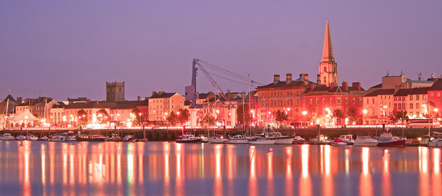
Waterford city at night Image of
Waterford city at night taken from across the River Suir
1110:
294:
244:
335:
78:
135:
1100:
278:
228:
977:
156:
146:
315:
967:
1070:
995:
327:
1120:
893:
Click on a date/time to view the file as it appeared at that time.
963:
List of urban areas in the
Republic of Ireland for the 2016 census
1050:
280:
230:
1025:
255:
205:
66:
1150:
265:
52° 15′ 40″ N, 7° 06′ 19″ W
215:
52° 15′ 55″ N, 7° 06′ 18″ W
1161:جمہوریہ آئر لینڈ کے شہری علاقہ جات کی فہرست بلحاظ آبادی
1140:
1005:
454:
Add a one-line explanation of what this file represents
116:
Waterford city at night - geograph.org.uk - 1034017.jpg
52:
Waterford_city_at_night_-_geograph.org.uk_-_1034017.jpg
1130:
1060:
1030:
1015:
1040:
1170:
110:
90:
Commons is a freely licensed media file repository.
623:
Creative
Commons Attribution-ShareAlike 2.0 Generic
56:(640 × 285 pixels, file size: 56 KB, MIME type:
958:List of urban areas in the Republic of Ireland
423:https://creativecommons.org/licenses/by-sa/2.0
71:
429:Creative Commons Attribution-Share Alike 2.0
347:
8:
825:
640:
389:– to copy, distribute and transmit the work
1188:
895:
450:
988:The following other wikis use this file:
807:https://www.geograph.org.uk/photo/1034017
550:https://www.geograph.org.uk/profile/26286
1190:
955:
849:
833:
754:
738:
720:
704:
664:
648:
620:
604:
584:
568:
501:
485:
468:
465:
446:
439:
258:
208:
287:View this and other nearby images on:
237:View this and other nearby images on:
7:
334:and is licensed for reuse under the
884:
370:Attribution-Share Alike 2.0 Generic
358:
353:
338:Attribution-ShareAlike 2.0 license.
1181:
459:
453:
344:
321:
120:
103:
49:
458:
651:coordinates of the point of view
444:
400:Under the following conditions:
365:This file is licensed under the
357:
352:
346:
314:
293:
279:
271:
243:
229:
221:
70:
31:
21:
441:
121:
46:No higher resolution available.
14:
1147:Usage on simple.wikipedia.org
1081:利用者:Omotecho/sandbox/ウォーターフォード
757:file available on the internet
440:
322:This image was taken from the
26:
1:
836:coordinates of depicted place
36:
792:Geograph Britain and Ireland
528:object of statement has role
466:Items portrayed in this file
270:
220:
1137:Usage on pl.wikivoyage.org
1111:Īrijas pilsētu uzskaitījums
1087:Usage on lez.wikipedia.org
1077:Usage on ja.wikivoyage.org
1037:Usage on es.wikivoyage.org
1002:Usage on en.wikivoyage.org
1212:
1167:Usage on vi.wikipedia.org
1157:Usage on ur.wikipedia.org
1127:Usage on no.wikipedia.org
1117:Usage on mt.wikipedia.org
1107:Usage on lv.wikipedia.org
1097:Usage on lt.wikipedia.org
1067:Usage on it.wikipedia.org
1057:Usage on is.wikipedia.org
1047:Usage on eu.wikipedia.org
1022:Usage on es.wikipedia.org
1012:Usage on eo.wikipedia.org
992:Usage on da.wikipedia.org
851:52°15'40.46"N, 7°6'19.44"W
666:52°15'55.33"N, 7°6'18.00"W
414:same or compatible license
996:Byer i Republikken Irland
885:
16:
770:geograph.org.uk image ID
443:
380:
196:tony quilty /
177:tony quilty /
77:This is a file from the
1101:Sąrašas:Airijos miestai
1071:Città dell'Irlanda
942:
921:19:36, 23 February 2011
198:Waterford city at night
179:Waterford city at night
168:required by the license
152:
141:
134:
131:
113:
81:. Information from its
1121:Repubblika tal-Irlanda
973:Nicholas Walsh (judge)
328:this photograph's page
299:52.261240; -7.105400
249:52.265370; -7.105000
84:description page there
1091:Ирландиядин шегьерар
1051:Waterford konderria
395:– to adapt the work
515:author name string
1199:
1198:
1026:Munster (Irlanda)
984:Global file usage
946:
827:
722:22 September 2008
642:
607:copyright license
452:
343:
342:
326:collection. See
304:
303:
254:
253:
203:
202:
171:
136:22 September 2008
99:
98:
79:Wikimedia Commons
32:Global file usage
1203:
1189:
933:
873:
872:
867:
809:
804:
800:described at URL
794:
789:
779:
774:
688:
687:
682:
571:copyright status
552:
547:
537:
532:
522:
519:
436:
433:
430:
427:
424:
416:as the original.
378:
367:Creative Commons
361:
360:
356:
355:
350:
349:
336:Creative Commons
324:Geograph project
318:
311:
300:
297:
283:
282:
276:
275:
274:
268:
267:
256:
250:
247:
233:
232:
226:
225:
224:
218:
217:
206:
165:
137:
125:
117:
111:
95:
74:
73:
67:
61:
59:
1211:
1210:
1206:
1205:
1204:
1202:
1201:
1200:
1177:
982:
954:
947:
939:
931:
887:
886:
883:
882:
881:
880:
879:
878:
877:
876:
875:
874:
870:
868:
865:
856:
855:
854:
852:
842:
841:
840:
838:
819:
818:
817:
816:
815:
814:
813:
812:
811:
810:
805:
802:
796:
795:
790:
787:
781:
780:
775:
772:
763:
762:
761:
759:
747:
746:
745:
743:
732:
731:
730:
729:
728:
727:
726:
725:
723:
713:
712:
711:
709:
698:
697:
696:
695:
694:
693:
692:
691:
690:
689:
685:
683:
680:
671:
670:
669:
667:
657:
656:
655:
653:
634:
633:
632:
631:
630:
629:
628:
627:
625:
613:
612:
611:
609:
598:
597:
596:
595:
594:
593:
592:
591:
589:
577:
576:
575:
573:
562:
561:
560:
559:
558:
557:
556:
555:
554:
553:
548:
545:
539:
538:
533:
530:
524:
523:
520:
517:
508:
507:
506:
504:
494:
493:
492:
490:
479:
478:
477:
476:
475:
473:
457:
456:
455:
438:
437:
434:
431:
428:
425:
422:
421:
379:
376:
373:
362:
339:
309:
298:
272:
263:
262:
259:Object location
248:
222:
213:
212:
209:Camera location
204:
193:
186:
174:
147:geograph.org.uk
127:
115:
108:
101:
100:
89:
88:
87:is shown below.
63:
57:
55:
48:
47:
12:
11:
5:
1209:
1207:
1197:
1196:
1193:
1180:
1176:
1175:
1174:
1173:
1165:
1164:
1163:
1155:
1154:
1153:
1145:
1144:
1143:
1135:
1134:
1133:
1125:
1124:
1123:
1115:
1114:
1113:
1105:
1104:
1103:
1095:
1094:
1093:
1085:
1084:
1083:
1075:
1074:
1073:
1065:
1064:
1063:
1055:
1054:
1053:
1045:
1044:
1043:
1035:
1034:
1033:
1028:
1020:
1019:
1018:
1010:
1009:
1008:
1000:
999:
998:
986:
985:
981:
980:
975:
970:
965:
960:
952:
951:
950:
945:
944:
941:
937:
934:
928:
923:
918:
914:
913:
910:
907:
904:
901:
898:
891:
890:
861:
860:
859:
858:
857:
853:
850:
848:
847:
846:
845:
844:
843:
839:
834:
832:
831:
830:
829:
823:
798:
797:
783:
782:
768:
767:
766:
765:
764:
760:
755:
753:
752:
751:
750:
749:
748:
744:
741:source of file
739:
737:
736:
735:
734:
733:
724:
721:
719:
718:
717:
716:
715:
714:
710:
705:
703:
702:
701:
700:
699:
676:
675:
674:
673:
672:
668:
665:
663:
662:
661:
660:
659:
658:
654:
649:
647:
646:
645:
644:
638:
626:
621:
619:
618:
617:
616:
615:
614:
610:
605:
603:
602:
601:
600:
599:
590:
585:
583:
582:
581:
580:
579:
578:
574:
569:
567:
566:
565:
564:
563:
541:
540:
526:
525:
513:
512:
511:
510:
509:
505:
502:
500:
499:
498:
497:
496:
495:
491:
486:
484:
483:
482:
481:
480:
474:
469:
467:
464:
463:
462:
461:
460:
449:
448:
445:
442:
420:
419:
418:
417:
407:
398:
397:
396:
390:
383:You are free:
374:
364:
363:
345:
341:
340:
319:
308:
305:
302:
301:
291:
285:
260:
252:
251:
241:
235:
210:
201:
200:
194:
191:
188:
187:
182:
175:
172:
160:
159:
154:
150:
149:
143:
139:
138:
133:
129:
128:
118:
109:
107:
104:
102:
97:
96:
75:
65:
64:
45:
41:
40:
39:
34:
29:
24:
19:
13:
10:
9:
6:
4:
3:
2:
1208:
1194:
1191:
1187:
1184:
1178:
1172:
1169:
1168:
1166:
1162:
1159:
1158:
1156:
1152:
1149:
1148:
1146:
1142:
1139:
1138:
1136:
1132:
1129:
1128:
1126:
1122:
1119:
1118:
1116:
1112:
1109:
1108:
1106:
1102:
1099:
1098:
1096:
1092:
1089:
1088:
1086:
1082:
1079:
1078:
1076:
1072:
1069:
1068:
1066:
1062:
1059:
1058:
1056:
1052:
1049:
1048:
1046:
1042:
1039:
1038:
1036:
1032:
1029:
1027:
1024:
1023:
1021:
1017:
1014:
1013:
1011:
1007:
1004:
1003:
1001:
997:
994:
993:
991:
990:
989:
983:
979:
976:
974:
971:
969:
966:
964:
961:
959:
956:
948:
940:
935:
929:
927:
924:
922:
919:
916:
915:
911:
908:
905:
902:
899:
897:
896:
894:
888:
864:
837:
808:
801:
793:
786:
778:
771:
758:
742:
708:
679:
652:
624:
608:
588:
572:
551:
544:
536:
529:
516:
489:
472:
426:CC BY-SA 2.0
415:
411:
408:
405:
402:
401:
399:
394:
391:
388:
385:
384:
382:
381:
375:Attribution:
371:
368:
351:
337:
333:
329:
325:
320:
317:
313:
312:
306:
296:
292:
290:
289:OpenStreetMap
286:
284:
266:
261:
257:
246:
242:
240:
239:OpenStreetMap
236:
234:
216:
211:
207:
199:
195:
190:
189:
185:
181: /
180:
176:
169:
164:
162:
161:
158:
155:
151:
148:
144:
140:
130:
124:
119:
112:
105:
93:
86:
85:
80:
76:
69:
68:
62:
53:
44:
38:
35:
33:
30:
28:
25:
23:
20:
18:
15:
1185:
1182:
987:
892:
889:File history
535:photographer
409:
403:
392:
386:
331:
269:
219:
197:
184:CC BY-SA 2.0
178:
122:
92:You can help
82:
50:
22:File history
938:GeographBot
587:copyrighted
521:tony quilty
410:share alike
404:attribution
377:tony quilty
332:tony quilty
163:Attribution
157:tony quilty
114:Description
1192:_error
949:File usage
930:640 × 285
906:Dimensions
503:some value
58:image/jpeg
27:File usage
1151:Waterford
1141:Waterford
1131:Waterford
1061:Waterford
1031:Waterford
1016:Waterford
1006:Waterford
978:Waterford
903:Thumbnail
900:Date/Time
707:inception
307:Licensing
192:InfoField
173:InfoField
123:English:
1179:Metadata
785:operator
447:Captions
393:to remix
387:to share
372:license.
37:Metadata
1171:Munster
1041:Irlanda
968:Munster
932:(56 KB)
917:current
912:Comment
863:heading
822:heading
777:1034017
678:heading
637:heading
488:creator
471:depicts
451:English
106:Summary
54:
871:degree
826:degree
686:degree
641:degree
277:
227:
153:Author
142:Source
145:From
909:User
869:135
684:135
435:true
432:true
132:Date
17:File
543:URL
866::
803::
788::
773::
681::
546::
531::
518::
1195:0
170:)
166:(
94:.
60:)
Text is available under the Creative Commons Attribution-ShareAlike License. Additional terms may apply.
_heading:135.00&language=en)
_heading:135.00&language=en)
