245:
178:
344:
192:
213:
251:
256:
67:
845:
862:== {{int:filedesc}} == {{Information |description={{en|1=Walkergate Crossroads. View looking east along Shields Road to the right, and up Benfield Road to the left. The actual railway that lends its name to the pub can be seen crossing Benfield Road via
169:
121:
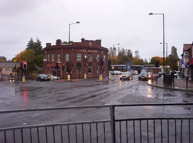
Walkergate
Crossroads. View looking east along Shields Road to the right, and up Benfield Road to the left. The actual railway that lends its name to the pub can be seen crossing Benfield Road via the metal bridge at the extreme left of the
38:
303:– You must give appropriate credit, provide a link to the license, and indicate if changes were made. You may do so in any reasonable manner, but not in any way that suggests the licensor endorses you or your use.
78:
46:
352:
369:
705:
635:
599:
185:
725:
1016:
220:
887:
This file contains additional information, probably added from the digital camera or scanner used to create or digitize it.
310:
562:
776:
733:
689:
583:
555:
542:
527:
445:
748:
718:
655:
619:
500:
483:
844:
839:
392:
384:
37:
207:
909:
266:
890:
If the file has been modified from its original state, some details may not fully reflect the modified file.
365:
872:
The following pages on the
English Knowledge (XXG) use this file (pages on other projects are not listed):
1061:
899:
309:– If you remix, transform, or build upon the material, you must distribute your contributions under the
227:
on the
Geograph website for the photographer's contact details. The copyright on this image is owned by
855:
263:
993:
1089:
373:
86:
1178:
358:
Remove redundant categories and try to put this image in the most specific category/categories
534:
755:
740:
436:
440:
432:
428:
424:
420:
416:
412:
408:
404:
400:
191:
1141:
1079:
1043:
916:
232:
73:
1188:
1151:
956:
1099:
131:
936:
876:
152:
175:
142:
1198:
926:
212:
224:
812:
Click on a date/time to view the file as it appeared at that time.
177:
160:
61:
769:
467:
Add a one-line explanation of what this file represents
372:
combined with a database. You can also have a look at
364:
The location categories are based on information from
105:
85:
Commons is a freely licensed media file repository.
636:
Creative
Commons Attribution-ShareAlike 2.0 Generic
111:
Walkergate
Crossroads - geograph.org.uk - 69417.jpg
47:
Walkergate_Crossroads_-_geograph.org.uk_-_69417.jpg
51:(640 × 475 pixels, file size: 95 KB, MIME type:
349:The categories of this image should be checked.
320:https://creativecommons.org/licenses/by-sa/2.0
66:
326:Creative Commons Attribution-Share Alike 2.0
244:
8:
286:– to copy, distribute and transmit the work
892:
814:
463:
444:
535:https://www.geograph.org.uk/profile/2239
1206:
1196:
1186:
1176:
1168:
1160:
1149:
1139:
1131:
1123:
1115:
1107:
1097:
1087:
1077:
1069:
1059:
1051:
1041:
1033:
1025:
1014:
1006:
998:
988:
980:
972:
964:
953:
945:
934:
924:
914:
904:
874:
790:
774:
756:https://www.geograph.org.uk/photo/69417
703:
687:
669:
653:
633:
617:
597:
581:
514:
498:
481:
478:
459:
452:
391:This image was uploaded as part of the
170:54° 59′ N, 1° 34′ W
163:
184:View this and other nearby images on:
894:
379:The topic category from Geograph was
7:
231:and is licensed for reuse under the
803:
267:Attribution-Share Alike 2.0 Generic
255:
250:
235:Attribution-ShareAlike 2.0 license.
885:
472:
466:
241:
218:
115:
98:
44:
471:
947:Date and time of data generation
457:
342:
297:Under the following conditions:
262:This file is licensed under the
254:
249:
243:
211:
190:
176:
65:
21:
921:33,333/1,000,000 sec (0.033333)
454:
116:
41:No higher resolution available.
14:
706:file available on the internet
453:
219:This image was taken from the
26:
1:
777:coordinates of depicted place
31:
726:Geograph Britain and Ireland
556:object of statement has role
479:Items portrayed in this file
1027:Date and time of digitizing
910:KODAK CX4310 DIGITAL CAMERA
1228:
1162:Focal length in 35 mm film
1120:One-chip color area sensor
311:same or compatible license
804:
16:
734:geograph.org.uk image ID
456:
374:this tool from mysociety
340:
339:
277:
72:This is a file from the
1125:Custom image processing
1084:Center weighted average
861:
370:this OpenStreetMap tool
148:
137:
130:
127:
108:
76:. Information from its
1208:Subject distance range
1035:Image compression mode
840:20:32, 30 January 2010
225:this photograph's page
196:54.983000; -1.560000
79:description page there
1071:Maximum land aperture
1030:05:37, 1 January 2002
974:Horizontal resolution
950:05:37, 1 January 2002
900:EASTMAN KODAK COMPANY
792:54°58'59"N, 1°33'36"W
393:Geograph batch upload
383:(find similar images
361:Remove this template
1000:Y and C positioning
982:Vertical resolution
896:Camera manufacturer
437:português do Brasil
292:– to adapt the work
1170:Scene capture type
1146:Auto white balance
1074:3.61 APEX (f/3.49)
543:author name string
366:this geonames tool
1215:
1214:
865:
620:copyright license
465:
448:
395:
240:
239:
223:collection. See
201:
200:
158:
157:
94:
93:
74:Wikimedia Commons
1219:
1008:Exposure Program
893:
852:
758:
753:
749:described at URL
743:
738:
728:
723:
584:copyright status
565:
560:
550:
547:
537:
532:
449:
390:
347:
346:
345:
333:
330:
327:
324:
321:
313:as the original.
275:
264:Creative Commons
258:
257:
253:
252:
247:
246:
233:Creative Commons
221:Geograph project
215:
208:
197:
194:
180:
179:
173:
172:
161:
133:
120:
112:
106:
90:
69:
68:
62:
56:
54:
1227:
1226:
1222:
1221:
1220:
1218:
1217:
1216:
994:Version 2.0000
881:
873:
866:
858:
850:
806:
805:
802:
801:
800:
799:
798:
797:
796:
795:
793:
783:
782:
781:
779:
768:
767:
766:
765:
764:
763:
762:
761:
760:
759:
754:
751:
745:
744:
739:
736:
730:
729:
724:
721:
712:
711:
710:
708:
696:
695:
694:
692:
681:
680:
679:
678:
677:
676:
675:
674:
672:
671:22 October 2005
662:
661:
660:
658:
647:
646:
645:
644:
643:
642:
641:
640:
638:
626:
625:
624:
622:
611:
610:
609:
608:
607:
606:
605:
604:
602:
590:
589:
588:
586:
575:
574:
573:
572:
571:
570:
569:
568:
567:
566:
561:
558:
552:
551:
548:
545:
539:
538:
533:
530:
521:
520:
519:
517:
507:
506:
505:
503:
492:
491:
490:
489:
488:
486:
470:
469:
468:
451:
399:
396:
353:Check them now!
343:
341:
335:
334:
331:
328:
325:
322:
319:
318:
276:
273:
270:
259:
236:
206:
195:
168:
167:
164:Object location
159:
143:geograph.org.uk
132:22 October 2005
123:
110:
103:
96:
95:
84:
83:
82:is shown below.
58:
52:
50:
43:
42:
12:
11:
5:
1225:
1223:
1213:
1212:
1209:
1205:
1204:
1201:
1195:
1194:
1191:
1185:
1184:
1181:
1175:
1174:
1171:
1167:
1166:
1163:
1159:
1158:
1155:
1148:
1147:
1144:
1138:
1137:
1134:
1130:
1129:
1128:Normal process
1126:
1122:
1121:
1118:
1117:Sensing method
1114:
1113:
1110:
1109:Exposure index
1106:
1105:
1102:
1096:
1095:
1092:
1086:
1085:
1082:
1076:
1075:
1072:
1068:
1067:
1064:
1058:
1057:
1054:
1050:
1049:
1046:
1040:
1039:
1036:
1032:
1031:
1028:
1024:
1023:
1020:
1013:
1012:
1011:Normal program
1009:
1005:
1004:
1001:
997:
996:
991:
987:
986:
983:
979:
978:
975:
971:
970:
967:
963:
962:
959:
952:
951:
948:
944:
943:
940:
933:
932:
929:
923:
922:
919:
913:
912:
907:
903:
902:
897:
884:
880:
879:
871:
870:
869:
864:
863:
860:
856:
853:
847:
842:
837:
833:
832:
829:
826:
823:
820:
817:
810:
809:
794:
791:
789:
788:
787:
786:
785:
784:
780:
775:
773:
772:
771:
770:
747:
746:
732:
731:
717:
716:
715:
714:
713:
709:
704:
702:
701:
700:
699:
698:
697:
693:
690:source of file
688:
686:
685:
684:
683:
682:
673:
670:
668:
667:
666:
665:
664:
663:
659:
654:
652:
651:
650:
649:
648:
639:
634:
632:
631:
630:
629:
628:
627:
623:
618:
616:
615:
614:
613:
612:
603:
598:
596:
595:
594:
593:
592:
591:
587:
582:
580:
579:
578:
577:
576:
554:
553:
541:
540:
526:
525:
524:
523:
522:
518:
515:
513:
512:
511:
510:
509:
508:
504:
499:
497:
496:
495:
494:
493:
487:
482:
480:
477:
476:
475:
474:
473:
462:
461:
458:
455:
389:
388:
377:
362:
359:
317:
316:
315:
314:
304:
295:
294:
293:
287:
280:You are free:
271:
261:
260:
242:
238:
237:
216:
205:
202:
199:
198:
188:
182:
165:
156:
155:
150:
146:
145:
139:
135:
134:
129:
125:
124:
113:
104:
102:
99:
97:
92:
91:
70:
60:
59:
40:
36:
35:
34:
29:
24:
19:
13:
10:
9:
6:
4:
3:
2:
1224:
1210:
1207:
1202:
1200:
1197:
1192:
1190:
1187:
1182:
1180:
1177:
1172:
1169:
1164:
1161:
1156:
1153:
1150:
1145:
1143:
1142:White balance
1140:
1136:Auto exposure
1135:
1133:Exposure mode
1132:
1127:
1124:
1119:
1116:
1111:
1108:
1103:
1101:
1098:
1093:
1091:
1088:
1083:
1081:
1080:Metering mode
1078:
1073:
1070:
1065:
1063:
1062:Exposure bias
1060:
1055:
1053:APEX aperture
1052:
1047:
1045:
1044:Shutter speed
1042:
1037:
1034:
1029:
1026:
1021:
1018:
1015:
1010:
1007:
1002:
999:
995:
992:
990:Software used
989:
984:
981:
976:
973:
968:
965:
960:
958:
954:
949:
946:
941:
938:
935:
930:
928:
925:
920:
918:
917:Exposure time
915:
911:
908:
905:
901:
898:
895:
891:
888:
882:
878:
875:
867:
859:
854:
848:
846:
843:
841:
838:
835:
834:
830:
827:
824:
821:
818:
816:
815:
813:
807:
778:
757:
750:
742:
735:
727:
720:
707:
691:
657:
637:
621:
601:
585:
564:
557:
544:
536:
529:
502:
485:
450:
447:
442:
438:
434:
430:
426:
422:
418:
414:
410:
406:
402:
397:
394:
386:
382:
378:
375:
371:
367:
363:
360:
357:
356:
355:
354:
350:
338:
337:
323:CC BY-SA 2.0
312:
308:
305:
302:
299:
298:
296:
291:
288:
285:
282:
281:
279:
278:
272:Attribution:
268:
265:
248:
234:
230:
226:
222:
217:
214:
210:
209:
203:
193:
189:
187:
186:OpenStreetMap
183:
181:
171:
166:
162:
154:
151:
147:
144:
140:
136:
126:
119:
114:
107:
100:
88:
81:
80:
75:
71:
64:
63:
57:
48:
39:
33:
30:
28:
25:
23:
20:
18:
15:
1152:Digital zoom
957:focal length
906:Camera model
889:
886:
811:
808:File history
563:photographer
398:
380:
351:
348:
336:
306:
300:
289:
283:
228:
117:
87:You can help
77:
45:
22:File history
1100:Color space
1094:Flash fired
966:Orientation
857:GeographBot
600:copyrighted
385:at Geograph
307:share alike
301:attribution
109:Description
1189:Saturation
877:Walkergate
868:File usage
849:640 × 475
825:Dimensions
516:some value
425:македонски
381:Crossroads
53:image/jpeg
27:File usage
1199:Sharpness
937:ISO speed
822:Thumbnail
819:Date/Time
656:inception
549:C G Burke
433:português
274:C G Burke
229:C G Burke
204:Licensing
153:C G Burke
118:English:
1179:Contrast
1173:Standard
1003:Co-sited
927:F-number
883:Metadata
719:operator
460:Captions
443: |
439: |
435: |
431: |
427: |
423: |
419: |
415: |
411: |
409:français
407: |
403: |
290:to remix
284:to share
269:license.
122:picture.
32:Metadata
1211:Unknown
1019:version
985:230 dpi
977:230 dpi
961:7.63 mm
851:(95 KB)
836:current
831:Comment
501:creator
484:depicts
464:English
401:English
101:Summary
49:
1203:Normal
1193:Normal
1183:Normal
969:Normal
939:rating
441:Türkçe
429:മലയാളം
421:magyar
413:galego
174:
149:Author
138:Source
1165:36 mm
1154:ratio
1090:Flash
955:Lens
931:f/3.5
741:69417
417:עברית
405:suomi
141:From
1104:sRGB
1056:3.61
1038:1.26
1017:Exif
828:User
368:and
332:true
329:true
128:Date
17:File
1112:140
1048:4.9
1022:2.2
942:140
528:URL
446:+/−
752::
737::
722::
559::
546::
531::
1157:0
1066:0
387:)
376:.
89:.
55:)
Text is available under the Creative Commons Attribution-ShareAlike License. Additional terms may apply.
_&language=en)
