261:
196:
188:
210:
229:
267:
272:
72:
673:"}},"text\/plain":{"en":{"":"heading"}}},"{\"value\":{\"amount\":\"+225\",\"unit\":\"http:\\\/\\\/www.wikidata.org\\\/entity\\\/Q28390\"},\"type\":\"quantity\"}":{"text\/html":{"en":{"P7787":"225
669:
319:– You must give appropriate credit, provide a link to the license, and indicate if changes were made. You may do so in any reasonable manner, but not in any way that suggests the licensor endorses you or your use.
179:
43:
670:
83:
51:
157:
571:
535:
499:
203:
621:
1111:
236:
1003:
This file contains additional information, probably added from the digital camera or scanner used to create or digitize it.
326:
434:
848:
811:
777:
740:
711:
684:
599:
555:
483:
455:
442:
427:
642:
614:
584:
519:
400:
383:
223:
282:
1006:
If the file has been modified from its original state, some details may not fully reflect the modified file.
115:
970:
952:
935:
1177:
325:– If you remix, transform, or build upon the material, you must distribute your contributions under the
243:
on the
Geograph website for the photographer's contact details. The copyright on this image is owned by
279:
916:
911:
677:"}},"text\/plain":{"en":{"P7787":"225 degree"}}}}": -->
42:
1213:
1025:
91:
606:
591:
462:
1015:
938:|Source=From |Date=Sunday, 11 May, 2008 |Author= |Permission=Creative Commons Attributio
209:
1203:
1159:
1032:
248:
78:
1061:
1231:
927:
193:
125:
146:
136:
1042:
228:
240:
884:
Click on a date/time to view the file as it appeared at that time.
195:
180:
51° 12′ 14.79″ N, 1° 23′ 01.13″ E
170:
66:
980:
367:
Add a one-line explanation of what this file represents
990:
164:
Creative
Commons Attribution Share-alike license 2.0
105:
90:
Commons is a freely licensed media file repository.
536:
Creative
Commons Attribution-ShareAlike 2.0 Generic
56:(640 × 480 pixels, file size: 173 KB, MIME type:
336:https://creativecommons.org/licenses/by-sa/2.0
71:
342:Creative Commons Attribution-Share Alike 2.0
260:
8:
674:
302:– to copy, distribute and transmit the work
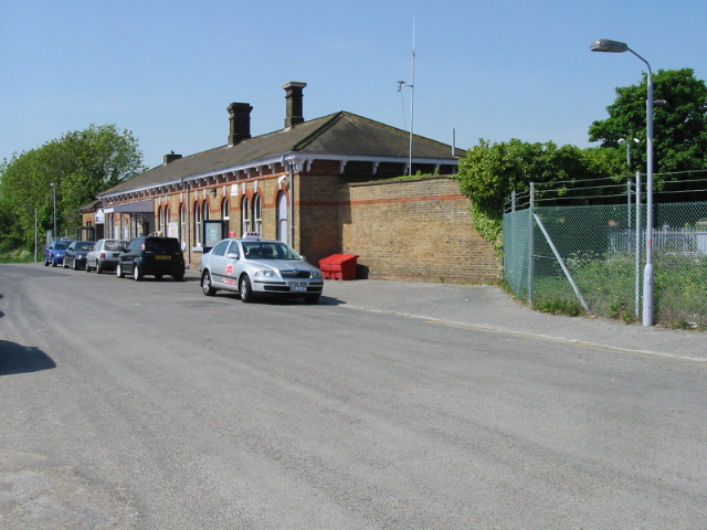
1008:
886:
363:
963:The following other wikis use this file:
592:https://www.geograph.org.uk/photo/801575
463:https://www.geograph.org.uk/profile/4474
1271:
1263:
1255:
1247:
1239:
1229:
1221:
1211:
1201:
1193:
1185:
1175:
1167:
1157:
1149:
1128:
1120:
1109:
1101:
1093:
1085:
1077:
1069:
1058:
1050:
1040:
1030:
1020:
950:
862:
846:
825:
809:
791:
775:
754:
738:
698:
682:
656:
640:
569:
553:
533:
517:
497:
481:
414:
398:
381:
378:
359:
352:
173:
202:View this and other nearby images on:
1010:
7:
247:and is licensed for reuse under the
948:The following page uses this file:
875:
283:Attribution-Share Alike 2.0 Generic
271:
266:
251:Attribution-ShareAlike 2.0 license.
1001:
372:
366:
257:
234:
111:Walmer railway station in 2008.jpg
103:
52:Walmer_railway_station_in_2008.jpg
49:
371:
1052:Date and time of data generation
685:coordinates of the point of view
357:
313:Under the following conditions:
278:This file is licensed under the
270:
265:
259:
227:
208:
194:
186:
70:
31:
21:
354:
46:No higher resolution available.
14:
572:file available on the internet
353:
235:This image was taken from the
26:
1:
36:
1190:2.9708557128906 APEX (f/2.8)
700:51°12'14.789"N, 1°23'1.133"E
622:Geograph Britain and Ireland
428:object of statement has role
379:Items portrayed in this file
185:
1257:Focal plane resolution unit
1122:Date and time of digitizing
967:Usage on arz.wikipedia.org
934:{{Information |Description=
1293:
1268:One-chip color area sensor
1223:Supported Flashpix version
987:Usage on www.wikidata.org
977:Usage on nl.wikipedia.org
327:same or compatible license
1130:Meaning of each component
1095:File change date and time
876:
16:
1249:Focal plane Y resolution
1241:Focal plane X resolution
936:w:Walmer railway station
600:geograph.org.uk image ID
356:
293:
77:This is a file from the
933:
152:
142:
131:
124:
121:
108:
81:. Information from its
1151:Image compression mode
953:Walmer railway station
241:this photograph's page
214:51.204108; 1.383648
116:Walmer railway station
84:description page there
1187:Maximum land aperture
1079:Horizontal resolution
1276:Digital still camera
1037:1/320 sec (0.003125)
1103:Y and C positioning
1087:Vertical resolution
1026:Canon PowerShot A20
1012:Camera manufacturer
308:– to adapt the work
1218:Flash did not fire
1125:10:55, 11 May 2008
1098:10:55, 11 May 2008
1055:10:55, 11 May 2008
912:09:47, 18 May 2008
443:author name string
1280:
1279:
1182:−0.33333333333333
959:Global file usage
941:
676:
520:copyright license
365:
256:
255:
239:collection. See
219:
218:
168:
167:
161:
158:Reusing this file
99:
98:
79:Wikimedia Commons
32:Global file usage
1284:
1252:3,096.7741935484
1244:3,106.7961165049
1195:Subject distance
1009:
924:
830:
759:
722:
721:
716:
624:
619:
609:
604:
594:
589:
585:described at URL
484:copyright status
465:
460:
450:
447:
437:
432:
349:
346:
343:
340:
337:
329:as the original.
291:
280:Creative Commons
274:
273:
269:
268:
263:
262:
249:Creative Commons
237:Geograph project
231:
224:
215:
212:
198:
197:
191:
190:
189:
183:
182:
171:
155:
127:
112:
106:
95:
74:
73:
67:
61:
59:
1292:
1291:
1287:
1286:
1285:
1283:
1282:
1281:
997:
957:
942:
930:
922:
878:
877:
874:
873:
872:
871:
870:
869:
868:
867:
865:
855:
854:
853:
851:
840:
839:
838:
837:
836:
835:
834:
833:
831:
828:
818:
817:
816:
814:
803:
802:
801:
800:
799:
798:
797:
796:
794:
784:
783:
782:
780:
769:
768:
767:
766:
765:
764:
763:
762:
760:
757:
747:
746:
745:
743:
732:
731:
730:
729:
728:
727:
726:
725:
724:
723:
719:
717:
714:
705:
704:
703:
701:
691:
690:
689:
687:
668:
667:
666:
665:
664:
663:
662:
661:
659:
649:
648:
647:
645:
634:
633:
632:
631:
630:
629:
628:
627:
626:
625:
620:
617:
611:
610:
605:
602:
596:
595:
590:
587:
578:
577:
576:
574:
562:
561:
560:
558:
547:
546:
545:
544:
543:
542:
541:
540:
538:
526:
525:
524:
522:
511:
510:
509:
508:
507:
506:
505:
504:
502:
490:
489:
488:
486:
475:
474:
473:
472:
471:
470:
469:
468:
467:
466:
461:
458:
452:
451:
448:
445:
439:
438:
433:
430:
421:
420:
419:
417:
407:
406:
405:
403:
392:
391:
390:
389:
388:
386:
370:
369:
368:
351:
350:
347:
344:
341:
338:
335:
334:
292:
289:
286:
275:
252:
213:
187:
178:
177:
174:Camera location
169:
137:geograph.org.uk
110:
101:
100:
89:
88:
87:is shown below.
63:
57:
55:
48:
47:
12:
11:
5:
1290:
1288:
1278:
1277:
1274:
1270:
1269:
1266:
1265:Sensing method
1262:
1261:
1258:
1254:
1253:
1250:
1246:
1245:
1242:
1238:
1237:
1234:
1228:
1227:
1224:
1220:
1219:
1216:
1210:
1209:
1206:
1200:
1199:
1196:
1192:
1191:
1188:
1184:
1183:
1180:
1174:
1173:
1170:
1166:
1165:
1162:
1156:
1155:
1152:
1148:
1147:
1146:
1145:
1144:does not exist
1142:
1139:
1136:
1131:
1127:
1126:
1123:
1119:
1118:
1115:
1108:
1107:
1104:
1100:
1099:
1096:
1092:
1091:
1088:
1084:
1083:
1080:
1076:
1075:
1072:
1068:
1067:
1064:
1057:
1056:
1053:
1049:
1048:
1045:
1039:
1038:
1035:
1029:
1028:
1023:
1019:
1018:
1013:
1000:
996:
995:
994:
993:
985:
984:
983:
981:Station Walmer
975:
974:
973:
961:
960:
956:
955:
946:
945:
940:
939:
932:
928:
925:
919:
914:
909:
905:
904:
901:
898:
895:
892:
889:
882:
881:
866:
863:
861:
860:
859:
858:
857:
856:
852:
847:
845:
844:
843:
842:
841:
832:
826:
824:
823:
822:
821:
820:
819:
815:
810:
808:
807:
806:
805:
804:
795:
792:
790:
789:
788:
787:
786:
785:
781:
776:
774:
773:
772:
771:
770:
761:
755:
753:
752:
751:
750:
749:
748:
744:
739:
737:
736:
735:
734:
733:
710:
709:
708:
707:
706:
702:
699:
697:
696:
695:
694:
693:
692:
688:
683:
681:
680:
679:
678:
672:
660:
657:
655:
654:
653:
652:
651:
650:
646:
641:
639:
638:
637:
636:
635:
613:
612:
598:
597:
583:
582:
581:
580:
579:
575:
570:
568:
567:
566:
565:
564:
563:
559:
556:source of file
554:
552:
551:
550:
549:
548:
539:
534:
532:
531:
530:
529:
528:
527:
523:
518:
516:
515:
514:
513:
512:
503:
498:
496:
495:
494:
493:
492:
491:
487:
482:
480:
479:
478:
477:
476:
454:
453:
441:
440:
426:
425:
424:
423:
422:
418:
415:
413:
412:
411:
410:
409:
408:
404:
399:
397:
396:
395:
394:
393:
387:
382:
380:
377:
376:
375:
374:
373:
362:
361:
358:
355:
333:
332:
331:
330:
320:
311:
310:
309:
303:
296:You are free:
287:
277:
276:
258:
254:
253:
232:
217:
216:
206:
200:
175:
166:
165:
162:
150:
149:
144:
140:
139:
133:
129:
128:
123:
119:
118:
113:
104:
102:
97:
96:
75:
65:
64:
45:
41:
40:
39:
34:
29:
24:
19:
13:
10:
9:
6:
4:
3:
2:
1289:
1275:
1272:
1267:
1264:
1259:
1256:
1251:
1248:
1243:
1240:
1235:
1233:
1230:
1225:
1222:
1217:
1215:
1212:
1207:
1205:
1204:Metering mode
1202:
1197:
1194:
1189:
1186:
1181:
1179:
1178:Exposure bias
1176:
1171:
1169:APEX aperture
1168:
1163:
1161:
1160:Shutter speed
1158:
1153:
1150:
1143:
1140:
1137:
1134:
1133:
1132:
1129:
1124:
1121:
1116:
1113:
1110:
1105:
1102:
1097:
1094:
1089:
1086:
1081:
1078:
1073:
1070:
1065:
1063:
1059:
1054:
1051:
1046:
1044:
1041:
1036:
1034:
1033:Exposure time
1031:
1027:
1024:
1021:
1017:
1014:
1011:
1007:
1004:
998:
992:
989:
988:
986:
982:
979:
978:
976:
972:
969:
968:
966:
965:
964:
958:
954:
951:
949:
943:
937:
931:
926:
920:
918:
915:
913:
910:
907:
906:
902:
899:
896:
893:
890:
888:
887:
885:
879:
850:
813:
779:
742:
741:exposure time
713:
686:
644:
623:
616:
608:
601:
593:
586:
573:
557:
537:
521:
501:
485:
464:
457:
444:
436:
429:
402:
385:
339:CC BY-SA 2.0
328:
324:
321:
318:
315:
314:
312:
307:
304:
301:
298:
297:
295:
294:
288:Attribution:
284:
281:
264:
250:
246:
242:
238:
233:
230:
226:
225:
222:
221:
211:
207:
205:
204:OpenStreetMap
201:
199:
181:
176:
172:
163:
159:
154:
151:
148:
145:
141:
138:
134:
130:
120:
117:
114:
107:
93:
86:
85:
80:
76:
69:
68:
62:
53:
44:
38:
35:
33:
30:
28:
25:
23:
20:
18:
15:
1198:0.717 meters
1062:focal length
1022:Camera model
1005:
1002:
962:
947:
883:
880:File history
812:focal length
435:photographer
322:
316:
305:
299:
244:
220:
184:
92:You can help
82:
50:
22:File history
1273:File source
1232:Color space
1071:Orientation
971:محطة والمير
658:11 May 2008
500:copyrighted
323:share alike
317:attribution
126:11 May 2008
109:Description
1066:6.59375 mm
944:File usage
921:640 × 480
897:Dimensions
864:image/jpeg
849:media type
829:millimetre
449:Nick Smith
416:some value
290:Nick Smith
245:Nick Smith
153:Permission
147:Nick Smith
58:image/jpeg
27:File usage
894:Thumbnail
891:Date/Time
756:0.003125
643:inception
1106:Centered
1043:F-number
999:Metadata
991:Q3502336
923:(173 KB)
827:6.59375
778:f-number
615:operator
360:Captions
306:to remix
300:to share
285:license.
37:Metadata
1208:Pattern
1172:6.34375
1114:version
1090:180 dpi
1082:180 dpi
908:current
903:Comment
712:heading
671:heading
401:creator
384:depicts
364:English
54:
1260:inches
1164:8.3125
1074:Normal
929:Edward
758:second
720:degree
675:degree
607:801575
192:
143:Author
132:Source
1214:Flash
1060:Lens
1016:Canon
135:From
1236:sRGB
1112:Exif
900:User
718:225
348:true
345:true
122:Date
17:File
1117:2.1
1047:f/9
456:URL
1141:Cr
1138:Cb
715::
618::
603::
588::
459::
446::
431::
1226:1
1154:5
1135:Y
793:9
160:)
156:(
94:.
60:)
Text is available under the Creative Commons Attribution-ShareAlike License. Additional terms may apply.
