258:
191:
183:
205:
226:
264:
269:
72:
670:"}},"text\/plain":{"en":{"":"heading"}}},"{\"value\":{\"amount\":\"+90\",\"unit\":\"http:\\\/\\\/www.wikidata.org\\\/entity\\\/Q28390\"},\"type\":\"quantity\"}":{"text\/html":{"en":{"P7787":"90
666:
947:
316:– You must give appropriate credit, provide a link to the license, and indicate if changes were made. You may do so in any reasonable manner, but not in any way that suggests the licensor endorses you or your use.
126:
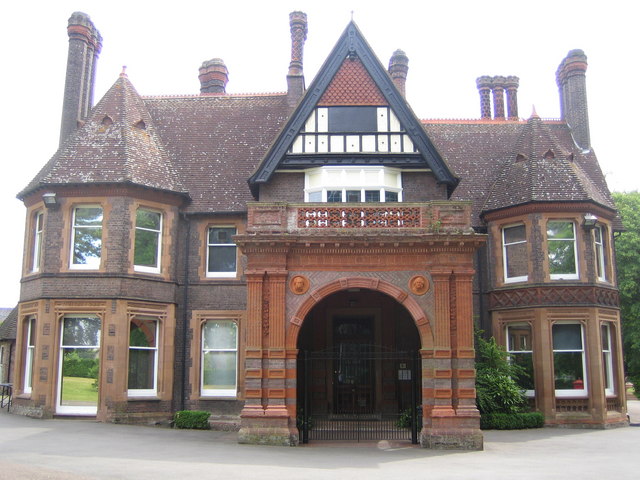
Luton: Wardown Park Museum One of two museums run by Luton
Culture. This one is housed in this Victorian mansion in the grounds of Wardown Park. The 1888 Ordnance Survey mapping shows this building as Bramingham
174:
667:
43:
825:{{Information |Description={{geograph|191354|Nigel Cox}} |Source=Originally from ; description page is/was . |Date=2006-08-18 (first version);
753:
602:
532:
496:
198:
844:
622:
1093:
233:
985:
This file contains additional information, probably added from the digital camera or scanner used to create or digitize it.
323:
459:
737:
708:
681:
630:
586:
480:
452:
439:
424:
645:
615:
552:
516:
397:
380:
220:
83:
279:
51:
988:
If the file has been modified from its original state, some details may not fully reflect the modified file.
1159:
1007:
322:– If you remix, transform, or build upon the material, you must distribute your contributions under the
240:
on the
Geograph website for the photographer's contact details. The copyright on this image is owned by
849:
276:
1187:
854:
674:"}},"text\/plain":{"en":{"P7787":"90 degree"}}}}": -->
818:
91:
652:
637:
431:
997:
839:
872:
204:
1271:
1177:
1141:
1014:
245:
78:
1281:
1043:
807:
802:
42:
907:
927:
188:
1205:
136:
157:
147:
1024:
225:
237:
775:
Click on a date/time to view the file as it appeared at that time.
190:
972:
175:
51° 53′ 38.48″ N, 0° 25′ 07.84″ W
165:
66:
917:
892:
364:
Add a one-line explanation of what this file represents
962:
957:
110:
90:
Commons is a freely licensed media file repository.
937:
897:
882:
533:
Creative
Commons Attribution-ShareAlike 2.0 Generic
56:(640 × 480 pixels, file size: 91 KB, MIME type:
333:https://creativecommons.org/licenses/by-sa/2.0
71:
339:Creative Commons Attribution-Share Alike 2.0
257:
8:
671:
299:– to copy, distribute and transmit the work
990:
777:
360:
865:The following other wikis use this file:
653:https://www.geograph.org.uk/photo/191354
432:https://www.geograph.org.uk/profile/2798
1290:
1279:
1269:
1261:
1253:
1245:
1237:
1229:
1221:
1213:
1203:
1195:
1185:
1175:
1167:
1157:
1149:
1139:
1131:
1110:
1102:
1091:
1083:
1075:
1067:
1059:
1051:
1040:
1032:
1022:
1012:
1002:
837:
751:
735:
695:
679:
600:
584:
566:
550:
530:
514:
494:
478:
411:
395:
378:
375:
356:
349:
168:
197:View this and other nearby images on:
992:
835:The following 4 pages use this file:
7:
244:and is licensed for reuse under the
766:
280:Attribution-Share Alike 2.0 Generic
268:
263:
248:Attribution-ShareAlike 2.0 license.
983:
369:
363:
254:
231:
120:
103:
49:
368:
1034:Date and time of data generation
908:Liste des musées du Bedfordshire
682:coordinates of the point of view
354:
310:Under the following conditions:
275:This file is licensed under the
267:
262:
256:
224:
203:
189:
181:
70:
31:
21:
845:List of museums in Bedfordshire
351:
121:
46:No higher resolution available.
14:
603:file available on the internet
350:
232:This image was taken from the
26:
1:
1192:Flash did not fire, auto mode
36:
697:51°53'38.476"N, 0°25'7.842"W
623:Geograph Britain and Ireland
453:object of statement has role
376:Items portrayed in this file
1231:Focal plane resolution unit
1104:Date and time of digitizing
934:Usage on it.wikivoyage.org
889:Usage on en.wikivoyage.org
879:Usage on de.wikivoyage.org
869:Usage on azb.wikipedia.org
180:
1312:
1242:One-chip color area sensor
1197:Supported Flashpix version
969:Usage on zh.wikipedia.org
954:Usage on www.wikidata.org
944:Usage on ka.wikipedia.org
924:Usage on hy.wikipedia.org
914:Usage on hu.wikipedia.org
904:Usage on fr.wikipedia.org
324:same or compatible license
1112:Meaning of each component
1077:File change date and time
767:
16:
1223:Focal plane Y resolution
1215:Focal plane X resolution
631:geograph.org.uk image ID
353:
290:
77:This is a file from the
1255:Custom image processing
824:
153:
142:
135:
132:
113:
81:. Information from its
1133:Image compression mode
948:უორდაუნ პარკის მუზეუმი
238:this photograph's page
209:51.894021; -0.418845
84:description page there
1169:Maximum land aperture
1061:Horizontal resolution
1008:Canon DIGITAL IXUS 40
754:Canon Digital IXUS 40
1250:Digital still camera
1172:2.96875 APEX (f/2.8)
850:Thomas Charles Sorby
803:19:20, 31 March 2007
1107:09:33, 25 June 2006
1085:Y and C positioning
1080:09:33, 25 June 2006
1069:Vertical resolution
1037:09:33, 25 June 2006
994:Camera manufacturer
855:Wardown Park Museum
305:– to adapt the work
1292:Scene capture type
1276:Auto white balance
440:author name string
1299:
1298:
1019:1/200 sec (0.005)
861:Global file usage
828:
673:
517:copyright license
362:
253:
252:
236:collection. See
214:
213:
163:
162:
116:Wardownmuseum.jpg
99:
98:
79:Wikimedia Commons
52:Wardownmuseum.jpg
32:Global file usage
1303:
1226:10,142.857142857
1218:10,142.857142857
991:
815:
719:
718:
713:
655:
650:
646:described at URL
640:
635:
625:
620:
481:copyright status
462:
457:
447:
444:
434:
429:
346:
343:
340:
337:
334:
326:as the original.
288:
277:Creative Commons
271:
270:
266:
265:
260:
259:
246:Creative Commons
234:Geograph project
228:
221:
210:
207:
193:
192:
186:
185:
184:
178:
177:
166:
138:
125:
117:
111:
95:
74:
73:
67:
61:
59:
1311:
1310:
1306:
1305:
1304:
1302:
1301:
1300:
979:
859:
840:Asher Hucklesby
829:
821:
813:
769:
768:
765:
764:
763:
762:
761:
760:
759:
758:
756:
744:
743:
742:
740:
729:
728:
727:
726:
725:
724:
723:
722:
721:
720:
716:
714:
711:
702:
701:
700:
698:
688:
687:
686:
684:
665:
664:
663:
662:
661:
660:
659:
658:
657:
656:
651:
648:
642:
641:
636:
633:
627:
626:
621:
618:
609:
608:
607:
605:
593:
592:
591:
589:
578:
577:
576:
575:
574:
573:
572:
571:
569:
559:
558:
557:
555:
544:
543:
542:
541:
540:
539:
538:
537:
535:
523:
522:
521:
519:
508:
507:
506:
505:
504:
503:
502:
501:
499:
487:
486:
485:
483:
472:
471:
470:
469:
468:
467:
466:
465:
464:
463:
458:
455:
449:
448:
445:
442:
436:
435:
430:
427:
418:
417:
416:
414:
404:
403:
402:
400:
389:
388:
387:
386:
385:
383:
367:
366:
365:
348:
347:
344:
341:
338:
335:
332:
331:
289:
286:
283:
272:
249:
219:
208:
182:
173:
172:
169:Camera location
164:
148:geograph.org.uk
128:
115:
108:
101:
100:
89:
88:
87:is shown below.
63:
57:
55:
48:
47:
12:
11:
5:
1309:
1307:
1297:
1296:
1293:
1289:
1288:
1285:
1278:
1277:
1274:
1268:
1267:
1264:
1260:
1259:
1258:Normal process
1256:
1252:
1251:
1248:
1244:
1243:
1240:
1239:Sensing method
1236:
1235:
1232:
1228:
1227:
1224:
1220:
1219:
1216:
1212:
1211:
1208:
1202:
1201:
1198:
1194:
1193:
1190:
1184:
1183:
1180:
1174:
1173:
1170:
1166:
1165:
1162:
1156:
1155:
1152:
1148:
1147:
1144:
1138:
1137:
1134:
1130:
1129:
1128:
1127:
1126:does not exist
1124:
1121:
1118:
1113:
1109:
1108:
1105:
1101:
1100:
1097:
1090:
1089:
1086:
1082:
1081:
1078:
1074:
1073:
1070:
1066:
1065:
1062:
1058:
1057:
1054:
1050:
1049:
1046:
1039:
1038:
1035:
1031:
1030:
1027:
1021:
1020:
1017:
1011:
1010:
1005:
1001:
1000:
995:
982:
978:
977:
976:
975:
967:
966:
965:
960:
952:
951:
950:
942:
941:
940:
932:
931:
930:
922:
921:
920:
912:
911:
910:
902:
901:
900:
895:
887:
886:
885:
877:
876:
875:
863:
862:
858:
857:
852:
847:
842:
833:
832:
827:
826:
823:
819:
816:
810:
805:
800:
796:
795:
792:
789:
786:
783:
780:
773:
772:
757:
752:
750:
749:
748:
747:
746:
745:
741:
736:
734:
733:
732:
731:
730:
707:
706:
705:
704:
703:
699:
696:
694:
693:
692:
691:
690:
689:
685:
680:
678:
677:
676:
675:
669:
644:
643:
629:
628:
614:
613:
612:
611:
610:
606:
601:
599:
598:
597:
596:
595:
594:
590:
587:source of file
585:
583:
582:
581:
580:
579:
570:
567:
565:
564:
563:
562:
561:
560:
556:
551:
549:
548:
547:
546:
545:
536:
531:
529:
528:
527:
526:
525:
524:
520:
515:
513:
512:
511:
510:
509:
500:
495:
493:
492:
491:
490:
489:
488:
484:
479:
477:
476:
475:
474:
473:
451:
450:
438:
437:
423:
422:
421:
420:
419:
415:
412:
410:
409:
408:
407:
406:
405:
401:
396:
394:
393:
392:
391:
390:
384:
379:
377:
374:
373:
372:
371:
370:
359:
358:
355:
352:
330:
329:
328:
327:
317:
308:
307:
306:
300:
293:You are free:
284:
274:
273:
255:
251:
250:
229:
218:
215:
212:
211:
201:
195:
170:
161:
160:
155:
151:
150:
144:
140:
139:
134:
130:
129:
118:
109:
107:
104:
102:
97:
96:
75:
65:
64:
45:
41:
40:
39:
34:
29:
24:
19:
13:
10:
9:
6:
4:
3:
2:
1308:
1294:
1291:
1286:
1283:
1280:
1275:
1273:
1272:White balance
1270:
1266:Auto exposure
1265:
1263:Exposure mode
1262:
1257:
1254:
1249:
1246:
1241:
1238:
1233:
1230:
1225:
1222:
1217:
1214:
1209:
1207:
1204:
1199:
1196:
1191:
1189:
1186:
1181:
1179:
1178:Metering mode
1176:
1171:
1168:
1163:
1161:
1160:Exposure bias
1158:
1153:
1151:APEX aperture
1150:
1145:
1143:
1142:Shutter speed
1140:
1135:
1132:
1125:
1122:
1119:
1116:
1115:
1114:
1111:
1106:
1103:
1098:
1095:
1092:
1087:
1084:
1079:
1076:
1071:
1068:
1063:
1060:
1055:
1052:
1047:
1045:
1041:
1036:
1033:
1028:
1026:
1023:
1018:
1016:
1015:Exposure time
1013:
1009:
1006:
1003:
999:
996:
993:
989:
986:
980:
974:
971:
970:
968:
964:
961:
959:
956:
955:
953:
949:
946:
945:
943:
939:
936:
935:
933:
929:
926:
925:
923:
919:
916:
915:
913:
909:
906:
905:
903:
899:
896:
894:
891:
890:
888:
884:
881:
880:
878:
874:
871:
870:
868:
867:
866:
860:
856:
853:
851:
848:
846:
843:
841:
838:
836:
830:
822:
820:Angusmclellan
817:
811:
809:
806:
804:
801:
798:
797:
793:
790:
787:
784:
781:
779:
778:
776:
770:
755:
739:
738:captured with
710:
683:
654:
647:
639:
632:
624:
617:
604:
588:
554:
534:
518:
498:
482:
461:
454:
441:
433:
426:
399:
382:
336:CC BY-SA 2.0
325:
321:
318:
315:
312:
311:
309:
304:
301:
298:
295:
294:
292:
291:
285:Attribution:
281:
278:
261:
247:
243:
239:
235:
230:
227:
223:
222:
216:
206:
202:
200:
199:OpenStreetMap
196:
194:
176:
171:
167:
159:
156:
152:
149:
145:
141:
131:
124:
119:
112:
105:
93:
86:
85:
80:
76:
69:
68:
62:
53:
44:
38:
35:
33:
30:
28:
25:
23:
20:
18:
15:
1282:Digital zoom
1044:focal length
1004:Camera model
987:
984:
918:Bedfordshire
864:
834:
774:
771:File history
568:25 June 2006
460:photographer
319:
313:
302:
296:
241:
179:
137:25 June 2006
122:
92:You can help
82:
50:
22:File history
1247:File source
1206:Color space
1053:Orientation
497:copyrighted
320:share alike
314:attribution
114:Description
831:File usage
812:640 × 480
788:Dimensions
413:some value
58:image/jpeg
27:File usage
893:Dunstable
785:Thumbnail
782:Date/Time
553:inception
446:Nigel Cox
287:Nigel Cox
242:Nigel Cox
217:Licensing
158:Nigel Cox
123:English:
1295:Standard
1088:Centered
1025:F-number
981:Metadata
963:Q7969194
958:Q4804834
616:operator
357:Captions
303:to remix
297:to share
282:license.
37:Metadata
1182:Pattern
1154:2.96875
1146:7.65625
1096:version
1072:180 dpi
1064:180 dpi
873:ویکفیلد
814:(91 KB)
799:current
794:Comment
709:heading
668:heading
398:creator
381:depicts
361:English
106:Summary
54:
1234:inches
1056:Normal
1048:5.8 mm
928:Լութոն
717:degree
672:degree
638:191354
187:
154:Author
143:Source
1284:ratio
1188:Flash
1042:Lens
1029:f/2.8
998:Canon
938:Luton
898:Luton
883:Luton
146:From
127:Shot.
1210:sRGB
1094:Exif
791:User
345:true
342:true
133:Date
17:File
1099:2.2
715:90
425:URL
1123:Cr
1120:Cb
973:卢顿
712::
649::
634::
619::
456::
443::
428::
1287:1
1200:1
1164:0
1136:3
1117:Y
94:.
60:)
Text is available under the Creative Commons Attribution-ShareAlike License. Additional terms may apply.
