38:
378:
311:
261:
303:
253:
325:
275:
346:
384:
389:
86:
854:"}},"text\/plain":{"en":{"":"heading"}}},"{\"value\":{\"amount\":\"+135\",\"unit\":\"http:\\\/\\\/www.wikidata.org\\\/entity\\\/Q28390\"},\"type\":\"quantity\"}":{"text\/html":{"en":{"P7787":"135
790:"}},"text\/plain":{"en":{"":"heading"}}},"{\"value\":{\"amount\":\"+135\",\"unit\":\"http:\\\/\\\/www.wikidata.org\\\/entity\\\/Q28390\"},\"type\":\"quantity\"}":{"text\/html":{"en":{"P7787":"135
956:
786:
244:
52:
48:
42:
65:
97:
436:– You must give appropriate credit, provide a link to the license, and indicate if changes were made. You may do so in any reasonable manner, but not in any way that suggests the licensor endorses you or your use.
851:
787:
955:
950:
56:
37:
181:
688:
652:
616:
318:
268:
708:
353:
443:
551:
892:
865:
828:
801:
716:
672:
600:
572:
559:
544:
759:
731:
701:
636:
517:
500:
340:
399:
442:– If you remix, transform, or build upon the material, you must distribute your contributions under the
360:
on the
Geograph website for the photographer's contact details. The copyright on this image is owned by
396:
858:"}},"text\/plain":{"en":{"P7787":"135 degree"}}}}": -->
794:"}},"text\/plain":{"en":{"P7787":"135 degree"}}}}": -->
105:
966:
738:
723:
579:
197:
987:
324:
274:
365:
92:
213:
258:
149:
308:
170:
160:
345:
130:
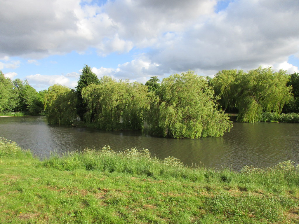
Weeping willow trees on islands in
Highfields Lake (geograph 4502636).jpg
357:
923:
Click on a date/time to view the file as it appeared at that time.
310:
260:
285:
235:
80:
1005:
295:
53° 33′ 25.6″ N, 1° 10′ 58″ W
245:
53° 33′ 26.2″ N, 1° 10′ 59″ W
484:
Add a one-line explanation of what this file represents
1015:
188:
Creative
Commons Attribution Share-alike license 2.0
124:
104:
Commons is a freely licensed media file repository.
653:
Creative
Commons Attribution-ShareAlike 2.0 Generic
70:(1,024 × 768 pixels, file size: 233 KB, MIME type:
228:Weeping willow trees on islands in Highfields Lake
209:Weeping willow trees on islands in Highfields Lake
140:Weeping willow trees on islands in Highfields Lake
453:https://creativecommons.org/licenses/by-sa/2.0
85:
459:Creative Commons Attribution-Share Alike 2.0
377:
8:
855:
791:
419:– to copy, distribute and transmit the work
925:
480:
998:The following other wikis use this file:
739:https://www.geograph.org.uk/photo/4502636
580:https://www.geograph.org.uk/profile/46229
985:
879:
863:
815:
799:
773:
757:
686:
670:
650:
634:
614:
598:
531:
515:
498:
495:
476:
469:
288:
238:
973:Transferred from geograph.co.uk using
317:View this and other nearby images on:
267:View this and other nearby images on:
7:
364:and is licensed for reuse under the
983:The following page uses this file:
914:
400:Attribution-Share Alike 2.0 Generic
388:
383:
368:Attribution-ShareAlike 2.0 license.
489:
483:
374:
351:
134:
117:
63:
488:
802:coordinates of the point of view
474:
430:Under the following conditions:
395:This file is licensed under the
387:
382:
376:
344:
323:
309:
301:
273:
259:
251:
84:
31:
21:
471:
135:
14:
689:file available on the internet
470:
352:This image was taken from the
26:
1:
866:coordinates of depicted place
817:53°33'26.215"N, 1°10'59.297"W
226:Jonathan Thacker /
207:Jonathan Thacker /
709:Geograph Britain and Ireland
545:object of statement has role
496:Items portrayed in this file
300:
250:
881:53°33'25.56"N, 1°10'57.68"W
1034:
1012:Usage on www.wikidata.org
1002:Usage on nn.wikipedia.org
444:same or compatible license
915:
16:
717:geograph.org.uk image ID
473:
410:
91:This is a file from the
972:
198:required by the license
176:
166:
155:
148:
145:
127:
95:. Information from its
358:this photograph's page
329:53.557100; -1.182690
279:53.557282; -1.183138
98:description page there
41:Size of this preview:
951:20:00, 6 August 2018
425:– to adapt the work
47:Other resolutions:
560:author name string
57:1,024 × 768 pixels
994:Global file usage
976:
857:
793:
637:copyright license
482:
373:
372:
356:collection. See
334:
333:
284:
283:
233:
232:
201:
185:
182:Reusing this file
113:
112:
93:Wikimedia Commons
32:Global file usage
1025:
963:
903:
902:
897:
839:
838:
833:
741:
736:
732:described at URL
726:
721:
711:
706:
601:copyright status
582:
577:
567:
566:Jonathan Thacker
564:
554:
549:
466:
463:
460:
457:
454:
446:as the original.
408:
407:Jonathan Thacker
397:Creative Commons
391:
390:
386:
385:
380:
379:
366:Creative Commons
362:Jonathan Thacker
354:Geograph project
348:
341:
330:
327:
313:
312:
306:
305:
304:
298:
297:
286:
280:
277:
263:
262:
256:
255:
254:
248:
247:
236:
195:
179:
171:Jonathan Thacker
151:
139:
131:
125:
109:
88:
87:
81:
75:
73:
60:
53:640 × 480 pixels
49:320 × 240 pixels
43:800 × 600 pixels
1033:
1032:
1028:
1027:
1026:
1024:
1023:
1022:
1006:Highfields Lake
992:
988:Highfields Lake
977:
969:
961:
917:
916:
913:
912:
911:
910:
909:
908:
907:
906:
905:
904:
900:
898:
895:
886:
885:
884:
882:
872:
871:
870:
868:
849:
848:
847:
846:
845:
844:
843:
842:
841:
840:
836:
834:
831:
822:
821:
820:
818:
808:
807:
806:
804:
785:
784:
783:
782:
781:
780:
779:
778:
776:
766:
765:
764:
762:
751:
750:
749:
748:
747:
746:
745:
744:
743:
742:
737:
734:
728:
727:
722:
719:
713:
712:
707:
704:
695:
694:
693:
691:
679:
678:
677:
675:
664:
663:
662:
661:
660:
659:
658:
657:
655:
643:
642:
641:
639:
628:
627:
626:
625:
624:
623:
622:
621:
619:
607:
606:
605:
603:
592:
591:
590:
589:
588:
587:
586:
585:
584:
583:
578:
575:
569:
568:
565:
562:
556:
555:
550:
547:
538:
537:
536:
534:
524:
523:
522:
520:
509:
508:
507:
506:
505:
503:
487:
486:
485:
468:
467:
464:
461:
458:
455:
452:
451:
409:
406:
403:
392:
369:
339:
328:
302:
293:
292:
289:Object location
278:
252:
243:
242:
239:Camera location
234:
223:
216:
204:
161:geograph.org.uk
141:
129:
122:
115:
114:
103:
102:
101:is shown below.
77:
71:
69:
62:
61:
46:
12:
11:
5:
1031:
1029:
1021:
1020:
1019:
1018:
1010:
1009:
1008:
996:
995:
991:
990:
981:
980:
975:
974:
971:
967:
964:
958:
953:
948:
944:
943:
940:
937:
934:
931:
928:
921:
920:
891:
890:
889:
888:
887:
883:
880:
878:
877:
876:
875:
874:
873:
869:
864:
862:
861:
860:
859:
853:
827:
826:
825:
824:
823:
819:
816:
814:
813:
812:
811:
810:
809:
805:
800:
798:
797:
796:
795:
789:
777:
774:
772:
771:
770:
769:
768:
767:
763:
758:
756:
755:
754:
753:
752:
730:
729:
715:
714:
700:
699:
698:
697:
696:
692:
687:
685:
684:
683:
682:
681:
680:
676:
673:source of file
671:
669:
668:
667:
666:
665:
656:
651:
649:
648:
647:
646:
645:
644:
640:
635:
633:
632:
631:
630:
629:
620:
615:
613:
612:
611:
610:
609:
608:
604:
599:
597:
596:
595:
594:
593:
571:
570:
558:
557:
543:
542:
541:
540:
539:
535:
532:
530:
529:
528:
527:
526:
525:
521:
516:
514:
513:
512:
511:
510:
504:
499:
497:
494:
493:
492:
491:
490:
479:
478:
475:
472:
450:
449:
448:
447:
437:
428:
427:
426:
420:
413:You are free:
404:
394:
393:
375:
371:
370:
349:
338:
335:
332:
331:
321:
315:
290:
282:
281:
271:
265:
240:
231:
230:
224:
221:
218:
217:
212:
205:
202:
190:
189:
186:
174:
173:
168:
164:
163:
157:
153:
152:
147:
143:
142:
132:
123:
121:
118:
116:
111:
110:
89:
79:
78:
40:
36:
35:
34:
29:
24:
19:
13:
10:
9:
6:
4:
3:
2:
1030:
1017:
1014:
1013:
1011:
1007:
1004:
1003:
1001:
1000:
999:
993:
989:
986:
984:
978:
970:
965:
959:
957:
954:
952:
949:
946:
945:
941:
938:
935:
932:
929:
927:
926:
924:
918:
894:
867:
830:
803:
761:
740:
733:
725:
718:
710:
703:
690:
674:
654:
638:
618:
602:
581:
574:
561:
553:
546:
519:
502:
456:CC BY-SA 2.0
445:
441:
438:
435:
432:
431:
429:
424:
421:
418:
415:
414:
412:
411:
405:Attribution:
401:
398:
381:
367:
363:
359:
355:
350:
347:
343:
342:
336:
326:
322:
320:
319:OpenStreetMap
316:
314:
296:
291:
287:
276:
272:
270:
269:OpenStreetMap
266:
264:
246:
241:
237:
229:
225:
220:
219:
215:
211: /
210:
206:
199:
194:
192:
191:
187:
183:
178:
175:
172:
169:
165:
162:
158:
154:
144:
138:
133:
126:
119:
107:
100:
99:
94:
90:
83:
82:
76:
67:
66:Original file
58:
54:
50:
44:
39:
33:
30:
28:
25:
23:
20:
18:
15:
997:
982:
960:1,024 × 768
922:
919:File history
552:photographer
439:
433:
422:
416:
361:
299:
249:
227:
214:CC BY-SA 2.0
208:
136:
106:You can help
96:
64:
22:File history
968:Schlosser67
775:31 May 2015
617:copyrighted
440:share alike
434:attribution
193:Attribution
150:31 May 2015
128:Description
979:File usage
936:Dimensions
533:some value
177:Permission
72:image/jpeg
27:File usage
933:Thumbnail
930:Date/Time
760:inception
337:Licensing
222:InfoField
203:InfoField
137:English:
1016:Q5758528
962:(233 KB)
702:operator
477:Captions
423:to remix
417:to share
402:license.
947:current
942:Comment
893:heading
852:heading
829:heading
788:heading
724:4502636
518:creator
501:depicts
481:English
120:Summary
68:
901:degree
856:degree
837:degree
792:degree
307:
257:
167:Author
156:Source
159:From
939:User
899:135
835:135
465:true
462:true
146:Date
17:File
573:URL
896::
832::
735::
720::
705::
576::
563::
548::
55:|
51:|
45:.
200:)
196:(
184:)
180:(
108:.
74:)
59:.
Text is available under the Creative Commons Attribution-ShareAlike License. Additional terms may apply.
.jpg)
.jpg¶ms=053.557282_N_-001.183138_E_globe:Earth_type:camera_source:geograph-osgb36(SE54210705)_heading:135.00&language=en)
.jpg¶ms=053.557100_N_-001.182690_E_globe:Earth_class:object_type:object_source:geograph-osgb36(SE54240703)_heading:135.00&language=en)
