38:
370:
303:
253:
295:
245:
317:
267:
338:
376:
381:
94:
865:"}},"text\/plain":{"en":{"":"heading"}}},"{\"value\":{\"amount\":\"+90\",\"unit\":\"http:\\\/\\\/www.wikidata.org\\\/entity\\\/Q28390\"},\"type\":\"quantity\"}":{"text\/html":{"en":{"P7787":"90
767:"}},"text\/plain":{"en":{"":"heading"}}},"{\"value\":{\"amount\":\"+90\",\"unit\":\"http:\\\/\\\/www.wikidata.org\\\/entity\\\/Q28390\"},\"type\":\"quantity\"}":{"text\/html":{"en":{"P7787":"90
861:
286:
236:
428:– You must give appropriate credit, provide a link to the license, and indicate if changes were made. You may do so in any reasonable manner, but not in any way that suggests the licensor endorses you or your use.
984:== {{int:filedesc}} == {{Information |description={{en|1=Weir - Warwick Castle View of the weir, seen from the large hall at Warwick Castle.}} |date=2009-04-06 |source=From |author=[http://www.geo
60:
56:
52:
48:
42:
105:
73:
862:
764:
699:
663:
627:
508:
310:
260:
749:
1146:
345:
1009:
This file contains additional information, probably added from the digital camera or scanner used to create or digitize it.
435:
562:
903:
876:
805:
778:
712:
683:
611:
585:
570:
555:
966:
961:
64:
37:
834:
742:
727:
647:
528:
492:
332:
391:
1012:
If the file has been modified from its original state, some details may not fully reflect the modified file.
1173:
434:– If you remix, transform, or build upon the material, you must distribute your contributions under the
352:
on the
Geograph website for the photographer's contact details. The copyright on this image is owned by
977:
388:
1209:
869:"}},"text\/plain":{"en":{"P7787":"90 degree"}}}}": -->
771:"}},"text\/plain":{"en":{"P7787":"90 degree"}}}}": -->
113:
205:
1290:
1115:
734:
719:
577:
189:
316:
266:
1253:
1191:
1038:
357:
100:
1300:
1263:
1078:
148:
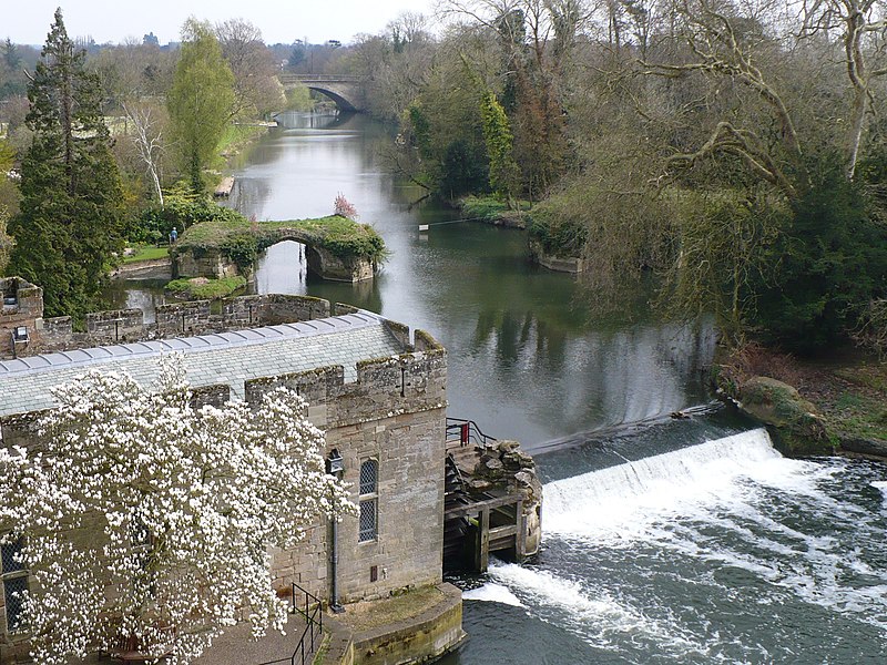
Weir - Warwick Castle View of the weir, seen from the large hall at
Warwick Castle.
1219:
157:
1058:
250:
300:
1021:
178:
168:
1310:
1048:
337:
1031:
998:
349:
934:
Click on a date/time to view the file as it appeared at that time.
302:
252:
277:
227:
88:
287:
52° 16′ 46″ N, 1° 35′ 02″ W
237:
52° 16′ 46″ N, 1° 35′ 07″ W
476:
Add a one-line explanation of what this file represents
138:
Weir - Warwick Castle - geograph.org.uk - 1712751.jpg
78:(2,048 × 1,536 pixels, file size: 1.3 MB, MIME type:
132:
112:
Commons is a freely licensed media file repository.
664:
Creative
Commons Attribution-ShareAlike 2.0 Generic
1214:Flash did not fire, compulsory flash suppression
445:https://creativecommons.org/licenses/by-sa/2.0
93:
451:Creative Commons Attribution-Share Alike 2.0
369:
8:
866:
768:
411:– to copy, distribute and transmit the work
1014:
936:
472:
735:https://www.geograph.org.uk/photo/1712751
578:https://www.geograph.org.uk/profile/44749
1308:
1298:
1288:
1280:
1272:
1261:
1251:
1243:
1235:
1227:
1217:
1207:
1199:
1189:
1181:
1171:
1163:
1155:
1144:
1136:
1128:
1120:
1110:
1102:
1094:
1086:
1075:
1067:
1056:
1046:
1036:
1026:
996:
890:
874:
848:
832:
792:
776:
697:
681:
661:
645:
625:
609:
542:
526:
506:
490:
487:
468:
461:
280:
230:
309:View this and other nearby images on:
259:View this and other nearby images on:
1016:
7:
356:and is licensed for reuse under the
994:The following page uses this file:
925:
392:Attribution-Share Alike 2.0 Generic
380:
375:
360:Attribution-ShareAlike 2.0 license.
1007:
481:
475:
366:
343:
142:
125:
71:
480:
1069:Date and time of data generation
779:coordinates of the point of view
466:
422:Under the following conditions:
387:This file is licensed under the
379:
374:
368:
336:
315:
301:
293:
265:
251:
243:
92:
21:
463:
143:
14:
700:file available on the internet
462:
344:This image was taken from the
26:
1:
877:coordinates of depicted place
31:
750:Geograph Britain and Ireland
556:object of statement has role
488:Items portrayed in this file
1157:Date and time of digitizing
292:
242:
1332:
1274:Focal length in 35 mm film
1232:One-chip color area sensor
892:52°16'45.52"N, 1°35'2.40"W
794:52°16'45.52"N, 1°35'7.44"W
436:same or compatible license
1122:File change date and time
926:
16:
713:geograph.org.uk image ID
465:
402:
99:This is a file from the
1237:Custom image processing
983:
218:Chris Page /
199:Chris Page /
190:required by the license
174:
163:
156:
153:
135:
103:. Information from its
1165:Image compression mode
350:this photograph's page
321:52.279310; -1.584000
271:52.279310; -1.585400
106:description page there
41:Size of this preview:
1183:Maximum land aperture
1096:Horizontal resolution
1043:1/640 sec (0.0015625)
220:Weir - Warwick Castle
201:Weir - Warwick Castle
65:2,048 × 1,536 pixels
1160:12:43, 6 April 2009
1130:Y and C positioning
1125:12:43, 6 April 2009
1104:Vertical resolution
1072:12:43, 6 April 2009
1018:Camera manufacturer
962:10:01, 5 March 2011
509:Warwick Castle Mill
417:– to adapt the work
47:Other resolutions:
1282:Scene capture type
1258:Auto white balance
586:author name string
61:1,280 × 960 pixels
57:1,024 × 768 pixels
1319:
1318:
987:
868:
770:
648:copyright license
474:
365:
364:
348:collection. See
326:
325:
276:
275:
225:
224:
193:
121:
120:
101:Wikimedia Commons
1323:
1138:Exposure Program
1015:
974:
914:
913:
908:
816:
815:
810:
752:
747:
737:
732:
728:described at URL
722:
717:
612:copyright status
593:
590:
580:
575:
565:
560:
458:
455:
452:
449:
446:
438:as the original.
400:
389:Creative Commons
383:
382:
378:
377:
372:
371:
358:Creative Commons
346:Geograph project
340:
333:
322:
319:
305:
304:
298:
297:
296:
290:
289:
278:
272:
269:
255:
254:
248:
247:
246:
240:
239:
228:
187:
159:
147:
139:
133:
117:
96:
95:
89:
83:
81:
68:
53:640 × 480 pixels
49:320 × 240 pixels
43:800 × 600 pixels
1331:
1330:
1326:
1325:
1324:
1322:
1321:
1320:
1186:3 APEX (f/2.83)
1003:
988:
980:
972:
928:
927:
924:
923:
922:
921:
920:
919:
918:
917:
916:
915:
911:
909:
906:
897:
896:
895:
893:
883:
882:
881:
879:
860:
859:
858:
857:
856:
855:
854:
853:
851:
841:
840:
839:
837:
826:
825:
824:
823:
822:
821:
820:
819:
818:
817:
813:
811:
808:
799:
798:
797:
795:
785:
784:
783:
781:
762:
761:
760:
759:
758:
757:
756:
755:
754:
753:
748:
745:
739:
738:
733:
730:
724:
723:
718:
715:
706:
705:
704:
702:
690:
689:
688:
686:
675:
674:
673:
672:
671:
670:
669:
668:
666:
654:
653:
652:
650:
639:
638:
637:
636:
635:
634:
633:
632:
630:
618:
617:
616:
614:
603:
602:
601:
600:
599:
598:
597:
596:
595:
594:
591:
588:
582:
581:
576:
573:
567:
566:
561:
558:
549:
548:
547:
545:
535:
534:
533:
531:
520:
519:
518:
517:
516:
515:
514:
513:
511:
499:
498:
497:
495:
479:
478:
477:
460:
459:
456:
453:
450:
447:
444:
443:
401:
398:
395:
384:
361:
331:
320:
294:
285:
284:
281:Object location
270:
244:
235:
234:
231:Camera location
226:
215:
208:
196:
169:geograph.org.uk
149:
137:
130:
123:
122:
111:
110:
109:is shown below.
85:
79:
77:
70:
69:
46:
12:
11:
5:
1329:
1327:
1317:
1316:
1313:
1307:
1306:
1303:
1297:
1296:
1293:
1287:
1286:
1283:
1279:
1278:
1275:
1271:
1270:
1267:
1260:
1259:
1256:
1250:
1249:
1246:
1242:
1241:
1240:Normal process
1238:
1234:
1233:
1230:
1229:Sensing method
1226:
1225:
1222:
1216:
1215:
1212:
1206:
1205:
1202:
1198:
1197:
1194:
1188:
1187:
1184:
1180:
1179:
1176:
1170:
1169:
1166:
1162:
1161:
1158:
1154:
1153:
1150:
1143:
1142:
1141:Normal program
1139:
1135:
1134:
1131:
1127:
1126:
1123:
1119:
1118:
1113:
1109:
1108:
1105:
1101:
1100:
1097:
1093:
1092:
1089:
1085:
1084:
1081:
1074:
1073:
1070:
1066:
1065:
1062:
1055:
1054:
1051:
1045:
1044:
1041:
1035:
1034:
1029:
1025:
1024:
1019:
1006:
1002:
1001:
992:
991:
986:
985:
982:
978:
975:
971:2,048 × 1,536
969:
964:
959:
955:
954:
951:
948:
945:
942:
939:
932:
931:
902:
901:
900:
899:
898:
894:
891:
889:
888:
887:
886:
885:
884:
880:
875:
873:
872:
871:
870:
864:
852:
849:
847:
846:
845:
844:
843:
842:
838:
833:
831:
830:
829:
828:
827:
804:
803:
802:
801:
800:
796:
793:
791:
790:
789:
788:
787:
786:
782:
777:
775:
774:
773:
772:
766:
741:
740:
726:
725:
711:
710:
709:
708:
707:
703:
698:
696:
695:
694:
693:
692:
691:
687:
684:source of file
682:
680:
679:
678:
677:
676:
667:
662:
660:
659:
658:
657:
656:
655:
651:
646:
644:
643:
642:
641:
640:
631:
626:
624:
623:
622:
621:
620:
619:
615:
610:
608:
607:
606:
605:
604:
584:
583:
569:
568:
554:
553:
552:
551:
550:
546:
543:
541:
540:
539:
538:
537:
536:
532:
527:
525:
524:
523:
522:
521:
512:
507:
505:
504:
503:
502:
501:
500:
496:
491:
489:
486:
485:
484:
483:
482:
471:
470:
467:
464:
442:
441:
440:
439:
429:
420:
419:
418:
412:
405:You are free:
396:
386:
385:
367:
363:
362:
341:
330:
327:
324:
323:
313:
307:
282:
274:
273:
263:
257:
232:
223:
222:
216:
213:
210:
209:
204:
197:
194:
182:
181:
176:
172:
171:
165:
161:
160:
155:
151:
150:
140:
131:
129:
126:
124:
119:
118:
97:
87:
86:
40:
36:
35:
34:
29:
24:
19:
13:
10:
9:
6:
4:
3:
2:
1328:
1314:
1312:
1309:
1304:
1302:
1299:
1294:
1292:
1289:
1284:
1281:
1276:
1273:
1268:
1265:
1262:
1257:
1255:
1254:White balance
1252:
1248:Auto exposure
1247:
1245:Exposure mode
1244:
1239:
1236:
1231:
1228:
1223:
1221:
1218:
1213:
1211:
1208:
1203:
1200:
1195:
1193:
1192:Metering mode
1190:
1185:
1182:
1177:
1175:
1174:Exposure bias
1172:
1167:
1164:
1159:
1156:
1151:
1148:
1145:
1140:
1137:
1132:
1129:
1124:
1121:
1117:
1114:
1112:Software used
1111:
1106:
1103:
1098:
1095:
1090:
1087:
1082:
1080:
1076:
1071:
1068:
1063:
1060:
1057:
1052:
1050:
1047:
1042:
1040:
1039:Exposure time
1037:
1033:
1030:
1027:
1023:
1020:
1017:
1013:
1010:
1004:
1000:
997:
995:
989:
981:
976:
970:
968:
965:
963:
960:
957:
956:
952:
949:
946:
943:
940:
938:
937:
935:
929:
905:
878:
836:
807:
780:
751:
744:
736:
729:
721:
714:
701:
685:
665:
649:
629:
613:
587:
579:
572:
564:
557:
530:
510:
494:
448:CC BY-SA 2.0
437:
433:
430:
427:
424:
423:
421:
416:
413:
410:
407:
406:
404:
403:
397:Attribution:
393:
390:
373:
359:
355:
351:
347:
342:
339:
335:
334:
328:
318:
314:
312:
311:OpenStreetMap
308:
306:
288:
283:
279:
268:
264:
262:
261:OpenStreetMap
258:
256:
238:
233:
229:
221:
217:
212:
211:
207:
203: /
202:
198:
191:
186:
184:
183:
180:
177:
173:
170:
166:
162:
152:
146:
141:
134:
127:
115:
108:
107:
102:
98:
91:
90:
84:
75:
74:Original file
66:
62:
58:
54:
50:
44:
39:
33:
30:
28:
25:
23:
20:
18:
15:
1264:Digital zoom
1201:Light source
1079:focal length
1028:Camera model
1011:
1008:
993:
933:
930:File history
850:6 April 2009
563:photographer
431:
425:
414:
408:
353:
291:
241:
219:
206:CC BY-SA 2.0
200:
158:6 April 2009
144:
114:You can help
104:
72:
22:File history
1220:Color space
1088:Orientation
979:GeographBot
628:copyrighted
432:share alike
426:attribution
185:Attribution
136:Description
1301:Saturation
990:File usage
947:Dimensions
592:Chris Page
544:some value
399:Chris Page
354:Chris Page
179:Chris Page
80:image/jpeg
27:File usage
1311:Sharpness
1116:Ver.1.0
1059:ISO speed
1022:Panasonic
944:Thumbnail
941:Date/Time
835:inception
329:Licensing
214:InfoField
195:InfoField
145:English:
1291:Contrast
1285:Standard
1133:Co-sited
1049:F-number
1005:Metadata
973:(1.3 MB)
743:operator
469:Captions
415:to remix
409:to share
394:license.
32:Metadata
1204:Unknown
1196:Pattern
1149:version
1032:DMC-LZ7
999:Warwick
958:current
953:Comment
904:heading
863:heading
806:heading
765:heading
720:1712751
529:creator
493:depicts
473:English
128:Summary
76:
1315:Normal
1305:Normal
1295:Normal
1107:72 dpi
1099:72 dpi
1091:Normal
1083:6.1 mm
1061:rating
912:degree
867:degree
814:degree
769:degree
299:
249:
175:Author
164:Source
1277:46 mm
1266:ratio
1210:Flash
1077:Lens
1053:f/2.8
167:From
1224:sRGB
1152:2.21
1147:Exif
950:User
457:true
454:true
154:Date
17:File
1064:100
910:90
812:90
571:URL
907::
809::
746::
731::
716::
589::
574::
559::
63:|
59:|
55:|
51:|
45:.
1269:0
1178:0
1168:4
192:)
188:(
116:.
82:)
67:.
Text is available under the Creative Commons Attribution-ShareAlike License. Additional terms may apply.

_heading:90.00&language=en)
_heading:90.00&language=en)
