348:
281:
231:
447:
273:
223:
295:
245:
316:
354:
359:
72:
976:"}},"text\/plain":{"en":{"":"heading"}}},"{\"value\":{\"amount\":\"+0\",\"unit\":\"http:\\\/\\\/www.wikidata.org\\\/entity\\\/Q28390\"},\"type\":\"quantity\"}":{"text\/html":{"en":{"P7787":"0
876:"}},"text\/plain":{"en":{"":"heading"}}},"{\"value\":{\"amount\":\"+0\",\"unit\":\"http:\\\/\\\/www.wikidata.org\\\/entity\\\/Q28390\"},\"type\":\"quantity\"}":{"text\/html":{"en":{"P7787":"0
972:
264:
214:
43:
406:– You must give appropriate credit, provide a link to the license, and indicate if changes were made. You may do so in any reasonable manner, but not in any way that suggests the licensor endorses you or your use.
1095:== {{int:filedesc}} == {{Information |description={{en|1=Werrington: Ladycross A bend in the B3254, the road to Bude and Kilkhampton from Launceston. Looking north}} |date=2007-06-05 |source=From |
83:
51:
455:
973:
873:
472:
774:
738:
702:
288:
238:
794:
1302:
323:
1165:
This file contains additional information, probably added from the digital camera or scanner used to create or digitize it.
413:
959:
665:
1271:
1077:
1072:
1014:
987:
943:
914:
887:
817:
758:
686:
658:
645:
630:
42:
548:
845:
802:
787:
722:
603:
586:
495:
310:
487:
369:
1168:
If the file has been modified from its original state, some details may not fully reflect the modified file.
468:
1187:
126:
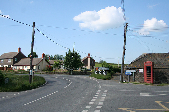
Werrington: Ladycross A bend in the B3254, the road to Bude and
Kilkhampton from Launceston. Looking north
1339:
412:– If you remix, transform, or build upon the material, you must distribute your contributions under the
330:
on the
Geograph website for the photographer's contact details. The copyright on this image is owned by
1088:
366:
1359:
980:"}},"text\/plain":{"en":{"P7787":"0 degree"}}}}": -->
880:"}},"text\/plain":{"en":{"P7787":"0 degree"}}}}": -->
476:
91:
183:
461:
Remove redundant categories and try to put this image in the most specific category/categories
824:
809:
637:
167:
1177:
539:
543:
535:
531:
527:
523:
519:
515:
511:
507:
503:
294:
244:
1419:
1349:
1321:
1194:
335:
78:
1234:
1369:
135:
1214:
278:
228:
1109:
156:
146:
1204:
315:
327:
1045:
Click on a date/time to view the file as it appeared at that time.
280:
230:
1142:
255:
205:
66:
1137:
265:
50° 40′ 08″ N, 4° 22′ 41″ W
215:
50° 40′ 08″ N, 4° 22′ 41″ W
570:
Add a one-line explanation of what this file represents
1127:
475:
combined with a database. You can also have a look at
467:
The location categories are based on information from
1152:
116:
Werrington, Ladycross - geograph.org.uk - 457056.jpg
110:
90:
Commons is a freely licensed media file repository.
52:
Werrington,_Ladycross_-_geograph.org.uk_-_457056.jpg
739:
Creative
Commons Attribution-ShareAlike 2.0 Generic
56:(640 × 427 pixels, file size: 132 KB, MIME type:
1364:Flash did not fire, compulsory flash suppression
452:The categories of this image should be checked.
423:https://creativecommons.org/licenses/by-sa/2.0
71:
429:Creative Commons Attribution-Share Alike 2.0
347:
8:
977:
877:
389:– to copy, distribute and transmit the work
1170:
1047:
566:
547:
1120:The following other wikis use this file:
810:https://www.geograph.org.uk/photo/457056
638:https://www.geograph.org.uk/profile/1578
1427:
1417:
1409:
1401:
1393:
1385:
1377:
1367:
1357:
1347:
1337:
1329:
1319:
1311:
1300:
1292:
1284:
1276:
1266:
1258:
1250:
1242:
1231:
1223:
1212:
1202:
1192:
1182:
1107:
1001:
985:
957:
941:
901:
885:
859:
843:
772:
756:
736:
720:
700:
684:
617:
601:
584:
581:
562:
555:
494:This image was uploaded as part of the
258:
208:
287:View this and other nearby images on:
237:View this and other nearby images on:
1172:
482:The topic category from Geograph was
7:
334:and is licensed for reuse under the
1105:The following page uses this file:
1036:
370:Attribution-Share Alike 2.0 Generic
358:
353:
338:Attribution-ShareAlike 2.0 license.
1163:
575:
569:
344:
321:
120:
103:
49:
574:
1225:Date and time of data generation
888:coordinates of the point of view
560:
445:
400:Under the following conditions:
365:This file is licensed under the
357:
352:
346:
314:
293:
279:
271:
243:
229:
221:
70:
31:
21:
557:
121:
46:No higher resolution available.
14:
775:file available on the internet
556:
322:This image was taken from the
26:
1:
988:coordinates of depicted place
36:
1272:Adobe Photoshop Elements 2.0
795:Geograph Britain and Ireland
659:object of statement has role
582:Items portrayed in this file
1395:Focal plane resolution unit
1313:Date and time of digitizing
1449:
1149:Usage on www.wikidata.org
1134:Usage on kw.wikipedia.org
1124:Usage on eu.wikipedia.org
1003:50°40'8.22"N, 4°22'41.16"W
903:50°40'7.57"N, 4°22'41.16"W
414:same or compatible license
270:
220:
196:Martin Bodman /
177:Martin Bodman /
1278:File change date and time
1037:
16:
1387:Focal plane Y resolution
1379:Focal plane X resolution
818:geograph.org.uk image ID
559:
477:this tool from mysociety
443:
442:
380:
77:This is a file from the
1403:Custom image processing
1094:
473:this OpenStreetMap tool
168:required by the license
152:
141:
134:
131:
113:
81:. Information from its
1188:Canon EOS 350D DIGITAL
1073:16:50, 4 February 2011
328:this photograph's page
299:50.668950; -4.378100
249:50.668770; -4.378100
84:description page there
1252:Horizontal resolution
1199:1/4,000 sec (0.00025)
496:Geograph batch upload
486:(find similar images
198:Werrington: Ladycross
179:Werrington: Ladycross
1424:Manual white balance
488:junction at Geograph
464:Remove this template
1286:Y and C positioning
1260:Vertical resolution
1174:Camera manufacturer
540:português do Brasil
395:– to adapt the work
1429:Scene capture type
1316:16:26, 5 June 2007
1281:22:18, 5 June 2007
1228:16:26, 5 June 2007
1143:Knowledge:Kernow/L
646:author name string
469:this geonames tool
1436:
1435:
1116:Global file usage
1098:
979:
879:
723:copyright license
568:
551:
498:
343:
342:
326:collection. See
304:
303:
254:
253:
203:
202:
171:
99:
98:
79:Wikimedia Commons
32:Global file usage
1440:
1390:3,958.7628865979
1294:Exposure Program
1171:
1138:Knowledge:Kernow
1085:
1025:
1024:
1019:
925:
924:
919:
827:
822:
812:
807:
803:described at URL
797:
792:
687:copyright status
668:
663:
653:
650:
640:
635:
552:
493:
450:
449:
448:
436:
433:
430:
427:
424:
416:as the original.
378:
367:Creative Commons
361:
360:
356:
355:
350:
349:
336:Creative Commons
324:Geograph project
318:
311:
300:
297:
283:
282:
276:
275:
274:
268:
267:
256:
250:
247:
233:
232:
226:
225:
224:
218:
217:
206:
165:
137:
125:
117:
111:
95:
74:
73:
67:
61:
59:
1448:
1447:
1443:
1442:
1441:
1439:
1438:
1437:
1382:3,954.233409611
1334:5.3106994628906
1326:11.965789794922
1159:
1114:
1099:
1091:
1083:
1039:
1038:
1035:
1034:
1033:
1032:
1031:
1030:
1029:
1028:
1027:
1026:
1022:
1020:
1017:
1008:
1007:
1006:
1004:
994:
993:
992:
990:
971:
970:
969:
968:
967:
966:
965:
964:
962:
950:
949:
948:
946:
935:
934:
933:
932:
931:
930:
929:
928:
927:
926:
922:
920:
917:
908:
907:
906:
904:
894:
893:
892:
890:
871:
870:
869:
868:
867:
866:
865:
864:
862:
852:
851:
850:
848:
837:
836:
835:
834:
833:
832:
831:
830:
829:
828:
823:
820:
814:
813:
808:
805:
799:
798:
793:
790:
781:
780:
779:
777:
765:
764:
763:
761:
750:
749:
748:
747:
746:
745:
744:
743:
741:
729:
728:
727:
725:
714:
713:
712:
711:
710:
709:
708:
707:
705:
693:
692:
691:
689:
678:
677:
676:
675:
674:
673:
672:
671:
670:
669:
664:
661:
655:
654:
651:
648:
642:
641:
636:
633:
624:
623:
622:
620:
610:
609:
608:
606:
595:
594:
593:
592:
591:
589:
573:
572:
571:
554:
502:
499:
456:Check them now!
446:
444:
438:
437:
434:
431:
428:
425:
422:
421:
379:
376:
373:
362:
339:
309:
298:
272:
263:
262:
259:Object location
248:
222:
213:
212:
209:Camera location
204:
193:
186:
174:
147:geograph.org.uk
127:
115:
108:
101:
100:
89:
88:
87:is shown below.
63:
57:
55:
48:
47:
12:
11:
5:
1446:
1444:
1434:
1433:
1430:
1426:
1425:
1422:
1416:
1415:
1412:
1408:
1407:
1406:Normal process
1404:
1400:
1399:
1396:
1392:
1391:
1388:
1384:
1383:
1380:
1376:
1375:
1372:
1366:
1365:
1362:
1356:
1355:
1352:
1346:
1345:
1342:
1336:
1335:
1332:
1328:
1327:
1324:
1318:
1317:
1314:
1310:
1309:
1306:
1299:
1298:
1295:
1291:
1290:
1287:
1283:
1282:
1279:
1275:
1274:
1269:
1265:
1264:
1261:
1257:
1256:
1253:
1249:
1248:
1245:
1241:
1240:
1237:
1230:
1229:
1226:
1222:
1221:
1218:
1211:
1210:
1207:
1201:
1200:
1197:
1191:
1190:
1185:
1181:
1180:
1175:
1162:
1158:
1157:
1156:
1155:
1147:
1146:
1145:
1140:
1132:
1131:
1130:
1118:
1117:
1113:
1112:
1103:
1102:
1097:
1096:
1093:
1089:
1086:
1080:
1075:
1070:
1066:
1065:
1062:
1059:
1056:
1053:
1050:
1043:
1042:
1013:
1012:
1011:
1010:
1009:
1005:
1002:
1000:
999:
998:
997:
996:
995:
991:
986:
984:
983:
982:
981:
975:
963:
960:Canon EOS 350D
958:
956:
955:
954:
953:
952:
951:
947:
942:
940:
939:
938:
937:
936:
913:
912:
911:
910:
909:
905:
902:
900:
899:
898:
897:
896:
895:
891:
886:
884:
883:
882:
881:
875:
863:
860:
858:
857:
856:
855:
854:
853:
849:
844:
842:
841:
840:
839:
838:
816:
815:
801:
800:
786:
785:
784:
783:
782:
778:
773:
771:
770:
769:
768:
767:
766:
762:
759:source of file
757:
755:
754:
753:
752:
751:
742:
737:
735:
734:
733:
732:
731:
730:
726:
721:
719:
718:
717:
716:
715:
706:
701:
699:
698:
697:
696:
695:
694:
690:
685:
683:
682:
681:
680:
679:
657:
656:
644:
643:
629:
628:
627:
626:
625:
621:
618:
616:
615:
614:
613:
612:
611:
607:
602:
600:
599:
598:
597:
596:
590:
585:
583:
580:
579:
578:
577:
576:
565:
564:
561:
558:
492:
491:
480:
465:
462:
420:
419:
418:
417:
407:
398:
397:
396:
390:
383:You are free:
374:
364:
363:
345:
341:
340:
319:
308:
305:
302:
301:
291:
285:
260:
252:
251:
241:
235:
210:
201:
200:
194:
191:
188:
187:
182:
175:
172:
160:
159:
154:
150:
149:
143:
139:
138:
133:
129:
128:
118:
109:
107:
104:
102:
97:
96:
75:
65:
64:
45:
41:
40:
39:
34:
29:
24:
19:
13:
10:
9:
6:
4:
3:
2:
1445:
1431:
1428:
1423:
1421:
1420:White balance
1418:
1414:Auto exposure
1413:
1411:Exposure mode
1410:
1405:
1402:
1397:
1394:
1389:
1386:
1381:
1378:
1373:
1371:
1368:
1363:
1361:
1358:
1353:
1351:
1350:Metering mode
1348:
1343:
1341:
1340:Exposure bias
1338:
1333:
1331:APEX aperture
1330:
1325:
1323:
1322:Shutter speed
1320:
1315:
1312:
1307:
1304:
1301:
1296:
1293:
1288:
1285:
1280:
1277:
1273:
1270:
1268:Software used
1267:
1262:
1259:
1254:
1251:
1246:
1243:
1238:
1236:
1232:
1227:
1224:
1219:
1216:
1213:
1208:
1206:
1203:
1198:
1196:
1195:Exposure time
1193:
1189:
1186:
1183:
1179:
1176:
1173:
1169:
1166:
1160:
1154:
1151:
1150:
1148:
1144:
1141:
1139:
1136:
1135:
1133:
1129:
1126:
1125:
1123:
1122:
1121:
1115:
1111:
1108:
1106:
1100:
1092:
1087:
1081:
1079:
1076:
1074:
1071:
1068:
1067:
1063:
1060:
1057:
1054:
1051:
1049:
1048:
1046:
1040:
1016:
989:
961:
945:
944:captured with
916:
889:
847:
826:
819:
811:
804:
796:
789:
776:
760:
740:
724:
704:
688:
667:
660:
652:Martin Bodman
647:
639:
632:
605:
588:
553:
550:
545:
541:
537:
533:
529:
525:
521:
517:
513:
509:
505:
500:
497:
489:
485:
484:Road junction
481:
478:
474:
470:
466:
463:
460:
459:
458:
457:
453:
441:
440:
426:CC BY-SA 2.0
415:
411:
408:
405:
402:
401:
399:
394:
391:
388:
385:
384:
382:
381:
377:Martin Bodman
375:Attribution:
371:
368:
351:
337:
333:
332:Martin Bodman
329:
325:
320:
317:
313:
312:
306:
296:
292:
290:
289:OpenStreetMap
286:
284:
266:
261:
257:
246:
242:
240:
239:OpenStreetMap
236:
234:
216:
211:
207:
199:
195:
190:
189:
185:
181: /
180:
176:
169:
164:
162:
161:
158:
157:Martin Bodman
155:
151:
148:
144:
140:
130:
124:
119:
112:
105:
93:
86:
85:
80:
76:
69:
68:
62:
53:
44:
38:
35:
33:
30:
28:
25:
23:
20:
18:
15:
1235:focal length
1184:Camera model
1167:
1164:
1119:
1104:
1044:
1041:File history
666:photographer
501:
483:
454:
451:
439:
409:
403:
392:
386:
331:
269:
219:
197:
184:CC BY-SA 2.0
178:
122:
92:You can help
82:
50:
22:File history
1370:Color space
1297:Not defined
1244:Orientation
1090:GeographBot
861:5 June 2007
703:copyrighted
410:share alike
404:attribution
163:Attribution
136:5 June 2007
114:Description
1101:File usage
1082:640 × 427
1058:Dimensions
619:some value
528:македонски
58:image/jpeg
27:File usage
1215:ISO speed
1128:Ladycross
1110:Ladycross
1055:Thumbnail
1052:Date/Time
846:inception
536:português
307:Licensing
192:InfoField
173:InfoField
123:English:
1432:Standard
1289:Co-sited
1205:F-number
1161:Metadata
1153:Q6470753
1084:(132 KB)
788:operator
563:Captions
546: |
542: |
538: |
534: |
530: |
526: |
522: |
518: |
514: |
512:français
510: |
506: |
393:to remix
387:to share
372:license.
37:Metadata
1354:Pattern
1305:version
1069:current
1064:Comment
1015:heading
974:heading
915:heading
874:heading
604:creator
587:depicts
567:English
504:English
106:Summary
54:
1398:inches
1263:72 dpi
1255:72 dpi
1247:Normal
1217:rating
1023:degree
978:degree
923:degree
878:degree
825:457056
544:Türkçe
532:മലയാളം
524:magyar
516:galego
277:
227:
153:Author
142:Source
1360:Flash
1239:27 mm
1233:Lens
1209:f/6.3
1178:Canon
520:עברית
508:suomi
145:From
1374:sRGB
1308:2.21
1303:Exif
1061:User
471:and
435:true
432:true
132:Date
17:File
1220:800
631:URL
549:+/−
1021:0
1018::
921:0
918::
821::
806::
791::
662::
649::
634::
1344:0
490:)
479:.
170:)
166:(
94:.
60:)
Text is available under the Creative Commons Attribution-ShareAlike License. Additional terms may apply.
_heading:0.00&language=en)
_heading:0.00&language=en)
