347:
280:
230:
272:
222:
294:
244:
315:
353:
358:
67:
823:"}},"text\/plain":{"en":{"":"heading"}}},"{\"value\":{\"amount\":\"+180\",\"unit\":\"http:\\\/\\\/www.wikidata.org\\\/entity\\\/Q28390\"},\"type\":\"quantity\"}":{"text\/html":{"en":{"P7787":"180
638:"}},"text\/plain":{"en":{"":"heading"}}},"{\"value\":{\"amount\":\"+180\",\"unit\":\"http:\\\/\\\/www.wikidata.org\\\/entity\\\/Q28390\"},\"type\":\"quantity\"}":{"text\/html":{"en":{"P7787":"180
959:
819:
213:
38:
405:– You must give appropriate credit, provide a link to the license, and indicate if changes were made. You may do so in any reasonable manner, but not in any way that suggests the licensor endorses you or your use.
78:
46:
122:
125:
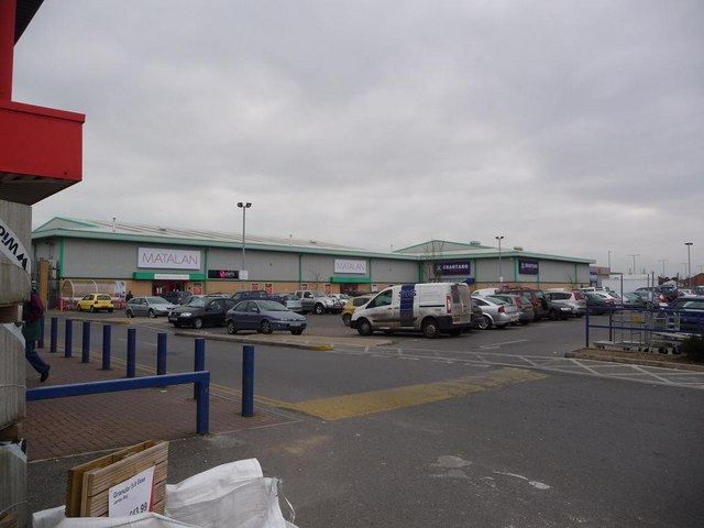
is immediately to the northeast. The building on the left is occupied by Wickes DIY store and there are a few more units to the right of the
Matalan and Brantano stores centre of picture.
820:
635:
976:== {{int:filedesc}} == {{Information |description={{en|1=West Howe: Turbary Retail Park One of two adjoining retail parks which merge more or less as one
958:
953:
37:
755:
621:
585:
287:
237:
790:
322:
1005:
This file contains additional information, probably added from the digital camera or scanner used to create or digitize it.
412:
533:
890:
861:
834:
768:
739:
676:
649:
569:
541:
526:
513:
798:
783:
705:
605:
486:
469:
309:
368:
1008:
If the file has been modified from its original state, some details may not fully reflect the modified file.
990:
The following pages on the
English Knowledge (XXG) use this file (pages on other projects are not listed):
411:– If you remix, transform, or build upon the material, you must distribute your contributions under the
329:
on the
Geograph website for the photographer's contact details. The copyright on this image is owned by
969:
365:
827:"}},"text\/plain":{"en":{"P7787":"180 degree"}}}}": -->
642:"}},"text\/plain":{"en":{"P7787":"180 degree"}}}}": -->
121:
West Howe: Turbary Retail Park One of two adjoining retail parks which merge more or less as one -
86:
182:
977:
805:
775:
548:
166:
293:
243:
980:
is immediately to the northeast. The building on the left is occupied by Wickes DIY st
334:
73:
994:
134:
277:
227:
155:
145:
314:
326:
926:
Click on a date/time to view the file as it appeared at that time.
279:
229:
254:
204:
111:
West Howe, Turbary Retail Park - geograph.org.uk - 1105817.jpg
61:
47:
West_Howe,_Turbary_Retail_Park_-_geograph.org.uk_-_1105817.jpg
264:
50° 45′ 22″ N, 1° 55′ 37″ W
214:
50° 45′ 24″ N, 1° 55′ 37″ W
453:
Add a one-line explanation of what this file represents
105:
85:
Commons is a freely licensed media file repository.
622:
Creative
Commons Attribution-ShareAlike 2.0 Generic
51:(640 × 480 pixels, file size: 48 KB, MIME type:
422:https://creativecommons.org/licenses/by-sa/2.0
66:
428:Creative Commons Attribution-Share Alike 2.0
346:
8:
824:
639:
388:– to copy, distribute and transmit the work
1010:
928:
449:
806:https://www.geograph.org.uk/photo/1105817
549:https://www.geograph.org.uk/profile/14700
1012:
992:
904:
888:
848:
832:
753:
737:
719:
703:
663:
647:
619:
603:
583:
567:
500:
484:
467:
464:
445:
438:
257:
207:
286:View this and other nearby images on:
236:View this and other nearby images on:
7:
333:and is licensed for reuse under the
917:
369:Attribution-Share Alike 2.0 Generic
357:
352:
337:Attribution-ShareAlike 2.0 license.
1003:
458:
452:
343:
320:
115:
98:
44:
457:
650:coordinates of the point of view
443:
399:Under the following conditions:
364:This file is licensed under the
356:
351:
345:
313:
292:
278:
270:
242:
228:
220:
65:
21:
440:
116:
41:No higher resolution available.
14:
756:file available on the internet
439:
321:This image was taken from the
197:West Howe: Turbary Retail Park
178:West Howe: Turbary Retail Park
26:
1:
835:coordinates of depicted place
31:
791:Geograph Britain and Ireland
527:object of statement has role
465:Items portrayed in this file
269:
219:
850:50°45'22.46"N, 1°55'37.20"W
665:50°45'24.41"N, 1°55'37.20"W
1034:
413:same or compatible license
918:
195:Chris Downer /
176:Chris Downer /
16:
769:geograph.org.uk image ID
442:
379:
72:This is a file from the
975:
954:19:30, 24 February 2011
167:required by the license
151:
140:
133:
130:
108:
76:. Information from its
327:this photograph's page
298:50.756240; -1.927000
248:50.756780; -1.927000
79:description page there
394:– to adapt the work
514:author name string
1021:
1020:
983:
826:
641:
606:copyright license
451:
342:
341:
325:collection. See
303:
302:
253:
252:
202:
201:
170:
94:
93:
74:Wikimedia Commons
1025:
1011:
966:
872:
871:
866:
808:
803:
799:described at URL
793:
788:
778:
773:
687:
686:
681:
570:copyright status
551:
546:
536:
531:
521:
518:
435:
432:
429:
426:
423:
415:as the original.
377:
366:Creative Commons
360:
359:
355:
354:
349:
348:
335:Creative Commons
323:Geograph project
317:
310:
299:
296:
282:
281:
275:
274:
273:
267:
266:
255:
249:
246:
232:
231:
225:
224:
223:
217:
216:
205:
164:
136:
120:
112:
106:
90:
69:
68:
62:
56:
54:
1033:
1032:
1028:
1027:
1026:
1024:
1023:
1022:
999:
991:
984:
972:
964:
920:
919:
916:
915:
914:
913:
912:
911:
910:
909:
907:
897:
896:
895:
893:
882:
881:
880:
879:
878:
877:
876:
875:
874:
873:
869:
867:
864:
855:
854:
853:
851:
841:
840:
839:
837:
818:
817:
816:
815:
814:
813:
812:
811:
810:
809:
804:
801:
795:
794:
789:
786:
780:
779:
774:
771:
762:
761:
760:
758:
746:
745:
744:
742:
731:
730:
729:
728:
727:
726:
725:
724:
722:
712:
711:
710:
708:
697:
696:
695:
694:
693:
692:
691:
690:
689:
688:
684:
682:
679:
670:
669:
668:
666:
656:
655:
654:
652:
633:
632:
631:
630:
629:
628:
627:
626:
624:
612:
611:
610:
608:
597:
596:
595:
594:
593:
592:
591:
590:
588:
576:
575:
574:
572:
561:
560:
559:
558:
557:
556:
555:
554:
553:
552:
547:
544:
538:
537:
532:
529:
523:
522:
519:
516:
507:
506:
505:
503:
493:
492:
491:
489:
478:
477:
476:
475:
474:
472:
456:
455:
454:
437:
436:
433:
430:
427:
424:
421:
420:
378:
375:
372:
361:
338:
308:
297:
271:
262:
261:
258:Object location
247:
221:
212:
211:
208:Camera location
203:
192:
185:
173:
146:geograph.org.uk
126:
110:
103:
96:
95:
84:
83:
82:is shown below.
58:
52:
50:
43:
42:
12:
11:
5:
1031:
1029:
1019:
1018:
1015:
1002:
998:
997:
989:
988:
987:
982:
981:
974:
970:
967:
961:
956:
951:
947:
946:
943:
940:
937:
934:
931:
924:
923:
908:
905:
903:
902:
901:
900:
899:
898:
894:
889:
887:
886:
885:
884:
883:
860:
859:
858:
857:
856:
852:
849:
847:
846:
845:
844:
843:
842:
838:
833:
831:
830:
829:
828:
822:
797:
796:
782:
781:
767:
766:
765:
764:
763:
759:
754:
752:
751:
750:
749:
748:
747:
743:
740:source of file
738:
736:
735:
734:
733:
732:
723:
721:4 January 2009
720:
718:
717:
716:
715:
714:
713:
709:
704:
702:
701:
700:
699:
698:
675:
674:
673:
672:
671:
667:
664:
662:
661:
660:
659:
658:
657:
653:
648:
646:
645:
644:
643:
637:
625:
620:
618:
617:
616:
615:
614:
613:
609:
604:
602:
601:
600:
599:
598:
589:
584:
582:
581:
580:
579:
578:
577:
573:
568:
566:
565:
564:
563:
562:
540:
539:
525:
524:
512:
511:
510:
509:
508:
504:
501:
499:
498:
497:
496:
495:
494:
490:
485:
483:
482:
481:
480:
479:
473:
468:
466:
463:
462:
461:
460:
459:
448:
447:
444:
441:
419:
418:
417:
416:
406:
397:
396:
395:
389:
382:You are free:
373:
363:
362:
344:
340:
339:
318:
307:
304:
301:
300:
290:
284:
259:
251:
250:
240:
234:
209:
200:
199:
193:
190:
187:
186:
181:
174:
171:
159:
158:
153:
149:
148:
142:
138:
137:
135:4 January 2009
132:
128:
127:
113:
104:
102:
99:
97:
92:
91:
70:
60:
59:
40:
36:
35:
34:
29:
24:
19:
13:
10:
9:
6:
4:
3:
2:
1030:
1016:
1013:
1009:
1006:
1000:
996:
993:
985:
979:
973:
968:
962:
960:
957:
955:
952:
949:
948:
944:
941:
938:
935:
932:
930:
929:
927:
921:
892:
863:
836:
807:
800:
792:
785:
777:
770:
757:
741:
707:
678:
651:
623:
607:
587:
571:
550:
543:
535:
528:
515:
488:
471:
425:CC BY-SA 2.0
414:
410:
407:
404:
401:
400:
398:
393:
390:
387:
384:
383:
381:
380:
374:Attribution:
370:
367:
350:
336:
332:
328:
324:
319:
316:
312:
311:
305:
295:
291:
289:
288:OpenStreetMap
285:
283:
265:
260:
256:
245:
241:
239:
238:OpenStreetMap
235:
233:
215:
210:
206:
198:
194:
189:
188:
184:
180: /
179:
175:
168:
163:
161:
160:
157:
154:
150:
147:
143:
139:
129:
124:
119:
114:
107:
100:
88:
81:
80:
75:
71:
64:
63:
57:
48:
39:
33:
30:
28:
25:
23:
20:
18:
15:
1007:
1004:
995:Turbary Park
925:
922:File history
534:photographer
520:Chris Downer
408:
402:
391:
385:
376:Chris Downer
331:Chris Downer
330:
268:
218:
196:
183:CC BY-SA 2.0
177:
156:Chris Downer
117:
87:You can help
77:
45:
22:File history
971:GeographBot
586:copyrighted
409:share alike
403:attribution
162:Attribution
109:Description
1014:_error
986:File usage
963:640 × 480
939:Dimensions
906:image/jpeg
891:media type
502:some value
53:image/jpeg
27:File usage
936:Thumbnail
933:Date/Time
706:inception
306:Licensing
191:InfoField
172:InfoField
118:English:
1001:Metadata
784:operator
446:Captions
392:to remix
386:to share
371:license.
32:Metadata
978:1105821
965:(48 KB)
950:current
945:Comment
862:heading
821:heading
776:1105817
677:heading
636:heading
487:creator
470:depicts
450:English
123:1105821
101:Summary
49:
870:degree
825:degree
685:degree
640:degree
276:
226:
152:Author
141:Source
144:From
942:User
868:180
683:180
434:true
431:true
131:Date
17:File
542:URL
865::
802::
787::
772::
680::
545::
530::
517::
1017:0
169:)
165:(
89:.
55:)
Text is available under the Creative Commons Attribution-ShareAlike License. Additional terms may apply.
_heading:180.00&language=en)
_heading:180.00&language=en)
