38:
242:
248:
253:
1041:
94:
538:
771:
881:
300:– You must give appropriate credit, provide a link to the license, and indicate if changes were made. You may do so in any reasonable manner, but not in any way that suggests the licensor endorses you or your use.
708:
901:
731:
703:
861:
559:, UK. Equirectangular map projection on WGS 84 datum, with N/S stretched 160% Geographic limits: *West: 2.22W *East: 1.40W *North: 52.68N *South: 52.33N |Source=[[w:O
60:
56:
52:
48:
42:
105:
73:
340:
713:
1006:
851:
846:
231:
678:
618:
449:
413:
1031:
688:
996:
307:
1001:
1026:
397:
683:
608:
469:
433:
380:
746:
573:
673:
202:
263:
663:
139:
991:
956:
761:
603:
569:
The following pages on the
English Knowledge (XXG) use this file (pages on other projects are not listed):
556:
537:
532:
64:
37:
791:
588:
306:– If you remix, transform, or build upon the material, you must distribute your contributions under the
981:
951:
821:
653:
260:
806:
741:
643:
628:
613:
598:
971:
816:
185:
781:
633:
113:
941:
1051:
841:
831:
698:
638:
593:
756:
658:
182:
648:
583:
578:
961:
668:
623:
548:
100:
1016:
976:
693:
751:
219:
1061:
891:
931:
911:
206:
171:
871:
766:
145:
Equirectangular map projection on WGS 84 datum, with N/S stretched 160%
195:
Administrative borders and coastline data from
Boundary-Line product.
921:
916:
801:
505:
Click on a date/time to view the file as it appeared at that time.
271:
Contains
Ordnance Survey data © Crown copyright and database right
1032:
Modül:Konum haritası/veri/Birleşik Krallık West
Midlands/belge
88:
1042:Шаблон:Карта розташування Велика Британія Західний Мідленд
982:
Module:Location map/data/United
Kingdom West Midlands/doc
957:
Module:Location map/data/United
Kingdom West Midlands/doc
822:
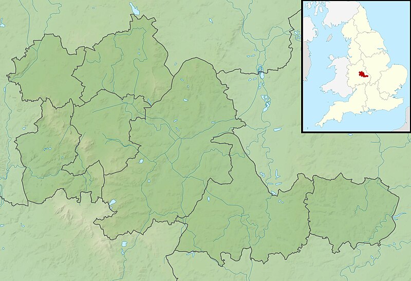
Module:Location map/data/United
Kingdom West Midlands/doc
709:
Module:Location map/data/United
Kingdom West Midlands/doc
1027:
Modül:Konum haritası/veri/Birleşik Krallık West
Midlands
1007:Модул:Location map/data/United Kingdom West Midlands/док
852:モジュール:Location map/data/United Kingdom West Midlands/doc
792:
Plantilla:Mapa de localización de
Midlands Occidentales
364:
Add a one-line explanation of what this file represents
972:
Module:Location map/data/United Kingdom West Midlands
952:
Module:Location map/data/United Kingdom West Midlands
817:
Module:Location map/data/United Kingdom West Midlands
704:
Module:Location map/data/United Kingdom West Midlands
78:(1,999 × 1,366 pixels, file size: 286 KB, MIME type:
1002:Модул:Location map/data/United Kingdom West Midlands
847:モジュール:Location map/data/United Kingdom West Midlands
450:
Creative Commons Attribution-ShareAlike 3.0 Unported
127:
112:
Commons is a freely licensed media file repository.
862:ಟೆಂಪ್ಲೇಟು:Location map United Kingdom West Midlands
782:
Plantilya:Location map United Kingdom West Midlands
942:Template:Location map United Kingdom West Midlands
842:Template:Location map United Kingdom West Midlands
198:All other geographic data from Meridian 2 product.
1052:Batakan:Location map United Kingdom West Midlands
832:Templat:Location map United Kingdom West Midlands
807:Modèle:Géolocalisation/Midlands de l'Ouest
341:File:West Midlands UK district map (blank).svg
317:https://creativecommons.org/licenses/by-sa/3.0
93:
555:{{Information |Description=Relief map of the
323:Creative Commons Attribution-Share Alike 3.0
241:
8:
192:Relief data from Land-Form Panorama product.
283:– to copy, distribute and transmit the work
507:
360:
997:Модул:Location map/data/West Midlands/док
724:The following other wikis use this file:
133:West Midlands UK relief location map.jpg
1017:Mall:Kartposition England West Midlands
571:
483:
467:
447:
431:
411:
395:
378:
375:
356:
349:
977:Module:Location map/data/West Midlands
962:Module:Location map/data/West Midlands
772:Шаблон:ПК Великобритания Уест Мидландс
714:Module:Location map/data/West Midlands
992:Модул:Location map/data/West Midlands
7:
264:Attribution-Share Alike 3.0 Unported
222:, created using Ordnance Survey data
1062:Template:Location map West Midlands
892:Sjabloon:Positiekaart West Midlands
496:
252:
247:
369:
363:
238:
125:
71:
872:Veidne:VietasKarte Rietummidlenda
368:
882:Шаблон:ПолКарта Западен Мидлендс
689:W.D. & H.O. Wills Tournament
679:True Temper Foursomes Tournament
619:Coventry Jewish Reform Community
354:
294:Under the following conditions:
259:This file is licensed under the
251:
246:
240:
92:
31:
21:
351:
14:
948:Usage on simple.wikipedia.org
350:
26:
1:
932:Moduł:Mapa/dane/West Midlands
912:Moduł:Mapa/dane/West Midlands
376:Items portrayed in this file
1048:Usage on war.wikipedia.org
938:Usage on sco.wikipedia.org
778:Usage on ceb.wikipedia.org
684:Turners Hill, West Midlands
609:Battle of Stourbridge Heath
1080:
1058:Usage on zh.wikipedia.org
1038:Usage on uk.wikipedia.org
1023:Usage on tr.wikipedia.org
1013:Usage on sv.wikipedia.org
988:Usage on sr.wikipedia.org
968:Usage on si.wikipedia.org
928:Usage on pl.wikibooks.org
908:Usage on pl.wikipedia.org
902:Ныгуылæн Мидлендс (графад)
898:Usage on os.wikipedia.org
888:Usage on nl.wikipedia.org
878:Usage on mk.wikipedia.org
868:Usage on lv.wikipedia.org
858:Usage on kn.wikipedia.org
838:Usage on ja.wikipedia.org
828:Usage on id.wikipedia.org
813:Usage on hi.wikipedia.org
798:Usage on fr.wikipedia.org
788:Usage on es.wikipedia.org
738:Usage on bg.wikipedia.org
732:قالب:خريطة مواقع غرب الوسط
728:Usage on ar.wikipedia.org
574:21 Yateley Road, Edgbaston
308:same or compatible license
497:
16:
674:The Homestead, Edgbaston
353:
274:
203:England location map.svg
99:This is a file from the
922:Blythe (rzeka w Anglii)
664:Severn Street Synagogue
554:
533:02:00, 29 November 2011
336:
226:
215:
177:
170:
167:
130:
103:. Information from its
802:Bataille de Tettenhall
604:Battle of Kings Norton
106:description page there
41:Size of this preview:
589:Barr Beacon Reservoir
654:Perry Barr Reservoir
65:1,999 × 1,366 pixels
644:Netherton Reservoir
629:Edgbaston Reservoir
614:Brookvale Park Lake
599:Battle of Camp Hill
289:– to adapt the work
201:Inset derived from
148:Geographic limits:
47:Other resolutions:
634:Frankley Reservoir
138:Relief map of the
61:1,280 × 875 pixels
57:1,024 × 700 pixels
917:Rea (dopływ Tame)
720:Global file usage
699:Wychall Reservoir
639:Lifford Reservoir
594:Bartley Reservoir
562:
434:copyright license
362:
347:
346:
235:
232:Reusing this file
121:
120:
101:Wikimedia Commons
32:Global file usage
1071:
659:Piccadilly Medal
545:
485:29 November 2010
398:copyright status
330:
327:
324:
321:
318:
310:as the original.
272:
261:Creative Commons
255:
254:
250:
249:
244:
243:
229:
173:
172:29 November 2010
134:
128:
117:
96:
95:
89:
83:
81:
68:
53:640 × 437 pixels
49:320 × 219 pixels
43:800 × 547 pixels
1079:
1078:
1074:
1073:
1072:
1070:
1069:
1068:
718:
649:Olton Reservoir
584:Babbs Mill Lake
579:Aston Reservoir
570:
563:
551:
543:
499:
498:
495:
494:
493:
492:
491:
490:
489:
488:
486:
476:
475:
474:
472:
461:
460:
459:
458:
457:
456:
455:
454:
452:
440:
439:
438:
436:
425:
424:
423:
422:
421:
420:
419:
418:
416:
404:
403:
402:
400:
389:
388:
387:
386:
385:
383:
367:
366:
365:
348:
332:
331:
328:
325:
322:
319:
316:
315:
273:
270:
267:
256:
183:Ordnance Survey
132:
123:
122:
111:
110:
109:is shown below.
85:
79:
77:
70:
69:
46:
12:
11:
5:
1077:
1075:
1067:
1066:
1065:
1064:
1056:
1055:
1054:
1046:
1045:
1044:
1036:
1035:
1034:
1029:
1021:
1020:
1019:
1011:
1010:
1009:
1004:
999:
994:
986:
985:
984:
979:
974:
966:
965:
964:
959:
954:
946:
945:
944:
936:
935:
934:
926:
925:
924:
919:
914:
906:
905:
904:
896:
895:
894:
886:
885:
884:
876:
875:
874:
866:
865:
864:
856:
855:
854:
849:
844:
836:
835:
834:
826:
825:
824:
819:
811:
810:
809:
804:
796:
795:
794:
786:
785:
784:
776:
775:
774:
769:
764:
759:
754:
749:
744:
736:
735:
734:
722:
721:
717:
716:
711:
706:
701:
696:
691:
686:
681:
676:
671:
669:Shard End Lake
666:
661:
656:
651:
646:
641:
636:
631:
626:
624:Edgbaston Pool
621:
616:
611:
606:
601:
596:
591:
586:
581:
576:
568:
567:
566:
561:
560:
553:
549:
546:
542:1,999 × 1,366
540:
535:
530:
526:
525:
522:
519:
516:
513:
510:
503:
502:
487:
484:
482:
481:
480:
479:
478:
477:
473:
468:
466:
465:
464:
463:
462:
453:
448:
446:
445:
444:
443:
442:
441:
437:
432:
430:
429:
428:
427:
426:
417:
412:
410:
409:
408:
407:
406:
405:
401:
396:
394:
393:
392:
391:
390:
384:
379:
377:
374:
373:
372:
371:
370:
359:
358:
355:
352:
345:
344:
338:
337:Other versions
334:
333:
314:
313:
312:
311:
301:
292:
291:
290:
284:
277:You are free:
268:
258:
257:
239:
236:
224:
223:
217:
213:
212:
211:
210:
199:
196:
193:
179:
175:
174:
169:
165:
164:
163:
162:
159:
156:
153:
135:
126:
124:
119:
118:
97:
87:
86:
40:
36:
35:
34:
29:
24:
19:
13:
10:
9:
6:
4:
3:
2:
1076:
1063:
1060:
1059:
1057:
1053:
1050:
1049:
1047:
1043:
1040:
1039:
1037:
1033:
1030:
1028:
1025:
1024:
1022:
1018:
1015:
1014:
1012:
1008:
1005:
1003:
1000:
998:
995:
993:
990:
989:
987:
983:
980:
978:
975:
973:
970:
969:
967:
963:
960:
958:
955:
953:
950:
949:
947:
943:
940:
939:
937:
933:
930:
929:
927:
923:
920:
918:
915:
913:
910:
909:
907:
903:
900:
899:
897:
893:
890:
889:
887:
883:
880:
879:
877:
873:
870:
869:
867:
863:
860:
859:
857:
853:
850:
848:
845:
843:
840:
839:
837:
833:
830:
829:
827:
823:
820:
818:
815:
814:
812:
808:
805:
803:
800:
799:
797:
793:
790:
789:
787:
783:
780:
779:
777:
773:
770:
768:
765:
763:
760:
758:
755:
753:
750:
748:
745:
743:
740:
739:
737:
733:
730:
729:
727:
726:
725:
719:
715:
712:
710:
707:
705:
702:
700:
697:
695:
692:
690:
687:
685:
682:
680:
677:
675:
672:
670:
667:
665:
662:
660:
657:
655:
652:
650:
647:
645:
642:
640:
637:
635:
632:
630:
627:
625:
622:
620:
617:
615:
612:
610:
607:
605:
602:
600:
597:
595:
592:
590:
587:
585:
582:
580:
577:
575:
572:
564:
558:
557:West Midlands
552:
547:
541:
539:
536:
534:
531:
528:
527:
523:
520:
517:
514:
511:
509:
508:
506:
500:
471:
451:
435:
415:
399:
382:
342:
339:
335:
320:CC BY-SA 3.0
309:
305:
302:
299:
296:
295:
293:
288:
285:
282:
279:
278:
276:
275:
269:Attribution:
265:
262:
245:
237:
233:
228:
225:
221:
218:
214:
208:
204:
200:
197:
194:
191:
190:
189:
187:
184:
180:
176:
166:
161:South: 52.33N
160:
158:North: 52.68N
157:
154:
151:
150:
149:
146:
143:
141:
140:West Midlands
136:
129:
115:
108:
107:
102:
98:
91:
90:
84:
75:
74:Original file
66:
62:
58:
54:
50:
44:
39:
33:
30:
28:
25:
23:
20:
18:
15:
747:Улвърхамптън
723:
694:Witton Lakes
504:
501:File history
303:
297:
286:
280:
181:
147:
144:
137:
114:You can help
104:
72:
22:File history
762:Уест Бромич
414:copyrighted
343:- Blank map
304:share alike
298:attribution
155:East: 1.40W
152:West: 2.22W
131:Description
565:File usage
518:Dimensions
227:Permission
80:image/jpeg
27:File usage
742:Бирмингам
550:Nilfanion
515:Thumbnail
512:Date/Time
470:inception
220:Nilfanion
757:Ковънтри
544:(286 KB)
357:Captions
287:to remix
281:to share
266:license.
207:Spischot
186:OpenData
529:current
524:Comment
381:depicts
361:English
76:
752:Уолсол
216:Author
178:Source
142:, UK.
767:Дъдли
521:User
329:true
326:true
168:Date
17:File
205:by
188:.
63:|
59:|
55:|
51:|
45:.
234:)
230:(
209:.
116:.
82:)
67:.
Text is available under the Creative Commons Attribution-ShareAlike License. Additional terms may apply.

.svg)