349:
282:
232:
274:
224:
296:
246:
317:
355:
360:
72:
825:"}},"text\/plain":{"en":{"":"heading"}}},"{\"value\":{\"amount\":\"+45\",\"unit\":\"http:\\\/\\\/www.wikidata.org\\\/entity\\\/Q28390\"},\"type\":\"quantity\"}":{"text\/html":{"en":{"P7787":"45
761:"}},"text\/plain":{"en":{"":"heading"}}},"{\"value\":{\"amount\":\"+45\",\"unit\":\"http:\\\/\\\/www.wikidata.org\\\/entity\\\/Q28390\"},\"type\":\"quantity\"}":{"text\/html":{"en":{"P7787":"45
821:
265:
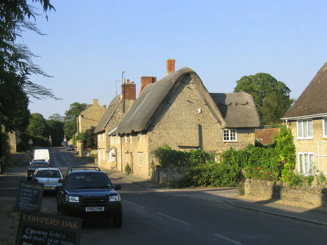
944:== {{int:filedesc}} == {{Information |description={{en|1=Weston Underwood. This picturesque village is located just a few miles west of Olney, and is a frequent winner of awards for Best Kept Village. It was the home of poet William Cowper from 1785 to 17
215:
43:
407:– You must give appropriate credit, provide a link to the license, and indicate if changes were made. You may do so in any reasonable manner, but not in any way that suggests the licensor endorses you or your use.
1016:
976:
83:
51:
822:
758:
958:
693:
623:
587:
289:
239:
713:
986:
324:
1099:
This file contains additional information, probably added from the digital camera or scanner used to create or digitize it.
414:
550:
863:
836:
799:
772:
721:
677:
571:
543:
530:
515:
736:
706:
643:
607:
488:
471:
311:
926:
921:
42:
370:
1102:
If the file has been modified from its original state, some details may not fully reflect the modified file.
413:– If you remix, transform, or build upon the material, you must distribute your contributions under the
331:
on the
Geograph website for the photographer's contact details. The copyright on this image is owned by
937:
367:
954:
The following pages on the
English Knowledge use this file (pages on other projects are not listed):
829:"}},"text\/plain":{"en":{"P7787":"45 degree"}}}}": -->
765:"}},"text\/plain":{"en":{"P7787":"45 degree"}}}}": -->
91:
184:
743:
728:
168:
522:
1086:
295:
245:
336:
78:
1036:
1056:
1026:
1006:
136:
1066:
1046:
279:
229:
147:
157:
996:
316:
328:
894:
Click on a date/time to view the file as it appeared at that time.
281:
231:
256:
206:
66:
266:
52° 08′ 44″ N, 0° 44′ 17″ W
216:
52° 08′ 41″ N, 0° 44′ 24″ W
455:
Add a one-line explanation of what this file represents
1076:
110:
90:
Commons is a freely licensed media file repository.
624:
Creative
Commons Attribution-ShareAlike 2.0 Generic
56:(640 × 480 pixels, file size: 89 KB, MIME type:
116:Weston Underwood - geograph.org.uk - 195518.jpg
52:Weston_Underwood_-_geograph.org.uk_-_195518.jpg
424:https://creativecommons.org/licenses/by-sa/2.0
71:
430:Creative Commons Attribution-Share Alike 2.0
348:
8:
826:
762:
390:– to copy, distribute and transmit the work
1104:
896:
451:
969:The following other wikis use this file:
744:https://www.geograph.org.uk/photo/195518
1106:
956:
850:
834:
786:
770:
691:
675:
657:
641:
621:
605:
585:
569:
523:https://www.geograph.org.uk/profile/759
502:
486:
469:
466:
447:
440:
259:
209:
288:View this and other nearby images on:
238:View this and other nearby images on:
7:
335:and is licensed for reuse under the
885:
371:Attribution-Share Alike 2.0 Generic
359:
354:
339:Attribution-ShareAlike 2.0 license.
1097:
1087:Weston Underwood (Buckinghamshire)
1083:Usage on zh-min-nan.wikipedia.org
1057:Weston Underwood (Buckinghamshire)
1037:Weston Underwood (Buckinghamshire)
1027:Weston Underwood (Buckinghamshire)
1007:Weston Underwood, Swydd Buckingham
460:
454:
345:
322:
120:
103:
49:
1067:Weston Underwood, Buckinghamshire
959:Weston Underwood, Buckinghamshire
459:
1047:Weston Underwood (Milton Keynes)
773:coordinates of the point of view
445:
401:Under the following conditions:
366:This file is licensed under the
358:
353:
347:
315:
294:
280:
272:
244:
230:
222:
70:
31:
21:
442:
127:spent much of his time writing.
121:
46:No higher resolution available.
14:
694:file available on the internet
441:
323:This image was taken from the
26:
1:
977:وستون يوندروود (باكينجهامشير)
837:coordinates of depicted place
36:
714:Geograph Britain and Ireland
544:object of statement has role
467:Items portrayed in this file
1033:Usage on lld.wikipedia.org
1017:وستون آندروود، باکینگهامشر
997:Weston Underwood (distrito)
993:Usage on ceb.wikipedia.org
983:Usage on arz.wikipedia.org
271:
221:
1128:
1073:Usage on www.wikidata.org
1063:Usage on sv.wikipedia.org
1053:Usage on pl.wikipedia.org
1043:Usage on no.wikipedia.org
1023:Usage on fr.wikipedia.org
1013:Usage on fa.wikipedia.org
1003:Usage on cy.wikipedia.org
973:Usage on ar.wikipedia.org
415:same or compatible license
197:John Winfield /
178:John Winfield /
886:
16:
852:52°8'44.2"N, 0°44'16.8"W
788:52°8'40.9"N, 0°44'24.0"W
722:geograph.org.uk image ID
444:
381:
77:This is a file from the
943:
169:required by the license
153:
142:
135:
132:
113:
81:. Information from its
922:19:41, 31 January 2010
329:this photograph's page
300:52.145600; -0.738000
250:52.144700; -0.740000
84:description page there
396:– to adapt the work
531:author name string
1115:
1114:
965:Global file usage
947:
828:
764:
608:copyright license
453:
344:
343:
327:collection. See
305:
304:
255:
254:
204:
203:
172:
99:
98:
79:Wikimedia Commons
32:Global file usage
1119:
1105:
934:
874:
873:
868:
810:
809:
804:
746:
741:
737:described at URL
731:
726:
716:
711:
572:copyright status
553:
548:
538:
535:
525:
520:
437:
434:
431:
428:
425:
417:as the original.
379:
368:Creative Commons
362:
361:
357:
356:
351:
350:
337:Creative Commons
325:Geograph project
319:
312:
301:
298:
284:
283:
277:
276:
275:
269:
268:
257:
251:
248:
234:
233:
227:
226:
225:
219:
218:
207:
199:Weston Underwood
180:Weston Underwood
166:
138:
125:
117:
111:
95:
74:
73:
67:
61:
59:
1127:
1126:
1122:
1121:
1120:
1118:
1117:
1116:
1093:
963:
955:
948:
940:
932:
888:
887:
884:
883:
882:
881:
880:
879:
878:
877:
876:
875:
871:
869:
866:
857:
856:
855:
853:
843:
842:
841:
839:
820:
819:
818:
817:
816:
815:
814:
813:
812:
811:
807:
805:
802:
793:
792:
791:
789:
779:
778:
777:
775:
756:
755:
754:
753:
752:
751:
750:
749:
748:
747:
742:
739:
733:
732:
727:
724:
718:
717:
712:
709:
700:
699:
698:
696:
684:
683:
682:
680:
669:
668:
667:
666:
665:
664:
663:
662:
660:
650:
649:
648:
646:
635:
634:
633:
632:
631:
630:
629:
628:
626:
614:
613:
612:
610:
599:
598:
597:
596:
595:
594:
593:
592:
590:
578:
577:
576:
574:
563:
562:
561:
560:
559:
558:
557:
556:
555:
554:
549:
546:
540:
539:
536:
533:
527:
526:
521:
518:
509:
508:
507:
505:
495:
494:
493:
491:
480:
479:
478:
477:
476:
474:
458:
457:
456:
439:
438:
435:
432:
429:
426:
423:
422:
380:
377:
374:
363:
340:
310:
299:
273:
264:
263:
260:Object location
249:
223:
214:
213:
210:Camera location
205:
194:
187:
175:
148:geograph.org.uk
128:
115:
108:
101:
100:
89:
88:
87:is shown below.
63:
57:
55:
48:
47:
12:
11:
5:
1125:
1123:
1113:
1112:
1109:
1096:
1092:
1091:
1090:
1089:
1081:
1080:
1079:
1071:
1070:
1069:
1061:
1060:
1059:
1051:
1050:
1049:
1041:
1040:
1039:
1031:
1030:
1029:
1021:
1020:
1019:
1011:
1010:
1009:
1001:
1000:
999:
991:
990:
989:
987:وستون يوندروود
981:
980:
979:
967:
966:
962:
961:
953:
952:
951:
946:
945:
942:
938:
935:
929:
924:
919:
915:
914:
911:
908:
905:
902:
899:
892:
891:
862:
861:
860:
859:
858:
854:
851:
849:
848:
847:
846:
845:
844:
840:
835:
833:
832:
831:
830:
824:
798:
797:
796:
795:
794:
790:
787:
785:
784:
783:
782:
781:
780:
776:
771:
769:
768:
767:
766:
760:
735:
734:
720:
719:
705:
704:
703:
702:
701:
697:
692:
690:
689:
688:
687:
686:
685:
681:
678:source of file
676:
674:
673:
672:
671:
670:
661:
658:
656:
655:
654:
653:
652:
651:
647:
642:
640:
639:
638:
637:
636:
627:
622:
620:
619:
618:
617:
616:
615:
611:
606:
604:
603:
602:
601:
600:
591:
586:
584:
583:
582:
581:
580:
579:
575:
570:
568:
567:
566:
565:
564:
542:
541:
529:
528:
514:
513:
512:
511:
510:
506:
503:
501:
500:
499:
498:
497:
496:
492:
487:
485:
484:
483:
482:
481:
475:
470:
468:
465:
464:
463:
462:
461:
450:
449:
446:
443:
421:
420:
419:
418:
408:
399:
398:
397:
391:
384:You are free:
375:
365:
364:
346:
342:
341:
320:
309:
306:
303:
302:
292:
286:
261:
253:
252:
242:
236:
211:
202:
201:
195:
192:
189:
188:
183:
176:
173:
161:
160:
155:
151:
150:
144:
140:
139:
134:
130:
129:
118:
109:
107:
104:
102:
97:
96:
75:
65:
64:
45:
41:
40:
39:
34:
29:
24:
19:
13:
10:
9:
6:
4:
3:
2:
1124:
1110:
1107:
1103:
1100:
1094:
1088:
1085:
1084:
1082:
1078:
1075:
1074:
1072:
1068:
1065:
1064:
1062:
1058:
1055:
1054:
1052:
1048:
1045:
1044:
1042:
1038:
1035:
1034:
1032:
1028:
1025:
1024:
1022:
1018:
1015:
1014:
1012:
1008:
1005:
1004:
1002:
998:
995:
994:
992:
988:
985:
984:
982:
978:
975:
974:
972:
971:
970:
964:
960:
957:
949:
941:
936:
930:
928:
925:
923:
920:
917:
916:
912:
909:
906:
903:
900:
898:
897:
895:
889:
865:
838:
801:
774:
745:
738:
730:
723:
715:
708:
695:
679:
645:
625:
609:
589:
573:
552:
545:
537:John Winfield
532:
524:
517:
490:
473:
427:CC BY-SA 2.0
416:
412:
409:
406:
403:
402:
400:
395:
392:
389:
386:
385:
383:
382:
378:John Winfield
376:Attribution:
372:
369:
352:
338:
334:
333:John Winfield
330:
326:
321:
318:
314:
313:
307:
297:
293:
291:
290:OpenStreetMap
287:
285:
267:
262:
258:
247:
243:
241:
240:OpenStreetMap
237:
235:
217:
212:
208:
200:
196:
191:
190:
186:
182: /
181:
177:
170:
165:
163:
162:
159:
158:John Winfield
156:
152:
149:
145:
141:
131:
124:
119:
112:
105:
93:
86:
85:
80:
76:
69:
68:
62:
53:
44:
38:
35:
33:
30:
28:
25:
23:
20:
18:
15:
1101:
1098:
968:
893:
890:File history
551:photographer
410:
404:
393:
387:
332:
270:
220:
198:
185:CC BY-SA 2.0
179:
122:
92:You can help
82:
50:
22:File history
939:GeographBot
659:1 July 2006
588:copyrighted
411:share alike
405:attribution
164:Attribution
137:1 July 2006
114:Description
1108:_error
950:File usage
931:640 × 480
907:Dimensions
504:some value
58:image/jpeg
27:File usage
904:Thumbnail
901:Date/Time
644:inception
308:Licensing
193:InfoField
174:InfoField
123:English:
1095:Metadata
1077:Q4572021
707:operator
448:Captions
394:to remix
388:to share
373:license.
37:Metadata
933:(89 KB)
918:current
913:Comment
864:heading
823:heading
800:heading
759:heading
489:creator
472:depicts
452:English
106:Summary
54:
872:degree
827:degree
808:degree
763:degree
729:195518
278:
228:
154:Author
143:Source
146:From
910:User
436:true
433:true
133:Date
17:File
870:45
806:45
516:URL
867::
803::
740::
725::
710::
547::
534::
519::
1111:0
171:)
167:(
94:.
60:)
Text is available under the Creative Commons Attribution-ShareAlike License. Additional terms may apply.
_heading:45.00&language=en)
_heading:45.00&language=en)
