38:
391:
324:
274:
316:
266:
338:
288:
359:
397:
402:
799:
94:
633:"}},"text\/plain":{"en":{"":"heading"}}},"{\"value\":{\"amount\":\"+90.0\",\"unit\":\"http:\\\/\\\/www.wikidata.org\\\/entity\\\/Q28390\"},\"type\":\"quantity\"}":{"text\/html":{"en":{"P7787":"90.0
697:"}},"text\/plain":{"en":{"":"heading"}}},"{\"value\":{\"amount\":\"+90\",\"unit\":\"http:\\\/\\\/www.wikidata.org\\\/entity\\\/Q28390\"},\"type\":\"quantity\"}":{"text\/html":{"en":{"P7787":"90
629:
257:
60:
56:
52:
48:
42:
73:
105:
449:– You must give appropriate credit, provide a link to the license, and indicate if changes were made. You may do so in any reasonable manner, but not in any way that suggests the licensor endorses you or your use.
694:
630:
798:
793:
64:
37:
194:
582:
546:
331:
281:
366:
456:
735:
708:
671:
644:
530:
602:
566:
513:
353:
830:
153:
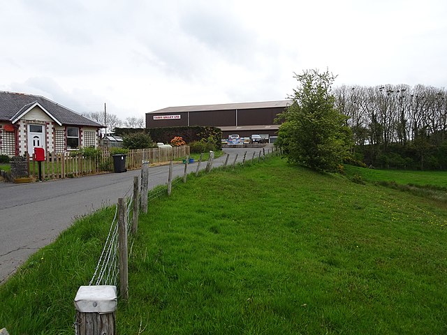
are. The railway embankment can still be seen on the far right of the image, heading towards Sorbie and
Whithorn.
412:
826:
The following pages on the
English Knowledge (XXG) use this file (pages on other projects are not listed):
455:– If you remix, transform, or build upon the material, you must distribute your contributions under the
373:
on the
Geograph website for the photographer's contact details. The copyright on this image is owned by
637:"}},"text\/plain":{"en":{"P7787":"90.0 degree"}}}}": -->
409:
701:"}},"text\/plain":{"en":{"P7787":"90 degree"}}}}": -->
113:
809:
210:
337:
287:
378:
100:
226:
271:
138:
Whauphill railway station (site), Dumfries & Galloway (geograph 6162471).jpg
321:
162:
183:
173:
358:
370:
766:
Click on a date/time to view the file as it appeared at that time.
323:
273:
298:
248:
88:
308:
54° 49′ 04.9″ N, 4° 29′ 03″ W
258:
54° 49′ 04.2″ N, 4° 29′ 08″ W
241:
Whauphill railway station (site), Dumfries & Galloway
222:
Whauphill railway station (site), Dumfries & Galloway
149:
Whauphill railway station (site), Dumfries & Galloway
848:
497:
Add a one-line explanation of what this file represents
858:
78:(1,600 × 1,200 pixels, file size: 433 KB, MIME type:
201:
Creative
Commons Attribution Share-alike license 2.0
132:
112:
Commons is a freely licensed media file repository.
583:
Creative
Commons Attribution-ShareAlike 2.0 Generic
466:https://creativecommons.org/licenses/by-sa/2.0
93:
472:Creative Commons Attribution-Share Alike 2.0
390:
8:
698:
634:
432:– to copy, distribute and transmit the work
768:
493:
841:The following other wikis use this file:
828:
722:
706:
658:
642:
616:
600:
580:
564:
544:
528:
511:
508:
489:
482:
301:
251:
816:Transferred from geograph.co.uk using
330:View this and other nearby images on:
280:View this and other nearby images on:
7:
377:and is licensed for reuse under the
757:
413:Attribution-Share Alike 2.0 Generic
401:
396:
381:Attribution-ShareAlike 2.0 license.
502:
496:
387:
364:
142:
125:
71:
501:
645:coordinates of the point of view
487:
443:Under the following conditions:
408:This file is licensed under the
400:
395:
389:
357:
336:
322:
314:
286:
272:
264:
92:
31:
21:
484:
143:
14:
483:
365:This image was taken from the
26:
1:
709:coordinates of depicted place
509:Items portrayed in this file
845:Usage on sco.wikipedia.org
660:54°49'4.177"N, 4°29'8.178"W
313:
263:
239:Nigel Thompson /
220:Nigel Thompson /
877:
855:Usage on www.wikidata.org
457:same or compatible license
831:Whauphill railway station
758:
724:54°49'4.94"N, 4°29'2.62"W
16:
486:
423:
99:This is a file from the
815:
211:required by the license
189:
179:
168:
161:
158:
135:
103:. Information from its
371:this photograph's page
342:54.818040; -4.484060
292:54.817827; -4.485605
106:description page there
41:Size of this preview:
794:19:39, 4 January 2020
65:1,600 × 1,200 pixels
438:– to adapt the work
47:Other resolutions:
61:1,280 × 960 pixels
57:1,024 × 768 pixels
837:Global file usage
819:
700:
636:
567:copyright license
495:
386:
385:
369:collection. See
347:
346:
297:
296:
246:
245:
214:
198:
195:Reusing this file
121:
120:
101:Wikimedia Commons
32:Global file usage
868:
806:
746:
745:
740:
682:
681:
676:
531:copyright status
479:
476:
473:
470:
467:
459:as the original.
421:
410:Creative Commons
404:
403:
399:
398:
393:
392:
379:Creative Commons
367:Geograph project
361:
354:
343:
340:
326:
325:
319:
318:
317:
311:
310:
299:
293:
290:
276:
275:
269:
268:
267:
261:
260:
249:
208:
192:
164:
147:
139:
133:
117:
96:
95:
89:
83:
81:
68:
53:640 × 480 pixels
49:320 × 240 pixels
43:800 × 600 pixels
876:
875:
871:
870:
869:
867:
866:
865:
835:
827:
820:
812:
804:
760:
759:
756:
755:
754:
753:
752:
751:
750:
749:
748:
747:
743:
741:
738:
729:
728:
727:
725:
715:
714:
713:
711:
692:
691:
690:
689:
688:
687:
686:
685:
684:
683:
679:
677:
674:
665:
664:
663:
661:
651:
650:
649:
647:
628:
627:
626:
625:
624:
623:
622:
621:
619:
609:
608:
607:
605:
594:
593:
592:
591:
590:
589:
588:
587:
585:
573:
572:
571:
569:
558:
557:
556:
555:
554:
553:
552:
551:
549:
537:
536:
535:
533:
522:
521:
520:
519:
518:
516:
500:
499:
498:
481:
480:
477:
474:
471:
468:
465:
464:
422:
419:
416:
405:
382:
352:
341:
315:
306:
305:
302:Object location
291:
265:
256:
255:
252:Camera location
247:
236:
229:
217:
174:geograph.org.uk
154:
137:
130:
123:
122:
111:
110:
109:is shown below.
85:
79:
77:
70:
69:
46:
12:
11:
5:
874:
872:
864:
863:
862:
861:
853:
852:
851:
839:
838:
834:
833:
825:
824:
823:
818:
817:
814:
810:
807:
803:1,600 × 1,200
801:
796:
791:
787:
786:
783:
780:
777:
774:
771:
764:
763:
734:
733:
732:
731:
730:
726:
723:
721:
720:
719:
718:
717:
716:
712:
707:
705:
704:
703:
702:
696:
670:
669:
668:
667:
666:
662:
659:
657:
656:
655:
654:
653:
652:
648:
643:
641:
640:
639:
638:
632:
620:
617:
615:
614:
613:
612:
611:
610:
606:
601:
599:
598:
597:
596:
595:
586:
581:
579:
578:
577:
576:
575:
574:
570:
565:
563:
562:
561:
560:
559:
550:
545:
543:
542:
541:
540:
539:
538:
534:
529:
527:
526:
525:
524:
523:
517:
512:
510:
507:
506:
505:
504:
503:
492:
491:
488:
485:
463:
462:
461:
460:
450:
441:
440:
439:
433:
426:You are free:
420:Nigel Thompson
417:
407:
406:
388:
384:
383:
375:Nigel Thompson
362:
351:
348:
345:
344:
334:
328:
303:
295:
294:
284:
278:
253:
244:
243:
237:
234:
231:
230:
225:
218:
215:
203:
202:
199:
187:
186:
184:Nigel Thompson
181:
177:
176:
170:
166:
165:
160:
156:
155:
140:
131:
129:
126:
124:
119:
118:
97:
87:
86:
40:
36:
35:
34:
29:
24:
19:
13:
10:
9:
6:
4:
3:
2:
873:
860:
857:
856:
854:
850:
847:
846:
844:
843:
842:
836:
832:
829:
821:
813:
808:
802:
800:
797:
795:
792:
789:
788:
784:
781:
778:
775:
772:
770:
769:
767:
761:
737:
710:
673:
646:
604:
584:
568:
548:
532:
515:
469:CC BY-SA 2.0
458:
454:
451:
448:
445:
444:
442:
437:
434:
431:
428:
427:
425:
424:
418:Attribution:
414:
411:
394:
380:
376:
372:
368:
363:
360:
356:
355:
349:
339:
335:
333:
332:OpenStreetMap
329:
327:
309:
304:
300:
289:
285:
283:
282:OpenStreetMap
279:
277:
259:
254:
250:
242:
238:
233:
232:
228:
224: /
223:
219:
212:
207:
205:
204:
200:
196:
191:
188:
185:
182:
178:
175:
171:
167:
157:
151:
150:
146:
141:
134:
127:
115:
108:
107:
102:
98:
91:
90:
84:
75:
74:Original file
66:
62:
58:
54:
50:
44:
39:
33:
30:
28:
25:
23:
20:
18:
15:
840:
765:
762:File history
452:
446:
435:
429:
374:
312:
262:
240:
227:CC BY-SA 2.0
221:
148:
144:
114:You can help
104:
72:
22:File history
811:Lamberhurst
547:copyrighted
453:share alike
447:attribution
206:Attribution
136:Description
822:File usage
779:Dimensions
618:8 May 2019
190:Permission
163:8 May 2019
80:image/jpeg
27:File usage
849:The Whaup
776:Thumbnail
773:Date/Time
603:inception
350:Licensing
235:InfoField
216:InfoField
145:English:
859:Q7991783
805:(433 KB)
490:Captions
436:to remix
430:to share
415:license.
790:current
785:Comment
736:heading
695:heading
672:heading
631:heading
514:depicts
494:English
128:Summary
76:
744:degree
699:degree
680:degree
635:degree
320:
270:
180:Author
169:Source
678:90.0
172:From
782:User
478:true
475:true
159:Date
17:File
742:90
739::
675::
63:|
59:|
55:|
51:|
45:.
213:)
209:(
197:)
193:(
116:.
82:)
67:.
Text is available under the Creative Commons Attribution-ShareAlike License. Additional terms may apply.

,_Dumfries_%26_Galloway_(geograph_6162471).jpg)
,_Dumfries_%26_Galloway_(geograph_6162471).jpg¶ms=054.817827_N_-004.485605_E_globe:Earth_type:camera_source:geograph-osgb36(NX40394983)_heading:90.00&language=en)
,_Dumfries_%26_Galloway_(geograph_6162471).jpg¶ms=054.818040_N_-004.484060_E_globe:Earth_class:object_type:object_source:geograph-osgb36(NX40494985)_heading:90.00&language=en)
