213:
320:
312:
168:
334:
219:
62:
631:"}},"text\/plain":{"en":{"":"heading"}}},"{\"value\":{\"amount\":\"+329\",\"unit\":\"http:\\\/\\\/www.wikidata.org\\\/entity\\\/Q28390\"},\"type\":\"quantity\"}":{"text\/html":{"en":{"P7787":"329
627:
260:– You must give appropriate credit, provide a link to the license, and indicate if changes were made. You may do so in any reasonable manner, but not in any way that suggests the licensor endorses you or your use.
303:
628:
33:
185:
183:; with no Invariant Sections, no Front-Cover Texts, and no Back-Cover Texts. A copy of the license is included in the section entitled
149:
175:
580:
544:
527:
491:
327:
750:{{Information |Description=New housing on Whitefield Road, Speedwell, Bristol. |Source=self-made |Date=13.9.06 |Author=
669:
642:
564:
475:
447:
432:
419:
180:
600:
511:
392:
375:
454:
73:
41:
778:
764:
The following pages on the
English Knowledge (XXG) use this file (pages on other projects are not listed):
229:
226:
635:"}},"text\/plain":{"en":{"P7787":"329 degree"}}}}": -->
439:
773:
751:
743:
768:
81:
162:
173:
Permission is granted to copy, distribute and/or modify this document under the terms of the
138:
333:
732:
727:
159:
I, the copyright holder of this work, hereby publish it under the following licenses:
68:
32:
317:
118:
700:
Click on a date/time to view the file as it appeared at that time.
319:
304:
51° 28′ 04.59″ N, 2° 32′ 04.52″ W
294:
56:
359:
Add a one-line explanation of what this file represents
545:
179:, Version 1.2 or any later version published by the
100:
80:
Commons is a freely licensed media file repository.
110:
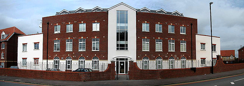
New housing on
Whitefield Road, Speedwell, Bristol.
440:https://commons.wikimedia.org/user:Weirdoldhattie
46:(500 × 177 pixels, file size: 73 KB, MIME type:
61:
212:
8:
632:
267:https://creativecommons.org/licenses/by/3.0
243:– to copy, distribute and transmit the work
702:
355:
285:You may select the license of your choice.
528:Creative Commons Attribution 3.0 Unported
766:
656:
640:
614:
598:
578:
562:
542:
525:
509:
489:
473:
406:
390:
373:
370:
351:
344:
297:
326:View this and other nearby images on:
7:
191:http://www.gnu.org/copyleft/fdl.html
691:
218:
364:
358:
284:
234:
209:
158:
93:
39:
754:|Permission= |other_versions= }}
363:
273:Creative Commons Attribution 3.0
643:coordinates of the point of view
349:
332:
318:
310:
254:Under the following conditions:
225:This file is licensed under the
217:
211:
167:
166:
60:
21:
346:
36:No higher resolution available.
14:
345:
197:GNU Free Documentation License
186:GNU Free Documentation License
176:GNU Free Documentation License
26:
1:
581:original creation by uploader
371:Items portrayed in this file
309:
658:51°28'4.591"N, 2°32'4.520"W
795:
692:
128:
16:
779:User talk:Weirdoldhattie
348:
230:Attribution 3.0 Unported
181:Free Software Foundation
67:This is a file from the
749:
144:
134:
124:
117:
114:
103:
71:. Information from its
728:23:16, 9 November 2007
338:51.467942; -2.534589
74:description page there
774:User:Weirdoldhattie
249:– to adapt the work
106:Whitefield Road.jpg
42:Whitefield_Road.jpg
769:Speedwell, Bristol
448:Wikimedia username
420:author name string
757:
634:
616:13 September 2006
512:copyright license
357:
343:
342:
292:
291:
208:
207:
153:
150:Reusing this file
119:13 September 2006
89:
88:
69:Wikimedia Commons
786:
740:
680:
679:
674:
476:copyright status
457:
452:
442:
437:
427:
424:
339:
336:
322:
321:
315:
314:
313:
307:
306:
295:
280:
277:
274:
271:
268:
227:Creative Commons
221:
220:
215:
214:
204:
201:
198:
195:
192:
170:
169:
163:
147:
130:
120:
107:
101:
85:
64:
63:
57:
51:
49:
794:
793:
789:
788:
787:
785:
784:
783:
765:
758:
746:
738:
694:
693:
690:
689:
688:
687:
686:
685:
684:
683:
682:
681:
677:
675:
672:
663:
662:
661:
659:
649:
648:
647:
645:
626:
625:
624:
623:
622:
621:
620:
619:
617:
607:
606:
605:
603:
592:
591:
590:
589:
588:
587:
586:
585:
583:
571:
570:
569:
567:
556:
555:
554:
553:
552:
551:
550:
549:
547:
536:
535:
534:
533:
532:
530:
518:
517:
516:
514:
503:
502:
501:
500:
499:
498:
497:
496:
494:
482:
481:
480:
478:
467:
466:
465:
464:
463:
462:
461:
460:
459:
458:
453:
450:
444:
443:
438:
435:
429:
428:
425:
422:
413:
412:
411:
409:
399:
398:
397:
395:
384:
383:
382:
381:
380:
378:
362:
361:
360:
337:
311:
302:
301:
298:Camera location
293:
288:
287:
286:
282:
281:
278:
275:
272:
269:
266:
265:
233:
222:
202:
199:
196:
193:
190:
161:
160:
105:
98:
91:
90:
79:
78:
77:is shown below.
53:
47:
45:
38:
37:
12:
11:
5:
792:
790:
782:
781:
776:
771:
763:
762:
761:
756:
755:
752:Weirdoldhattie
748:
745:Weirdoldhattie
744:
741:
735:
730:
725:
721:
720:
717:
714:
711:
708:
705:
698:
697:
668:
667:
666:
665:
664:
660:
657:
655:
654:
653:
652:
651:
650:
646:
641:
639:
638:
637:
636:
630:
618:
615:
613:
612:
611:
610:
609:
608:
604:
599:
597:
596:
595:
594:
593:
584:
579:
577:
576:
575:
574:
573:
572:
568:
565:source of file
563:
561:
560:
559:
558:
557:
548:
543:
541:
540:
539:
538:
537:
531:
526:
524:
523:
522:
521:
520:
519:
515:
510:
508:
507:
506:
505:
504:
495:
490:
488:
487:
486:
485:
484:
483:
479:
474:
472:
471:
470:
469:
468:
455:Weirdoldhattie
446:
445:
431:
430:
426:Weirdoldhattie
418:
417:
416:
415:
414:
410:
407:
405:
404:
403:
402:
401:
400:
396:
391:
389:
388:
387:
386:
385:
379:
374:
372:
369:
368:
367:
366:
365:
354:
353:
350:
347:
341:
340:
330:
324:
299:
290:
289:
283:
264:
263:
262:
261:
252:
251:
250:
244:
237:You are free:
224:
223:
210:
206:
205:
171:
157:
156:
154:
142:
141:
139:Weirdoldhattie
136:
132:
131:
126:
122:
121:
116:
112:
111:
108:
99:
97:
94:
92:
87:
86:
65:
55:
54:
35:
31:
30:
29:
24:
19:
13:
10:
9:
6:
4:
3:
2:
791:
780:
777:
775:
772:
770:
767:
759:
753:
747:
742:
736:
734:
731:
729:
726:
723:
722:
718:
715:
712:
709:
706:
704:
703:
701:
695:
671:
644:
602:
582:
566:
546:
529:
513:
493:
477:
456:
449:
441:
434:
421:
394:
377:
335:
331:
329:
328:OpenStreetMap
325:
323:
305:
300:
296:
259:
256:
255:
253:
248:
245:
242:
239:
238:
236:
235:
231:
228:
216:
188:
187:
182:
178:
177:
172:
165:
164:
155:
151:
146:
143:
140:
137:
133:
127:
123:
113:
109:
102:
95:
83:
76:
75:
70:
66:
59:
58:
52:
43:
34:
28:
25:
23:
20:
18:
15:
699:
696:File history
308:
257:
246:
240:
184:
174:
82:You can help
72:
40:
22:File history
492:copyrighted
258:attribution
104:Description
760:File usage
737:500 × 177
713:Dimensions
408:some value
270:CC BY 3.0
145:Permission
48:image/jpeg
27:File usage
710:Thumbnail
707:Date/Time
601:inception
352:Captions
247:to remix
241:to share
232:license.
129:Own work
739:(73 KB)
724:current
719:Comment
670:heading
629:heading
393:creator
376:depicts
356:English
96:Summary
44:
678:degree
633:degree
316:
135:Author
125:Source
716:User
676:329
279:true
276:true
203:true
200:true
194:GFDL
115:Date
17:File
433:URL
673::
451::
436::
423::
189:.
152:)
148:(
84:.
50:)
Text is available under the Creative Commons Attribution-ShareAlike License. Additional terms may apply.