290:
223:
237:
258:
296:
301:
72:
774:
214:
43:
348:– You must give appropriate credit, provide a link to the license, and indicate if changes were made. You may do so in any reasonable manner, but not in any way that suggests the licensor endorses you or your use.
791:== {{int:filedesc}} == {{Information |description={{en|1=Whitepond Farm, Stonor. Some of the farm buildings have been converted as self-catering accommodation.}} |date=2005-08-17 |source=From |autho
83:
51:
600:
564:
528:
230:
635:
1001:
265:
856:
This file contains additional information, probably added from the digital camera or scanner used to create or digitize it.
355:
463:
773:
768:
705:
613:
584:
512:
484:
471:
456:
42:
671:
643:
628:
548:
429:
412:
252:
311:
859:
If the file has been modified from its original state, some details may not fully reflect the modified file.
1020:
354:– If you remix, transform, or build upon the material, you must distribute your contributions under the
272:
on the
Geograph website for the photographer's contact details. The copyright on this image is owned by
784:
126:
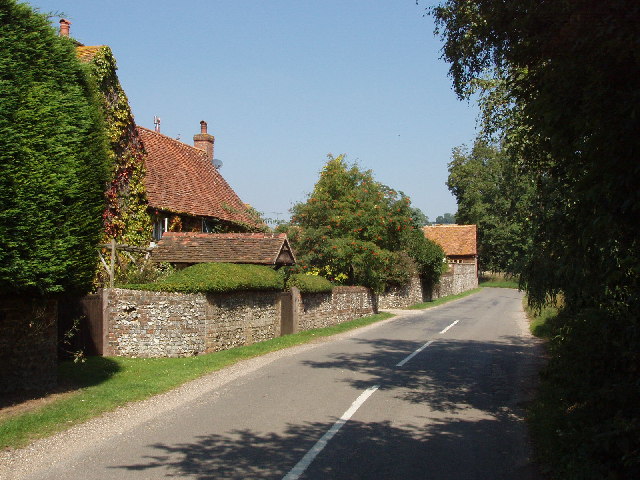
Whitepond Farm, Stonor. Some of the farm buildings have been converted as self-catering accommodation.
308:
1056:
876:
970:
91:
183:
1121:
167:
650:
620:
491:
236:
1092:
1038:
893:
277:
78:
1131:
1102:
933:
1066:
135:
913:
886:
823:
220:
156:
146:
1141:
903:
257:
805:
269:
741:
Click on a date/time to view the file as it appeared at that time.
222:
205:
66:
698:
215:
51° 35′ 54″ N, 0° 56′ 17″ W
396:
Add a one-line explanation of what this file represents
843:
116:
Whitepond Farm, Stonor - geograph.org.uk - 39067.jpg
110:
90:
Commons is a freely licensed media file repository.
52:
Whitepond_Farm,_Stonor_-_geograph.org.uk_-_39067.jpg
833:
565:
Creative
Commons Attribution-ShareAlike 2.0 Generic
56:(640 × 480 pixels, file size: 118 KB, MIME type:
1061:Flash did not fire, compulsory flash suppression
365:https://creativecommons.org/licenses/by-sa/2.0
71:
371:Creative Commons Attribution-Share Alike 2.0
289:
8:
331:– to copy, distribute and transmit the work
861:
743:
392:
816:The following other wikis use this file:
1139:
1129:
1119:
1111:
1100:
1090:
1082:
1074:
1064:
1054:
1046:
1036:
1028:
1018:
1010:
999:
991:
983:
975:
965:
957:
949:
941:
930:
922:
911:
901:
891:
881:
863:
803:
719:
703:
685:
669:
651:https://www.geograph.org.uk/photo/39067
598:
582:
562:
546:
526:
510:
492:https://www.geograph.org.uk/profile/560
443:
427:
410:
407:
388:
381:
208:
229:View this and other nearby images on:
871:
7:
276:and is licensed for reuse under the
801:The following page uses this file:
732:
312:Attribution-Share Alike 2.0 Generic
300:
295:
280:Attribution-ShareAlike 2.0 license.
854:
824:Saison 5 d'Inspecteur Barnaby
401:
395:
286:
263:
120:
103:
49:
400:
924:Date and time of data generation
386:
342:Under the following conditions:
307:This file is licensed under the
299:
294:
288:
256:
235:
221:
70:
31:
21:
971:Version 1.1
868:OLYMPUS DIGITAL CAMERA
383:
121:
46:No higher resolution available.
14:
601:file available on the internet
382:
264:This image was taken from the
26:
1:
706:coordinates of depicted place
36:
636:Geograph Britain and Ireland
457:object of statement has role
408:Items portrayed in this file
1012:Date and time of digitizing
1163:
840:Usage on www.wikidata.org
830:Usage on pl.wikipedia.org
820:Usage on fr.wikipedia.org
356:same or compatible license
196:David Hawgood /
177:David Hawgood /
977:File change date and time
733:
721:51°35'53.5"N, 0°56'16.8"W
16:
614:geograph.org.uk image ID
385:
322:
77:This is a file from the
1076:Custom image processing
877:OLYMPUS CORPORATION
790:
168:required by the license
152:
141:
134:
131:
113:
81:. Information from its
769:18:56, 30 January 2010
270:this photograph's page
241:51.598200; -0.938000
198:Whitepond Farm, Stonor
179:Whitepond Farm, Stonor
84:description page there
1030:Maximum land aperture
1015:13:31, 17 August 2005
980:13:31, 17 August 2005
951:Horizontal resolution
927:13:31, 17 August 2005
898:1/320 sec (0.003125)
985:Y and C positioning
959:Vertical resolution
873:Camera manufacturer
337:– to adapt the work
1113:Scene capture type
1097:Auto white balance
472:author name string
1150:
1149:
996:Aperture priority
812:Global file usage
794:
549:copyright license
394:
285:
284:
268:collection. See
246:
245:
203:
202:
171:
99:
98:
79:Wikimedia Commons
32:Global file usage
1154:
993:Exposure Program
887:X-3,C-60Z
862:
781:
653:
648:
644:described at URL
638:
633:
623:
618:
513:copyright status
494:
489:
479:
476:
466:
461:
378:
375:
372:
369:
366:
358:as the original.
320:
309:Creative Commons
303:
302:
298:
297:
292:
291:
278:Creative Commons
266:Geograph project
260:
253:
242:
239:
225:
224:
218:
217:
206:
165:
137:
125:
117:
111:
95:
74:
73:
67:
61:
59:
1162:
1161:
1157:
1156:
1155:
1153:
1152:
1151:
1033:3 APEX (f/2.83)
850:
810:
795:
787:
779:
735:
734:
731:
730:
729:
728:
727:
726:
725:
724:
722:
712:
711:
710:
708:
697:
696:
695:
694:
693:
692:
691:
690:
688:
678:
677:
676:
674:
663:
662:
661:
660:
659:
658:
657:
656:
655:
654:
649:
646:
640:
639:
634:
631:
625:
624:
619:
616:
607:
606:
605:
603:
591:
590:
589:
587:
576:
575:
574:
573:
572:
571:
570:
569:
567:
555:
554:
553:
551:
540:
539:
538:
537:
536:
535:
534:
533:
531:
519:
518:
517:
515:
504:
503:
502:
501:
500:
499:
498:
497:
496:
495:
490:
487:
481:
480:
477:
474:
468:
467:
462:
459:
450:
449:
448:
446:
436:
435:
434:
432:
421:
420:
419:
418:
417:
415:
399:
398:
397:
380:
379:
376:
373:
370:
367:
364:
363:
321:
318:
315:
304:
281:
251:
240:
213:
212:
209:Object location
204:
193:
186:
174:
147:geograph.org.uk
127:
115:
108:
101:
100:
89:
88:
87:is shown below.
63:
57:
55:
48:
47:
12:
11:
5:
1160:
1158:
1148:
1147:
1144:
1138:
1137:
1134:
1128:
1127:
1124:
1118:
1117:
1114:
1110:
1109:
1106:
1099:
1098:
1095:
1089:
1088:
1085:
1081:
1080:
1079:Normal process
1077:
1073:
1072:
1069:
1063:
1062:
1059:
1053:
1052:
1049:
1045:
1044:
1041:
1035:
1034:
1031:
1027:
1026:
1023:
1017:
1016:
1013:
1009:
1008:
1005:
998:
997:
994:
990:
989:
986:
982:
981:
978:
974:
973:
968:
964:
963:
960:
956:
955:
952:
948:
947:
944:
940:
939:
936:
929:
928:
925:
921:
920:
917:
910:
909:
906:
900:
899:
896:
890:
889:
884:
880:
879:
874:
870:
869:
866:
853:
849:
848:
847:
846:
838:
837:
836:
828:
827:
826:
814:
813:
809:
808:
799:
798:
793:
792:
789:
785:
782:
776:
771:
766:
762:
761:
758:
755:
752:
749:
746:
739:
738:
723:
720:
718:
717:
716:
715:
714:
713:
709:
704:
702:
701:
700:
699:
689:
687:17 August 2005
686:
684:
683:
682:
681:
680:
679:
675:
670:
668:
667:
666:
665:
664:
642:
641:
627:
626:
612:
611:
610:
609:
608:
604:
599:
597:
596:
595:
594:
593:
592:
588:
585:source of file
583:
581:
580:
579:
578:
577:
568:
563:
561:
560:
559:
558:
557:
556:
552:
547:
545:
544:
543:
542:
541:
532:
527:
525:
524:
523:
522:
521:
520:
516:
511:
509:
508:
507:
506:
505:
483:
482:
470:
469:
455:
454:
453:
452:
451:
447:
444:
442:
441:
440:
439:
438:
437:
433:
428:
426:
425:
424:
423:
422:
416:
411:
409:
406:
405:
404:
403:
402:
391:
390:
387:
384:
362:
361:
360:
359:
349:
340:
339:
338:
332:
325:You are free:
316:
306:
305:
287:
283:
282:
261:
250:
247:
244:
243:
233:
227:
210:
201:
200:
194:
191:
188:
187:
182:
175:
172:
160:
159:
154:
150:
149:
143:
139:
138:
136:17 August 2005
133:
129:
128:
118:
109:
107:
104:
102:
97:
96:
75:
65:
64:
45:
41:
40:
39:
34:
29:
24:
19:
13:
10:
9:
6:
4:
3:
2:
1159:
1145:
1143:
1140:
1135:
1133:
1130:
1125:
1123:
1120:
1115:
1112:
1107:
1104:
1101:
1096:
1094:
1093:White balance
1091:
1087:Auto exposure
1086:
1084:Exposure mode
1083:
1078:
1075:
1070:
1068:
1065:
1060:
1058:
1055:
1050:
1047:
1042:
1040:
1039:Metering mode
1037:
1032:
1029:
1024:
1022:
1021:Exposure bias
1019:
1014:
1011:
1006:
1003:
1000:
995:
992:
987:
984:
979:
976:
972:
969:
967:Software used
966:
961:
958:
953:
950:
945:
942:
937:
935:
931:
926:
923:
918:
915:
912:
907:
905:
902:
897:
895:
894:Exposure time
892:
888:
885:
882:
878:
875:
872:
867:
864:
860:
857:
851:
845:
842:
841:
839:
835:
832:
831:
829:
825:
822:
821:
819:
818:
817:
811:
807:
804:
802:
796:
788:
783:
777:
775:
772:
770:
767:
764:
763:
759:
756:
753:
750:
747:
745:
744:
742:
736:
707:
673:
652:
645:
637:
630:
622:
615:
602:
586:
566:
550:
530:
514:
493:
486:
478:David Hawgood
473:
465:
458:
431:
414:
368:CC BY-SA 2.0
357:
353:
350:
347:
344:
343:
341:
336:
333:
330:
327:
326:
324:
323:
319:David Hawgood
317:Attribution:
313:
310:
293:
279:
275:
274:David Hawgood
271:
267:
262:
259:
255:
254:
248:
238:
234:
232:
231:OpenStreetMap
228:
226:
216:
211:
207:
199:
195:
190:
189:
185:
181: /
180:
176:
169:
164:
162:
161:
158:
157:David Hawgood
155:
151:
148:
144:
140:
130:
124:
119:
112:
105:
93:
86:
85:
80:
76:
69:
68:
62:
53:
44:
38:
35:
33:
30:
28:
25:
23:
20:
18:
15:
1103:Digital zoom
1048:Light source
934:focal length
883:Camera model
858:
855:
815:
800:
740:
737:File history
464:photographer
351:
345:
334:
328:
273:
197:
184:CC BY-SA 2.0
178:
122:
92:You can help
82:
50:
22:File history
1067:Color space
943:Orientation
865:Image title
786:GeographBot
529:copyrighted
352:share alike
346:attribution
163:Attribution
114:Description
1132:Saturation
797:File usage
778:640 × 480
754:Dimensions
445:some value
58:image/jpeg
27:File usage
1142:Sharpness
914:ISO speed
751:Thumbnail
748:Date/Time
672:inception
249:Licensing
192:InfoField
173:InfoField
123:English:
1122:Contrast
1116:Standard
988:Co-sited
904:F-number
852:Metadata
844:Q9346002
780:(118 KB)
629:operator
389:Captions
335:to remix
329:to share
314:license.
37:Metadata
1051:Unknown
1004:version
962:200 dpi
954:200 dpi
938:8.67 mm
765:current
760:Comment
430:creator
413:depicts
393:English
106:Summary
54:
1146:Normal
1136:Normal
1126:Normal
946:Normal
916:rating
834:Stonor
806:Stonor
219:
153:Author
142:Source
1105:ratio
1057:Flash
932:Lens
621:39067
145:From
1071:sRGB
1043:Spot
1007:2.21
1002:Exif
757:User
377:true
374:true
132:Date
17:File
919:200
908:f/8
485:URL
647::
632::
617::
488::
475::
460::
1108:1
1025:0
170:)
166:(
94:.
60:)
Text is available under the Creative Commons Attribution-ShareAlike License. Additional terms may apply.
_&language=en)
