348:
281:
231:
273:
223:
295:
245:
316:
354:
359:
72:
824:"}},"text\/plain":{"en":{"":"heading"}}},"{\"value\":{\"amount\":\"+45\",\"unit\":\"http:\\\/\\\/www.wikidata.org\\\/entity\\\/Q28390\"},\"type\":\"quantity\"}":{"text\/html":{"en":{"P7787":"45
760:"}},"text\/plain":{"en":{"":"heading"}}},"{\"value\":{\"amount\":\"+45\",\"unit\":\"http:\\\/\\\/www.wikidata.org\\\/entity\\\/Q28390\"},\"type\":\"quantity\"}":{"text\/html":{"en":{"P7787":"45
820:
264:
214:
43:
406:– You must give appropriate credit, provide a link to the license, and indicate if changes were made. You may do so in any reasonable manner, but not in any way that suggests the licensor endorses you or your use.
83:
51:
821:
757:
962:
943:== {{int:filedesc}} == {{Information |description={{en|1=Withington Church}} |date=2008-05-20 |source=From |author= |permission= |other_versions= }}
957:
658:
622:
586:
288:
238:
708:
323:
1078:
This file contains additional information, probably added from the digital camera or scanner used to create or digitize it.
413:
521:
862:
835:
798:
771:
686:
642:
570:
542:
529:
514:
729:
701:
671:
606:
487:
470:
925:
920:
310:
42:
967:
369:
1081:
If the file has been modified from its original state, some details may not fully reflect the modified file.
972:
412:– If you remix, transform, or build upon the material, you must distribute your contributions under the
330:
on the
Geograph website for the photographer's contact details. The copyright on this image is owned by
990:
936:
366:
828:"}},"text\/plain":{"en":{"P7787":"45 degree"}}}}": -->
764:"}},"text\/plain":{"en":{"P7787":"45 degree"}}}}": -->
91:
183:
549:
693:
678:
167:
294:
244:
335:
78:
126:
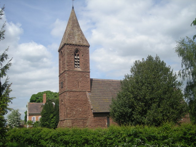
St John the
Baptist parish church, Withington, Shropshire, seen from the southwest
135:
278:
228:
156:
146:
315:
1000:
1030:
327:
1040:
1020:
1010:
1050:
893:
Click on a date/time to view the file as it appeared at that time.
280:
230:
255:
205:
66:
991:
Withington (distrito sa
Hiniusang Gingharian, Shropshire)
265:
52° 42′ 46″ N, 2° 37′ 44″ W
215:
52° 42′ 44″ N, 2° 37′ 48″ W
454:
Add a one-line explanation of what this file represents
1065:
1060:
110:
90:
Commons is a freely licensed media file repository.
623:
Creative
Commons Attribution-ShareAlike 2.0 Generic
116:Withington Church - geograph.org.uk - 809876.jpg
56:(640 × 480 pixels, file size: 81 KB, MIME type:
52:Withington_Church_-_geograph.org.uk_-_809876.jpg
423:https://creativecommons.org/licenses/by-sa/2.0
71:
429:Creative Commons Attribution-Share Alike 2.0
347:
8:
825:
761:
389:– to copy, distribute and transmit the work
1083:
963:Listed buildings in Withington, Shropshire
895:
450:
983:The following other wikis use this file:
550:https://www.geograph.org.uk/profile/17899
679:https://www.geograph.org.uk/photo/809876
1085:
955:
849:
833:
785:
769:
743:
727:
656:
640:
620:
604:
584:
568:
501:
485:
468:
465:
446:
439:
258:
208:
287:View this and other nearby images on:
237:View this and other nearby images on:
953:The following 4 pages use this file:
7:
958:List of new churches by G. E. Street
334:and is licensed for reuse under the
884:
370:Attribution-Share Alike 2.0 Generic
358:
353:
338:Attribution-ShareAlike 2.0 license.
1076:
459:
453:
344:
321:
120:
103:
49:
458:
772:coordinates of the point of view
444:
400:Under the following conditions:
365:This file is licensed under the
357:
352:
346:
314:
293:
279:
271:
243:
229:
221:
70:
31:
21:
441:
121:
46:No higher resolution available.
14:
659:file available on the internet
440:
322:This image was taken from the
26:
1:
836:coordinates of depicted place
36:
709:Geograph Britain and Ireland
515:object of statement has role
466:Items portrayed in this file
1027:Usage on lld.wikipedia.org
987:Usage on ceb.wikipedia.org
851:52°42'46.26"N, 2°37'43.68"W
787:52°42'43.67"N, 2°37'47.64"W
270:
220:
1107:
1057:Usage on www.wikidata.org
1047:Usage on tr.wikipedia.org
1037:Usage on pl.wikipedia.org
1017:Usage on it.wikipedia.org
1007:Usage on fr.wikipedia.org
1001:Withington, Swydd Amwythig
997:Usage on cy.wikipedia.org
414:same or compatible license
968:Samuel Fisher (died 1681)
885:
16:
687:geograph.org.uk image ID
443:
380:
77:This is a file from the
1041:Withington (Shropshire)
1031:Withington (Shropshire)
1021:Withington (Shropshire)
1011:Withington (Shropshire)
942:
921:10:23, 20 February 2011
168:required by the license
152:
141:
134:
131:
113:
81:. Information from its
1051:Withington, Shropshire
973:Withington, Shropshire
328:this photograph's page
299:52.712850; -2.628800
249:52.712130; -2.629900
84:description page there
395:– to adapt the work
530:author name string
196:Row17 /
177:Row17 /
1094:
1093:
979:Global file usage
946:
827:
763:
607:copyright license
452:
343:
342:
326:collection. See
304:
303:
254:
253:
203:
202:
198:Withington Church
179:Withington Church
171:
99:
98:
79:Wikimedia Commons
32:Global file usage
1098:
1084:
933:
873:
872:
867:
809:
808:
803:
711:
706:
696:
691:
681:
676:
672:described at URL
571:copyright status
552:
547:
537:
534:
524:
519:
436:
433:
430:
427:
424:
416:as the original.
378:
367:Creative Commons
361:
360:
356:
355:
350:
349:
336:Creative Commons
324:Geograph project
318:
311:
300:
297:
283:
282:
276:
275:
274:
268:
267:
256:
250:
247:
233:
232:
226:
225:
224:
218:
217:
206:
165:
137:
125:
117:
111:
95:
74:
73:
67:
61:
59:
1106:
1105:
1101:
1100:
1099:
1097:
1096:
1095:
1072:
977:
947:
939:
931:
887:
886:
883:
882:
881:
880:
879:
878:
877:
876:
875:
874:
870:
868:
865:
856:
855:
854:
852:
842:
841:
840:
838:
819:
818:
817:
816:
815:
814:
813:
812:
811:
810:
806:
804:
801:
792:
791:
790:
788:
778:
777:
776:
774:
755:
754:
753:
752:
751:
750:
749:
748:
746:
736:
735:
734:
732:
721:
720:
719:
718:
717:
716:
715:
714:
713:
712:
707:
704:
698:
697:
692:
689:
683:
682:
677:
674:
665:
664:
663:
661:
649:
648:
647:
645:
634:
633:
632:
631:
630:
629:
628:
627:
625:
613:
612:
611:
609:
598:
597:
596:
595:
594:
593:
592:
591:
589:
577:
576:
575:
573:
562:
561:
560:
559:
558:
557:
556:
555:
554:
553:
548:
545:
539:
538:
535:
532:
526:
525:
520:
517:
508:
507:
506:
504:
494:
493:
492:
490:
479:
478:
477:
476:
475:
473:
457:
456:
455:
438:
437:
434:
431:
428:
425:
422:
421:
379:
376:
373:
362:
339:
309:
298:
272:
263:
262:
259:Object location
248:
222:
213:
212:
209:Camera location
204:
193:
186:
174:
147:geograph.org.uk
127:
115:
108:
101:
100:
89:
88:
87:is shown below.
63:
57:
55:
48:
47:
12:
11:
5:
1104:
1102:
1092:
1091:
1088:
1075:
1071:
1070:
1069:
1068:
1063:
1055:
1054:
1053:
1045:
1044:
1043:
1035:
1034:
1033:
1025:
1024:
1023:
1015:
1014:
1013:
1005:
1004:
1003:
995:
994:
993:
981:
980:
976:
975:
970:
965:
960:
951:
950:
945:
944:
941:
937:
934:
928:
923:
918:
914:
913:
910:
907:
904:
901:
898:
891:
890:
861:
860:
859:
858:
857:
853:
850:
848:
847:
846:
845:
844:
843:
839:
834:
832:
831:
830:
829:
823:
797:
796:
795:
794:
793:
789:
786:
784:
783:
782:
781:
780:
779:
775:
770:
768:
767:
766:
765:
759:
747:
744:
742:
741:
740:
739:
738:
737:
733:
728:
726:
725:
724:
723:
722:
700:
699:
685:
684:
670:
669:
668:
667:
666:
662:
657:
655:
654:
653:
652:
651:
650:
646:
643:source of file
641:
639:
638:
637:
636:
635:
626:
621:
619:
618:
617:
616:
615:
614:
610:
605:
603:
602:
601:
600:
599:
590:
585:
583:
582:
581:
580:
579:
578:
574:
569:
567:
566:
565:
564:
563:
541:
540:
528:
527:
513:
512:
511:
510:
509:
505:
502:
500:
499:
498:
497:
496:
495:
491:
486:
484:
483:
482:
481:
480:
474:
469:
467:
464:
463:
462:
461:
460:
449:
448:
445:
442:
420:
419:
418:
417:
407:
398:
397:
396:
390:
383:You are free:
374:
364:
363:
345:
341:
340:
319:
308:
305:
302:
301:
291:
285:
260:
252:
251:
241:
235:
210:
201:
200:
194:
191:
188:
187:
182:
175:
172:
160:
159:
154:
150:
149:
143:
139:
138:
133:
129:
128:
118:
109:
107:
104:
102:
97:
96:
75:
65:
64:
45:
41:
40:
39:
34:
29:
24:
19:
13:
10:
9:
6:
4:
3:
2:
1103:
1089:
1086:
1082:
1079:
1073:
1067:
1064:
1062:
1059:
1058:
1056:
1052:
1049:
1048:
1046:
1042:
1039:
1038:
1036:
1032:
1029:
1028:
1026:
1022:
1019:
1018:
1016:
1012:
1009:
1008:
1006:
1002:
999:
998:
996:
992:
989:
988:
986:
985:
984:
978:
974:
971:
969:
966:
964:
961:
959:
956:
954:
948:
940:
935:
929:
927:
924:
922:
919:
916:
915:
911:
908:
905:
902:
899:
897:
896:
894:
888:
864:
837:
800:
773:
731:
710:
703:
695:
688:
680:
673:
660:
644:
624:
608:
588:
572:
551:
544:
531:
523:
516:
489:
472:
426:CC BY-SA 2.0
415:
411:
408:
405:
402:
401:
399:
394:
391:
388:
385:
384:
382:
381:
375:Attribution:
371:
368:
351:
337:
333:
329:
325:
320:
317:
313:
312:
306:
296:
292:
290:
289:OpenStreetMap
286:
284:
266:
261:
257:
246:
242:
240:
239:OpenStreetMap
236:
234:
216:
211:
207:
199:
195:
190:
189:
185:
181: /
180:
176:
169:
164:
162:
161:
158:
155:
151:
148:
144:
140:
130:
124:
119:
112:
105:
93:
86:
85:
80:
76:
69:
68:
62:
53:
44:
38:
35:
33:
30:
28:
25:
23:
20:
18:
15:
1080:
1077:
982:
952:
892:
889:File history
522:photographer
409:
403:
392:
386:
331:
269:
219:
197:
184:CC BY-SA 2.0
178:
122:
92:You can help
82:
50:
22:File history
938:GeographBot
745:20 May 2008
587:copyrighted
410:share alike
404:attribution
163:Attribution
136:20 May 2008
114:Description
1087:_error
949:File usage
930:640 × 480
906:Dimensions
503:some value
58:image/jpeg
27:File usage
1066:Q26557824
903:Thumbnail
900:Date/Time
730:inception
307:Licensing
192:InfoField
173:InfoField
123:English:
1074:Metadata
1061:Q3877046
702:operator
447:Captions
393:to remix
387:to share
372:license.
37:Metadata
932:(81 KB)
917:current
912:Comment
863:heading
822:heading
799:heading
758:heading
488:creator
471:depicts
451:English
106:Summary
54:
871:degree
826:degree
807:degree
762:degree
694:809876
277:
227:
153:Author
142:Source
536:Row17
377:Row17
332:Row17
157:Row17
145:From
909:User
435:true
432:true
132:Date
17:File
869:45
805:45
543:URL
866::
802::
705::
690::
675::
546::
533::
518::
1090:0
170:)
166:(
94:.
60:)
Text is available under the Creative Commons Attribution-ShareAlike License. Additional terms may apply.
_heading:45.00&language=en)
_heading:45.00&language=en)
