353:
286:
278:
300:
321:
359:
364:
72:
580:"}},"text\/plain":{"en":{"":"heading"}}},"{\"value\":{\"amount\":\"+315\",\"unit\":\"http:\\\/\\\/www.wikidata.org\\\/entity\\\/Q28390\"},\"type\":\"quantity\"}":{"text\/html":{"en":{"P7787":"315
576:
411:– You must give appropriate credit, provide a link to the license, and indicate if changes were made. You may do so in any reasonable manner, but not in any way that suggests the licensor endorses you or your use.
43:
269:
577:
51:
83:
817:
803:{{Information |Description={{en|1={{Information |Description=Withyham Church |Source=From |Date=2006-12 |Author= |Permission=Creative Commons A
206:
563:
527:
491:
293:
970:
328:
903:
This file contains additional information, probably added from the digital camera or scanner used to create or digitize it.
697:
418:
717:
681:
618:
591:
511:
647:
547:
475:
315:
374:
906:
If the file has been modified from its original state, some details may not fully reflect the modified file.
785:
780:
42:
813:
The following pages on the
English Knowledge (XXG) use this file (pages on other projects are not listed):
417:– If you remix, transform, or build upon the material, you must distribute your contributions under the
335:
on the
Geograph website for the photographer's contact details. The copyright on this image is owned by
947:
860:
371:
115:
584:"}},"text\/plain":{"en":{"P7787":"315 degree"}}}}": -->
865:
822:
796:
91:
238:
110:
222:
299:
845:
340:
78:
880:
981:
283:
157:
177:
192:
827:
320:
332:
753:
Click on a date/time to view the file as it appeared at that time.
855:
285:
270:
51° 05′ 57.31″ N, 0° 07′ 56.96″ E
260:
66:
459:
Add a one-line explanation of what this file represents
890:
875:
213:
Creative
Commons Attribution Share-alike license 2.0
132:
104:
90:
Commons is a freely licensed media file repository.
861:
564:
Creative
Commons Attribution-ShareAlike 2.0 Generic
866:Liste der Hallenkirchen im Vereinigten Königreich
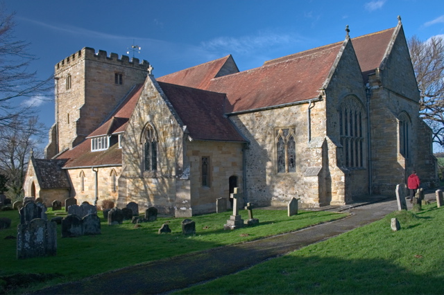
492:The church of St Michael and All Angels, Withyham
56:(640 × 426 pixels, file size: 155 KB, MIME type:
428:https://creativecommons.org/licenses/by-sa/2.0
71:
434:Creative Commons Attribution-Share Alike 2.0
352:
8:
581:
394:– to copy, distribute and transmit the work
908:
755:
455:
838:The following other wikis use this file:
979:
968:
960:
952:
942:
934:
926:
918:
910:
846:Grade I listed buildings in East Sussex
818:Grade I listed buildings in East Sussex
815:
731:
715:
695:
679:
661:
645:
605:
589:
561:
545:
525:
509:
489:
473:
470:
451:
444:
263:
292:View this and other nearby images on:
138:Withyham Church (geograph 456458).jpg
52:Withyham_Church_(geograph_456458).jpg
7:
881:St Michael and all Angels (Withyham)
339:and is licensed for reuse under the
744:
375:Attribution-Share Alike 2.0 Generic
363:
358:
343:Attribution-ShareAlike 2.0 license.
172:
901:
464:
458:
349:
326:
142:
108:
103:
49:
463:
592:coordinates of the point of view
449:
405:Under the following conditions:
370:This file is licensed under the
362:
357:
351:
319:
298:
284:
276:
70:
31:
21:
446:
143:
46:No higher resolution available.
14:
445:
327:This image was taken from the
26:
1:
36:
471:Items portrayed in this file
275:
842:Usage on dag.wikipedia.org
607:51°5'57.314"N, 0°7'56.960"E
1003:
887:Usage on www.wikidata.org
872:Usage on nl.wikipedia.org
852:Usage on de.wikipedia.org
419:same or compatible license
251:David BROOKER /
232:David BROOKER /
954:File change date and time
745:
16:
448:
385:
77:This is a file from the
802:
781:08:59, 20 November 2008
223:required by the license
201:
187:
163:
156:
153:
135:
81:. Information from its
333:this photograph's page
304:51.099254; 0.132489
175:
84:description page there
928:Horizontal resolution
682:location of creation
962:Y and C positioning
936:Vertical resolution
856:Vita Sackville-West
823:Vita Sackville-West
400:– to adapt the work
109:This is a photo of
957:11:00, 5 June 2007
990:
989:
912:JPEG file comment
834:Global file usage
806:
583:
548:copyright license
457:
348:
347:
331:collection. See
309:
308:
258:
257:
226:
210:
207:Reusing this file
125:
124:
99:
98:
79:Wikimedia Commons
32:Global file usage
994:
909:
793:
629:
628:
623:
512:copyright status
441:
438:
435:
432:
429:
421:as the original.
383:
372:Creative Commons
366:
365:
361:
360:
355:
354:
341:Creative Commons
329:Geograph project
323:
316:
305:
302:
288:
287:
281:
280:
279:
273:
272:
261:
220:
204:
182:
159:
147:
139:
133:
118:
105:
95:
74:
73:
67:
61:
59:
1002:
1001:
997:
996:
995:
993:
992:
991:
948:QuickTime 7.1.6
897:
832:
814:
807:
799:
791:
747:
746:
743:
742:
741:
740:
739:
738:
737:
736:
734:
724:
723:
722:
720:
709:
708:
707:
706:
705:
704:
703:
702:
700:
688:
687:
686:
684:
673:
672:
671:
670:
669:
668:
667:
666:
664:
654:
653:
652:
650:
639:
638:
637:
636:
635:
634:
633:
632:
631:
630:
626:
624:
621:
612:
611:
610:
608:
598:
597:
596:
594:
575:
574:
573:
572:
571:
570:
569:
568:
566:
554:
553:
552:
550:
539:
538:
537:
536:
535:
534:
533:
532:
530:
518:
517:
516:
514:
503:
502:
501:
500:
499:
498:
497:
496:
494:
482:
481:
480:
478:
462:
461:
460:
443:
442:
439:
436:
433:
430:
427:
426:
384:
381:
378:
367:
344:
314:
303:
277:
268:
267:
264:Camera location
259:
253:Withyham Church
248:
241:
234:Withyham Church
229:
180:
178:geograph.org.uk
173:Original text:
149:
148:Withyham Church
137:
130:
120:
114:
111:listed building
101:
100:
89:
88:
87:is shown below.
63:
57:
55:
48:
47:
12:
11:
5:
1000:
998:
988:
987:
984:
978:
977:
974:
967:
966:
963:
959:
958:
955:
951:
950:
945:
941:
940:
937:
933:
932:
929:
925:
924:
921:
917:
916:
913:
900:
896:
895:
894:
893:
885:
884:
883:
878:
870:
869:
868:
863:
858:
850:
849:
848:
836:
835:
831:
830:
825:
820:
812:
811:
810:
805:
804:
801:
798:MarmadukePercy
797:
794:
788:
783:
778:
774:
773:
770:
767:
764:
761:
758:
751:
750:
735:
732:
730:
729:
728:
727:
726:
725:
721:
716:
714:
713:
712:
711:
710:
701:
696:
694:
693:
692:
691:
690:
689:
685:
680:
678:
677:
676:
675:
674:
665:
662:
660:
659:
658:
657:
656:
655:
651:
646:
644:
643:
642:
641:
640:
617:
616:
615:
614:
613:
609:
606:
604:
603:
602:
601:
600:
599:
595:
590:
588:
587:
586:
585:
579:
567:
562:
560:
559:
558:
557:
556:
555:
551:
546:
544:
543:
542:
541:
540:
531:
526:
524:
523:
522:
521:
520:
519:
515:
510:
508:
507:
506:
505:
504:
495:
490:
488:
487:
486:
485:
484:
483:
479:
474:
472:
469:
468:
467:
466:
465:
454:
453:
450:
447:
425:
424:
423:
422:
412:
403:
402:
401:
395:
388:You are free:
379:
369:
368:
350:
346:
345:
324:
313:
310:
307:
306:
296:
290:
265:
256:
255:
249:
246:
243:
242:
237:
230:
227:
215:
214:
211:
199:
198:
189:
185:
184:
165:
161:
160:
155:
151:
150:
140:
131:
129:
126:
123:
122:
102:
97:
96:
75:
65:
64:
45:
41:
40:
39:
34:
29:
24:
19:
13:
10:
9:
6:
4:
3:
2:
999:
985:
983:
980:
975:
972:
969:
964:
961:
956:
953:
949:
946:
944:Software used
943:
938:
935:
930:
927:
922:
919:
914:
911:
907:
904:
898:
892:
889:
888:
886:
882:
879:
877:
874:
873:
871:
867:
864:
862:
859:
857:
854:
853:
851:
847:
844:
843:
841:
840:
839:
833:
829:
826:
824:
821:
819:
816:
808:
800:
795:
789:
787:
784:
782:
779:
776:
775:
771:
768:
765:
762:
759:
757:
756:
754:
748:
719:
699:
683:
663:December 2006
649:
620:
593:
565:
549:
529:
513:
493:
477:
431:CC BY-SA 2.0
420:
416:
413:
410:
407:
406:
404:
399:
396:
393:
390:
389:
387:
386:
382:David BROOKER
380:Attribution:
376:
373:
356:
342:
338:
337:David BROOKER
334:
330:
325:
322:
318:
317:
311:
301:
297:
295:
294:OpenStreetMap
291:
289:
271:
266:
262:
254:
250:
245:
244:
240:
236: /
235:
231:
224:
219:
217:
216:
212:
208:
203:
200:
197:David Brooker
196:
194:
193:David BROOKER
190:
186:
181:
179:
170:
169:
166:
162:
158:December 2006
152:
146:
141:
134:
127:
121:
117:
112:
107:
106:
93:
86:
85:
80:
76:
69:
68:
62:
53:
44:
38:
35:
33:
30:
28:
25:
23:
20:
18:
15:
905:
902:
837:
752:
749:File history
414:
408:
397:
391:
336:
274:
252:
239:CC BY-SA 2.0
233:
191:
174:
168:geograph.org
167:
144:
92:You can help
82:
50:
22:File history
982:Color space
920:Orientation
528:copyrighted
415:share alike
409:attribution
218:Attribution
136:Description
809:File usage
790:640 × 426
766:Dimensions
733:image/jpeg
718:media type
202:Permission
58:image/jpeg
27:File usage
915:AppleMark
891:Q17535441
763:Thumbnail
760:Date/Time
648:inception
312:Licensing
247:InfoField
228:InfoField
145:English:
965:Centered
899:Metadata
876:Withyham
828:Withyham
792:(155 KB)
698:Withyham
452:Captions
398:to remix
392:to share
377:license.
37:Metadata
973:version
939:240 dpi
931:240 dpi
777:current
772:Comment
619:heading
578:heading
476:depicts
456:English
128:Summary
116:1180384
113:number
54:
923:Normal
627:degree
582:degree
282:
188:Author
164:Source
176:From
986:sRGB
971:Exif
769:User
625:315
440:true
437:true
154:Date
17:File
976:2.2
622::
195:.
225:)
221:(
209:)
205:(
183:)
171:(
119:.
94:.
60:)
Text is available under the Creative Commons Attribution-ShareAlike License. Additional terms may apply.
.jpg)
.jpg¶ms=051.099254_N_0000.132489_E_globe:Earth_type:camera_heading:315.00&language=en)
