38:
251:
212:
204:
226:
346:
257:
262:
596:"}},"text\/plain":{"en":{"":"heading"}}},"{\"value\":{\"amount\":\"+153.310105\",\"unit\":\"http:\\\/\\\/www.wikidata.org\\\/entity\\\/Q28390\"},\"type\":\"quantity\"}":{"text\/html":{"en":{"P7787":"153.310105
98:
592:
195:
303:– You must give appropriate credit, provide a link to the license, and indicate if changes were made. You may do so in any reasonable manner, but not in any way that suggests the licensor endorses you or your use.
64:
60:
56:
52:
48:
42:
109:
77:
593:
352:
579:
543:
507:
219:
971:
810:
This file contains additional information, probably added from the digital camera or scanner used to create or digitize it.
679:
310:
663:
634:
607:
563:
491:
463:
450:
435:
699:
527:
408:
391:
146:
Eastbound
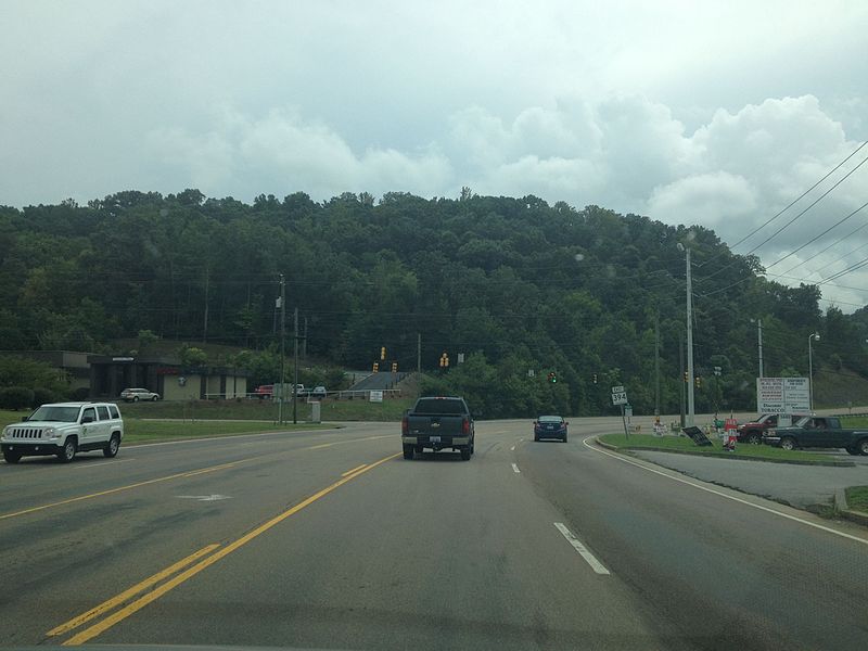
Tennessee State Route 394 between Tennessee State Route 126 and Franklin Drive in Blountville, Tennessee
799:
767:
762:
68:
37:
442:
272:
813:
If the file has been modified from its original state, some details may not fully reflect the modified file.
600:"}},"text\/plain":{"en":{"P7787":"153.310105 degree"}}}}": -->
795:
The following pages on the
English Knowledge (XXG) use this file (pages on other projects are not listed):
309:– If you remix, transform, or build upon the material, you must distribute your contributions under the
269:
1047:
117:
470:
940:
778:
225:
1115:
1037:
1011:
839:
104:
244:
I, the copyright holder of this work, hereby publish it under the following license:
879:
209:
178:
1081:
859:
822:
832:
345:
849:
735:
Click on a date/time to view the file as it appeared at that time.
156:
211:
196:
36° 31′ 57.2″ N, 82° 19′ 38.81″ W
340:
186:
92:
375:
Add a one-line explanation of what this file represents
82:(3,264 × 2,448 pixels, file size: 2.07 MB, MIME type:
544:
Creative
Commons Attribution-ShareAlike 3.0 Unported
136:
116:
Commons is a freely licensed media file repository.
1052:Flash did not fire, compulsory flash suppression
142:TN 394 EB between TN 126 and Franklin Drive.jpg
320:https://creativecommons.org/licenses/by-sa/3.0
97:
326:Creative Commons Attribution-Share Alike 3.0
250:
8:
471:https://commons.wikimedia.org/user:Dough4872
597:
286:– to copy, distribute and transmit the work
815:
737:
371:
1155:
1147:
1139:
1131:
1123:
1113:
1105:
1097:
1089:
1079:
1071:
1063:
1055:
1045:
1035:
1027:
1019:
1009:
988:
980:
969:
961:
953:
945:
935:
927:
919:
911:
903:
895:
887:
876:
868:
857:
847:
837:
827:
797:
713:
697:
677:
661:
621:
605:
577:
561:
541:
525:
505:
489:
422:
406:
389:
386:
367:
360:
189:
218:View this and other nearby images on:
817:
7:
273:Attribution-Share Alike 3.0 Unported
726:
261:
256:
201:
155:
808:
380:
374:
247:
243:
154:19 August 2016 (according to
129:
75:
844:1/2,045 sec (0.00048899755501222)
379:
1149:Reference for direction of image
870:Date and time of data generation
608:coordinates of the point of view
365:
344:
297:Under the following conditions:
268:This file is licensed under the
260:
255:
249:
224:
210:
202:
96:
21:
362:
14:
623:36°31'57.202"N, 82°19'38.809"W
361:
26:
1:
1102:A directly photographed image
785:Uploaded with Commons for iOS
580:original creation by uploader
31:
1065:DateTimeDigitized subseconds
387:Items portrayed in this file
1057:DateTimeOriginal subseconds
982:Date and time of digitizing
351:This file was uploaded via
1177:
1125:Focal length in 35 mm film
1094:One-chip color area sensor
1073:Supported Flashpix version
908:468 meters above sea level
311:same or compatible license
990:Meaning of each component
947:File change date and time
800:Tennessee State Route 394
727:
168:
16:
364:
277:
103:This is a file from the
1141:GPS time (atomic clock)
784:
174:
164:
153:
150:
139:
107:. Information from its
230:36.532556; -82.327447
110:description page there
41:Size of this preview:
985:13:59, 19 August 2016
950:13:59, 19 August 2016
921:Horizontal resolution
873:13:59, 19 August 2016
763:02:16, 23 August 2016
69:3,264 × 2,448 pixels
65:2,560 × 1,920 pixels
955:Y and C positioning
929:Vertical resolution
819:Camera manufacturer
292:– to adapt the work
47:Other resolutions:
1157:Direction of image
1133:Scene capture type
1120:Auto white balance
451:author name string
436:Wikimedia username
61:1,280 × 960 pixels
57:1,024 × 768 pixels
1164:
1163:
788:
599:
528:copyright license
373:
359:
358:
235:
234:
184:
183:
125:
124:
105:Wikimedia Commons
1168:
963:Exposure Program
900:82° 19′ 38.81″ W
816:
775:
645:
644:
639:
492:copyright status
473:
468:
458:
455:
445:
440:
348:
341:
333:
330:
327:
324:
321:
313:as the original.
270:Creative Commons
264:
263:
259:
258:
253:
252:
231:
228:
214:
213:
207:
206:
205:
199:
198:
187:
170:
159:
143:
137:
121:
100:
99:
93:
87:
85:
72:
53:640 × 480 pixels
49:320 × 240 pixels
43:800 × 600 pixels
1176:
1175:
1171:
1170:
1169:
1167:
1166:
1165:
1160:153.31010452962
1032:9.9679324894515
1029:APEX brightness
1024:2.5260688216893
1016:10.997876857749
892:36° 31′ 57.2″ N
804:
796:
789:
781:
773:
729:
728:
725:
724:
723:
722:
721:
720:
719:
718:
716:
706:
705:
704:
702:
691:
690:
689:
688:
687:
686:
685:
684:
682:
670:
669:
668:
666:
655:
654:
653:
652:
651:
650:
649:
648:
647:
646:
642:
640:
637:
628:
627:
626:
624:
614:
613:
612:
610:
591:
590:
589:
588:
587:
586:
585:
584:
582:
570:
569:
568:
566:
555:
554:
553:
552:
551:
550:
549:
548:
546:
534:
533:
532:
530:
519:
518:
517:
516:
515:
514:
513:
512:
510:
498:
497:
496:
494:
483:
482:
481:
480:
479:
478:
477:
476:
475:
474:
469:
466:
460:
459:
456:
453:
447:
446:
441:
438:
429:
428:
427:
425:
415:
414:
413:
411:
400:
399:
398:
397:
396:
394:
378:
377:
376:
336:
335:
334:
331:
328:
325:
322:
319:
318:
276:
265:
246:
245:
240:
229:
203:
194:
193:
190:Camera location
185:
141:
134:
127:
126:
115:
114:
113:is shown below.
89:
83:
81:
74:
73:
46:
12:
11:
5:
1174:
1172:
1162:
1161:
1158:
1154:
1153:
1152:True direction
1150:
1146:
1145:
1142:
1138:
1137:
1134:
1130:
1129:
1126:
1122:
1121:
1118:
1112:
1111:
1108:
1104:
1103:
1100:
1096:
1095:
1092:
1091:Sensing method
1088:
1087:
1084:
1078:
1077:
1074:
1070:
1069:
1066:
1062:
1061:
1058:
1054:
1053:
1050:
1044:
1043:
1040:
1034:
1033:
1030:
1026:
1025:
1022:
1018:
1017:
1014:
1008:
1007:
1006:
1005:
1004:does not exist
1002:
999:
996:
991:
987:
986:
983:
979:
978:
975:
968:
967:
966:Normal program
964:
960:
959:
956:
952:
951:
948:
944:
943:
938:
934:
933:
930:
926:
925:
922:
918:
917:
914:
910:
909:
906:
902:
901:
898:
894:
893:
890:
886:
885:
882:
875:
874:
871:
867:
866:
863:
856:
855:
852:
846:
845:
842:
836:
835:
830:
826:
825:
820:
807:
803:
802:
794:
793:
792:
787:
786:
783:
779:
776:
772:3,264 × 2,448
770:
765:
760:
756:
755:
752:
749:
746:
743:
740:
733:
732:
717:
715:19 August 2016
714:
712:
711:
710:
709:
708:
707:
703:
698:
696:
695:
694:
693:
692:
683:
678:
676:
675:
674:
673:
672:
671:
667:
662:
660:
659:
658:
657:
656:
633:
632:
631:
630:
629:
625:
622:
620:
619:
618:
617:
616:
615:
611:
606:
604:
603:
602:
601:
595:
583:
578:
576:
575:
574:
573:
572:
571:
567:
564:source of file
562:
560:
559:
558:
557:
556:
547:
542:
540:
539:
538:
537:
536:
535:
531:
526:
524:
523:
522:
521:
520:
511:
506:
504:
503:
502:
501:
500:
499:
495:
490:
488:
487:
486:
485:
484:
462:
461:
449:
448:
434:
433:
432:
431:
430:
426:
423:
421:
420:
419:
418:
417:
416:
412:
407:
405:
404:
403:
402:
401:
395:
390:
388:
385:
384:
383:
382:
381:
370:
369:
366:
363:
357:
356:
349:
317:
316:
315:
314:
304:
295:
294:
293:
287:
280:You are free:
267:
266:
248:
242:
241:
239:
236:
233:
232:
222:
216:
191:
182:
181:
176:
172:
171:
166:
162:
161:
152:
148:
147:
144:
135:
133:
130:
128:
123:
122:
101:
91:
90:
40:
36:
35:
34:
29:
24:
19:
13:
10:
9:
6:
4:
3:
2:
1173:
1159:
1156:
1151:
1148:
1143:
1140:
1135:
1132:
1127:
1124:
1119:
1117:
1116:White balance
1114:
1110:Auto exposure
1109:
1107:Exposure mode
1106:
1101:
1098:
1093:
1090:
1085:
1083:
1080:
1075:
1072:
1067:
1064:
1059:
1056:
1051:
1049:
1046:
1041:
1039:
1038:Metering mode
1036:
1031:
1028:
1023:
1021:APEX aperture
1020:
1015:
1013:
1012:Shutter speed
1010:
1003:
1000:
997:
994:
993:
992:
989:
984:
981:
976:
973:
970:
965:
962:
957:
954:
949:
946:
942:
939:
937:Software used
936:
931:
928:
923:
920:
915:
912:
907:
904:
899:
896:
891:
888:
883:
881:
877:
872:
869:
864:
861:
858:
853:
851:
848:
843:
841:
840:Exposure time
838:
834:
831:
828:
824:
821:
818:
814:
811:
805:
801:
798:
790:
782:
777:
771:
769:
766:
764:
761:
758:
757:
753:
750:
747:
744:
741:
739:
738:
736:
730:
701:
681:
665:
664:captured with
636:
609:
581:
565:
545:
529:
509:
493:
472:
465:
452:
444:
437:
410:
393:
354:
350:
347:
343:
342:
339:
338:
323:CC BY-SA 3.0
312:
308:
305:
302:
299:
298:
296:
291:
288:
285:
282:
281:
279:
278:
274:
271:
254:
237:
227:
223:
221:
220:OpenStreetMap
217:
215:
197:
192:
188:
180:
177:
173:
167:
163:
158:
149:
145:
138:
131:
119:
112:
111:
106:
102:
95:
94:
88:
79:
78:Original file
70:
66:
62:
58:
54:
50:
44:
39:
33:
30:
28:
25:
23:
20:
18:
15:
880:focal length
829:Camera model
812:
809:
734:
731:File history
355:iOS 1.0.10.
337:
306:
300:
289:
283:
200:
118:You can help
108:
76:
22:File history
1144:17:58:59.99
1082:Color space
913:Orientation
641:153.310105
508:copyrighted
307:share alike
301:attribution
140:Description
1099:Scene type
791:File usage
748:Dimensions
424:some value
84:image/jpeg
27:File usage
897:Longitude
860:ISO speed
833:iPhone 4S
780:Dough4872
774:(2.07 MB)
745:Thumbnail
742:Date/Time
700:inception
680:iPhone 4S
457:Dough4872
443:Dough4872
238:Licensing
179:Dough4872
1136:Standard
958:Centered
905:Altitude
889:Latitude
850:F-number
806:Metadata
368:Captions
290:to remix
284:to share
275:license.
169:Own work
32:Metadata
1042:Pattern
974:version
884:4.28 mm
759:current
754:Comment
635:heading
594:heading
409:creator
392:depicts
372:English
132:Summary
80:
932:72 dpi
924:72 dpi
916:Normal
862:rating
643:degree
598:degree
353:Mobile
208:
175:Author
165:Source
1128:35 mm
1048:Flash
941:7.1.2
878:Lens
854:f/2.4
823:Apple
160:data)
1086:sRGB
977:2.21
972:Exif
751:User
332:true
329:true
157:Exif
151:Date
17:File
1068:561
1060:561
464:URL
1001:Cr
998:Cb
865:50
638::
467::
454::
439::
67:|
63:|
59:|
55:|
51:|
45:.
1076:1
995:Y
120:.
86:)
71:.
Text is available under the Creative Commons Attribution-ShareAlike License. Additional terms may apply.
