368:
301:
251:
293:
243:
315:
265:
336:
374:
379:
67:
844:"}},"text\/plain":{"en":{"":"heading"}}},"{\"value\":{\"amount\":\"+90\",\"unit\":\"http:\\\/\\\/www.wikidata.org\\\/entity\\\/Q28390\"},\"type\":\"quantity\"}":{"text\/html":{"en":{"P7787":"90
780:"}},"text\/plain":{"en":{"":"heading"}}},"{\"value\":{\"amount\":\"+90\",\"unit\":\"http:\\\/\\\/www.wikidata.org\\\/entity\\\/Q28390\"},\"type\":\"quantity\"}":{"text\/html":{"en":{"P7787":"90
776:
284:
234:
38:
426:– You must give appropriate credit, provide a link to the license, and indicate if changes were made. You may do so in any reasonable manner, but not in any way that suggests the licensor endorses you or your use.
997:== {{int:filedesc}} == {{Information |Description={{en|1=Tower on Rivington Pike, near to Rivington, Lancashire, Great Britain. A popular objective for a Sunday afternoon walk.}} |Source=From ; tra
78:
46:
841:
777:
171:
678:
642:
606:
308:
258:
698:
343:
1022:
This file contains additional information, probably added from the digital camera or scanner used to create or digitize it.
433:
990:
569:
979:
974:
37:
911:
882:
855:
818:
791:
706:
662:
590:
562:
547:
534:
121:
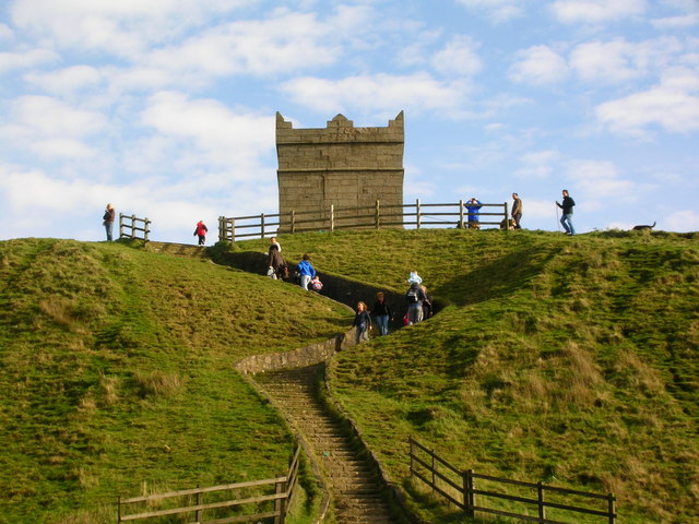
Tower on
Rivington Pike, near to Rivington, Lancashire, Great Britain. A popular objective for a Sunday afternoon walk.
749:
721:
691:
626:
507:
490:
330:
389:
1025:
If the file has been modified from its original state, some details may not fully reflect the modified file.
1007:
The following pages on the
English Knowledge (XXG) use this file (pages on other projects are not listed):
432:– If you remix, transform, or build upon the material, you must distribute your contributions under the
350:
on the
Geograph website for the photographer's contact details. The copyright on this image is owned by
386:
848:"}},"text\/plain":{"en":{"P7787":"90 degree"}}}}": -->
784:"}},"text\/plain":{"en":{"P7787":"90 degree"}}}}": -->
145:
86:
203:
728:
713:
187:
554:
1011:
314:
264:
355:
73:
248:
130:
298:
141:
160:
335:
347:
947:
Click on a date/time to view the file as it appeared at that time.
300:
250:
149:
275:
235:
53° 37′ 09.28″ N, 2° 32′ 30.4″ W
225:
61:
285:
53° 37′ 09″ N, 2° 32′ 28″ W
474:
Add a one-line explanation of what this file represents
111:
Tower on
Rivington Pike - geograph.org.uk - 1205995.jpg
47:
Tower_on_Rivington_Pike_-_geograph.org.uk_-_1205995.jpg
178:
Creative
Commons Attribution Share-alike license 2.0
105:
85:
Commons is a freely licensed media file repository.
643:
Creative
Commons Attribution-ShareAlike 2.0 Generic
51:(640 × 480 pixels, file size: 91 KB, MIME type:
443:https://creativecommons.org/licenses/by-sa/2.0
66:
449:Creative Commons Attribution-Share Alike 2.0
367:
8:
845:
781:
409:– to copy, distribute and transmit the work
1027:
949:
470:
729:https://www.geograph.org.uk/photo/1205995
1029:
1009:
925:
909:
869:
853:
805:
789:
763:
747:
676:
660:
640:
624:
604:
588:
555:https://www.geograph.org.uk/profile/955
521:
505:
488:
485:
466:
459:
278:
228:
307:View this and other nearby images on:
257:View this and other nearby images on:
7:
354:and is licensed for reuse under the
938:
390:Attribution-Share Alike 2.0 Generic
378:
373:
358:Attribution-ShareAlike 2.0 license.
1020:
479:
473:
364:
341:
115:
98:
44:
478:
792:coordinates of the point of view
464:
420:Under the following conditions:
385:This file is licensed under the
377:
372:
366:
334:
313:
299:
291:
263:
249:
241:
65:
21:
992:File Upload Bot (Magnus Manske)
461:
116:
41:No higher resolution available.
14:
679:file available on the internet
460:
342:This image was taken from the
26:
1:
856:coordinates of depicted place
31:
807:53°37'9.278"N, 2°32'30.401"W
699:Geograph Britain and Ireland
563:object of statement has role
486:Items portrayed in this file
290:
240:
1051:
871:53°37'9.44"N, 2°32'27.96"W
434:same or compatible license
939:
16:
975:20:23, 29 September 2010
707:geograph.org.uk image ID
463:
400:
72:This is a file from the
996:
218:Tower on Rivington Pike
216:John Darch /
199:Tower on Rivington Pike
197:John Darch /
188:required by the license
166:
156:
136:
129:
126:
108:
76:. Information from its
348:this photograph's page
319:53.619290; -2.541100
269:53.619244; -2.541778
146:User:Kurpfalzbilder.de
79:description page there
150:geograph_org2commons
415:– to adapt the work
535:author name string
1038:
1037:
1000:
847:
783:
627:copyright license
472:
363:
362:
346:collection. See
324:
323:
274:
273:
223:
222:
191:
175:
172:Reusing this file
144:; transferred by
94:
93:
74:Wikimedia Commons
1042:
1028:
987:
893:
892:
887:
829:
828:
823:
731:
726:
722:described at URL
716:
711:
701:
696:
591:copyright status
572:
567:
557:
552:
542:
539:
456:
453:
450:
447:
444:
436:as the original.
398:
387:Creative Commons
381:
380:
376:
375:
370:
369:
356:Creative Commons
344:Geograph project
338:
331:
320:
317:
303:
302:
296:
295:
294:
288:
287:
276:
270:
267:
253:
252:
246:
245:
244:
238:
237:
226:
185:
169:
132:
120:
112:
106:
90:
69:
68:
62:
56:
54:
1050:
1049:
1045:
1044:
1043:
1041:
1040:
1039:
1016:
1008:
1001:
993:
985:
941:
940:
937:
936:
935:
934:
933:
932:
931:
930:
928:
918:
917:
916:
914:
903:
902:
901:
900:
899:
898:
897:
896:
895:
894:
890:
888:
885:
876:
875:
874:
872:
862:
861:
860:
858:
839:
838:
837:
836:
835:
834:
833:
832:
831:
830:
826:
824:
821:
812:
811:
810:
808:
798:
797:
796:
794:
775:
774:
773:
772:
771:
770:
769:
768:
766:
765:29 October 2006
756:
755:
754:
752:
741:
740:
739:
738:
737:
736:
735:
734:
733:
732:
727:
724:
718:
717:
712:
709:
703:
702:
697:
694:
685:
684:
683:
681:
669:
668:
667:
665:
654:
653:
652:
651:
650:
649:
648:
647:
645:
633:
632:
631:
629:
618:
617:
616:
615:
614:
613:
612:
611:
609:
597:
596:
595:
593:
582:
581:
580:
579:
578:
577:
576:
575:
574:
573:
568:
565:
559:
558:
553:
550:
544:
543:
540:
537:
528:
527:
526:
524:
514:
513:
512:
510:
499:
498:
497:
496:
495:
493:
477:
476:
475:
458:
457:
454:
451:
448:
445:
442:
441:
399:
396:
393:
382:
359:
329:
318:
292:
283:
282:
279:Object location
268:
242:
233:
232:
229:Camera location
224:
213:
206:
194:
142:geograph.org.uk
131:29 October 2006
122:
110:
103:
96:
95:
84:
83:
82:is shown below.
58:
52:
50:
43:
42:
12:
11:
5:
1048:
1046:
1036:
1035:
1032:
1019:
1015:
1014:
1012:Rivington Pike
1006:
1005:
1004:
999:
998:
995:
991:
988:
982:
977:
972:
968:
967:
964:
961:
958:
955:
952:
945:
944:
929:
926:
924:
923:
922:
921:
920:
919:
915:
910:
908:
907:
906:
905:
904:
881:
880:
879:
878:
877:
873:
870:
868:
867:
866:
865:
864:
863:
859:
854:
852:
851:
850:
849:
843:
817:
816:
815:
814:
813:
809:
806:
804:
803:
802:
801:
800:
799:
795:
790:
788:
787:
786:
785:
779:
767:
764:
762:
761:
760:
759:
758:
757:
753:
748:
746:
745:
744:
743:
742:
720:
719:
705:
704:
690:
689:
688:
687:
686:
682:
677:
675:
674:
673:
672:
671:
670:
666:
663:source of file
661:
659:
658:
657:
656:
655:
646:
641:
639:
638:
637:
636:
635:
634:
630:
625:
623:
622:
621:
620:
619:
610:
605:
603:
602:
601:
600:
599:
598:
594:
589:
587:
586:
585:
584:
583:
561:
560:
546:
545:
533:
532:
531:
530:
529:
525:
522:
520:
519:
518:
517:
516:
515:
511:
506:
504:
503:
502:
501:
500:
494:
489:
487:
484:
483:
482:
481:
480:
469:
468:
465:
462:
440:
439:
438:
437:
427:
418:
417:
416:
410:
403:You are free:
394:
384:
383:
365:
361:
360:
339:
328:
325:
322:
321:
311:
305:
280:
272:
271:
261:
255:
230:
221:
220:
214:
211:
208:
207:
202:
195:
192:
180:
179:
176:
164:
163:
158:
154:
153:
138:
134:
133:
128:
124:
123:
113:
104:
102:
99:
97:
92:
91:
70:
60:
59:
40:
36:
35:
34:
29:
24:
19:
13:
10:
9:
6:
4:
3:
2:
1047:
1033:
1030:
1026:
1023:
1017:
1013:
1010:
1002:
994:
989:
983:
981:
978:
976:
973:
970:
969:
965:
962:
959:
956:
953:
951:
950:
948:
942:
913:
884:
857:
820:
793:
751:
730:
723:
715:
708:
700:
693:
680:
664:
644:
628:
608:
592:
571:
564:
556:
549:
536:
509:
492:
446:CC BY-SA 2.0
435:
431:
428:
425:
422:
421:
419:
414:
411:
408:
405:
404:
402:
401:
395:Attribution:
391:
388:
371:
357:
353:
349:
345:
340:
337:
333:
332:
326:
316:
312:
310:
309:OpenStreetMap
306:
304:
286:
281:
277:
266:
262:
260:
259:OpenStreetMap
256:
254:
236:
231:
227:
219:
215:
210:
209:
205:
201: /
200:
196:
189:
184:
182:
181:
177:
173:
168:
165:
162:
159:
155:
151:
147:
143:
139:
135:
125:
119:
114:
107:
100:
88:
81:
80:
75:
71:
64:
63:
57:
48:
39:
33:
30:
28:
25:
23:
20:
18:
15:
1024:
1021:
946:
943:File history
570:photographer
429:
423:
412:
406:
351:
289:
239:
217:
204:CC BY-SA 2.0
198:
117:
87:You can help
77:
45:
22:File history
607:copyrighted
430:share alike
424:attribution
183:Attribution
109:Description
1031:_error
1003:File usage
984:640 × 480
960:Dimensions
927:image/jpeg
912:media type
541:John Darch
523:some value
397:John Darch
352:John Darch
167:Permission
161:John Darch
53:image/jpeg
27:File usage
957:Thumbnail
954:Date/Time
750:inception
327:Licensing
212:InfoField
193:InfoField
118:English:
1018:Metadata
692:operator
467:Captions
413:to remix
407:to share
392:license.
32:Metadata
986:(91 KB)
971:current
966:Comment
883:heading
842:heading
819:heading
778:heading
714:1205995
508:creator
491:depicts
471:English
101:Summary
49:
891:degree
846:degree
827:degree
782:degree
297:
247:
157:Author
148:using
137:Source
140:From
963:User
455:true
452:true
127:Date
17:File
889:90
825:90
548:URL
886::
822::
725::
710::
695::
566::
551::
538::
1034:0
190:)
186:(
174:)
170:(
152:.
89:.
55:)
Text is available under the Creative Commons Attribution-ShareAlike License. Additional terms may apply.
_region:GB-GBN_heading:90.00&language=en)
