349:
282:
232:
274:
224:
296:
246:
317:
355:
360:
927:
72:
825:"}},"text\/plain":{"en":{"":"heading"}}},"{\"value\":{\"amount\":\"+315\",\"unit\":\"http:\\\/\\\/www.wikidata.org\\\/entity\\\/Q28390\"},\"type\":\"quantity\"}":{"text\/html":{"en":{"P7787":"315
640:"}},"text\/plain":{"en":{"":"heading"}}},"{\"value\":{\"amount\":\"+315\",\"unit\":\"http:\\\/\\\/www.wikidata.org\\\/entity\\\/Q28390\"},\"type\":\"quantity\"}":{"text\/html":{"en":{"P7787":"315
821:
126:
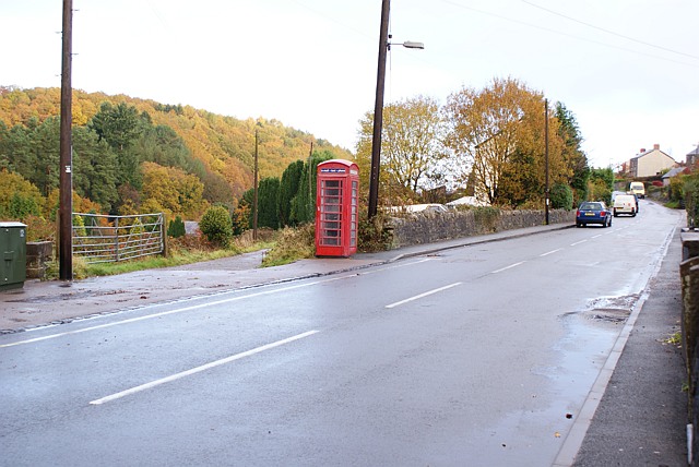
Telephone Kiosk, Ruspidge Road, Forests of Dean Just at the
Northern end of the Ruspidge football pitch is the telephone kiosk. This view is looking North up Ruspidge road towards Cinderford. The lane to the left of the kiosk leads down to a farm by Cinderford brook and to a large and somewhat
43:
215:
944:== {{int:filedesc}} == {{Information |description={{en|1=Telephone Kiosk, Ruspidge Road, Forests of Dean Just at the Northern end of the Ruspidge football pitch is the telephone kiosk. This view is looking North up Ruspidge road towards Cinderford. The la
51:
83:
407:– You must give appropriate credit, provide a link to the license, and indicate if changes were made. You may do so in any reasonable manner, but not in any way that suggests the licensor endorses you or your use.
822:
637:
926:
921:
42:
757:
623:
587:
289:
239:
792:
324:
1029:
This file contains additional information, probably added from the digital camera or scanner used to create or digitize it.
414:
535:
863:
836:
770:
741:
678:
651:
571:
543:
528:
515:
800:
785:
707:
607:
488:
471:
311:
370:
1032:
If the file has been modified from its original state, some details may not fully reflect the modified file.
413:– If you remix, transform, or build upon the material, you must distribute your contributions under the
331:
on the
Geograph website for the photographer's contact details. The copyright on this image is owned by
937:
367:
829:"}},"text\/plain":{"en":{"P7787":"315 degree"}}}}": -->
644:"}},"text\/plain":{"en":{"P7787":"315 degree"}}}}": -->
91:
184:
807:
777:
550:
168:
295:
245:
336:
78:
136:
116:
Telephone Kiosk, Ruspidge Road, Forests of Dean - geograph.org.uk - 1039067.jpg
52:
Telephone_Kiosk,_Ruspidge_Road,_Forests_of_Dean_-_geograph.org.uk_-_1039067.jpg
279:
229:
157:
147:
958:
316:
328:
894:
Click on a date/time to view the file as it appeared at that time.
281:
231:
256:
206:
66:
266:
51° 48′ 12″ N, 2° 30′ 31″ W
216:
51° 48′ 11″ N, 2° 30′ 30″ W
455:
Add a one-line explanation of what this file represents
1016:
1006:
996:
986:
976:
110:
90:
Commons is a freely licensed media file repository.
624:
Creative
Commons Attribution-ShareAlike 2.0 Generic
56:(640 × 428 pixels, file size: 87 KB, MIME type:
199:Telephone Kiosk, Ruspidge Road, Forests of Dean
180:Telephone Kiosk, Ruspidge Road, Forests of Dean
424:https://creativecommons.org/licenses/by-sa/2.0
71:
430:Creative Commons Attribution-Share Alike 2.0
348:
8:
826:
641:
390:– to copy, distribute and transmit the work
1034:
896:
451:
969:The following other wikis use this file:
808:https://www.geograph.org.uk/photo/1039067
551:https://www.geograph.org.uk/profile/30633
1036:
956:
850:
834:
755:
739:
721:
705:
665:
649:
621:
605:
585:
569:
502:
486:
469:
466:
447:
440:
259:
209:
288:View this and other nearby images on:
238:View this and other nearby images on:
7:
335:and is licensed for reuse under the
954:The following page uses this file:
885:
371:Attribution-Share Alike 2.0 Generic
359:
354:
339:Attribution-ShareAlike 2.0 license.
1027:
460:
454:
345:
322:
120:
103:
49:
459:
652:coordinates of the point of view
445:
401:Under the following conditions:
366:This file is licensed under the
358:
353:
347:
315:
294:
280:
272:
244:
230:
222:
70:
31:
21:
442:
121:
46:No higher resolution available.
14:
758:file available on the internet
441:
323:This image was taken from the
26:
1:
837:coordinates of depicted place
36:
793:Geograph Britain and Ireland
529:object of statement has role
467:Items portrayed in this file
271:
221:
852:51°48'11.99"N, 2°30'30.96"W
667:51°48'10.73"N, 2°30'29.52"W
1058:
1013:Usage on www.wikidata.org
1003:Usage on pl.wikipedia.org
993:Usage on fr.wikipedia.org
983:Usage on eu.wikipedia.org
973:Usage on cy.wikipedia.org
415:same or compatible license
886:
16:
771:geograph.org.uk image ID
444:
381:
77:This is a file from the
943:
922:19:10, 23 February 2011
197:Eric Soons /
178:Eric Soons /
169:required by the license
153:
142:
135:
132:
113:
81:. Information from its
329:this photograph's page
300:51.803330; -2.508600
250:51.802980; -2.508200
84:description page there
396:– to adapt the work
516:author name string
1045:
1044:
965:Global file usage
947:
828:
643:
608:copyright license
453:
344:
343:
327:collection. See
305:
304:
255:
254:
204:
203:
172:
99:
98:
79:Wikimedia Commons
32:Global file usage
1049:
1035:
934:
874:
873:
868:
810:
805:
801:described at URL
795:
790:
780:
775:
689:
688:
683:
572:copyright status
553:
548:
538:
533:
523:
520:
437:
434:
431:
428:
425:
417:as the original.
379:
368:Creative Commons
362:
361:
357:
356:
351:
350:
337:Creative Commons
325:Geograph project
319:
312:
301:
298:
284:
283:
277:
276:
275:
269:
268:
257:
251:
248:
234:
233:
227:
226:
225:
219:
218:
207:
166:
138:
125:
117:
111:
95:
74:
73:
67:
61:
59:
1057:
1056:
1052:
1051:
1050:
1048:
1047:
1046:
1023:
963:
948:
940:
932:
888:
887:
884:
883:
882:
881:
880:
879:
878:
877:
876:
875:
871:
869:
866:
857:
856:
855:
853:
843:
842:
841:
839:
820:
819:
818:
817:
816:
815:
814:
813:
812:
811:
806:
803:
797:
796:
791:
788:
782:
781:
776:
773:
764:
763:
762:
760:
748:
747:
746:
744:
733:
732:
731:
730:
729:
728:
727:
726:
724:
723:9 November 2008
714:
713:
712:
710:
699:
698:
697:
696:
695:
694:
693:
692:
691:
690:
686:
684:
681:
672:
671:
670:
668:
658:
657:
656:
654:
635:
634:
633:
632:
631:
630:
629:
628:
626:
614:
613:
612:
610:
599:
598:
597:
596:
595:
594:
593:
592:
590:
578:
577:
576:
574:
563:
562:
561:
560:
559:
558:
557:
556:
555:
554:
549:
546:
540:
539:
534:
531:
525:
524:
521:
518:
509:
508:
507:
505:
495:
494:
493:
491:
480:
479:
478:
477:
476:
474:
458:
457:
456:
439:
438:
435:
432:
429:
426:
423:
422:
380:
377:
374:
363:
340:
310:
299:
273:
264:
263:
260:Object location
249:
223:
214:
213:
210:Camera location
205:
194:
187:
175:
148:geograph.org.uk
137:9 November 2008
128:
127:isolated house.
115:
108:
101:
100:
89:
88:
87:is shown below.
63:
57:
55:
48:
47:
12:
11:
5:
1055:
1053:
1043:
1042:
1039:
1026:
1022:
1021:
1020:
1019:
1011:
1010:
1009:
1001:
1000:
999:
991:
990:
989:
981:
980:
979:
967:
966:
962:
961:
952:
951:
946:
945:
942:
938:
935:
929:
924:
919:
915:
914:
911:
908:
905:
902:
899:
892:
891:
862:
861:
860:
859:
858:
854:
851:
849:
848:
847:
846:
845:
844:
840:
835:
833:
832:
831:
830:
824:
799:
798:
784:
783:
769:
768:
767:
766:
765:
761:
756:
754:
753:
752:
751:
750:
749:
745:
742:source of file
740:
738:
737:
736:
735:
734:
725:
722:
720:
719:
718:
717:
716:
715:
711:
706:
704:
703:
702:
701:
700:
677:
676:
675:
674:
673:
669:
666:
664:
663:
662:
661:
660:
659:
655:
650:
648:
647:
646:
645:
639:
627:
622:
620:
619:
618:
617:
616:
615:
611:
606:
604:
603:
602:
601:
600:
591:
586:
584:
583:
582:
581:
580:
579:
575:
570:
568:
567:
566:
565:
564:
542:
541:
527:
526:
514:
513:
512:
511:
510:
506:
503:
501:
500:
499:
498:
497:
496:
492:
487:
485:
484:
483:
482:
481:
475:
470:
468:
465:
464:
463:
462:
461:
450:
449:
446:
443:
421:
420:
419:
418:
408:
399:
398:
397:
391:
384:You are free:
375:
365:
364:
346:
342:
341:
320:
309:
306:
303:
302:
292:
286:
261:
253:
252:
242:
236:
211:
202:
201:
195:
192:
189:
188:
183:
176:
173:
161:
160:
155:
151:
150:
144:
140:
139:
134:
130:
129:
118:
109:
107:
104:
102:
97:
96:
75:
65:
64:
45:
41:
40:
39:
34:
29:
24:
19:
13:
10:
9:
6:
4:
3:
2:
1054:
1040:
1037:
1033:
1030:
1024:
1018:
1015:
1014:
1012:
1008:
1005:
1004:
1002:
998:
995:
994:
992:
988:
985:
984:
982:
978:
975:
974:
972:
971:
970:
964:
960:
957:
955:
949:
941:
936:
930:
928:
925:
923:
920:
917:
916:
912:
909:
906:
903:
900:
898:
897:
895:
889:
865:
838:
809:
802:
794:
787:
779:
772:
759:
743:
709:
680:
653:
625:
609:
589:
573:
552:
545:
537:
530:
517:
490:
473:
427:CC BY-SA 2.0
416:
412:
409:
406:
403:
402:
400:
395:
392:
389:
386:
385:
383:
382:
376:Attribution:
372:
369:
352:
338:
334:
330:
326:
321:
318:
314:
313:
307:
297:
293:
291:
290:OpenStreetMap
287:
285:
267:
262:
258:
247:
243:
241:
240:OpenStreetMap
237:
235:
217:
212:
208:
200:
196:
191:
190:
186:
182: /
181:
177:
170:
165:
163:
162:
159:
156:
152:
149:
145:
141:
131:
124:
119:
112:
105:
93:
86:
85:
80:
76:
69:
68:
62:
53:
44:
38:
35:
33:
30:
28:
25:
23:
20:
18:
15:
1031:
1028:
968:
953:
893:
890:File history
536:photographer
410:
404:
393:
387:
332:
270:
220:
198:
185:CC BY-SA 2.0
179:
122:
92:You can help
82:
50:
22:File history
939:GeographBot
588:copyrighted
411:share alike
405:attribution
164:Attribution
114:Description
1038:_error
950:File usage
931:640 × 428
907:Dimensions
522:Eric Soons
504:some value
378:Eric Soons
333:Eric Soons
158:Eric Soons
58:image/jpeg
27:File usage
904:Thumbnail
901:Date/Time
708:inception
308:Licensing
193:InfoField
174:InfoField
123:English:
1025:Metadata
1017:Q7381084
1007:Ruspidge
997:Ruspidge
987:Ruspidge
977:Ruspidge
959:Ruspidge
786:operator
448:Captions
394:to remix
388:to share
373:license.
37:Metadata
933:(87 KB)
918:current
913:Comment
864:heading
823:heading
778:1039067
679:heading
638:heading
489:creator
472:depicts
452:English
106:Summary
54:
872:degree
827:degree
687:degree
642:degree
278:
228:
154:Author
143:Source
146:From
910:User
870:315
685:315
436:true
433:true
133:Date
17:File
544:URL
867::
804::
789::
774::
682::
547::
532::
519::
1041:0
171:)
167:(
94:.
60:)
Text is available under the Creative Commons Attribution-ShareAlike License. Additional terms may apply.
_heading:315.00&language=en)
_heading:315.00&language=en)
