33:
381:
314:
264:
306:
256:
328:
278:
349:
387:
392:
89:
876:"}},"text\/plain":{"en":{"":"heading"}}},"{\"value\":{\"amount\":\"+292\",\"unit\":\"http:\\\/\\\/www.wikidata.org\\\/entity\\\/Q28390\"},\"type\":\"quantity\"}":{"text\/html":{"en":{"P7787":"292
812:"}},"text\/plain":{"en":{"":"heading"}}},"{\"value\":{\"amount\":\"+292\",\"unit\":\"http:\\\/\\\/www.wikidata.org\\\/entity\\\/Q28390\"},\"type\":\"quantity\"}":{"text\/html":{"en":{"P7787":"292
978:
808:
247:
439:– You must give appropriate credit, provide a link to the license, and indicate if changes were made. You may do so in any reasonable manner, but not in any way that suggests the licensor endorses you or your use.
1014:
55:
51:
47:
43:
37:
68:
100:
873:
809:
184:
710:
674:
638:
519:
321:
271:
1009:
977:
972:
730:
59:
32:
356:
446:
573:
914:
887:
850:
823:
738:
694:
622:
594:
581:
566:
781:
753:
723:
658:
539:
503:
343:
402:
1005:
The following pages on the
English Knowledge (XXG) use this file (pages on other projects are not listed):
445:– If you remix, transform, or build upon the material, you must distribute your contributions under the
363:
on the
Geograph website for the photographer's contact details. The copyright on this image is owned by
399:
880:"}},"text\/plain":{"en":{"P7787":"292 degree"}}}}": -->
816:"}},"text\/plain":{"en":{"P7787":"292 degree"}}}}": -->
108:
760:
745:
601:
200:
327:
277:
368:
95:
988:
216:
261:
311:
152:
163:
173:
348:
360:
945:
Click on a date/time to view the file as it appeared at that time.
1015:
Template:Did you know nominations/Bailey Bridge (Walton on Trent)
313:
263:
288:
238:
83:
298:
52° 45′ 40.2″ N, 1° 41′ 05″ W
248:
52° 45′ 39.5″ N, 1° 41′ 01″ W
133:
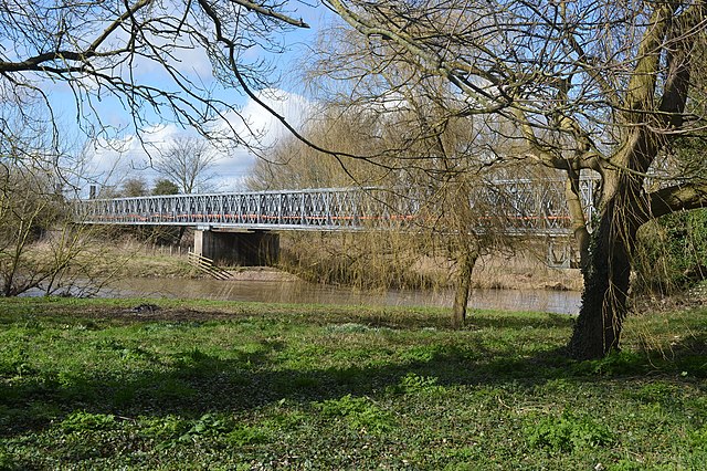
Temporary bridge over River Trent (geograph 3877911).jpg
487:
Add a one-line explanation of what this file represents
73:(1,600 × 1,064 pixels, file size: 785 KB, MIME type:
191:
Creative
Commons Attribution Share-alike license 2.0
127:
107:
Commons is a freely licensed media file repository.
675:
Creative
Commons Attribution-ShareAlike 2.0 Generic
456:https://creativecommons.org/licenses/by-sa/2.0
88:
462:Creative Commons Attribution-Share Alike 2.0
380:
8:
877:
813:
422:– to copy, distribute and transmit the work
947:
483:
761:https://www.geograph.org.uk/photo/3877911
602:https://www.geograph.org.uk/profile/7388
1007:
901:
885:
837:
821:
795:
779:
708:
692:
672:
656:
636:
620:
553:
537:
517:
501:
498:
479:
472:
291:
241:
995:Transferred from geograph.co.uk using
320:View this and other nearby images on:
270:View this and other nearby images on:
7:
367:and is licensed for reuse under the
936:
403:Attribution-Share Alike 2.0 Generic
391:
386:
371:Attribution-ShareAlike 2.0 license.
492:
486:
377:
354:
137:
120:
66:
491:
231:Temporary bridge over River Trent
212:Temporary bridge over River Trent
143:Temporary bridge over River Trent
824:coordinates of the point of view
477:
433:Under the following conditions:
398:This file is licensed under the
390:
385:
379:
347:
326:
312:
304:
276:
262:
254:
87:
21:
1010:Bailey Bridge (Walton on Trent)
520:Bailey Bridge (Walton on Trent)
474:
138:
14:
711:file available on the internet
473:
355:This image was taken from the
26:
1:
888:coordinates of depicted place
839:52°45'39.539"N, 1°41'1.417"W
731:Geograph Britain and Ireland
567:object of statement has role
499:Items portrayed in this file
303:
253:
1031:
903:52°45'40.21"N, 1°41'4.60"W
447:same or compatible license
937:
16:
739:geograph.org.uk image ID
476:
413:
94:This is a file from the
994:
201:required by the license
179:
169:
158:
151:
148:
130:
98:. Information from its
973:15:33, 26 October 2018
361:this photograph's page
332:52.761170; -1.684610
282:52.760983; -1.683727
101:description page there
36:Size of this preview:
60:1,600 × 1,064 pixels
428:– to adapt the work
229:John M /
210:John M /
42:Other resolutions:
582:author name string
56:1,280 × 851 pixels
52:1,024 × 681 pixels
998:
879:
815:
659:copyright license
485:
376:
375:
359:collection. See
337:
336:
287:
286:
236:
235:
204:
188:
185:Reusing this file
116:
115:
96:Wikimedia Commons
1022:
985:
925:
924:
919:
861:
860:
855:
763:
758:
754:described at URL
748:
743:
733:
728:
623:copyright status
604:
599:
589:
586:
576:
571:
469:
466:
463:
460:
457:
449:as the original.
411:
400:Creative Commons
394:
393:
389:
388:
383:
382:
369:Creative Commons
357:Geograph project
351:
344:
333:
330:
316:
315:
309:
308:
307:
301:
300:
289:
283:
280:
266:
265:
259:
258:
257:
251:
250:
239:
198:
182:
154:
142:
134:
128:
112:
91:
90:
84:
78:
76:
63:
48:640 × 426 pixels
44:320 × 213 pixels
38:800 × 532 pixels
1030:
1029:
1025:
1024:
1023:
1021:
1020:
1019:
1006:
999:
991:
983:
939:
938:
935:
934:
933:
932:
931:
930:
929:
928:
927:
926:
922:
920:
917:
908:
907:
906:
904:
894:
893:
892:
890:
871:
870:
869:
868:
867:
866:
865:
864:
863:
862:
858:
856:
853:
844:
843:
842:
840:
830:
829:
828:
826:
807:
806:
805:
804:
803:
802:
801:
800:
798:
788:
787:
786:
784:
773:
772:
771:
770:
769:
768:
767:
766:
765:
764:
759:
756:
750:
749:
744:
741:
735:
734:
729:
726:
717:
716:
715:
713:
701:
700:
699:
697:
686:
685:
684:
683:
682:
681:
680:
679:
677:
665:
664:
663:
661:
650:
649:
648:
647:
646:
645:
644:
643:
641:
629:
628:
627:
625:
614:
613:
612:
611:
610:
609:
608:
607:
606:
605:
600:
597:
591:
590:
587:
584:
578:
577:
572:
569:
560:
559:
558:
556:
546:
545:
544:
542:
531:
530:
529:
528:
527:
526:
525:
524:
522:
510:
509:
508:
506:
490:
489:
488:
471:
470:
467:
464:
461:
458:
455:
454:
412:
409:
406:
395:
372:
342:
331:
305:
296:
295:
292:Object location
281:
255:
246:
245:
242:Camera location
237:
226:
219:
207:
164:geograph.org.uk
144:
132:
125:
118:
117:
106:
105:
104:is shown below.
80:
74:
72:
65:
64:
41:
12:
11:
5:
1028:
1026:
1018:
1017:
1012:
1004:
1003:
1002:
997:
996:
993:
989:
986:
982:1,600 × 1,064
980:
975:
970:
966:
965:
962:
959:
956:
953:
950:
943:
942:
913:
912:
911:
910:
909:
905:
902:
900:
899:
898:
897:
896:
895:
891:
886:
884:
883:
882:
881:
875:
849:
848:
847:
846:
845:
841:
838:
836:
835:
834:
833:
832:
831:
827:
822:
820:
819:
818:
817:
811:
799:
796:
794:
793:
792:
791:
790:
789:
785:
780:
778:
777:
776:
775:
774:
752:
751:
737:
736:
722:
721:
720:
719:
718:
714:
709:
707:
706:
705:
704:
703:
702:
698:
695:source of file
693:
691:
690:
689:
688:
687:
678:
673:
671:
670:
669:
668:
667:
666:
662:
657:
655:
654:
653:
652:
651:
642:
637:
635:
634:
633:
632:
631:
630:
626:
621:
619:
618:
617:
616:
615:
593:
592:
580:
579:
565:
564:
563:
562:
561:
557:
554:
552:
551:
550:
549:
548:
547:
543:
538:
536:
535:
534:
533:
532:
523:
518:
516:
515:
514:
513:
512:
511:
507:
502:
500:
497:
496:
495:
494:
493:
482:
481:
478:
475:
453:
452:
451:
450:
440:
431:
430:
429:
423:
416:You are free:
407:
397:
396:
378:
374:
373:
352:
341:
338:
335:
334:
324:
318:
293:
285:
284:
274:
268:
243:
234:
233:
227:
224:
221:
220:
215:
208:
205:
193:
192:
189:
177:
176:
171:
167:
166:
160:
156:
155:
150:
146:
145:
135:
126:
124:
121:
119:
114:
113:
92:
82:
81:
35:
31:
30:
29:
24:
19:
13:
10:
9:
6:
4:
3:
2:
1027:
1016:
1013:
1011:
1008:
1000:
992:
987:
981:
979:
976:
974:
971:
968:
967:
963:
960:
957:
954:
951:
949:
948:
946:
940:
916:
889:
852:
825:
783:
762:
755:
747:
740:
732:
725:
712:
696:
676:
660:
640:
624:
603:
596:
583:
575:
568:
541:
521:
505:
459:CC BY-SA 2.0
448:
444:
441:
438:
435:
434:
432:
427:
424:
421:
418:
417:
415:
414:
408:Attribution:
404:
401:
384:
370:
366:
362:
358:
353:
350:
346:
345:
339:
329:
325:
323:
322:OpenStreetMap
319:
317:
299:
294:
290:
279:
275:
273:
272:OpenStreetMap
269:
267:
249:
244:
240:
232:
228:
223:
222:
218:
214: /
213:
209:
202:
197:
195:
194:
190:
186:
181:
178:
175:
172:
168:
165:
161:
157:
147:
141:
136:
129:
122:
110:
103:
102:
97:
93:
86:
85:
79:
70:
69:Original file
61:
57:
53:
49:
45:
39:
34:
28:
25:
23:
20:
18:
15:
944:
941:File history
797:7 March 2014
574:photographer
442:
436:
425:
419:
364:
302:
252:
230:
217:CC BY-SA 2.0
211:
153:7 March 2014
139:
109:You can help
99:
67:
22:File history
639:copyrighted
443:share alike
437:attribution
196:Attribution
131:Description
1001:File usage
958:Dimensions
555:some value
180:Permission
75:image/jpeg
27:File usage
955:Thumbnail
952:Date/Time
782:inception
340:Licensing
225:InfoField
206:InfoField
140:English:
984:(785 KB)
724:operator
480:Captions
426:to remix
420:to share
405:license.
990:Dumelow
969:current
964:Comment
915:heading
874:heading
851:heading
810:heading
746:3877911
540:creator
504:depicts
484:English
123:Summary
71:
923:degree
878:degree
859:degree
814:degree
588:John M
410:John M
365:John M
310:
260:
174:John M
170:Author
159:Source
162:From
961:User
921:292
857:292
468:true
465:true
149:Date
17:File
595:URL
918::
854::
757::
742::
727::
598::
585::
570::
58:|
54:|
50:|
46:|
40:.
203:)
199:(
187:)
183:(
111:.
77:)
62:.
Text is available under the Creative Commons Attribution-ShareAlike License. Additional terms may apply.

.jpg)
.jpg¶ms=052.760983_N_-001.683727_E_globe:Earth_type:camera_source:geograph-osgb36(SK21441820)_heading:292.00&language=en)
.jpg¶ms=052.761170_N_-001.684610_E_globe:Earth_class:object_type:object_source:geograph-osgb36(SK21381822)_heading:292.00&language=en)
