316:
246:
43:
238:
260:
284:
322:
327:
87:
728:"}},"text\/plain":{"en":{"":"heading"}}},"{\"value\":{\"amount\":\"+90\",\"unit\":\"http:\\\/\\\/www.wikidata.org\\\/entity\\\/Q28390\"},\"type\":\"quantity\"}":{"text\/html":{"en":{"P7787":"90
830:
724:
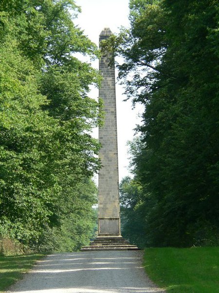
847:== {{int:filedesc}} == {{Information |description={{en|1=The Obelisk At Castle Howard. Erected in 1714, with two inscriptions added later, the obelisk commemorates the victories of the Duke of Marlborough and the architectural activities of the 3rd Earl o
374:– You must give appropriate credit, provide a link to the license, and indicate if changes were made. You may do so in any reasonable manner, but not in any way that suggests the licensor endorses you or your use.
141:
The
Obelisk At Castle Howard. Erected in 1714, with two inscriptions added later, the obelisk commemorates the victories of the Duke of Marlborough and the architectural activities of the 3rd Earl of Carlisle
53:
47:
98:
66:
861:
725:
660:
590:
554:
253:
680:
829:
824:
291:
57:
42:
927:
This file contains additional information, probably added from the digital camera or scanner used to create or digitize it.
381:
517:
766:
739:
688:
644:
538:
510:
497:
482:
703:
673:
610:
574:
455:
438:
278:
337:
930:
If the file has been modified from its original state, some details may not fully reflect the modified file.
904:
380:– If you remix, transform, or build upon the material, you must distribute your contributions under the
298:
on the
Geograph website for the photographer's contact details. The copyright on this image is owned by
840:
334:
732:"}},"text\/plain":{"en":{"P7787":"90 degree"}}}}": -->
106:
198:
710:
695:
489:
182:
259:
303:
93:
150:
243:
171:
161:
283:
295:
797:
Click on a date/time to view the file as it appeared at that time.
884:
245:
894:
879:
220:
81:
131:
The
Obelisk At Castle Howard - geograph.org.uk - 211022.jpg
230:
54° 07′ 11″ N, 0° 55′ 08″ W
422:
Add a one-line explanation of what this file represents
914:
862:
Grade I listed buildings in North
Yorkshire (district)
125:
105:
Commons is a freely licensed media file repository.
591:
Creative
Commons Attribution-ShareAlike 2.0 Generic
71:(480 × 640 pixels, file size: 108 KB, MIME type:
391:https://creativecommons.org/licenses/by-sa/2.0
86:
397:Creative Commons Attribution-Share Alike 2.0
315:
8:
729:
357:– to copy, distribute and transmit the work
932:
799:
418:
872:The following other wikis use this file:
711:https://www.geograph.org.uk/photo/211022
490:https://www.geograph.org.uk/profile/6184
934:
859:
753:
737:
658:
642:
624:
608:
588:
572:
552:
536:
469:
453:
436:
433:
414:
407:
223:
252:View this and other nearby images on:
7:
302:and is licensed for reuse under the
857:The following page uses this file:
788:
338:Attribution-Share Alike 2.0 Generic
326:
321:
306:Attribution-ShareAlike 2.0 license.
925:
427:
421:
312:
289:
135:
118:
64:
426:
412:
368:Under the following conditions:
333:This file is licensed under the
325:
320:
314:
282:
258:
244:
236:
85:
31:
21:
409:
136:
14:
661:file available on the internet
408:
290:This image was taken from the
26:
1:
740:coordinates of depicted place
211:Roger Gilbertson /
192:Roger Gilbertson /
36:
681:Geograph Britain and Ireland
511:object of statement has role
434:Items portrayed in this file
213:The Obelisk At Castle Howard
194:The Obelisk At Castle Howard
235:
956:
911:Usage on www.wikidata.org
901:Usage on hy.wikipedia.org
891:Usage on es.wikipedia.org
876:Usage on cs.wikipedia.org
382:same or compatible license
789:
16:
689:geograph.org.uk image ID
411:
348:
92:This is a file from the
846:
755:54°7'10.9"N, 0°55'8.4"W
183:required by the license
167:
156:
149:
146:
128:
96:. Information from its
825:01:04, 1 February 2010
296:this photograph's page
264:54.119700; -0.919000
99:description page there
46:Size of this preview:
363:– to adapt the work
52:Other resolutions:
895:Castillo de Howard
498:author name string
943:
942:
868:Global file usage
850:
731:
575:copyright license
420:
311:
310:
294:collection. See
269:
268:
218:
217:
186:
114:
113:
94:Wikimedia Commons
32:Global file usage
947:
933:
837:
777:
776:
771:
713:
708:
704:described at URL
698:
693:
683:
678:
539:copyright status
520:
515:
505:
504:Roger Gilbertson
502:
492:
487:
404:
401:
398:
395:
392:
384:as the original.
346:
345:Roger Gilbertson
335:Creative Commons
329:
328:
324:
323:
318:
317:
304:Creative Commons
300:Roger Gilbertson
292:Geograph project
286:
279:
265:
262:
248:
247:
241:
240:
239:
233:
232:
221:
180:
172:Roger Gilbertson
152:
140:
132:
126:
110:
89:
88:
82:
76:
74:
61:
58:480 × 640 pixels
54:180 × 240 pixels
48:450 × 600 pixels
955:
954:
950:
949:
948:
946:
945:
944:
921:
866:
851:
843:
835:
791:
790:
787:
786:
785:
784:
783:
782:
781:
780:
779:
778:
774:
772:
769:
760:
759:
758:
756:
746:
745:
744:
742:
723:
722:
721:
720:
719:
718:
717:
716:
715:
714:
709:
706:
700:
699:
694:
691:
685:
684:
679:
676:
667:
666:
665:
663:
651:
650:
649:
647:
636:
635:
634:
633:
632:
631:
630:
629:
627:
617:
616:
615:
613:
602:
601:
600:
599:
598:
597:
596:
595:
593:
581:
580:
579:
577:
566:
565:
564:
563:
562:
561:
560:
559:
557:
545:
544:
543:
541:
530:
529:
528:
527:
526:
525:
524:
523:
522:
521:
516:
513:
507:
506:
503:
500:
494:
493:
488:
485:
476:
475:
474:
472:
462:
461:
460:
458:
447:
446:
445:
444:
443:
441:
425:
424:
423:
406:
405:
402:
399:
396:
393:
390:
389:
347:
344:
341:
330:
307:
277:
263:
237:
228:
227:
224:Object location
219:
208:
201:
189:
162:geograph.org.uk
142:
130:
123:
116:
115:
104:
103:
102:is shown below.
78:
72:
70:
63:
62:
51:
12:
11:
5:
953:
951:
941:
940:
937:
924:
920:
919:
918:
917:
909:
908:
907:
899:
898:
897:
889:
888:
887:
885:Howard (zámek)
882:
870:
869:
865:
864:
855:
854:
849:
848:
845:
841:
838:
832:
827:
822:
818:
817:
814:
811:
808:
805:
802:
795:
794:
765:
764:
763:
762:
761:
757:
754:
752:
751:
750:
749:
748:
747:
743:
738:
736:
735:
734:
733:
727:
702:
701:
687:
686:
672:
671:
670:
669:
668:
664:
659:
657:
656:
655:
654:
653:
652:
648:
645:source of file
643:
641:
640:
639:
638:
637:
628:
625:
623:
622:
621:
620:
619:
618:
614:
609:
607:
606:
605:
604:
603:
594:
589:
587:
586:
585:
584:
583:
582:
578:
573:
571:
570:
569:
568:
567:
558:
553:
551:
550:
549:
548:
547:
546:
542:
537:
535:
534:
533:
532:
531:
509:
508:
496:
495:
481:
480:
479:
478:
477:
473:
470:
468:
467:
466:
465:
464:
463:
459:
454:
452:
451:
450:
449:
448:
442:
437:
435:
432:
431:
430:
429:
428:
417:
416:
413:
410:
388:
387:
386:
385:
375:
366:
365:
364:
358:
351:You are free:
342:
332:
331:
313:
309:
308:
287:
276:
273:
267:
266:
256:
250:
225:
216:
215:
209:
206:
203:
202:
197:
190:
187:
175:
174:
169:
165:
164:
158:
154:
153:
148:
144:
143:
133:
124:
122:
119:
117:
112:
111:
90:
80:
79:
45:
41:
40:
39:
34:
29:
24:
19:
13:
10:
9:
6:
4:
3:
2:
952:
938:
935:
931:
928:
922:
916:
913:
912:
910:
906:
903:
902:
900:
896:
893:
892:
890:
886:
883:
881:
880:Anglický park
878:
877:
875:
874:
873:
867:
863:
860:
858:
852:
844:
839:
833:
831:
828:
826:
823:
820:
819:
815:
812:
809:
806:
803:
801:
800:
798:
792:
768:
741:
712:
705:
697:
690:
682:
675:
662:
646:
612:
592:
576:
556:
540:
519:
512:
499:
491:
484:
457:
440:
394:CC BY-SA 2.0
383:
379:
376:
373:
370:
369:
367:
362:
359:
356:
353:
352:
350:
349:
343:Attribution:
339:
336:
319:
305:
301:
297:
293:
288:
285:
281:
280:
274:
272:
271:
261:
257:
255:
254:OpenStreetMap
251:
249:
231:
226:
222:
214:
210:
205:
204:
200:
196: /
195:
191:
184:
179:
177:
176:
173:
170:
166:
163:
159:
155:
145:
139:
134:
127:
120:
108:
101:
100:
95:
91:
84:
83:
77:
68:
67:Original file
59:
55:
49:
44:
38:
35:
33:
30:
28:
25:
23:
20:
18:
15:
929:
926:
871:
856:
796:
793:File history
626:25 July 2006
518:photographer
377:
371:
360:
354:
299:
270:
234:
212:
199:CC BY-SA 2.0
193:
151:25 July 2006
137:
107:You can help
97:
65:
22:File history
905:Քասլ Հովարդ
842:GeographBot
555:copyrighted
378:share alike
372:attribution
178:Attribution
129:Description
936:_error
853:File usage
834:480 × 640
810:Dimensions
471:some value
73:image/jpeg
27:File usage
915:Q17538311
807:Thumbnail
804:Date/Time
611:inception
275:Licensing
207:InfoField
188:InfoField
138:English:
923:Metadata
836:(108 KB)
674:operator
415:Captions
361:to remix
355:to share
340:license.
37:Metadata
821:current
816:Comment
767:heading
726:heading
456:creator
439:depicts
419:English
121:Summary
69:
775:degree
730:degree
696:211022
242:
168:Author
157:Source
160:From
813:User
403:true
400:true
147:Date
17:File
773:90
483:URL
770::
707::
692::
677::
514::
501::
486::
56:|
50:.
939:0
185:)
181:(
109:.
75:)
60:.
Text is available under the Creative Commons Attribution-ShareAlike License. Additional terms may apply.

_heading:90.00&language=en)
