38:
386:
319:
269:
311:
261:
333:
283:
354:
392:
397:
94:
692:"}},"text\/plain":{"en":{"":"heading"}}},"{\"value\":{\"amount\":\"+67\",\"unit\":\"http:\\\/\\\/www.wikidata.org\\\/entity\\\/Q28390\"},\"type\":\"quantity\"}":{"text\/html":{"en":{"P7787":"67
628:"}},"text\/plain":{"en":{"":"heading"}}},"{\"value\":{\"amount\":\"+67\",\"unit\":\"http:\\\/\\\/www.wikidata.org\\\/entity\\\/Q28390\"},\"type\":\"quantity\"}":{"text\/html":{"en":{"P7787":"67
811:== {{int:filedesc}} == {{Information |Description={{en|1=The Old Burgh Hall}} |Source=From |Date=2018-05-12 |Author= |Permission=Creative Commons Attribution Share-alike license 2.0 |Other fields={{Credit line |Author=Lairich Rig |License= |Other=''The Old Burgh Hall'' }} }} {{Location|55.943668|-4.567844|source:ge...
624:
302:
860:
252:
444:– You must give appropriate credit, provide a link to the license, and indicate if changes were made. You may do so in any reasonable manner, but not in any way that suggests the licensor endorses you or your use.
845:
835:
60:
56:
52:
48:
42:
840:
689:
625:
73:
105:
189:
577:
541:
326:
276:
361:
451:
730:
703:
666:
639:
525:
597:
561:
508:
348:
793:
788:
64:
37:
407:
450:– If you remix, transform, or build upon the material, you must distribute your contributions under the
368:
on the
Geograph website for the photographer's contact details. The copyright on this image is owned by
830:
404:
821:
The following pages on the
English Knowledge use this file (pages on other projects are not listed):
850:
696:"}},"text\/plain":{"en":{"P7787":"67 degree"}}}}": -->
632:"}},"text\/plain":{"en":{"P7787":"67 degree"}}}}": -->
113:
205:
855:
804:
332:
282:
861:
Knowledge:WikiProject
Historic sites/Images of listed buildings in Scotland without ID
373:
100:
221:
266:
316:
157:
825:
178:
168:
353:
365:
761:
Click on a date/time to view the file as it appeared at that time.
318:
268:
293:
243:
88:
303:
55° 56′ 37.6″ N, 4° 34′ 03″ W
253:
55° 56′ 37.2″ N, 4° 34′ 04″ W
846:
List of listed buildings in
Dumbarton, West Dunbartonshire
836:
List of
Category A listed buildings in West Dunbartonshire
492:
Add a one-line explanation of what this file represents
878:
78:(1,600 × 1,244 pixels, file size: 359 KB, MIME type:
196:
Creative
Commons Attribution Share-alike license 2.0
132:
112:
Commons is a freely licensed media file repository.
578:
Creative
Commons Attribution-ShareAlike 2.0 Generic
841:List of city chambers and town halls in Scotland
461:https://creativecommons.org/licenses/by-sa/2.0
93:
467:Creative Commons Attribution-Share Alike 2.0
385:
8:
693:
629:
427:– to copy, distribute and transmit the work
763:
488:
871:The following other wikis use this file:
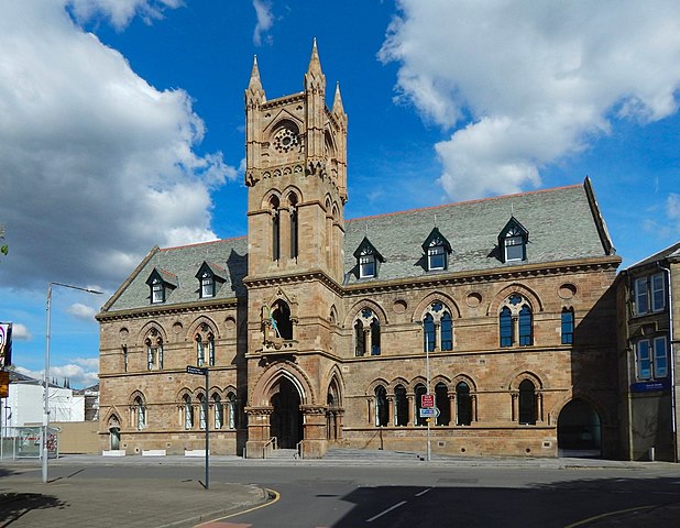
138:The Old Burgh Hall (geograph 5785538).jpg
823:
717:
701:
653:
637:
611:
595:
575:
559:
539:
523:
506:
503:
484:
477:
296:
246:
325:View this and other nearby images on:
275:View this and other nearby images on:
7:
372:and is licensed for reuse under the
752:
408:Attribution-Share Alike 2.0 Generic
396:
391:
376:Attribution-ShareAlike 2.0 license.
497:
491:
382:
359:
142:
125:
71:
496:
640:coordinates of the point of view
482:
438:Under the following conditions:
403:This file is licensed under the
395:
390:
384:
352:
331:
317:
309:
281:
267:
259:
92:
31:
21:
479:
143:
14:
478:
360:This image was taken from the
26:
1:
704:coordinates of depicted place
655:55°56'37.205"N, 4°34'4.238"W
504:Items portrayed in this file
308:
258:
897:
875:Usage on www.wikidata.org
719:55°56'37.57"N, 4°34'2.53"W
452:same or compatible license
753:
16:
481:
418:
234:Lairich Rig /
215:Lairich Rig /
99:This is a file from the
810:
206:required by the license
184:
174:
163:
156:
153:
135:
103:. Information from its
366:this photograph's page
337:55.943770; -4.567370
287:55.943668; -4.567844
106:description page there
41:Size of this preview:
831:Dumbarton Burgh Hall
65:1,600 × 1,244 pixels
851:West Dunbartonshire
433:– to adapt the work
47:Other resolutions:
789:17:34, 3 June 2021
236:The Old Burgh Hall
217:The Old Burgh Hall
148:The Old Burgh Hall
61:1,280 × 995 pixels
867:Global file usage
814:
695:
631:
562:copyright license
490:
381:
380:
364:collection. See
342:
341:
292:
291:
241:
240:
209:
193:
190:Reusing this file
121:
120:
101:Wikimedia Commons
32:Global file usage
888:
801:
741:
740:
735:
677:
676:
671:
526:copyright status
474:
471:
468:
465:
462:
454:as the original.
416:
405:Creative Commons
399:
398:
394:
393:
388:
387:
374:Creative Commons
362:Geograph project
356:
349:
338:
335:
321:
320:
314:
313:
312:
306:
305:
294:
288:
285:
271:
270:
264:
263:
262:
256:
255:
244:
203:
187:
159:
147:
139:
133:
117:
96:
95:
89:
83:
81:
68:
57:988 × 768 pixels
53:618 × 480 pixels
49:309 × 240 pixels
43:771 × 599 pixels
896:
895:
891:
890:
889:
887:
886:
885:
865:
822:
815:
807:
799:
755:
754:
751:
750:
749:
748:
747:
746:
745:
744:
743:
742:
738:
736:
733:
724:
723:
722:
720:
710:
709:
708:
706:
687:
686:
685:
684:
683:
682:
681:
680:
679:
678:
674:
672:
669:
660:
659:
658:
656:
646:
645:
644:
642:
623:
622:
621:
620:
619:
618:
617:
616:
614:
604:
603:
602:
600:
589:
588:
587:
586:
585:
584:
583:
582:
580:
568:
567:
566:
564:
553:
552:
551:
550:
549:
548:
547:
546:
544:
532:
531:
530:
528:
517:
516:
515:
514:
513:
511:
495:
494:
493:
476:
475:
472:
469:
466:
463:
460:
459:
417:
414:
411:
400:
377:
347:
336:
310:
301:
300:
297:Object location
286:
260:
251:
250:
247:Camera location
242:
231:
224:
212:
169:geograph.org.uk
149:
137:
130:
123:
122:
111:
110:
109:is shown below.
85:
79:
77:
70:
69:
46:
12:
11:
5:
894:
892:
884:
883:
882:
881:
869:
868:
864:
863:
858:
856:William Leiper
853:
848:
843:
838:
833:
828:
820:
819:
818:
813:
812:
809:
805:
802:
798:1,600 × 1,244
796:
791:
786:
782:
781:
778:
775:
772:
769:
766:
759:
758:
729:
728:
727:
726:
725:
721:
718:
716:
715:
714:
713:
712:
711:
707:
702:
700:
699:
698:
697:
691:
665:
664:
663:
662:
661:
657:
654:
652:
651:
650:
649:
648:
647:
643:
638:
636:
635:
634:
633:
627:
615:
612:
610:
609:
608:
607:
606:
605:
601:
596:
594:
593:
592:
591:
590:
581:
576:
574:
573:
572:
571:
570:
569:
565:
560:
558:
557:
556:
555:
554:
545:
540:
538:
537:
536:
535:
534:
533:
529:
524:
522:
521:
520:
519:
518:
512:
507:
505:
502:
501:
500:
499:
498:
487:
486:
483:
480:
458:
457:
456:
455:
445:
436:
435:
434:
428:
421:You are free:
412:
402:
401:
383:
379:
378:
357:
346:
343:
340:
339:
329:
323:
298:
290:
289:
279:
273:
248:
239:
238:
232:
229:
226:
225:
220:
213:
210:
198:
197:
194:
182:
181:
176:
172:
171:
165:
161:
160:
155:
151:
150:
140:
131:
129:
126:
124:
119:
118:
97:
87:
86:
40:
36:
35:
34:
29:
24:
19:
13:
10:
9:
6:
4:
3:
2:
893:
880:
877:
876:
874:
873:
872:
866:
862:
859:
857:
854:
852:
849:
847:
844:
842:
839:
837:
834:
832:
829:
827:
824:
816:
808:
803:
797:
795:
792:
790:
787:
784:
783:
779:
776:
773:
770:
767:
765:
764:
762:
756:
732:
705:
668:
641:
599:
579:
563:
543:
527:
510:
464:CC BY-SA 2.0
453:
449:
446:
443:
440:
439:
437:
432:
429:
426:
423:
422:
420:
419:
413:Attribution:
409:
406:
389:
375:
371:
367:
363:
358:
355:
351:
350:
344:
334:
330:
328:
327:OpenStreetMap
324:
322:
304:
299:
295:
284:
280:
278:
277:OpenStreetMap
274:
272:
254:
249:
245:
237:
233:
228:
227:
223:
219: /
218:
214:
207:
202:
200:
199:
195:
191:
186:
183:
180:
177:
173:
170:
166:
162:
152:
146:
141:
134:
127:
115:
108:
107:
102:
98:
91:
90:
84:
75:
74:Original file
66:
62:
58:
54:
50:
44:
39:
33:
30:
28:
25:
23:
20:
18:
15:
870:
760:
757:File history
447:
441:
430:
424:
369:
307:
257:
235:
222:CC BY-SA 2.0
216:
144:
114:You can help
104:
72:
22:File history
613:12 May 2018
542:copyrighted
448:share alike
442:attribution
415:Lairich Rig
370:Lairich Rig
201:Attribution
179:Lairich Rig
158:12 May 2018
136:Description
817:File usage
774:Dimensions
185:Permission
80:image/jpeg
27:File usage
879:Q17572083
826:Dumbarton
806:Dormskirk
771:Thumbnail
768:Date/Time
598:inception
345:Licensing
230:InfoField
211:InfoField
145:English:
800:(359 KB)
485:Captions
431:to remix
425:to share
410:license.
785:current
780:Comment
731:heading
690:heading
667:heading
626:heading
509:depicts
489:English
128:Summary
76:
739:degree
694:degree
675:degree
630:degree
315:
265:
175:Author
164:Source
167:From
777:User
473:true
470:true
154:Date
17:File
737:67
673:67
734::
670::
63:|
59:|
55:|
51:|
45:.
208:)
204:(
192:)
188:(
116:.
82:)
67:.
Text is available under the Creative Commons Attribution-ShareAlike License. Additional terms may apply.

.jpg)
.jpg¶ms=055.943668_N_-004.567844_E_globe:Earth_type:camera_source:geograph-osgb36(NS39737527)_heading:67.00&language=en)
.jpg¶ms=055.943770_N_-004.567370_E_globe:Earth_class:object_type:object_source:geograph-osgb36(NS39767528)_heading:67.00&language=en)
