307:
240:
190:
232:
182:
254:
204:
275:
313:
318:
72:
819:"}},"text\/plain":{"en":{"":"heading"}}},"{\"value\":{\"amount\":\"+22\",\"unit\":\"http:\\\/\\\/www.wikidata.org\\\/entity\\\/Q28390\"},\"type\":\"quantity\"}":{"text\/html":{"en":{"P7787":"22
755:"}},"text\/plain":{"en":{"":"heading"}}},"{\"value\":{\"amount\":\"+22\",\"unit\":\"http:\\\/\\\/www.wikidata.org\\\/entity\\\/Q28390\"},\"type\":\"quantity\"}":{"text\/html":{"en":{"P7787":"22
955:
815:
173:
43:
365:– You must give appropriate credit, provide a link to the license, and indicate if changes were made. You may do so in any reasonable manner, but not in any way that suggests the licensor endorses you or your use.
83:
51:
972:== {{int:filedesc}} == {{Information |description={{en|1=The B2699 crosses the Whitrope burn The dense Whitrope Woodlands are in the background}} |date=2008-06-02 |source=From |author=[http://www.g
816:
752:
954:
949:
42:
653:
617:
581:
445:
247:
197:
703:
462:
282:
1017:
This file contains additional information, probably added from the digital camera or scanner used to create or digitize it.
372:
516:
886:
857:
830:
793:
766:
681:
637:
565:
537:
524:
509:
724:
696:
666:
601:
482:
429:
269:
328:
1020:
If the file has been modified from its original state, some details may not fully reflect the modified file.
982:
The following pages on the
English Knowledge (XXG) use this file (pages on other projects are not listed):
371:– If you remix, transform, or build upon the material, you must distribute your contributions under the
289:
on the
Geograph website for the photographer's contact details. The copyright on this image is owned by
965:
325:
823:"}},"text\/plain":{"en":{"P7787":"22 degree"}}}}": -->
759:"}},"text\/plain":{"en":{"P7787":"22 degree"}}}}": -->
91:
544:
688:
673:
253:
203:
126:
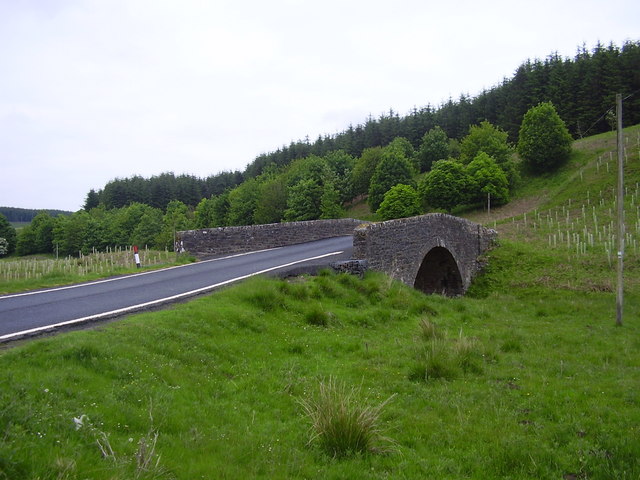
The B6399 crosses the
Whitrope burn The dense Whitrope Woodlands are in the background
294:
78:
135:
237:
187:
156:
146:
986:
274:
286:
922:
Click on a date/time to view the file as it appeared at that time.
116:
The B6399 crosses the
Whitrope burn - geograph.org.uk - 828390.jpg
52:
The_B6399_crosses_the_Whitrope_burn_-_geograph.org.uk_-_828390.jpg
239:
189:
214:
164:
66:
224:
55° 16′ 14″ N, 2° 46′ 23″ W
174:
55° 16′ 11″ N, 2° 46′ 27″ W
413:
Add a one-line explanation of what this file represents
1004:
110:
90:
Commons is a freely licensed media file repository.
618:
Creative
Commons Attribution-ShareAlike 2.0 Generic
56:(640 × 480 pixels, file size: 76 KB, MIME type:
382:https://creativecommons.org/licenses/by-sa/2.0
71:
388:Creative Commons Attribution-Share Alike 2.0
306:
8:
820:
756:
348:– to copy, distribute and transmit the work
1022:
924:
409:
997:The following other wikis use this file:
545:https://www.geograph.org.uk/profile/21251
674:https://www.geograph.org.uk/photo/828390
1024:
984:
900:
884:
844:
828:
780:
764:
738:
722:
651:
635:
615:
599:
579:
563:
496:
480:
460:
443:
427:
424:
405:
398:
217:
167:
246:View this and other nearby images on:
196:View this and other nearby images on:
7:
293:and is licensed for reuse under the
913:
329:Attribution-Share Alike 2.0 Generic
317:
312:
297:Attribution-ShareAlike 2.0 license.
1015:
418:
412:
303:
280:
120:
103:
49:
417:
767:coordinates of the point of view
403:
359:Under the following conditions:
324:This file is licensed under the
316:
311:
305:
273:
252:
238:
230:
202:
188:
180:
70:
31:
21:
400:
121:
46:No higher resolution available.
14:
654:file available on the internet
399:
281:This image was taken from the
26:
1:
831:coordinates of depicted place
36:
704:Geograph Britain and Ireland
510:object of statement has role
425:Items portrayed in this file
846:55°16'14.12"N, 2°46'23.16"W
782:55°16'11.21"N, 2°46'26.76"W
229:
179:
1046:
1001:Usage on www.wikidata.org
373:same or compatible license
914:
16:
682:geograph.org.uk image ID
402:
339:
77:This is a file from the
971:
950:17:07, 20 February 2011
152:
141:
134:
131:
113:
81:. Information from its
287:this photograph's page
258:55.270590; -2.773100
208:55.269780; -2.774100
84:description page there
354:– to adapt the work
525:author name string
1033:
1032:
993:Global file usage
975:
822:
758:
602:copyright license
411:
302:
301:
285:collection. See
263:
262:
213:
212:
162:
161:
99:
98:
79:Wikimedia Commons
32:Global file usage
1037:
1023:
962:
868:
867:
862:
804:
803:
798:
706:
701:
691:
686:
676:
671:
667:described at URL
566:copyright status
547:
542:
532:
529:
519:
514:
395:
392:
389:
386:
383:
375:as the original.
337:
326:Creative Commons
320:
319:
315:
314:
309:
308:
295:Creative Commons
283:Geograph project
277:
270:
259:
256:
242:
241:
235:
234:
233:
227:
226:
215:
209:
206:
192:
191:
185:
184:
183:
177:
176:
165:
137:
125:
117:
111:
95:
74:
73:
67:
61:
59:
1045:
1044:
1040:
1039:
1038:
1036:
1035:
1034:
1011:
991:
983:
976:
968:
960:
916:
915:
912:
911:
910:
909:
908:
907:
906:
905:
903:
893:
892:
891:
889:
878:
877:
876:
875:
874:
873:
872:
871:
870:
869:
865:
863:
860:
851:
850:
849:
847:
837:
836:
835:
833:
814:
813:
812:
811:
810:
809:
808:
807:
806:
805:
801:
799:
796:
787:
786:
785:
783:
773:
772:
771:
769:
750:
749:
748:
747:
746:
745:
744:
743:
741:
731:
730:
729:
727:
716:
715:
714:
713:
712:
711:
710:
709:
708:
707:
702:
699:
693:
692:
687:
684:
678:
677:
672:
669:
660:
659:
658:
656:
644:
643:
642:
640:
629:
628:
627:
626:
625:
624:
623:
622:
620:
608:
607:
606:
604:
593:
592:
591:
590:
589:
588:
587:
586:
584:
572:
571:
570:
568:
557:
556:
555:
554:
553:
552:
551:
550:
549:
548:
543:
540:
534:
533:
530:
527:
521:
520:
515:
512:
503:
502:
501:
499:
489:
488:
487:
485:
474:
473:
472:
471:
470:
469:
468:
467:
465:
454:
453:
452:
451:
450:
448:
436:
435:
434:
432:
416:
415:
414:
397:
396:
393:
390:
387:
384:
381:
380:
338:
335:
332:
321:
298:
268:
257:
231:
222:
221:
218:Object location
207:
181:
172:
171:
168:Camera location
163:
147:geograph.org.uk
127:
115:
108:
101:
100:
89:
88:
87:is shown below.
63:
57:
55:
48:
47:
12:
11:
5:
1043:
1041:
1031:
1030:
1027:
1014:
1010:
1009:
1008:
1007:
995:
994:
990:
989:
981:
980:
979:
974:
973:
970:
966:
963:
957:
952:
947:
943:
942:
939:
936:
933:
930:
927:
920:
919:
904:
901:
899:
898:
897:
896:
895:
894:
890:
885:
883:
882:
881:
880:
879:
856:
855:
854:
853:
852:
848:
845:
843:
842:
841:
840:
839:
838:
834:
829:
827:
826:
825:
824:
818:
792:
791:
790:
789:
788:
784:
781:
779:
778:
777:
776:
775:
774:
770:
765:
763:
762:
761:
760:
754:
742:
739:
737:
736:
735:
734:
733:
732:
728:
723:
721:
720:
719:
718:
717:
695:
694:
680:
679:
665:
664:
663:
662:
661:
657:
652:
650:
649:
648:
647:
646:
645:
641:
638:source of file
636:
634:
633:
632:
631:
630:
621:
616:
614:
613:
612:
611:
610:
609:
605:
600:
598:
597:
596:
595:
594:
585:
580:
578:
577:
576:
575:
574:
573:
569:
564:
562:
561:
560:
559:
558:
536:
535:
523:
522:
508:
507:
506:
505:
504:
500:
497:
495:
494:
493:
492:
491:
490:
486:
481:
479:
478:
477:
476:
475:
466:
461:
459:
458:
457:
456:
455:
449:
444:
442:
441:
440:
439:
438:
437:
433:
428:
426:
423:
422:
421:
420:
419:
408:
407:
404:
401:
379:
378:
377:
376:
366:
357:
356:
355:
349:
342:You are free:
333:
323:
322:
304:
300:
299:
278:
267:
264:
261:
260:
250:
244:
219:
211:
210:
200:
194:
169:
160:
159:
154:
150:
149:
143:
139:
138:
133:
129:
128:
118:
109:
107:
104:
102:
97:
96:
75:
65:
64:
45:
41:
40:
39:
34:
29:
24:
19:
13:
10:
9:
6:
4:
3:
2:
1042:
1028:
1025:
1021:
1018:
1012:
1006:
1003:
1002:
1000:
999:
998:
992:
988:
985:
977:
969:
964:
958:
956:
953:
951:
948:
945:
944:
940:
937:
934:
931:
928:
926:
925:
923:
917:
888:
859:
832:
795:
768:
726:
705:
698:
690:
683:
675:
668:
655:
639:
619:
603:
583:
567:
546:
539:
526:
518:
511:
484:
464:
447:
431:
385:CC BY-SA 2.0
374:
370:
367:
364:
361:
360:
358:
353:
350:
347:
344:
343:
341:
340:
334:Attribution:
330:
327:
310:
296:
292:
288:
284:
279:
276:
272:
271:
265:
255:
251:
249:
248:OpenStreetMap
245:
243:
225:
220:
216:
205:
201:
199:
198:OpenStreetMap
195:
193:
175:
170:
166:
158:
155:
151:
148:
144:
140:
130:
124:
119:
112:
105:
93:
86:
85:
80:
76:
69:
68:
62:
53:
44:
38:
35:
33:
30:
28:
25:
23:
20:
18:
15:
1019:
1016:
996:
921:
918:File history
531:james denham
517:photographer
368:
362:
351:
345:
336:james denham
291:james denham
290:
228:
178:
157:james denham
122:
92:You can help
82:
50:
22:File history
967:GeographBot
740:2 June 2008
582:copyrighted
369:share alike
363:attribution
136:2 June 2008
114:Description
1026:_error
978:File usage
959:640 × 480
935:Dimensions
902:image/jpeg
887:media type
498:some value
446:B6399 road
58:image/jpeg
27:File usage
932:Thumbnail
929:Date/Time
725:inception
266:Licensing
123:English:
1013:Metadata
1005:Q7996782
987:Whitrope
697:operator
463:Whitrope
406:Captions
352:to remix
346:to share
331:license.
37:Metadata
961:(76 KB)
946:current
941:Comment
858:heading
817:heading
794:heading
753:heading
483:creator
430:depicts
410:English
106:Summary
54:
866:degree
821:degree
802:degree
757:degree
689:828390
236:
186:
153:Author
142:Source
145:From
938:User
394:true
391:true
132:Date
17:File
864:22
800:22
538:URL
861::
797::
700::
685::
670::
541::
528::
513::
1029:0
94:.
60:)
Text is available under the Creative Commons Attribution-ShareAlike License. Additional terms may apply.
_heading:22.00&language=en)
_heading:22.00&language=en)
