347:
280:
230:
272:
222:
294:
244:
315:
353:
358:
67:
859:"}},"text\/plain":{"en":{"":"heading"}}},"{\"value\":{\"amount\":\"+22\",\"unit\":\"http:\\\/\\\/www.wikidata.org\\\/entity\\\/Q28390\"},\"type\":\"quantity\"}":{"text\/html":{"en":{"P7787":"22
638:"}},"text\/plain":{"en":{"":"heading"}}},"{\"value\":{\"amount\":\"+22\",\"unit\":\"http:\\\/\\\/www.wikidata.org\\\/entity\\\/Q28390\"},\"type\":\"quantity\"}":{"text\/html":{"en":{"P7787":"22
961:
855:
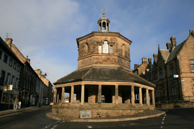
978:== {{int:filedesc}} == {{Information |description={{en|1=The Butter Market, Barnard Castle A plaque inside reads:
"This building in its time has been Town Hall, Court Room, Lock-Up and Fire Station. Up to the 1930's Farmers' Wives sold dairy produce r
213:
38:
405:– You must give appropriate credit, provide a link to the license, and indicate if changes were made. You may do so in any reasonable manner, but not in any way that suggests the licensor endorses you or your use.
78:
46:
123:"This building in its time has been Town Hall, Court Room, Lock-Up and Fire Station. Up to the 1930's Farmers' Wives sold dairy produce round the veranda, Hence the name "Butter Market"".
856:
635:
960:
955:
37:
755:
621:
585:
287:
237:
790:
1122:
322:
1003:
This file contains additional information, probably added from the digital camera or scanner used to create or digitize it.
412:
842:
533:
992:
897:
870:
826:
768:
739:
676:
649:
569:
541:
526:
513:
798:
783:
705:
605:
486:
469:
309:
368:
1006:
If the file has been modified from its original state, some details may not fully reflect the modified file.
1025:
988:
The following pages on the
English Knowledge (XXG) use this file (pages on other projects are not listed):
1159:
411:– If you remix, transform, or build upon the material, you must distribute your contributions under the
329:
on the
Geograph website for the photographer's contact details. The copyright on this image is owned by
971:
365:
1179:
863:"}},"text\/plain":{"en":{"P7787":"22 degree"}}}}": -->
642:"}},"text\/plain":{"en":{"P7787":"22 degree"}}}}": -->
86:
182:
805:
775:
548:
166:
1015:
293:
243:
1169:
1141:
1032:
334:
73:
1072:
1189:
134:
1052:
277:
227:
155:
145:
1042:
314:
326:
928:
Click on a date/time to view the file as it appeared at that time.
111:
The Butter Market, Barnard Castle - geograph.org.uk - 1046942.jpg
47:
The_Butter_Market,_Barnard_Castle_-_geograph.org.uk_-_1046942.jpg
279:
229:
254:
204:
61:
264:
54° 32′ 31″ N, 1° 55′ 26″ W
214:
54° 32′ 30″ N, 1° 55′ 27″ W
121:
The Butter Market, Barnard Castle A plaque inside reads:
453:
Add a one-line explanation of what this file represents
125:
Note: my capitalisation, apostrophes as per the plaque.
105:
85:
Commons is a freely licensed media file repository.
622:
Creative
Commons Attribution-ShareAlike 2.0 Generic
51:(640 × 426 pixels, file size: 195 KB, MIME type:
1184:Flash did not fire, compulsory flash suppression
422:https://creativecommons.org/licenses/by-sa/2.0
66:
428:Creative Commons Attribution-Share Alike 2.0
346:
8:
860:
639:
388:– to copy, distribute and transmit the work
1008:
930:
449:
806:https://www.geograph.org.uk/photo/1046942
549:https://www.geograph.org.uk/profile/17441
1213:
1205:
1197:
1187:
1177:
1167:
1157:
1149:
1139:
1131:
1120:
1112:
1104:
1096:
1088:
1080:
1069:
1061:
1050:
1040:
1030:
1020:
990:
884:
868:
840:
824:
753:
737:
719:
703:
663:
647:
619:
603:
583:
567:
500:
484:
467:
464:
445:
438:
257:
207:
286:View this and other nearby images on:
236:View this and other nearby images on:
1010:
7:
333:and is licensed for reuse under the
919:
369:Attribution-Share Alike 2.0 Generic
357:
352:
337:Attribution-ShareAlike 2.0 license.
1001:
458:
452:
343:
320:
115:
98:
44:
457:
197:The Butter Market, Barnard Castle
178:The Butter Market, Barnard Castle
1063:Date and time of data generation
650:coordinates of the point of view
443:
399:Under the following conditions:
364:This file is licensed under the
356:
351:
345:
313:
292:
278:
270:
242:
228:
220:
65:
21:
440:
116:
41:No higher resolution available.
14:
756:file available on the internet
439:
321:This image was taken from the
26:
1:
871:coordinates of depicted place
31:
993:Market Cross, Barnard Castle
791:Geograph Britain and Ireland
527:object of statement has role
465:Items portrayed in this file
1215:Focal plane resolution unit
1133:Date and time of digitizing
886:54°32'31.13"N, 1°55'25.68"W
665:54°32'29.83"N, 1°55'27.12"W
269:
219:
1235:
413:same or compatible license
1098:File change date and time
920:
16:
1207:Focal plane Y resolution
1199:Focal plane X resolution
769:geograph.org.uk image ID
442:
379:
195:David Lally /
176:David Lally /
72:This is a file from the
1136:13:06, 10 November 2008
1101:13:06, 10 November 2008
1066:13:06, 10 November 2008
977:
956:22:38, 23 February 2011
167:required by the license
151:
140:
133:
130:
108:
76:. Information from its
1026:Canon EOS 400D DIGITAL
327:this photograph's page
298:54.541980; -1.923800
248:54.541620; -1.924200
79:description page there
1082:Horizontal resolution
1106:Y and C positioning
1090:Vertical resolution
1037:1/800 sec (0.00125)
1012:Camera manufacturer
394:– to adapt the work
514:author name string
1222:
1221:
1117:Aperture priority
981:
862:
641:
606:copyright license
451:
342:
341:
325:collection. See
303:
302:
253:
252:
202:
201:
170:
94:
93:
74:Wikimedia Commons
1226:
1202:2,207.5256556442
1114:Exposure Program
1009:
968:
908:
907:
902:
808:
803:
799:described at URL
793:
788:
778:
773:
721:10 November 2008
687:
686:
681:
570:copyright status
551:
546:
536:
531:
521:
518:
435:
432:
429:
426:
423:
415:as the original.
377:
366:Creative Commons
360:
359:
355:
354:
349:
348:
335:Creative Commons
323:Geograph project
317:
310:
299:
296:
282:
281:
275:
274:
273:
267:
266:
255:
249:
246:
232:
231:
225:
224:
223:
217:
216:
205:
164:
136:
135:10 November 2008
120:
112:
106:
90:
69:
68:
62:
56:
54:
1234:
1233:
1229:
1228:
1227:
1225:
1224:
1223:
1210:2,213.058419244
1146:9.6438598632812
997:
989:
982:
974:
966:
922:
921:
918:
917:
916:
915:
914:
913:
912:
911:
910:
909:
905:
903:
900:
891:
890:
889:
887:
877:
876:
875:
873:
854:
853:
852:
851:
850:
849:
848:
847:
845:
833:
832:
831:
829:
818:
817:
816:
815:
814:
813:
812:
811:
810:
809:
804:
801:
795:
794:
789:
786:
780:
779:
774:
771:
762:
761:
760:
758:
746:
745:
744:
742:
731:
730:
729:
728:
727:
726:
725:
724:
722:
712:
711:
710:
708:
697:
696:
695:
694:
693:
692:
691:
690:
689:
688:
684:
682:
679:
670:
669:
668:
666:
656:
655:
654:
652:
633:
632:
631:
630:
629:
628:
627:
626:
624:
612:
611:
610:
608:
597:
596:
595:
594:
593:
592:
591:
590:
588:
576:
575:
574:
572:
561:
560:
559:
558:
557:
556:
555:
554:
553:
552:
547:
544:
538:
537:
532:
529:
523:
522:
519:
516:
507:
506:
505:
503:
493:
492:
491:
489:
478:
477:
476:
475:
474:
472:
456:
455:
454:
437:
436:
433:
430:
427:
424:
421:
420:
378:
375:
372:
361:
338:
308:
297:
271:
262:
261:
258:Object location
247:
221:
212:
211:
208:Camera location
203:
192:
185:
173:
146:geograph.org.uk
126:
110:
103:
96:
95:
84:
83:
82:is shown below.
58:
52:
50:
43:
42:
12:
11:
5:
1232:
1230:
1220:
1219:
1216:
1212:
1211:
1208:
1204:
1203:
1200:
1196:
1195:
1192:
1186:
1185:
1182:
1176:
1175:
1172:
1166:
1165:
1162:
1156:
1155:
1152:
1148:
1147:
1144:
1138:
1137:
1134:
1130:
1129:
1126:
1119:
1118:
1115:
1111:
1110:
1107:
1103:
1102:
1099:
1095:
1094:
1091:
1087:
1086:
1083:
1079:
1078:
1075:
1068:
1067:
1064:
1060:
1059:
1056:
1049:
1048:
1045:
1039:
1038:
1035:
1029:
1028:
1023:
1019:
1018:
1013:
1000:
996:
995:
987:
986:
985:
980:
979:
976:
972:
969:
963:
958:
953:
949:
948:
945:
942:
939:
936:
933:
926:
925:
896:
895:
894:
893:
892:
888:
885:
883:
882:
881:
880:
879:
878:
874:
869:
867:
866:
865:
864:
858:
846:
843:Canon EOS 400D
841:
839:
838:
837:
836:
835:
834:
830:
825:
823:
822:
821:
820:
819:
797:
796:
782:
781:
767:
766:
765:
764:
763:
759:
754:
752:
751:
750:
749:
748:
747:
743:
740:source of file
738:
736:
735:
734:
733:
732:
723:
720:
718:
717:
716:
715:
714:
713:
709:
704:
702:
701:
700:
699:
698:
675:
674:
673:
672:
671:
667:
664:
662:
661:
660:
659:
658:
657:
653:
648:
646:
645:
644:
643:
637:
625:
620:
618:
617:
616:
615:
614:
613:
609:
604:
602:
601:
600:
599:
598:
589:
584:
582:
581:
580:
579:
578:
577:
573:
568:
566:
565:
564:
563:
562:
540:
539:
525:
524:
512:
511:
510:
509:
508:
504:
501:
499:
498:
497:
496:
495:
494:
490:
485:
483:
482:
481:
480:
479:
473:
468:
466:
463:
462:
461:
460:
459:
448:
447:
444:
441:
419:
418:
417:
416:
406:
397:
396:
395:
389:
382:You are free:
373:
363:
362:
344:
340:
339:
318:
307:
304:
301:
300:
290:
284:
259:
251:
250:
240:
234:
209:
200:
199:
193:
190:
187:
186:
181:
174:
171:
159:
158:
153:
149:
148:
142:
138:
137:
132:
128:
127:
113:
104:
102:
99:
97:
92:
91:
70:
60:
59:
40:
36:
35:
34:
29:
24:
19:
13:
10:
9:
6:
4:
3:
2:
1231:
1217:
1214:
1209:
1206:
1201:
1198:
1193:
1191:
1188:
1183:
1181:
1178:
1173:
1171:
1170:Metering mode
1168:
1163:
1161:
1160:Exposure bias
1158:
1153:
1151:APEX aperture
1150:
1145:
1143:
1142:Shutter speed
1140:
1135:
1132:
1127:
1124:
1121:
1116:
1113:
1108:
1105:
1100:
1097:
1092:
1089:
1084:
1081:
1076:
1074:
1070:
1065:
1062:
1057:
1054:
1051:
1046:
1044:
1041:
1036:
1034:
1033:Exposure time
1031:
1027:
1024:
1021:
1017:
1014:
1011:
1007:
1004:
998:
994:
991:
983:
975:
970:
964:
962:
959:
957:
954:
951:
950:
946:
943:
940:
937:
934:
932:
931:
929:
923:
899:
872:
844:
828:
827:captured with
807:
800:
792:
785:
777:
770:
757:
741:
707:
678:
651:
623:
607:
587:
571:
550:
543:
535:
528:
515:
488:
471:
425:CC BY-SA 2.0
414:
410:
407:
404:
401:
400:
398:
393:
390:
387:
384:
383:
381:
380:
374:Attribution:
370:
367:
350:
336:
332:
328:
324:
319:
316:
312:
311:
305:
295:
291:
289:
288:OpenStreetMap
285:
283:
265:
260:
256:
245:
241:
239:
238:OpenStreetMap
235:
233:
215:
210:
206:
198:
194:
189:
188:
184:
180: /
179:
175:
168:
163:
161:
160:
157:
154:
150:
147:
143:
139:
129:
124:
119:
114:
107:
100:
88:
81:
80:
75:
71:
64:
63:
57:
48:
39:
33:
30:
28:
25:
23:
20:
18:
15:
1073:focal length
1022:Camera model
1005:
1002:
927:
924:File history
534:photographer
408:
402:
391:
385:
330:
268:
218:
196:
183:CC BY-SA 2.0
177:
122:
117:
87:You can help
77:
45:
22:File history
1190:Color space
973:GeographBot
586:copyrighted
520:David Lally
409:share alike
403:attribution
376:David Lally
331:David Lally
162:Attribution
156:David Lally
109:Description
1154:6.33984375
984:File usage
965:640 × 426
941:Dimensions
502:some value
53:image/jpeg
27:File usage
1053:ISO speed
938:Thumbnail
935:Date/Time
706:inception
306:Licensing
191:InfoField
172:InfoField
118:English:
1109:Co-sited
1043:F-number
999:Metadata
967:(195 KB)
784:operator
446:Captions
392:to remix
386:to share
371:license.
32:Metadata
1174:Pattern
1125:version
952:current
947:Comment
898:heading
857:heading
776:1046942
677:heading
636:heading
487:creator
470:depicts
450:English
101:Summary
49:
1218:inches
1093:72 dpi
1085:72 dpi
1055:rating
906:degree
861:degree
685:degree
640:degree
276:
226:
152:Author
141:Source
1180:Flash
1077:18 mm
1071:Lens
1016:Canon
144:From
1194:sRGB
1123:Exif
944:User
434:true
431:true
131:Date
17:File
1128:2.2
1058:400
1047:f/9
904:22
683:22
542:URL
901::
802::
787::
772::
680::
545::
530::
517::
1164:0
169:)
165:(
89:.
55:)
Text is available under the Creative Commons Attribution-ShareAlike License. Additional terms may apply.
_heading:22.00&language=en)
_heading:22.00&language=en)
