307:
240:
190:
232:
182:
254:
204:
275:
313:
318:
72:
783:"}},"text\/plain":{"en":{"":"heading"}}},"{\"value\":{\"amount\":\"+270\",\"unit\":\"http:\\\/\\\/www.wikidata.org\\\/entity\\\/Q28390\"},\"type\":\"quantity\"}":{"text\/html":{"en":{"P7787":"270
719:"}},"text\/plain":{"en":{"":"heading"}}},"{\"value\":{\"amount\":\"+270\",\"unit\":\"http:\\\/\\\/www.wikidata.org\\\/entity\\\/Q28390\"},\"type\":\"quantity\"}":{"text\/html":{"en":{"P7787":"270
885:
779:
173:
43:
365:– You must give appropriate credit, provide a link to the license, and indicate if changes were made. You may do so in any reasonable manner, but not in any way that suggests the licensor endorses you or your use.
83:
51:
780:
716:
902:== {{int:filedesc}} == {{Information |description={{en|1=The Black Horse, Great Durnford}} |date=2007-02-12 |source=From |author= |permission= |
884:
879:
42:
989:
617:
581:
545:
247:
197:
667:
1120:
282:
967:
This file contains additional information, probably added from the digital camera or scanner used to create or digitize it.
372:
480:
821:
794:
757:
730:
645:
601:
529:
501:
488:
473:
688:
660:
630:
565:
446:
429:
269:
328:
970:
If the file has been modified from its original state, some details may not fully reflect the modified file.
1157:
979:
371:– If you remix, transform, or build upon the material, you must distribute your contributions under the
289:
on the
Geograph website for the photographer's contact details. The copyright on this image is owned by
895:
325:
787:"}},"text\/plain":{"en":{"P7787":"270 degree"}}}}": -->
723:"}},"text\/plain":{"en":{"P7787":"270 degree"}}}}": -->
1193:
916:
91:
1290:
652:
637:
508:
253:
203:
1245:
1175:
1139:
996:
294:
78:
1300:
1255:
1036:
1203:
135:
1081:
1016:
237:
187:
156:
146:
1310:
1006:
274:
286:
852:
Click on a date/time to view the file as it appeared at that time.
934:
944:
239:
189:
214:
164:
116:
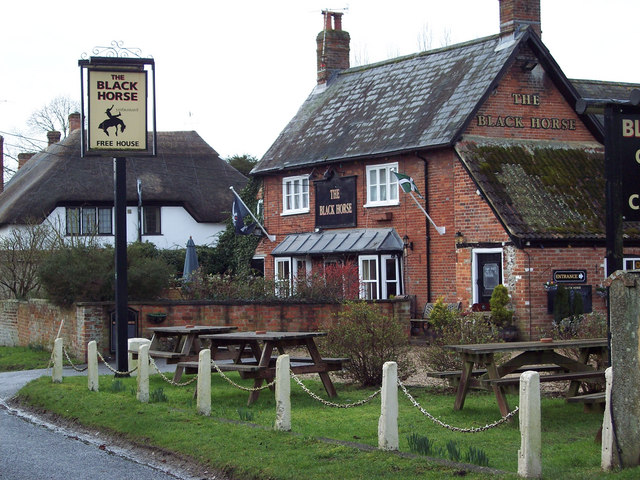
The Black Horse, Great
Durnford - geograph.org.uk - 336708.jpg
66:
52:
The_Black_Horse,_Great_Durnford_-_geograph.org.uk_-_336708.jpg
224:
51° 08′ 27″ N, 1° 48′ 32″ W
174:
51° 08′ 27″ N, 1° 48′ 29″ W
413:
Add a one-line explanation of what this file represents
954:
110:
90:
Commons is a freely licensed media file repository.
582:
Creative
Commons Attribution-ShareAlike 2.0 Generic
56:(640 × 480 pixels, file size: 117 KB, MIME type:
382:https://creativecommons.org/licenses/by-sa/2.0
71:
388:Creative Commons Attribution-Share Alike 2.0
306:
8:
784:
720:
348:– to copy, distribute and transmit the work
972:
854:
409:
927:The following other wikis use this file:
638:https://www.geograph.org.uk/photo/336708
509:https://www.geograph.org.uk/profile/9274
1318:
1308:
1298:
1288:
1280:
1272:
1264:
1253:
1243:
1235:
1227:
1219:
1211:
1201:
1191:
1183:
1173:
1165:
1155:
1147:
1137:
1129:
1118:
1110:
1102:
1094:
1086:
1076:
1068:
1060:
1052:
1044:
1033:
1025:
1014:
1004:
994:
984:
914:
808:
792:
744:
728:
702:
686:
615:
599:
579:
563:
543:
527:
460:
444:
427:
424:
405:
398:
217:
167:
246:View this and other nearby images on:
196:View this and other nearby images on:
974:
7:
293:and is licensed for reuse under the
912:The following page uses this file:
843:
329:Attribution-Share Alike 2.0 Generic
317:
312:
297:Attribution-ShareAlike 2.0 license.
965:
418:
412:
303:
280:
120:
103:
49:
417:
1027:Date and time of data generation
990:KODAK DX7630 ZOOM DIGITAL CAMERA
731:coordinates of the point of view
403:
359:Under the following conditions:
324:This file is licensed under the
316:
311:
305:
273:
252:
238:
230:
202:
188:
180:
70:
31:
21:
400:
126:The Black Horse, Great Durnford
121:
46:No higher resolution available.
14:
1001:1/180 sec (0.0055555555555556)
618:file available on the internet
399:
281:This image was taken from the
26:
1:
1198:Flash did not fire, auto mode
795:coordinates of depicted place
36:
668:Geograph Britain and Ireland
474:object of statement has role
425:Items portrayed in this file
229:
179:
1131:Date and time of digitizing
931:Usage on ceb.wikipedia.org
1340:
1266:Focal length in 35 mm film
1224:One-chip color area sensor
951:Usage on www.wikidata.org
941:Usage on tr.wikipedia.org
810:51°8'27.20"N, 1°48'32.04"W
746:51°8'27.20"N, 1°48'29.16"W
373:same or compatible license
844:
16:
646:geograph.org.uk image ID
402:
339:
77:This is a file from the
1229:Custom image processing
1134:11:38, 12 February 2007
1030:11:38, 12 February 2007
901:
880:22:39, 30 December 2010
152:
141:
134:
131:
113:
81:. Information from its
1320:Subject distance range
287:this photograph's page
258:51.140890; -1.808900
208:51.140890; -1.808100
84:description page there
1167:Maximum land aperture
1062:Horizontal resolution
980:EASTMAN KODAK COMPANY
1104:Y and C positioning
1070:Vertical resolution
976:Camera manufacturer
945:Durnford, Wiltshire
935:Durnford (distrito)
917:Durnford, Wiltshire
354:– to adapt the work
1274:Scene capture type
1250:Auto white balance
1096:Bytes of JPEG data
1088:Offset to JPEG SOI
1046:Compression scheme
489:author name string
1327:
1326:
1170:3.9 APEX (f/3.86)
923:Global file usage
905:
786:
722:
566:copyright license
411:
302:
301:
285:collection. See
263:
262:
213:
212:
162:
161:
99:
98:
79:Wikimedia Commons
32:Global file usage
1331:
1112:Exposure Program
973:
892:
832:
831:
826:
768:
767:
762:
704:12 February 2007
670:
665:
655:
650:
640:
635:
631:described at URL
530:copyright status
511:
506:
496:
493:
483:
478:
395:
392:
389:
386:
383:
375:as the original.
337:
326:Creative Commons
320:
319:
315:
314:
309:
308:
295:Creative Commons
283:Geograph project
277:
270:
259:
256:
242:
241:
235:
234:
233:
227:
226:
215:
209:
206:
192:
191:
185:
184:
183:
177:
176:
165:
137:
136:12 February 2007
125:
117:
111:
95:
74:
73:
67:
61:
59:
1339:
1338:
1334:
1333:
1332:
1330:
1329:
1328:
961:
921:
906:
898:
890:
846:
845:
842:
841:
840:
839:
838:
837:
836:
835:
834:
833:
829:
827:
824:
815:
814:
813:
811:
801:
800:
799:
797:
778:
777:
776:
775:
774:
773:
772:
771:
770:
769:
765:
763:
760:
751:
750:
749:
747:
737:
736:
735:
733:
714:
713:
712:
711:
710:
709:
708:
707:
705:
695:
694:
693:
691:
680:
679:
678:
677:
676:
675:
674:
673:
672:
671:
666:
663:
657:
656:
651:
648:
642:
641:
636:
633:
624:
623:
622:
620:
608:
607:
606:
604:
593:
592:
591:
590:
589:
588:
587:
586:
584:
572:
571:
570:
568:
557:
556:
555:
554:
553:
552:
551:
550:
548:
536:
535:
534:
532:
521:
520:
519:
518:
517:
516:
515:
514:
513:
512:
507:
504:
498:
497:
494:
491:
485:
484:
479:
476:
467:
466:
465:
463:
453:
452:
451:
449:
438:
437:
436:
435:
434:
432:
416:
415:
414:
397:
396:
393:
390:
387:
384:
381:
380:
338:
335:
332:
321:
298:
268:
257:
231:
222:
221:
218:Object location
207:
181:
172:
171:
168:Camera location
163:
147:geograph.org.uk
127:
115:
108:
101:
100:
89:
88:
87:is shown below.
63:
57:
55:
48:
47:
12:
11:
5:
1337:
1335:
1325:
1324:
1321:
1317:
1316:
1313:
1307:
1306:
1303:
1297:
1296:
1293:
1287:
1286:
1283:
1279:
1278:
1275:
1271:
1270:
1267:
1263:
1262:
1259:
1252:
1251:
1248:
1242:
1241:
1238:
1234:
1233:
1232:Normal process
1230:
1226:
1225:
1222:
1221:Sensing method
1218:
1217:
1214:
1213:Exposure index
1210:
1209:
1206:
1200:
1199:
1196:
1190:
1189:
1186:
1182:
1181:
1178:
1172:
1171:
1168:
1164:
1163:
1160:
1154:
1153:
1150:
1146:
1145:
1142:
1136:
1135:
1132:
1128:
1127:
1124:
1117:
1116:
1115:Normal program
1113:
1109:
1108:
1105:
1101:
1100:
1097:
1093:
1092:
1089:
1085:
1084:
1079:
1075:
1074:
1071:
1067:
1066:
1063:
1059:
1058:
1055:
1051:
1050:
1047:
1043:
1042:
1039:
1032:
1031:
1028:
1024:
1023:
1020:
1013:
1012:
1009:
1003:
1002:
999:
993:
992:
987:
983:
982:
977:
964:
960:
959:
958:
957:
949:
948:
947:
939:
938:
937:
925:
924:
920:
919:
910:
909:
904:
903:
900:
896:
893:
887:
882:
877:
873:
872:
869:
866:
863:
860:
857:
850:
849:
820:
819:
818:
817:
816:
812:
809:
807:
806:
805:
804:
803:
802:
798:
793:
791:
790:
789:
788:
782:
756:
755:
754:
753:
752:
748:
745:
743:
742:
741:
740:
739:
738:
734:
729:
727:
726:
725:
724:
718:
706:
703:
701:
700:
699:
698:
697:
696:
692:
687:
685:
684:
683:
682:
681:
659:
658:
644:
643:
629:
628:
627:
626:
625:
621:
616:
614:
613:
612:
611:
610:
609:
605:
602:source of file
600:
598:
597:
596:
595:
594:
585:
580:
578:
577:
576:
575:
574:
573:
569:
564:
562:
561:
560:
559:
558:
549:
544:
542:
541:
540:
539:
538:
537:
533:
528:
526:
525:
524:
523:
522:
500:
499:
487:
486:
472:
471:
470:
469:
468:
464:
461:
459:
458:
457:
456:
455:
454:
450:
445:
443:
442:
441:
440:
439:
433:
428:
426:
423:
422:
421:
420:
419:
408:
407:
404:
401:
379:
378:
377:
376:
366:
357:
356:
355:
349:
342:You are free:
333:
323:
322:
304:
300:
299:
278:
267:
264:
261:
260:
250:
244:
219:
211:
210:
200:
194:
169:
160:
159:
154:
150:
149:
143:
139:
138:
133:
129:
128:
118:
109:
107:
104:
102:
97:
96:
75:
65:
64:
45:
41:
40:
39:
34:
29:
24:
19:
13:
10:
9:
6:
4:
3:
2:
1336:
1322:
1319:
1314:
1312:
1309:
1304:
1302:
1299:
1294:
1292:
1289:
1284:
1282:Scene control
1281:
1276:
1273:
1268:
1265:
1260:
1257:
1254:
1249:
1247:
1246:White balance
1244:
1240:Auto exposure
1239:
1237:Exposure mode
1236:
1231:
1228:
1223:
1220:
1215:
1212:
1207:
1205:
1202:
1197:
1195:
1192:
1187:
1184:
1179:
1177:
1176:Metering mode
1174:
1169:
1166:
1161:
1159:
1158:Exposure bias
1156:
1151:
1149:APEX aperture
1148:
1143:
1141:
1140:Shutter speed
1138:
1133:
1130:
1125:
1122:
1119:
1114:
1111:
1106:
1103:
1098:
1095:
1090:
1087:
1083:
1080:
1078:Software used
1077:
1072:
1069:
1064:
1061:
1056:
1053:
1048:
1045:
1040:
1038:
1034:
1029:
1026:
1021:
1018:
1015:
1010:
1008:
1005:
1000:
998:
997:Exposure time
995:
991:
988:
985:
981:
978:
975:
971:
968:
962:
956:
953:
952:
950:
946:
943:
942:
940:
936:
933:
932:
930:
929:
928:
922:
918:
915:
913:
907:
899:
894:
888:
886:
883:
881:
878:
875:
874:
870:
867:
864:
861:
858:
856:
855:
853:
847:
823:
796:
759:
732:
690:
669:
662:
654:
647:
639:
632:
619:
603:
583:
567:
547:
531:
510:
503:
490:
482:
475:
448:
431:
385:CC BY-SA 2.0
374:
370:
367:
364:
361:
360:
358:
353:
350:
347:
344:
343:
341:
340:
334:Attribution:
330:
327:
310:
296:
292:
288:
284:
279:
276:
272:
271:
265:
255:
251:
249:
248:OpenStreetMap
245:
243:
225:
220:
216:
205:
201:
199:
198:OpenStreetMap
195:
193:
175:
170:
166:
158:
155:
151:
148:
144:
140:
130:
124:
119:
112:
105:
93:
86:
85:
80:
76:
69:
68:
62:
53:
44:
38:
35:
33:
30:
28:
25:
23:
20:
18:
15:
1256:Digital zoom
1185:Light source
1037:focal length
986:Camera model
969:
966:
926:
911:
851:
848:File history
481:photographer
368:
362:
351:
345:
290:
228:
178:
122:
92:You can help
82:
50:
22:File history
1204:Color space
1054:Orientation
897:GeographBot
546:copyrighted
495:Trish Steel
369:share alike
363:attribution
336:Trish Steel
291:Trish Steel
157:Trish Steel
114:Description
1301:Saturation
1082:ImageReady
1049:JPEG (old)
908:File usage
889:640 × 480
865:Dimensions
462:some value
58:image/jpeg
27:File usage
1311:Sharpness
1017:ISO speed
955:Q19850780
862:Thumbnail
859:Date/Time
689:inception
266:Licensing
123:English:
1291:Contrast
1277:Standard
1107:Centered
1007:F-number
963:Metadata
891:(117 KB)
661:operator
406:Captions
352:to remix
346:to share
331:license.
37:Metadata
1323:Unknown
1188:Unknown
1180:Pattern
1123:version
876:current
871:Comment
822:heading
781:heading
758:heading
717:heading
447:creator
430:depicts
410:English
106:Summary
54:
1315:Normal
1305:Normal
1295:Normal
1073:72 dpi
1065:72 dpi
1057:Normal
1019:rating
830:degree
785:degree
766:degree
721:degree
653:336708
236:
186:
153:Author
142:Source
1269:78 mm
1258:ratio
1194:Flash
1099:5,372
1091:3,060
1041:16 mm
1035:Lens
1011:f/4.8
145:From
1285:None
1208:sRGB
1126:2.21
1121:Exif
868:User
828:270
764:270
394:true
391:true
132:Date
17:File
1216:100
1152:4.5
1144:7.5
1022:100
502:URL
825::
761::
664::
649::
634::
505::
492::
477::
1261:0
1162:0
94:.
60:)
Text is available under the Creative Commons Attribution-ShareAlike License. Additional terms may apply.
_heading:270.00&language=en)
_heading:270.00&language=en)
