373:
306:
256:
298:
248:
320:
270:
341:
379:
384:
33:
81:
581:"}},"text\/plain":{"en":{"":"heading"}}},"{\"value\":{\"amount\":\"+45.0\",\"unit\":\"http:\\\/\\\/www.wikidata.org\\\/entity\\\/Q28390\"},\"type\":\"quantity\"}":{"text\/html":{"en":{"P7787":"45.0
679:"}},"text\/plain":{"en":{"":"heading"}}},"{\"value\":{\"amount\":\"+45\",\"unit\":\"http:\\\/\\\/www.wikidata.org\\\/entity\\\/Q28390\"},\"type\":\"quantity\"}":{"text\/html":{"en":{"P7787":"45
798:== {{int:filedesc}} == {{Information |Description={{en|1=The Down Arts Centre}} |Source=From |Date=2012-03-17 |Author= |Permission=Creative Commons Attribution Share-alike license 2.0 |Other fields={{Credit line |Author=Eric Jones |License= |Other=''The Down Arts Centre'' }} }} {{Location|54.328479|-5.715764|source:g...
577:
289:
239:
431:– You must give appropriate credit, provide a link to the license, and indicate if changes were made. You may do so in any reasonable manner, but not in any way that suggests the licensor endorses you or your use.
47:
43:
37:
676:
578:
60:
822:
92:
176:
564:
528:
313:
263:
348:
438:
717:
690:
619:
592:
512:
648:
548:
495:
335:
780:
775:
51:
32:
394:
808:
The following pages on the
English Knowledge (XXG) use this file (pages on other projects are not listed):
437:– If you remix, transform, or build upon the material, you must distribute your contributions under the
355:
on the
Geograph website for the photographer's contact details. The copyright on this image is owned by
585:"}},"text\/plain":{"en":{"P7787":"45.0 degree"}}}}": -->
391:
683:"}},"text\/plain":{"en":{"P7787":"45 degree"}}}}": -->
100:
812:
192:
791:
319:
269:
360:
87:
208:
253:
817:
303:
144:
155:
165:
340:
352:
748:
Click on a date/time to view the file as it appeared at that time.
305:
255:
280:
230:
75:
290:
54° 19′ 43.5″ N, 5° 42′ 56″ W
240:
54° 19′ 42.5″ N, 5° 42′ 57″ W
479:
Add a one-line explanation of what this file represents
183:
Creative
Commons Attribution Share-alike license 2.0
119:
99:
Commons is a freely licensed media file repository.
565:
Creative
Commons Attribution-ShareAlike 2.0 Generic
65:(1,024 × 766 pixels, file size: 161 KB, MIME type:
823:List of city and town halls in Northern Ireland
448:https://creativecommons.org/licenses/by-sa/2.0
80:
454:Creative Commons Attribution-Share Alike 2.0
372:
8:
680:
582:
414:– to copy, distribute and transmit the work
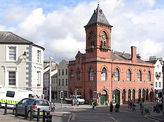
125:The Down Arts Centre (geograph 2853261).jpg
750:
475:
810:
704:
688:
662:
646:
606:
590:
562:
546:
526:
510:
493:
490:
471:
464:
283:
233:
312:View this and other nearby images on:
262:View this and other nearby images on:
7:
359:and is licensed for reuse under the
739:
395:Attribution-Share Alike 2.0 Generic
383:
378:
363:Attribution-ShareAlike 2.0 license.
484:
478:
369:
346:
129:
112:
58:
483:
593:coordinates of the point of view
469:
425:Under the following conditions:
390:This file is licensed under the
382:
377:
371:
339:
318:
304:
296:
268:
254:
246:
79:
21:
466:
130:
14:
465:
347:This image was taken from the
26:
1:
691:coordinates of depicted place
608:54°19'42.524"N, 5°42'56.750"W
491:Items portrayed in this file
706:54°19'43.46"N, 5°42'55.58"W
295:
245:
839:
439:same or compatible license
740:
16:
468:
405:
86:This is a file from the
797:
221:Eric Jones /
202:Eric Jones /
193:required by the license
171:
161:
150:
143:
140:
122:
90:. Information from its
353:this photograph's page
324:54.328740; -5.715440
274:54.328479; -5.715764
93:description page there
36:Size of this preview:
223:The Down Arts Centre
204:The Down Arts Centre
135:The Down Arts Centre
420:– to adapt the work
42:Other resolutions:
776:13:22, 5 June 2021
52:1,024 × 766 pixels
801:
682:
584:
549:copyright license
477:
368:
367:
351:collection. See
329:
328:
279:
278:
228:
227:
196:
180:
177:Reusing this file
108:
107:
88:Wikimedia Commons
830:
813:Down Arts Centre
788:
728:
727:
722:
630:
629:
624:
513:copyright status
461:
458:
455:
452:
449:
441:as the original.
403:
392:Creative Commons
386:
385:
381:
380:
375:
374:
361:Creative Commons
349:Geograph project
343:
336:
325:
322:
308:
307:
301:
300:
299:
293:
292:
281:
275:
272:
258:
257:
251:
250:
249:
243:
242:
231:
190:
174:
146:
134:
126:
120:
104:
83:
82:
76:
70:
68:
55:
48:640 × 479 pixels
44:320 × 239 pixels
38:800 × 598 pixels
838:
837:
833:
832:
831:
829:
828:
827:
809:
802:
794:
786:
742:
741:
738:
737:
736:
735:
734:
733:
732:
731:
730:
729:
725:
723:
720:
711:
710:
709:
707:
697:
696:
695:
693:
674:
673:
672:
671:
670:
669:
668:
667:
665:
655:
654:
653:
651:
640:
639:
638:
637:
636:
635:
634:
633:
632:
631:
627:
625:
622:
613:
612:
611:
609:
599:
598:
597:
595:
576:
575:
574:
573:
572:
571:
570:
569:
567:
555:
554:
553:
551:
540:
539:
538:
537:
536:
535:
534:
533:
531:
519:
518:
517:
515:
504:
503:
502:
501:
500:
498:
482:
481:
480:
463:
462:
459:
456:
453:
450:
447:
446:
404:
401:
398:
387:
364:
334:
323:
297:
288:
287:
284:Object location
273:
247:
238:
237:
234:Camera location
229:
218:
211:
199:
156:geograph.org.uk
136:
124:
117:
110:
109:
98:
97:
96:is shown below.
72:
66:
64:
57:
56:
41:
12:
11:
5:
836:
834:
826:
825:
820:
815:
807:
806:
805:
800:
799:
796:
792:
789:
783:
778:
773:
769:
768:
765:
762:
759:
756:
753:
746:
745:
716:
715:
714:
713:
712:
708:
705:
703:
702:
701:
700:
699:
698:
694:
689:
687:
686:
685:
684:
678:
666:
663:
661:
660:
659:
658:
657:
656:
652:
647:
645:
644:
643:
642:
641:
618:
617:
616:
615:
614:
610:
607:
605:
604:
603:
602:
601:
600:
596:
591:
589:
588:
587:
586:
580:
568:
563:
561:
560:
559:
558:
557:
556:
552:
547:
545:
544:
543:
542:
541:
532:
527:
525:
524:
523:
522:
521:
520:
516:
511:
509:
508:
507:
506:
505:
499:
494:
492:
489:
488:
487:
486:
485:
474:
473:
470:
467:
445:
444:
443:
442:
432:
423:
422:
421:
415:
408:You are free:
399:
389:
388:
370:
366:
365:
344:
333:
330:
327:
326:
316:
310:
285:
277:
276:
266:
260:
235:
226:
225:
219:
216:
213:
212:
207:
200:
197:
185:
184:
181:
169:
168:
163:
159:
158:
152:
148:
147:
142:
138:
137:
127:
118:
116:
113:
111:
106:
105:
84:
74:
73:
35:
31:
30:
29:
24:
19:
13:
10:
9:
6:
4:
3:
2:
835:
824:
821:
819:
816:
814:
811:
803:
795:
790:
784:
782:
779:
777:
774:
771:
770:
766:
763:
760:
757:
754:
752:
751:
749:
743:
719:
692:
664:17 March 2012
650:
621:
594:
566:
550:
530:
514:
497:
451:CC BY-SA 2.0
440:
436:
433:
430:
427:
426:
424:
419:
416:
413:
410:
409:
407:
406:
400:Attribution:
396:
393:
376:
362:
358:
354:
350:
345:
342:
338:
337:
331:
321:
317:
315:
314:OpenStreetMap
311:
309:
291:
286:
282:
271:
267:
265:
264:OpenStreetMap
261:
259:
241:
236:
232:
224:
220:
215:
214:
210:
206: /
205:
201:
194:
189:
187:
186:
182:
178:
173:
170:
167:
164:
160:
157:
153:
149:
145:17 March 2012
139:
133:
128:
121:
114:
102:
95:
94:
89:
85:
78:
77:
71:
62:
61:Original file
53:
49:
45:
39:
34:
28:
25:
23:
20:
18:
15:
785:1,024 × 766
747:
744:File history
434:
428:
417:
411:
356:
294:
244:
222:
209:CC BY-SA 2.0
203:
131:
101:You can help
91:
59:
22:File history
818:Downpatrick
529:copyrighted
435:share alike
429:attribution
188:Attribution
123:Description
804:File usage
761:Dimensions
402:Eric Jones
357:Eric Jones
172:Permission
166:Eric Jones
67:image/jpeg
27:File usage
793:Dormskirk
758:Thumbnail
755:Date/Time
649:inception
332:Licensing
217:InfoField
198:InfoField
132:English:
787:(161 KB)
472:Captions
418:to remix
412:to share
397:license.
772:current
767:Comment
718:heading
677:heading
620:heading
579:heading
496:depicts
476:English
115:Summary
63:
726:degree
681:degree
628:degree
583:degree
302:
252:
162:Author
151:Source
626:45.0
154:From
764:User
460:true
457:true
141:Date
17:File
724:45
721::
623::
50:|
46:|
40:.
195:)
191:(
179:)
175:(
103:.
69:)
54:.
Text is available under the Creative Commons Attribution-ShareAlike License. Additional terms may apply.

.jpg)
.jpg¶ms=054.328479_N_-005.715764_E_globe:Earth_type:camera_source:geograph-irishgrid(J48654460)_heading:45.00&language=en)
.jpg¶ms=054.328740_N_-005.715440_E_globe:Earth_class:object_type:object_source:geograph-irishgrid(J48674463)_heading:45.00&language=en)
