392:
325:
275:
317:
267:
339:
289:
360:
398:
403:
72:
957:"}},"text\/plain":{"en":{"":"heading"}}},"{\"value\":{\"amount\":\"+202\",\"unit\":\"http:\\\/\\\/www.wikidata.org\\\/entity\\\/Q28390\"},\"type\":\"quantity\"}":{"text\/html":{"en":{"P7787":"202
857:"}},"text\/plain":{"en":{"":"heading"}}},"{\"value\":{\"amount\":\"+202\",\"unit\":\"http:\\\/\\\/www.wikidata.org\\\/entity\\\/Q28390\"},\"type\":\"quantity\"}":{"text\/html":{"en":{"P7787":"202
1059:
953:
258:
1076:== {{int:filedesc}} == {{Information |description={{en|1=The Standing Stone at Taston Picture shows the standing stone thought to be a Neolithic Menhir and the Ancient Cross}} |date=2008-09-21 |source=From [http://www.geograph.org.uk/photo/975027 geograph
43:
450:– You must give appropriate credit, provide a link to the license, and indicate if changes were made. You may do so in any reasonable manner, but not in any way that suggests the licensor endorses you or your use.
83:
51:
954:
854:
789:
719:
683:
564:
547:
530:
332:
282:
940:
839:
1058:
1053:
367:
42:
1121:
This file contains additional information, probably added from the digital camera or scanner used to create or digitize it.
457:
618:
995:
968:
924:
895:
868:
817:
773:
667:
641:
626:
611:
832:
802:
739:
703:
584:
514:
354:
413:
1124:
If the file has been modified from its original state, some details may not fully reflect the modified file.
1086:
The following pages on the
English Knowledge (XXG) use this file (pages on other projects are not listed):
456:– If you remix, transform, or build upon the material, you must distribute your contributions under the
374:
on the
Geograph website for the photographer's contact details. The copyright on this image is owned by
1069:
410:
238:
216:
961:"}},"text\/plain":{"en":{"P7787":"202 degree"}}}}": -->
861:"}},"text\/plain":{"en":{"P7787":"202 degree"}}}}": -->
91:
183:
233:
211:
633:
824:
809:
167:
338:
288:
379:
78:
135:
126:
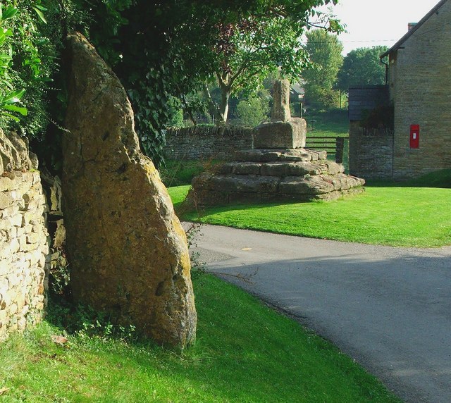
Taston, Oxfordshire: the Thor Stone (left) and
Medieval preaching cross (ahead)
322:
272:
156:
146:
359:
1090:
371:
1026:
Click on a date/time to view the file as it appeared at that time.
324:
274:
299:
249:
66:
116:
The
Standing Stone at Taston - geograph.org.uk - 975027.jpg
52:
The_Standing_Stone_at_Taston_-_geograph.org.uk_-_975027.jpg
309:
51° 53′ 47″ N, 1° 28′ 45″ W
259:
51° 53′ 48″ N, 1° 28′ 44″ W
531:
Taston standing stone 12m north of Taston village cross
498:
Add a one-line explanation of what this file represents
1108:
227:
205:
110:
90:
Commons is a freely licensed media file repository.
720:
Creative
Commons Attribution-ShareAlike 2.0 Generic
56:(640 × 572 pixels, file size: 127 KB, MIME type:
467:https://creativecommons.org/licenses/by-sa/2.0
71:
473:Creative Commons Attribution-Share Alike 2.0
391:
8:
958:
858:
433:– to copy, distribute and transmit the work
1126:
1028:
494:
1101:The following other wikis use this file:
634:https://www.geograph.org.uk/profile/22917
810:https://www.geograph.org.uk/photo/975027
1128:
1088:
982:
966:
938:
922:
882:
866:
787:
771:
753:
737:
717:
701:
681:
665:
598:
582:
562:
545:
528:
512:
509:
490:
483:
302:
252:
331:View this and other nearby images on:
281:View this and other nearby images on:
7:
378:and is licensed for reuse under the
1017:
414:Attribution-Share Alike 2.0 Generic
402:
397:
382:Attribution-ShareAlike 2.0 license.
1119:
503:
497:
388:
365:
231:
209:
120:
103:
49:
502:
869:coordinates of the point of view
488:
444:Under the following conditions:
409:This file is licensed under the
401:
396:
390:
358:
337:
323:
315:
287:
273:
265:
70:
31:
21:
485:
121:
46:No higher resolution available.
14:
790:file available on the internet
484:
366:This image was taken from the
26:
1:
969:coordinates of depicted place
36:
840:Geograph Britain and Ireland
612:object of statement has role
510:Items portrayed in this file
314:
264:
198:The Standing Stone at Taston
179:The Standing Stone at Taston
984:51°53'46.82"N, 1°28'45.48"W
884:51°53'48.44"N, 1°28'44.04"W
1150:
1105:Usage on www.wikidata.org
458:same or compatible license
1018:
16:
818:geograph.org.uk image ID
487:
424:
77:This is a file from the
1075:
1054:21:49, 22 February 2011
168:required by the license
152:
141:
134:
131:
113:
81:. Information from its
372:this photograph's page
343:51.896340; -1.479300
293:51.896790; -1.478900
84:description page there
925:location of creation
196:Michael /
177:Michael /
439:– to adapt the work
232:This is a photo of
210:This is a photo of
642:author name string
1137:
1136:
1097:Global file usage
1079:
960:
860:
755:21 September 2008
704:copyright license
496:
387:
386:
370:collection. See
348:
347:
298:
297:
248:
247:
226:
225:
203:
202:
171:
136:21 September 2008
99:
98:
79:Wikimedia Commons
32:Global file usage
1141:
1127:
1066:
1006:
1005:
1000:
906:
905:
900:
842:
837:
827:
822:
812:
807:
803:described at URL
668:copyright status
649:
646:
636:
631:
621:
616:
480:
477:
474:
471:
468:
460:as the original.
422:
411:Creative Commons
405:
404:
400:
399:
394:
393:
380:Creative Commons
368:Geograph project
362:
355:
344:
341:
327:
326:
320:
319:
318:
312:
311:
300:
294:
291:
277:
276:
270:
269:
268:
262:
261:
250:
241:
228:
219:
206:
165:
137:
125:
117:
111:
95:
74:
73:
67:
61:
59:
1149:
1148:
1144:
1143:
1142:
1140:
1139:
1138:
1115:
1095:
1087:
1080:
1072:
1064:
1020:
1019:
1016:
1015:
1014:
1013:
1012:
1011:
1010:
1009:
1008:
1007:
1003:
1001:
998:
989:
988:
987:
985:
975:
974:
973:
971:
952:
951:
950:
949:
948:
947:
946:
945:
943:
931:
930:
929:
927:
916:
915:
914:
913:
912:
911:
910:
909:
908:
907:
903:
901:
898:
889:
888:
887:
885:
875:
874:
873:
871:
852:
851:
850:
849:
848:
847:
846:
845:
844:
843:
838:
835:
829:
828:
823:
820:
814:
813:
808:
805:
796:
795:
794:
792:
780:
779:
778:
776:
765:
764:
763:
762:
761:
760:
759:
758:
756:
746:
745:
744:
742:
731:
730:
729:
728:
727:
726:
725:
724:
722:
710:
709:
708:
706:
695:
694:
693:
692:
691:
690:
689:
688:
686:
674:
673:
672:
670:
659:
658:
657:
656:
655:
654:
653:
652:
651:
650:
647:
644:
638:
637:
632:
629:
623:
622:
617:
614:
605:
604:
603:
601:
591:
590:
589:
587:
576:
575:
574:
573:
572:
571:
570:
569:
567:
556:
555:
554:
553:
552:
550:
539:
538:
537:
536:
535:
533:
521:
520:
519:
517:
501:
500:
499:
482:
481:
478:
475:
472:
469:
466:
465:
423:
420:
417:
406:
383:
353:
342:
316:
307:
306:
303:Object location
292:
266:
257:
256:
253:Camera location
243:
237:
234:listed building
221:
215:
212:listed building
204:
193:
186:
174:
147:geograph.org.uk
127:
115:
108:
101:
100:
89:
88:
87:is shown below.
63:
57:
55:
48:
47:
12:
11:
5:
1147:
1145:
1135:
1134:
1131:
1118:
1114:
1113:
1112:
1111:
1099:
1098:
1094:
1093:
1085:
1084:
1083:
1078:
1077:
1074:
1070:
1067:
1061:
1056:
1051:
1047:
1046:
1043:
1040:
1037:
1034:
1031:
1024:
1023:
994:
993:
992:
991:
990:
986:
983:
981:
980:
979:
978:
977:
976:
972:
967:
965:
964:
963:
962:
956:
944:
939:
937:
936:
935:
934:
933:
932:
928:
923:
921:
920:
919:
918:
917:
894:
893:
892:
891:
890:
886:
883:
881:
880:
879:
878:
877:
876:
872:
867:
865:
864:
863:
862:
856:
831:
830:
816:
815:
801:
800:
799:
798:
797:
793:
788:
786:
785:
784:
783:
782:
781:
777:
774:source of file
772:
770:
769:
768:
767:
766:
757:
754:
752:
751:
750:
749:
748:
747:
743:
738:
736:
735:
734:
733:
732:
723:
718:
716:
715:
714:
713:
712:
711:
707:
702:
700:
699:
698:
697:
696:
687:
682:
680:
679:
678:
677:
676:
675:
671:
666:
664:
663:
662:
661:
660:
640:
639:
625:
624:
610:
609:
608:
607:
606:
602:
599:
597:
596:
595:
594:
593:
592:
588:
583:
581:
580:
579:
578:
577:
568:
563:
561:
560:
559:
558:
557:
551:
546:
544:
543:
542:
541:
540:
534:
529:
527:
526:
525:
524:
523:
522:
518:
513:
511:
508:
507:
506:
505:
504:
493:
492:
489:
486:
464:
463:
462:
461:
451:
442:
441:
440:
434:
427:You are free:
418:
408:
407:
389:
385:
384:
363:
352:
349:
346:
345:
335:
329:
304:
296:
295:
285:
279:
254:
246:
245:
224:
223:
201:
200:
194:
191:
188:
187:
182:
175:
172:
160:
159:
154:
150:
149:
143:
139:
138:
133:
129:
128:
118:
109:
107:
104:
102:
97:
96:
75:
65:
64:
45:
41:
40:
39:
34:
29:
24:
19:
13:
10:
9:
6:
4:
3:
2:
1146:
1132:
1129:
1125:
1122:
1116:
1110:
1107:
1106:
1104:
1103:
1102:
1096:
1092:
1089:
1081:
1073:
1068:
1062:
1060:
1057:
1055:
1052:
1049:
1048:
1044:
1041:
1038:
1035:
1032:
1030:
1029:
1027:
1021:
997:
970:
942:
926:
897:
870:
841:
834:
826:
819:
811:
804:
791:
775:
741:
721:
705:
685:
669:
643:
635:
628:
620:
613:
586:
566:
549:
532:
516:
470:CC BY-SA 2.0
459:
455:
452:
449:
446:
445:
443:
438:
435:
432:
429:
428:
426:
425:
419:Attribution:
415:
412:
395:
381:
377:
373:
369:
364:
361:
357:
356:
350:
340:
336:
334:
333:OpenStreetMap
330:
328:
310:
305:
301:
290:
286:
284:
283:OpenStreetMap
280:
278:
260:
255:
251:
244:
240:
235:
230:
229:
222:
218:
213:
208:
207:
199:
195:
190:
189:
185:
181: /
180:
176:
169:
164:
162:
161:
158:
155:
151:
148:
144:
140:
130:
124:
119:
112:
105:
93:
86:
85:
80:
76:
69:
68:
62:
53:
44:
38:
35:
33:
30:
28:
25:
23:
20:
18:
15:
1123:
1120:
1100:
1025:
1022:File history
619:photographer
565:Taston Cross
548:Taston Cross
453:
447:
436:
430:
375:
313:
263:
197:
184:CC BY-SA 2.0
178:
122:
92:You can help
82:
50:
22:File history
1071:GeographBot
684:copyrighted
454:share alike
448:attribution
163:Attribution
114:Description
1130:_error
1082:File usage
1063:640 × 572
1039:Dimensions
600:some value
58:image/jpeg
27:File usage
1036:Thumbnail
1033:Date/Time
941:Spelsbury
740:inception
351:Licensing
192:InfoField
173:InfoField
123:English:
1117:Metadata
1109:Q7687737
1065:(127 KB)
833:operator
491:Captions
437:to remix
431:to share
416:license.
37:Metadata
1050:current
1045:Comment
996:heading
955:heading
896:heading
855:heading
648:Michael
585:creator
515:depicts
495:English
421:Michael
376:Michael
239:1008406
236:number
217:1008407
214:number
157:Michael
106:Summary
54:
1091:Taston
1004:degree
959:degree
904:degree
859:degree
825:975027
321:
271:
153:Author
142:Source
145:From
1042:User
1002:202
902:202
479:true
476:true
132:Date
17:File
627:URL
999::
899::
836::
821::
806::
645::
630::
615::
1133:0
242:.
220:.
170:)
166:(
94:.
60:)
Text is available under the Creative Commons Attribution-ShareAlike License. Additional terms may apply.
_heading:202.00&language=en)
_heading:202.00&language=en)
