370:
303:
253:
295:
245:
1069:
317:
267:
338:
376:
381:
72:
867:"}},"text\/plain":{"en":{"":"heading"}}},"{\"value\":{\"amount\":\"+315\",\"unit\":\"http:\\\/\\\/www.wikidata.org\\\/entity\\\/Q28390\"},\"type\":\"quantity\"}":{"text\/html":{"en":{"P7787":"315
803:"}},"text\/plain":{"en":{"":"heading"}}},"{\"value\":{\"amount\":\"+315\",\"unit\":\"http:\\\/\\\/www.wikidata.org\\\/entity\\\/Q28390\"},\"type\":\"quantity\"}":{"text\/html":{"en":{"P7787":"315
1005:
863:
236:
1022:== {{int:filedesc}} == {{Information |description={{en|1=The church of St Nicholas St Nicholas' church > http://www.geograph.org.uk/photo/861988 - http://www.geograph.org.uk/photo/861993 has an octagonal tower > http://www.geograph.org.uk/photo/861886 whi
43:
1046:
428:– You must give appropriate credit, provide a link to the license, and indicate if changes were made. You may do so in any reasonable manner, but not in any way that suggests the licensor endorses you or your use.
83:
51:
864:
800:
1041:
1004:
999:
42:
701:
665:
629:
310:
260:
950:
721:
510:
345:
1102:
This file contains additional information, probably added from the digital camera or scanner used to create or digitize it.
435:
1051:
592:
934:
905:
878:
841:
814:
744:
685:
613:
585:
572:
557:
484:"}},"text\/plain":{"en":{"P180":"St Nicholas' Church, Buckenham"}}}}": -->
772:
729:
714:
649:
530:
494:
332:
391:
1105:
If the file has been modified from its original state, some details may not fully reflect the modified file.
434:– If you remix, transform, or build upon the material, you must distribute your contributions under the
352:
on the
Geograph website for the photographer's contact details. The copyright on this image is owned by
1015:
388:
115:
871:"}},"text\/plain":{"en":{"P7787":"315 degree"}}}}": -->
807:"}},"text\/plain":{"en":{"P7787":"315 degree"}}}}": -->
91:
205:
110:
564:
751:
736:
189:
316:
266:
357:
78:
1047:
List of churches preserved by the
Churches Conservation Trust in the East of England
157:
300:
250:
1036:
178:
168:
337:
1070:Список церквей в Восточной Англии, сохранённых Фондом сохранения церквей
148:
St
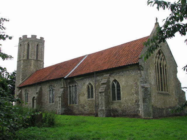
Nicholas' parish church, Buckenham, Norfolk, seen from the southeast
349:
972:
Click on a date/time to view the file as it appeared at that time.
138:
The church of St
Nicholas, Buckenham - geograph.org.uk - 485330.jpg
52:
The_church_of_St_Nicholas,_Buckenham_-_geograph.org.uk_-_485330.jpg
302:
252:
277:
227:
66:
287:
52° 35′ 59″ N, 1° 28′ 38″ E
237:
52° 35′ 54″ N, 1° 28′ 42″ E
476:
Add a one-line explanation of what this file represents
1079:
1089:
132:
104:
90:
Commons is a freely licensed media file repository.
666:
Creative
Commons Attribution-ShareAlike 2.0 Generic
56:(640 × 480 pixels, file size: 65 KB, MIME type:
445:https://creativecommons.org/licenses/by-sa/2.0
71:
451:Creative Commons Attribution-Share Alike 2.0
369:
8:
868:
804:
411:– to copy, distribute and transmit the work
1107:
974:
472:
1062:The following other wikis use this file:
565:https://www.geograph.org.uk/profile/14840
737:https://www.geograph.org.uk/photo/485330
1109:
1034:
948:
932:
892:
876:
828:
812:
786:
770:
699:
683:
663:
647:
627:
611:
544:
528:
508:
492:
489:
468:
461:
280:
230:
309:View this and other nearby images on:
259:View this and other nearby images on:
1042:Grade I listed buildings in Broadland
1032:The following 4 pages use this file:
7:
356:and is licensed for reuse under the
963:
392:Attribution-Share Alike 2.0 Generic
380:
375:
360:Attribution-ShareAlike 2.0 license.
1100:
481:
475:
366:
343:
142:
108:
103:
49:
480:
815:coordinates of the point of view
466:
422:Under the following conditions:
387:This file is licensed under the
379:
374:
368:
336:
315:
301:
293:
265:
251:
243:
70:
31:
21:
463:
143:
46:No higher resolution available.
14:
702:file available on the internet
511:St Nicholas' Church, Buckenham
462:
344:This image was taken from the
26:
1:
1052:St Nicholas Church, Buckenham
879:coordinates of depicted place
36:
722:Geograph Britain and Ireland
586:object of statement has role
490:Items portrayed in this file
292:
242:
894:52°35'58.74"N, 1°28'37.56"E
830:52°35'54.06"N, 1°28'42.24"E
482:
1086:Usage on www.wikidata.org
1076:Usage on sv.wikipedia.org
1066:Usage on ru.wikipedia.org
436:same or compatible license
964:
220:The church of St Nicholas
218:Evelyn Simak /
201:The church of St Nicholas
199:Evelyn Simak /
16:
745:geograph.org.uk image ID
465:
402:
77:This is a file from the
1021:
190:required by the license
174:
163:
156:
153:
135:
81:. Information from its
1000:02:58, 5 February 2011
350:this photograph's page
321:52.599650; 1.477100
271:52.598350; 1.478400
84:description page there
935:location of creation
417:– to adapt the work
109:This is a photo of
573:author name string
1118:
1117:
1058:Global file usage
1025:
870:
806:
650:copyright license
474:
365:
364:
348:collection. See
326:
325:
276:
275:
225:
224:
193:
125:
124:
99:
98:
79:Wikimedia Commons
32:Global file usage
1122:
1108:
1012:
916:
915:
910:
852:
851:
846:
754:
749:
739:
734:
730:described at URL
724:
719:
614:copyright status
595:
590:
580:
577:
567:
562:
458:
455:
452:
449:
446:
438:as the original.
400:
389:Creative Commons
383:
382:
378:
377:
372:
371:
358:Creative Commons
346:Geograph project
340:
333:
322:
319:
305:
304:
298:
297:
296:
290:
289:
278:
272:
269:
255:
254:
248:
247:
246:
240:
239:
228:
187:
159:
147:
139:
133:
118:
105:
95:
74:
73:
67:
61:
59:
1130:
1129:
1125:
1124:
1123:
1121:
1120:
1119:
1096:
1056:
1026:
1018:
1010:
966:
965:
962:
961:
960:
959:
958:
957:
956:
955:
953:
941:
940:
939:
937:
926:
925:
924:
923:
922:
921:
920:
919:
918:
917:
913:
911:
908:
899:
898:
897:
895:
885:
884:
883:
881:
862:
861:
860:
859:
858:
857:
856:
855:
854:
853:
849:
847:
844:
835:
834:
833:
831:
821:
820:
819:
817:
798:
797:
796:
795:
794:
793:
792:
791:
789:
779:
778:
777:
775:
764:
763:
762:
761:
760:
759:
758:
757:
756:
755:
750:
747:
741:
740:
735:
732:
726:
725:
720:
717:
708:
707:
706:
704:
692:
691:
690:
688:
677:
676:
675:
674:
673:
672:
671:
670:
668:
656:
655:
654:
652:
641:
640:
639:
638:
637:
636:
635:
634:
632:
620:
619:
618:
616:
605:
604:
603:
602:
601:
600:
599:
598:
597:
596:
591:
588:
582:
581:
578:
575:
569:
568:
563:
560:
551:
550:
549:
547:
537:
536:
535:
533:
522:
521:
520:
519:
518:
517:
516:
515:
513:
501:
500:
499:
497:
479:
478:
477:
460:
459:
456:
453:
450:
447:
444:
443:
401:
398:
395:
384:
361:
331:
320:
294:
285:
284:
281:Object location
270:
244:
235:
234:
231:Camera location
226:
215:
208:
196:
169:geograph.org.uk
149:
137:
130:
120:
114:
111:listed building
101:
100:
89:
88:
87:is shown below.
63:
57:
55:
48:
47:
12:
11:
5:
1128:
1126:
1116:
1115:
1112:
1099:
1095:
1094:
1093:
1092:
1084:
1083:
1082:
1074:
1073:
1072:
1060:
1059:
1055:
1054:
1049:
1044:
1039:
1030:
1029:
1024:
1023:
1020:
1016:
1013:
1007:
1002:
997:
993:
992:
989:
986:
983:
980:
977:
970:
969:
954:
949:
947:
946:
945:
944:
943:
942:
938:
933:
931:
930:
929:
928:
927:
904:
903:
902:
901:
900:
896:
893:
891:
890:
889:
888:
887:
886:
882:
877:
875:
874:
873:
872:
866:
840:
839:
838:
837:
836:
832:
829:
827:
826:
825:
824:
823:
822:
818:
813:
811:
810:
809:
808:
802:
790:
787:
785:
784:
783:
782:
781:
780:
776:
771:
769:
768:
767:
766:
765:
743:
742:
728:
727:
713:
712:
711:
710:
709:
705:
700:
698:
697:
696:
695:
694:
693:
689:
686:source of file
684:
682:
681:
680:
679:
678:
669:
664:
662:
661:
660:
659:
658:
657:
653:
648:
646:
645:
644:
643:
642:
633:
628:
626:
625:
624:
623:
622:
621:
617:
612:
610:
609:
608:
607:
606:
584:
583:
571:
570:
556:
555:
554:
553:
552:
548:
545:
543:
542:
541:
540:
539:
538:
534:
529:
527:
526:
525:
524:
523:
514:
509:
507:
506:
505:
504:
503:
502:
498:
493:
491:
488:
487:
486:
485:
483:
471:
470:
467:
464:
442:
441:
440:
439:
429:
420:
419:
418:
412:
405:You are free:
396:
386:
385:
367:
363:
362:
341:
330:
327:
324:
323:
313:
307:
282:
274:
273:
263:
257:
232:
223:
222:
216:
213:
210:
209:
204:
197:
194:
182:
181:
176:
172:
171:
165:
161:
160:
155:
151:
150:
140:
131:
129:
126:
123:
122:
102:
97:
96:
75:
65:
64:
45:
41:
40:
39:
34:
29:
24:
19:
13:
10:
9:
6:
4:
3:
2:
1127:
1113:
1110:
1106:
1103:
1097:
1091:
1088:
1087:
1085:
1081:
1078:
1077:
1075:
1071:
1068:
1067:
1065:
1064:
1063:
1057:
1053:
1050:
1048:
1045:
1043:
1040:
1038:
1035:
1033:
1027:
1019:
1014:
1008:
1006:
1003:
1001:
998:
995:
994:
990:
987:
984:
981:
978:
976:
975:
973:
967:
952:
936:
907:
880:
843:
816:
774:
753:
746:
738:
731:
723:
716:
703:
687:
667:
651:
631:
615:
594:
587:
574:
566:
559:
532:
512:
496:
448:CC BY-SA 2.0
437:
433:
430:
427:
424:
423:
421:
416:
413:
410:
407:
406:
404:
403:
397:Attribution:
393:
390:
373:
359:
355:
351:
347:
342:
339:
335:
334:
328:
318:
314:
312:
311:OpenStreetMap
308:
306:
288:
283:
279:
268:
264:
262:
261:OpenStreetMap
258:
256:
238:
233:
229:
221:
217:
212:
211:
207:
203: /
202:
198:
191:
186:
184:
183:
180:
177:
173:
170:
166:
162:
152:
146:
141:
134:
127:
121:
117:
112:
107:
106:
93:
86:
85:
80:
76:
69:
68:
62:
53:
44:
38:
35:
33:
30:
28:
25:
23:
20:
18:
15:
1104:
1101:
1061:
1031:
971:
968:File history
593:photographer
579:Evelyn Simak
431:
425:
414:
408:
399:Evelyn Simak
354:Evelyn Simak
353:
291:
241:
219:
206:CC BY-SA 2.0
200:
179:Evelyn Simak
144:
92:You can help
82:
50:
22:File history
1017:GeographBot
788:4 July 2007
630:copyrighted
432:share alike
426:attribution
185:Attribution
158:4 July 2007
136:Description
1111:_error
1028:File usage
1009:640 × 480
985:Dimensions
951:Strumpshaw
546:some value
58:image/jpeg
27:File usage
1080:Buckenham
1037:Buckenham
982:Thumbnail
979:Date/Time
773:inception
329:Licensing
214:InfoField
195:InfoField
145:English:
1098:Metadata
1090:Q7594918
715:operator
469:Captions
415:to remix
409:to share
394:license.
37:Metadata
1011:(65 KB)
996:current
991:Comment
906:heading
865:heading
842:heading
801:heading
531:creator
495:depicts
473:English
128:Summary
116:1304389
113:number
54:
914:degree
869:degree
850:degree
805:degree
752:485330
299:
249:
175:Author
164:Source
167:From
988:User
912:315
848:315
457:true
454:true
154:Date
17:File
558:URL
909::
845::
748::
733::
718::
589::
576::
561::
1114:0
192:)
188:(
119:.
94:.
60:)
Text is available under the Creative Commons Attribution-ShareAlike License. Additional terms may apply.
_heading:315.00&language=en)
_heading:315.00&language=en)
