273:
206:
198:
220:
241:
279:
284:
72:
651:"}},"text\/plain":{"en":{"":"heading"}}},"{\"value\":{\"amount\":\"+112\",\"unit\":\"http:\\\/\\\/www.wikidata.org\\\/entity\\\/Q28390\"},\"type\":\"quantity\"}":{"text\/html":{"en":{"P7787":"112
647:
331:– You must give appropriate credit, provide a link to the license, and indicate if changes were made. You may do so in any reasonable manner, but not in any way that suggests the licensor endorses you or your use.
189:
804:== {{int:filedesc}} == {{Information |Description={{en|1=The summit of Moelwyn Mawr. Seen from the final stages of the west ridge.}} |Source=From |Date=1988 |Author=[http://www.geograph.org.uk/pro
43:
648:
83:
167:
51:
583:
547:
511:
213:
633:
248:
909:
This file contains additional information, probably added from the digital camera or scanner used to create or digitize it.
338:
446:
945:
689:
662:
611:
567:
495:
469:
454:
439:
718:
626:
596:
531:
412:
395:
235:
294:
912:
If the file has been modified from its original state, some details may not fully reflect the modified file.
814:
The following pages on the
English Knowledge (XXG) use this file (pages on other projects are not listed):
337:– If you remix, transform, or build upon the material, you must distribute your contributions under the
255:
on the
Geograph website for the photographer's contact details. The copyright on this image is owned by
291:
655:"}},"text\/plain":{"en":{"P7787":"112 degree"}}}}": -->
91:
786:
781:
42:
461:
618:
603:
219:
260:
78:
818:
861:
203:
960:
797:
156:
146:
126:
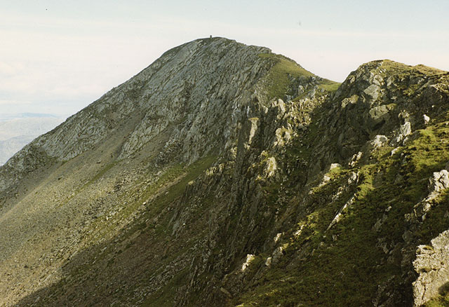
The summit of
Moelwyn Mawr. Seen from the final stages of the west ridge.
240:
135:
252:
754:
Click on a date/time to view the file as it appeared at that time.
205:
896:
180:
66:
190:
52° 59′ 06.9″ N, 4° 00′ 13.1″ W
871:
846:
881:
856:
836:
379:
Add a one-line explanation of what this file represents
891:
174:
Creative
Commons Attribution Share-alike license 2.0
110:
90:
Commons is a freely licensed media file repository.
548:
Creative
Commons Attribution-ShareAlike 2.0 Generic
56:(640 × 438 pixels, file size: 107 KB, MIME type:
348:https://creativecommons.org/licenses/by-sa/2.0
71:
354:Creative Commons Attribution-Share Alike 2.0
272:
8:
652:
314:– to copy, distribute and transmit the work
914:
756:
375:
829:The following other wikis use this file:
462:https://www.geograph.org.uk/profile/15376
604:https://www.geograph.org.uk/photo/874878
958:
950:
940:
932:
924:
916:
862:Moelwyn Mawr copa'r crib gogleddol
816:
732:
716:
676:
660:
581:
565:
545:
529:
509:
493:
426:
410:
393:
390:
371:
364:
183:
212:View this and other nearby images on:
7:
259:and is licensed for reuse under the
745:
295:Attribution-Share Alike 2.0 Generic
283:
278:
263:Attribution-ShareAlike 2.0 license.
907:
384:
378:
269:
246:
120:
103:
49:
383:
663:coordinates of the point of view
369:
325:Under the following conditions:
290:This file is licensed under the
282:
277:
271:
239:
218:
204:
196:
70:
31:
21:
366:
121:
46:No higher resolution available.
14:
584:file available on the internet
365:
247:This image was taken from the
116:The summit of Moelwyn Mawr.jpg
52:The_summit_of_Moelwyn_Mawr.jpg
26:
1:
36:
946:Adobe Photoshop Elements 2.0
634:Geograph Britain and Ireland
440:object of statement has role
391:Items portrayed in this file
195:
868:Usage on lld.wikipedia.org
843:Usage on ceb.wikipedia.org
678:52°59'6.904"N, 4°0'13.100"W
982:
888:Usage on www.wikidata.org
878:Usage on sv.wikipedia.org
853:Usage on cy.wikipedia.org
833:Usage on br.wikipedia.org
339:same or compatible license
952:File change date and time
746:
16:
612:geograph.org.uk image ID
368:
305:
77:This is a file from the
803:
162:
152:
141:
134:
131:
113:
81:. Information from its
253:this photograph's page
224:52.985251; -4.003639
84:description page there
926:Horizontal resolution
782:13:01, 24 April 2010
934:Vertical resolution
320:– to adapt the work
955:00:47, 7 July 2008
897:User:Jura1/cy/p131
470:author name string
969:
968:
825:Global file usage
807:
654:
532:copyright license
377:
268:
267:
251:collection. See
229:
228:
178:
177:
171:
168:Reusing this file
99:
98:
79:Wikimedia Commons
32:Global file usage
973:
915:
794:
700:
699:
694:
636:
631:
621:
616:
606:
601:
597:described at URL
496:copyright status
477:
474:
464:
459:
449:
444:
361:
358:
355:
352:
349:
341:as the original.
303:
292:Creative Commons
286:
285:
281:
280:
275:
274:
261:Creative Commons
249:Geograph project
243:
236:
225:
222:
208:
207:
201:
200:
199:
193:
192:
181:
165:
137:
125:
117:
111:
95:
74:
73:
67:
61:
59:
981:
980:
976:
975:
974:
972:
971:
970:
903:
823:
815:
808:
800:
792:
748:
747:
744:
743:
742:
741:
740:
739:
738:
737:
735:
725:
724:
723:
721:
710:
709:
708:
707:
706:
705:
704:
703:
702:
701:
697:
695:
692:
683:
682:
681:
679:
669:
668:
667:
665:
646:
645:
644:
643:
642:
641:
640:
639:
638:
637:
632:
629:
623:
622:
617:
614:
608:
607:
602:
599:
590:
589:
588:
586:
574:
573:
572:
570:
559:
558:
557:
556:
555:
554:
553:
552:
550:
538:
537:
536:
534:
523:
522:
521:
520:
519:
518:
517:
516:
514:
502:
501:
500:
498:
487:
486:
485:
484:
483:
482:
481:
480:
479:
478:
475:
472:
466:
465:
460:
457:
451:
450:
445:
442:
433:
432:
431:
429:
419:
418:
417:
415:
404:
403:
402:
401:
400:
398:
382:
381:
380:
363:
362:
359:
356:
353:
350:
347:
346:
304:
301:
298:
287:
264:
234:
223:
197:
188:
187:
184:Camera location
179:
147:geograph.org.uk
127:
115:
108:
101:
100:
89:
88:
87:is shown below.
63:
57:
55:
48:
47:
12:
11:
5:
979:
977:
967:
966:
963:
957:
956:
953:
949:
948:
943:
939:
938:
935:
931:
930:
927:
923:
922:
919:
906:
902:
901:
900:
899:
894:
886:
885:
884:
876:
875:
874:
866:
865:
864:
859:
851:
850:
849:
841:
840:
839:
827:
826:
822:
821:
813:
812:
811:
806:
805:
802:
798:
795:
789:
784:
779:
775:
774:
771:
768:
765:
762:
759:
752:
751:
736:
733:
731:
730:
729:
728:
727:
726:
722:
717:
715:
714:
713:
712:
711:
688:
687:
686:
685:
684:
680:
677:
675:
674:
673:
672:
671:
670:
666:
661:
659:
658:
657:
656:
650:
625:
624:
610:
609:
595:
594:
593:
592:
591:
587:
582:
580:
579:
578:
577:
576:
575:
571:
568:source of file
566:
564:
563:
562:
561:
560:
551:
546:
544:
543:
542:
541:
540:
539:
535:
530:
528:
527:
526:
525:
524:
515:
510:
508:
507:
506:
505:
504:
503:
499:
494:
492:
491:
490:
489:
488:
468:
467:
453:
452:
438:
437:
436:
435:
434:
430:
427:
425:
424:
423:
422:
421:
420:
416:
411:
409:
408:
407:
406:
405:
399:
394:
392:
389:
388:
387:
386:
385:
374:
373:
370:
367:
345:
344:
343:
342:
332:
323:
322:
321:
315:
308:You are free:
299:
289:
288:
270:
266:
265:
244:
233:
230:
227:
226:
216:
210:
185:
176:
175:
172:
160:
159:
154:
150:
149:
143:
139:
138:
133:
129:
128:
118:
109:
107:
104:
102:
97:
96:
75:
65:
64:
45:
41:
40:
39:
34:
29:
24:
19:
13:
10:
9:
6:
4:
3:
2:
978:
964:
962:
959:
954:
951:
947:
944:
942:Software used
941:
936:
933:
928:
925:
920:
917:
913:
910:
904:
898:
895:
893:
890:
889:
887:
883:
880:
879:
877:
873:
870:
869:
867:
863:
860:
858:
855:
854:
852:
848:
845:
844:
842:
838:
835:
834:
832:
831:
830:
824:
820:
817:
809:
801:
796:
790:
788:
785:
783:
780:
777:
776:
772:
769:
766:
763:
760:
758:
757:
755:
749:
720:
691:
664:
635:
628:
620:
613:
605:
598:
585:
569:
549:
533:
513:
497:
471:
463:
456:
448:
441:
414:
397:
351:CC BY-SA 2.0
340:
336:
333:
330:
327:
326:
324:
319:
316:
313:
310:
309:
307:
306:
300:Attribution:
296:
293:
276:
262:
258:
254:
250:
245:
242:
238:
237:
231:
221:
217:
215:
214:OpenStreetMap
211:
209:
191:
186:
182:
173:
169:
164:
161:
158:
155:
151:
148:
144:
140:
130:
124:
119:
112:
105:
93:
86:
85:
80:
76:
69:
68:
62:
53:
44:
38:
35:
33:
30:
28:
25:
23:
20:
18:
15:
965:Uncalibrated
911:
908:
882:Moelwyn Mawr
872:Moelwyn Mawr
857:Moelwyn Mawr
847:Moelwyn Mawr
837:Moelwyn Mawr
828:
819:Moelwyn Mawr
753:
750:File history
447:photographer
334:
328:
317:
311:
256:
194:
122:
92:You can help
82:
50:
22:File history
961:Color space
918:Orientation
512:copyrighted
476:Nigel Brown
335:share alike
329:attribution
302:Nigel Brown
257:Nigel Brown
157:Nigel Brown
114:Description
810:File usage
791:640 × 438
767:Dimensions
428:some value
163:Permission
58:image/jpeg
27:File usage
764:Thumbnail
761:Date/Time
719:inception
232:Licensing
123:English:
905:Metadata
892:Q6890193
793:(107 KB)
627:operator
372:Captions
318:to remix
312:to share
297:license.
37:Metadata
937:800 dpi
929:800 dpi
778:current
773:Comment
690:heading
649:heading
413:creator
396:depicts
376:English
106:Summary
54:
921:Normal
698:degree
653:degree
619:874878
202:
153:Author
142:Source
799:Bjh21
145:From
770:User
734:1988
696:112
360:true
357:true
136:1988
132:Date
17:File
455:URL
693::
630::
615::
600::
473::
458::
443::
170:)
166:(
94:.
60:)
Text is available under the Creative Commons Attribution-ShareAlike License. Additional terms may apply.
