343:
276:
226:
268:
218:
290:
240:
311:
349:
354:
67:
819:"}},"text\/plain":{"en":{"":"heading"}}},"{\"value\":{\"amount\":\"+135\",\"unit\":\"http:\\\/\\\/www.wikidata.org\\\/entity\\\/Q28390\"},\"type\":\"quantity\"}":{"text\/html":{"en":{"P7787":"135
634:"}},"text\/plain":{"en":{"":"heading"}}},"{\"value\":{\"amount\":\"+135\",\"unit\":\"http:\\\/\\\/www.wikidata.org\\\/entity\\\/Q28390\"},\"type\":\"quantity\"}":{"text\/html":{"en":{"P7787":"135
955:
815:
209:
38:
401:– You must give appropriate credit, provide a link to the license, and indicate if changes were made. You may do so in any reasonable manner, but not in any way that suggests the licensor endorses you or your use.
78:
46:
816:
631:
972:== {{int:filedesc}} == {{Information |description={{en|1=The 'Three Ships' Birchen Edge}} |date=2008-04-04 |source=From |author= |permission= |o
954:
949:
37:
751:
617:
581:
283:
233:
786:
318:
997:
This file contains additional information, probably added from the digital camera or scanner used to create or digitize it.
408:
529:
886:
857:
830:
764:
735:
672:
645:
565:
537:
522:
509:
794:
779:
701:
601:
482:
465:
305:
364:
1000:
If the file has been modified from its original state, some details may not fully reflect the modified file.
982:
The following pages on the
English Knowledge (XXG) use this file (pages on other projects are not listed):
407:– If you remix, transform, or build upon the material, you must distribute your contributions under the
325:
on the
Geograph website for the photographer's contact details. The copyright on this image is owned by
965:
361:
823:"}},"text\/plain":{"en":{"P7787":"135 degree"}}}}": -->
638:"}},"text\/plain":{"en":{"P7787":"135 degree"}}}}": -->
86:
178:
801:
771:
544:
162:
289:
239:
330:
73:
986:
130:
273:
223:
141:
151:
310:
322:
47:
The_'Three_Ships'_Birchen_Edge_-_geograph.org.uk_-_1143134.jpg
922:
Click on a date/time to view the file as it appeared at that time.
275:
225:
250:
200:
111:
The 'Three Ships' Birchen Edge - geograph.org.uk - 1143134.jpg
61:
260:
53° 15′ 08″ N, 1° 34′ 57″ W
210:
53° 15′ 10″ N, 1° 35′ 00″ W
449:
Add a one-line explanation of what this file represents
105:
85:
Commons is a freely licensed media file repository.
618:
Creative
Commons Attribution-ShareAlike 2.0 Generic
51:(640 × 480 pixels, file size: 76 KB, MIME type:
418:https://creativecommons.org/licenses/by-sa/2.0
66:
424:Creative Commons Attribution-Share Alike 2.0
342:
8:
820:
635:
384:– to copy, distribute and transmit the work
1002:
924:
445:
802:https://www.geograph.org.uk/photo/1143134
545:https://www.geograph.org.uk/profile/4335
1004:
984:
900:
884:
844:
828:
749:
733:
715:
699:
659:
643:
615:
599:
579:
563:
496:
480:
463:
460:
441:
434:
253:
203:
282:View this and other nearby images on:
232:View this and other nearby images on:
7:
329:and is licensed for reuse under the
913:
365:Attribution-Share Alike 2.0 Generic
353:
348:
333:Attribution-ShareAlike 2.0 license.
995:
454:
448:
339:
316:
115:
98:
44:
453:
646:coordinates of the point of view
439:
395:Under the following conditions:
360:This file is licensed under the
352:
347:
341:
309:
288:
274:
266:
238:
224:
216:
65:
21:
436:
116:
41:No higher resolution available.
14:
752:file available on the internet
435:
317:This image was taken from the
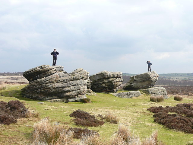
193:The 'Three Ships' Birchen Edge
174:The 'Three Ships' Birchen Edge
121:The 'Three Ships' Birchen Edge
26:
1:
831:coordinates of depicted place
31:
787:Geograph Britain and Ireland
523:object of statement has role
461:Items portrayed in this file
265:
215:
1026:
846:53°15'8.10"N, 1°34'57.00"W
409:same or compatible license
914:
16:
765:geograph.org.uk image ID
661:53°15'9.7"N, 1°34'59.5"W
438:
375:
72:This is a file from the
971:
950:08:19, 25 February 2011
191:Colin Park /
172:Colin Park /
163:required by the license
147:
136:
129:
126:
108:
76:. Information from its
323:this photograph's page
294:53.252250; -1.582500
244:53.252700; -1.583200
79:description page there
390:– to adapt the work
510:author name string
1013:
1012:
975:
822:
637:
602:copyright license
447:
338:
337:
321:collection. See
299:
298:
249:
248:
198:
197:
166:
94:
93:
74:Wikimedia Commons
1017:
1003:
962:
868:
867:
862:
804:
799:
795:described at URL
789:
784:
774:
769:
683:
682:
677:
566:copyright status
547:
542:
532:
527:
517:
514:
431:
428:
425:
422:
419:
411:as the original.
373:
362:Creative Commons
356:
355:
351:
350:
345:
344:
331:Creative Commons
319:Geograph project
313:
306:
295:
292:
278:
277:
271:
270:
269:
263:
262:
251:
245:
242:
228:
227:
221:
220:
219:
213:
212:
201:
160:
132:
120:
112:
106:
90:
69:
68:
62:
56:
54:
1025:
1024:
1020:
1019:
1018:
1016:
1015:
1014:
991:
983:
976:
968:
960:
916:
915:
912:
911:
910:
909:
908:
907:
906:
905:
903:
893:
892:
891:
889:
878:
877:
876:
875:
874:
873:
872:
871:
870:
869:
865:
863:
860:
851:
850:
849:
847:
837:
836:
835:
833:
814:
813:
812:
811:
810:
809:
808:
807:
806:
805:
800:
797:
791:
790:
785:
782:
776:
775:
770:
767:
758:
757:
756:
754:
742:
741:
740:
738:
727:
726:
725:
724:
723:
722:
721:
720:
718:
708:
707:
706:
704:
693:
692:
691:
690:
689:
688:
687:
686:
685:
684:
680:
678:
675:
666:
665:
664:
662:
652:
651:
650:
648:
629:
628:
627:
626:
625:
624:
623:
622:
620:
608:
607:
606:
604:
593:
592:
591:
590:
589:
588:
587:
586:
584:
572:
571:
570:
568:
557:
556:
555:
554:
553:
552:
551:
550:
549:
548:
543:
540:
534:
533:
528:
525:
519:
518:
515:
512:
503:
502:
501:
499:
489:
488:
487:
485:
474:
473:
472:
471:
470:
468:
452:
451:
450:
433:
432:
429:
426:
423:
420:
417:
416:
374:
371:
368:
357:
334:
304:
293:
267:
258:
257:
254:Object location
243:
217:
208:
207:
204:Camera location
199:
188:
181:
169:
142:geograph.org.uk
122:
110:
103:
96:
95:
84:
83:
82:is shown below.
58:
52:
50:
43:
42:
12:
11:
5:
1023:
1021:
1011:
1010:
1007:
994:
990:
989:
981:
980:
979:
974:
973:
970:
966:
963:
957:
952:
947:
943:
942:
939:
936:
933:
930:
927:
920:
919:
904:
901:
899:
898:
897:
896:
895:
894:
890:
885:
883:
882:
881:
880:
879:
856:
855:
854:
853:
852:
848:
845:
843:
842:
841:
840:
839:
838:
834:
829:
827:
826:
825:
824:
818:
793:
792:
778:
777:
763:
762:
761:
760:
759:
755:
750:
748:
747:
746:
745:
744:
743:
739:
736:source of file
734:
732:
731:
730:
729:
728:
719:
716:
714:
713:
712:
711:
710:
709:
705:
700:
698:
697:
696:
695:
694:
671:
670:
669:
668:
667:
663:
660:
658:
657:
656:
655:
654:
653:
649:
644:
642:
641:
640:
639:
633:
621:
616:
614:
613:
612:
611:
610:
609:
605:
600:
598:
597:
596:
595:
594:
585:
580:
578:
577:
576:
575:
574:
573:
569:
564:
562:
561:
560:
559:
558:
536:
535:
521:
520:
508:
507:
506:
505:
504:
500:
497:
495:
494:
493:
492:
491:
490:
486:
481:
479:
478:
477:
476:
475:
469:
464:
462:
459:
458:
457:
456:
455:
444:
443:
440:
437:
415:
414:
413:
412:
402:
393:
392:
391:
385:
378:You are free:
369:
359:
358:
340:
336:
335:
314:
303:
300:
297:
296:
286:
280:
255:
247:
246:
236:
230:
205:
196:
195:
189:
186:
183:
182:
177:
170:
167:
155:
154:
149:
145:
144:
138:
134:
133:
128:
124:
123:
113:
104:
102:
99:
97:
92:
91:
70:
60:
59:
40:
36:
35:
34:
29:
24:
19:
13:
10:
9:
6:
4:
3:
2:
1022:
1008:
1005:
1001:
998:
992:
988:
985:
977:
969:
964:
958:
956:
953:
951:
948:
945:
944:
940:
937:
934:
931:
928:
926:
925:
923:
917:
888:
859:
832:
803:
796:
788:
781:
773:
766:
753:
737:
703:
674:
647:
619:
603:
583:
567:
546:
539:
531:
524:
511:
484:
467:
421:CC BY-SA 2.0
410:
406:
403:
400:
397:
396:
394:
389:
386:
383:
380:
379:
377:
376:
370:Attribution:
366:
363:
346:
332:
328:
324:
320:
315:
312:
308:
307:
301:
291:
287:
285:
284:OpenStreetMap
281:
279:
261:
256:
252:
241:
237:
235:
234:OpenStreetMap
231:
229:
211:
206:
202:
194:
190:
185:
184:
180:
176: /
175:
171:
164:
159:
157:
156:
153:
150:
146:
143:
139:
135:
125:
119:
114:
107:
100:
88:
81:
80:
75:
71:
64:
63:
57:
48:
39:
33:
30:
28:
25:
23:
20:
18:
15:
999:
996:
987:Birchen Edge
921:
918:File history
717:4 April 2008
530:photographer
404:
398:
387:
381:
326:
264:
214:
192:
179:CC BY-SA 2.0
173:
131:4 April 2008
117:
87:You can help
77:
45:
22:File history
967:GeographBot
582:copyrighted
405:share alike
399:attribution
158:Attribution
109:Description
1006:_error
978:File usage
959:640 × 480
935:Dimensions
902:image/jpeg
887:media type
516:Colin Park
498:some value
372:Colin Park
327:Colin Park
152:Colin Park
53:image/jpeg
27:File usage
932:Thumbnail
929:Date/Time
702:inception
302:Licensing
187:InfoField
168:InfoField
118:English:
993:Metadata
780:operator
442:Captions
388:to remix
382:to share
367:license.
32:Metadata
961:(76 KB)
946:current
941:Comment
858:heading
817:heading
772:1143134
673:heading
632:heading
483:creator
466:depicts
446:English
101:Summary
49:
866:degree
821:degree
681:degree
636:degree
272:
222:
148:Author
137:Source
140:From
938:User
864:135
679:135
430:true
427:true
127:Date
17:File
538:URL
861::
798::
783::
768::
676::
541::
526::
513::
1009:0
165:)
161:(
89:.
55:)
Text is available under the Creative Commons Attribution-ShareAlike License. Additional terms may apply.
_heading:135.00&language=en)
_heading:135.00&language=en)
