300:
233:
225:
247:
268:
306:
311:
151:
67:
610:"}},"text\/plain":{"en":{"":"heading"}}},"{\"value\":{\"amount\":\"+90\",\"unit\":\"http:\\\/\\\/www.wikidata.org\\\/entity\\\/Q28390\"},\"type\":\"quantity\"}":{"text\/html":{"en":{"P7787":"90
606:
358:– You must give appropriate credit, provide a link to the license, and indicate if changes were made. You may do so in any reasonable manner, but not in any way that suggests the licensor endorses you or your use.
216:
915:
607:
38:
121:
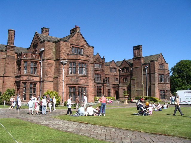
Thornton Manor Open day at
Thornton Manor, for many years the home of the Lever family who had established their soap business in nearby Port Sunlight in the 1880s.
968:
905:
925:
920:
814:
727:
593:
557:
240:
762:
438:
275:
365:
505:
798:
740:
711:
648:
621:
541:
513:
498:
485:
900:
770:
755:
677:
577:
458:
422:
78:
262:
930:
46:
321:
364:– If you remix, transform, or build upon the material, you must distribute your contributions under the
282:
on the
Geograph website for the photographer's contact details. The copyright on this image is owned by
318:
134:
879:
614:"}},"text\/plain":{"en":{"P7787":"90 degree"}}}}": -->
156:
86:
129:
777:
747:
520:
978:
940:
935:
910:
246:
958:
868:
863:
287:
73:
37:
230:
988:
178:
199:
189:
267:
160:
279:
836:
Click on a date/time to view the file as it appeared at that time.
150:
1013:
232:
217:
53° 19′ 41.83″ N, 3° 03′ 09.52″ W
207:
145:
61:
993:
916:
List of houses and associated buildings by John
Douglas
406:
Add a one-line explanation of what this file represents
1003:
123:
105:
85:
Commons is a freely licensed media file repository.
594:
Creative
Commons Attribution-ShareAlike 2.0 Generic
51:(640 × 480 pixels, file size: 93 KB, MIME type:
375:https://creativecommons.org/licenses/by-sa/2.0
66:
381:Creative Commons Attribution-Share Alike 2.0
299:
8:
611:
341:– to copy, distribute and transmit the work
838:
402:
951:The following other wikis use this file:
778:https://www.geograph.org.uk/photo/1148949
521:https://www.geograph.org.uk/profile/34020
959:Grade II* listed buildings in Merseyside
906:Grade II* listed buildings in Merseyside
898:
812:
796:
725:
709:
691:
675:
635:
619:
591:
575:
555:
539:
472:
456:
436:
420:
417:
398:
391:
210:
239:View this and other nearby images on:
989:Protocollo sull'Irlanda del Nord
896:The following 9 pages use this file:
7:
286:and is licensed for reuse under the
827:
322:Attribution-Share Alike 2.0 Generic
310:
305:
290:Attribution-ShareAlike 2.0 license.
979:An Prótacal um Thuaisceart Éireann
926:Listed buildings in Thornton Hough
411:
405:
296:
273:
127:
115:
98:
44:
921:List of works by Grayson and Ould
410:
622:coordinates of the point of view
396:
352:Under the following conditions:
317:This file is licensed under the
309:
304:
298:
266:
245:
231:
223:
149:
65:
31:
21:
393:
166:with data related to this item.
116:
41:No higher resolution available.
14:
728:file available on the internet
392:
274:This image was taken from the
26:
1:
763:Geograph Britain and Ireland
499:object of statement has role
418:Items portrayed in this file
955:Usage on dag.wikipedia.org
901:Brexit and the Irish border
637:53°19'41.826"N, 3°3'9.522"W
222:
1032:
1010:Usage on zh.wikipedia.org
1000:Usage on www.wikidata.org
985:Usage on it.wikipedia.org
975:Usage on ga.wikipedia.org
965:Usage on fa.wikipedia.org
366:same or compatible license
931:Northern Ireland Protocol
828:
16:
741:geograph.org.uk image ID
395:
332:
72:This is a file from the
885:
195:
184:
177:
174:
148:
108:
76:. Information from its
280:this photograph's page
251:53.328285; -3.052645
79:description page there
161:entry Thornton Manor
1014:User:Johnson.Xia/NRP
799:location of creation
969:پروتکل ایرلند شمالی
864:16:12, 7 April 2009
347:– to adapt the work
128:This is a photo of
111:Thornton Manor.jpeg
47:Thornton_Manor.jpeg
486:author name string
947:Global file usage
889:
613:
578:copyright license
404:
295:
294:
278:collection. See
256:
255:
205:
204:
170:
169:
164:
144:
143:
94:
93:
74:Wikimedia Commons
32:Global file usage
1023:
876:
780:
775:
771:described at URL
765:
760:
750:
745:
659:
658:
653:
542:copyright status
523:
518:
508:
503:
493:
490:
388:
385:
382:
379:
376:
368:as the original.
330:
319:Creative Commons
313:
312:
308:
307:
302:
301:
288:Creative Commons
276:Geograph project
270:
263:
252:
249:
235:
234:
228:
227:
226:
220:
219:
208:
180:
162:
153:
146:
137:
124:
120:
112:
106:
90:
69:
68:
62:
56:
54:
1031:
1030:
1026:
1025:
1024:
1022:
1021:
1020:
945:
890:
882:
874:
830:
829:
826:
825:
824:
823:
822:
821:
820:
819:
817:
805:
804:
803:
801:
790:
789:
788:
787:
786:
785:
784:
783:
782:
781:
776:
773:
767:
766:
761:
758:
752:
751:
746:
743:
734:
733:
732:
730:
718:
717:
716:
714:
703:
702:
701:
700:
699:
698:
697:
696:
694:
684:
683:
682:
680:
669:
668:
667:
666:
665:
664:
663:
662:
661:
660:
656:
654:
651:
642:
641:
640:
638:
628:
627:
626:
624:
605:
604:
603:
602:
601:
600:
599:
598:
596:
584:
583:
582:
580:
569:
568:
567:
566:
565:
564:
563:
562:
560:
548:
547:
546:
544:
533:
532:
531:
530:
529:
528:
527:
526:
525:
524:
519:
516:
510:
509:
504:
501:
495:
494:
491:
488:
479:
478:
477:
475:
465:
464:
463:
461:
450:
449:
448:
447:
446:
445:
444:
443:
441:
429:
428:
427:
425:
409:
408:
407:
390:
389:
386:
383:
380:
377:
374:
373:
331:
328:
325:
314:
291:
261:
250:
224:
215:
214:
211:Camera location
206:
190:geograph.org.uk
139:
133:
130:listed building
122:
110:
103:
96:
95:
84:
83:
82:is shown below.
58:
52:
50:
43:
42:
12:
11:
5:
1029:
1027:
1019:
1018:
1017:
1016:
1008:
1007:
1006:
998:
997:
996:
994:Thornton Manor
991:
983:
982:
981:
973:
972:
971:
963:
962:
961:
949:
948:
944:
943:
941:Thornton Manor
938:
936:Thornton Hough
933:
928:
923:
918:
913:
911:Irish backstop
908:
903:
894:
893:
888:
887:
884:
881:Peter I. Vardy
880:
877:
871:
866:
861:
857:
856:
853:
850:
847:
844:
841:
834:
833:
818:
813:
811:
810:
809:
808:
807:
806:
802:
797:
795:
794:
793:
792:
791:
769:
768:
754:
753:
739:
738:
737:
736:
735:
731:
726:
724:
723:
722:
721:
720:
719:
715:
712:source of file
710:
708:
707:
706:
705:
704:
695:
692:
690:
689:
688:
687:
686:
685:
681:
676:
674:
673:
672:
671:
670:
647:
646:
645:
644:
643:
639:
636:
634:
633:
632:
631:
630:
629:
625:
620:
618:
617:
616:
615:
609:
597:
592:
590:
589:
588:
587:
586:
585:
581:
576:
574:
573:
572:
571:
570:
561:
556:
554:
553:
552:
551:
550:
549:
545:
540:
538:
537:
536:
535:
534:
512:
511:
497:
496:
492:John Robertson
484:
483:
482:
481:
480:
476:
473:
471:
470:
469:
468:
467:
466:
462:
457:
455:
454:
453:
452:
451:
442:
439:Thornton Manor
437:
435:
434:
433:
432:
431:
430:
426:
421:
419:
416:
415:
414:
413:
412:
401:
400:
397:
394:
372:
371:
370:
369:
359:
350:
349:
348:
342:
335:You are free:
329:John Robertson
326:
316:
315:
297:
293:
292:
284:John Robertson
271:
260:
257:
254:
253:
243:
237:
212:
203:
202:
200:John Robertson
197:
193:
192:
186:
182:
181:
176:
172:
171:
168:
167:
154:
142:
141:
113:
104:
102:
99:
97:
92:
91:
70:
60:
59:
40:
36:
35:
34:
29:
24:
19:
13:
10:
9:
6:
4:
3:
2:
1028:
1015:
1012:
1011:
1009:
1005:
1002:
1001:
999:
995:
992:
990:
987:
986:
984:
980:
977:
976:
974:
970:
967:
966:
964:
960:
957:
956:
954:
953:
952:
946:
942:
939:
937:
934:
932:
929:
927:
924:
922:
919:
917:
914:
912:
909:
907:
904:
902:
899:
897:
891:
883:
878:
872:
870:
867:
865:
862:
859:
858:
854:
851:
848:
845:
842:
840:
839:
837:
831:
816:
800:
779:
772:
764:
757:
749:
742:
729:
713:
679:
650:
623:
595:
579:
559:
543:
522:
515:
507:
500:
487:
460:
440:
424:
378:CC BY-SA 2.0
367:
363:
360:
357:
354:
353:
351:
346:
343:
340:
337:
336:
334:
333:
327:Attribution:
323:
320:
303:
289:
285:
281:
277:
272:
269:
265:
264:
258:
248:
244:
242:
241:OpenStreetMap
238:
236:
218:
213:
209:
201:
198:
194:
191:
187:
183:
173:
165:
158:
155:
152:
147:
140:
136:
131:
126:
125:
119:
114:
107:
100:
88:
81:
80:
75:
71:
64:
63:
57:
48:
39:
33:
30:
28:
25:
23:
20:
18:
15:
950:
895:
835:
832:File history
506:photographer
361:
355:
344:
338:
283:
221:
117:
87:You can help
77:
45:
22:File history
693:30 May 2005
558:copyrighted
362:share alike
356:attribution
179:30 May 2005
109:Description
892:File usage
873:640 × 480
849:Dimensions
474:some value
163:(Q7796547)
53:image/jpeg
27:File usage
846:Thumbnail
843:Date/Time
678:inception
259:Licensing
118:English:
1004:Q7796547
756:operator
399:Captions
345:to remix
339:to share
324:license.
157:Wikidata
875:(93 KB)
860:current
855:Comment
748:1148949
649:heading
608:heading
459:creator
423:depicts
403:English
135:1075420
132:number
101:Summary
49:
815:Wirral
657:degree
612:degree
229:
196:Author
185:Source
188:From
852:User
387:true
384:true
175:Date
159:has
17:File
655:90
514:URL
774::
759::
744::
652::
517::
502::
489::
138:.
89:.
55:)
Text is available under the Creative Commons Attribution-ShareAlike License. Additional terms may apply.
