38:
386:
319:
269:
311:
261:
333:
283:
354:
392:
397:
94:
862:"}},"text\/plain":{"en":{"":"heading"}}},"{\"value\":{\"amount\":\"+90\",\"unit\":\"http:\\\/\\\/www.wikidata.org\\\/entity\\\/Q28390\"},\"type\":\"quantity\"}":{"text\/html":{"en":{"P7787":"90
798:"}},"text\/plain":{"en":{"":"heading"}}},"{\"value\":{\"amount\":\"+90\",\"unit\":\"http:\\\/\\\/www.wikidata.org\\\/entity\\\/Q28390\"},\"type\":\"quantity\"}":{"text\/html":{"en":{"P7787":"90
794:
302:
252:
444:– You must give appropriate credit, provide a link to the license, and indicate if changes were made. You may do so in any reasonable manner, but not in any way that suggests the licensor endorses you or your use.
60:
56:
52:
48:
42:
105:
73:
859:
795:
189:
696:
660:
624:
326:
276:
716:
994:
361:
963:
958:
451:
64:
37:
974:
587:
900:
873:
836:
809:
739:
680:
608:
580:
567:
552:
767:
724:
709:
644:
525:
508:
348:
407:
990:
The following pages on the
English Knowledge (XXG) use this file (pages on other projects are not listed):
450:– If you remix, transform, or build upon the material, you must distribute your contributions under the
368:
on the
Geograph website for the photographer's contact details. The copyright on this image is owned by
404:
866:"}},"text\/plain":{"en":{"P7787":"90 degree"}}}}": -->
802:"}},"text\/plain":{"en":{"P7787":"90 degree"}}}}": -->
113:
221:
746:
731:
559:
205:
332:
282:
373:
100:
266:
157:
316:
178:
168:
353:
365:
931:
Click on a date/time to view the file as it appeared at that time.
318:
268:
253:
58° 23′ 25.23″ N, 3° 08′ 10.44″ W
293:
243:
88:
303:
58° 23′ 25.4″ N, 3° 08′ 10″ W
138:
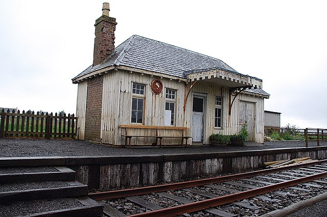
Thrumster
Railway Station - geograph.org.uk - 2448109.jpg
492:
Add a one-line explanation of what this file represents
1012:
78:(1,600 × 1,061 pixels, file size: 482 KB, MIME type:
196:
Creative
Commons Attribution Share-alike license 2.0
132:
112:
Commons is a freely licensed media file repository.
661:
Creative
Commons Attribution-ShareAlike 2.0 Generic
461:https://creativecommons.org/licenses/by-sa/2.0
93:
467:Creative Commons Attribution-Share Alike 2.0
385:
8:
863:
799:
427:– to copy, distribute and transmit the work
933:
488:
1005:The following other wikis use this file:
732:https://www.geograph.org.uk/photo/2448109
560:https://www.geograph.org.uk/profile/61790
992:
887:
871:
823:
807:
781:
765:
694:
678:
658:
642:
622:
606:
539:
523:
506:
503:
484:
477:
296:
246:
325:View this and other nearby images on:
275:View this and other nearby images on:
7:
372:and is licensed for reuse under the
922:
408:Attribution-Share Alike 2.0 Generic
396:
391:
376:Attribution-ShareAlike 2.0 license.
497:
491:
382:
359:
142:
125:
71:
496:
810:coordinates of the point of view
482:
438:Under the following conditions:
403:This file is licensed under the
395:
390:
384:
352:
331:
317:
309:
281:
267:
259:
92:
31:
21:
976:File Upload Bot (Magnus Manske)
479:
143:
14:
995:Wick and Lybster Light Railway
697:file available on the internet
478:
360:This image was taken from the
26:
1:
874:coordinates of depicted place
825:58°23'25.228"N, 3°8'10.442"W
717:Geograph Britain and Ireland
581:object of statement has role
504:Items portrayed in this file
308:
258:
1031:
1009:Usage on www.wikidata.org
889:58°23'25.40"N, 3°8'10.32"W
452:same or compatible license
923:
236:Thrumster Railway Station
234:Glen Breaden /
217:Thrumster Railway Station
215:Glen Breaden /
148:Thrumster Railway Station
16:
740:geograph.org.uk image ID
481:
418:
99:This is a file from the
980:
206:required by the license
184:
174:
163:
156:
153:
135:
103:. Information from its
959:22:52, 15 October 2012
366:this photograph's page
337:58.390390; -3.136200
287:58.390341; -3.136234
106:description page there
41:Size of this preview:
65:1,600 × 1,061 pixels
433:– to adapt the work
47:Other resolutions:
568:author name string
61:1,280 × 849 pixels
57:1,024 × 679 pixels
1001:Global file usage
983:
865:
801:
645:copyright license
490:
381:
380:
364:collection. See
342:
341:
292:
291:
241:
240:
209:
193:
190:Reusing this file
121:
120:
101:Wikimedia Commons
32:Global file usage
1022:
971:
911:
910:
905:
847:
846:
841:
749:
744:
734:
729:
725:described at URL
719:
714:
609:copyright status
590:
585:
575:
572:
562:
557:
474:
471:
468:
465:
462:
454:as the original.
416:
405:Creative Commons
399:
398:
394:
393:
388:
387:
374:Creative Commons
362:Geograph project
356:
349:
338:
335:
321:
320:
314:
313:
312:
306:
305:
294:
288:
285:
271:
270:
264:
263:
262:
256:
255:
244:
203:
187:
159:
147:
139:
133:
117:
96:
95:
89:
83:
81:
68:
53:640 × 424 pixels
49:320 × 212 pixels
43:800 × 531 pixels
1030:
1029:
1025:
1024:
1023:
1021:
1020:
1019:
999:
991:
984:
977:
969:
925:
924:
921:
920:
919:
918:
917:
916:
915:
914:
913:
912:
908:
906:
903:
894:
893:
892:
890:
880:
879:
878:
876:
857:
856:
855:
854:
853:
852:
851:
850:
849:
848:
844:
842:
839:
830:
829:
828:
826:
816:
815:
814:
812:
793:
792:
791:
790:
789:
788:
787:
786:
784:
774:
773:
772:
770:
759:
758:
757:
756:
755:
754:
753:
752:
751:
750:
745:
742:
736:
735:
730:
727:
721:
720:
715:
712:
703:
702:
701:
699:
687:
686:
685:
683:
672:
671:
670:
669:
668:
667:
666:
665:
663:
651:
650:
649:
647:
636:
635:
634:
633:
632:
631:
630:
629:
627:
615:
614:
613:
611:
600:
599:
598:
597:
596:
595:
594:
593:
592:
591:
586:
583:
577:
576:
573:
570:
564:
563:
558:
555:
546:
545:
544:
542:
532:
531:
530:
528:
517:
516:
515:
514:
513:
511:
495:
494:
493:
476:
475:
472:
469:
466:
463:
460:
459:
417:
414:
411:
400:
377:
347:
336:
310:
301:
300:
297:Object location
286:
260:
251:
250:
247:Camera location
242:
231:
224:
212:
169:geograph.org.uk
149:
137:
130:
123:
122:
111:
110:
109:is shown below.
85:
79:
77:
70:
69:
46:
12:
11:
5:
1028:
1026:
1018:
1017:
1016:
1015:
1003:
1002:
998:
997:
989:
988:
987:
982:
981:
979:
975:
972:
968:1,600 × 1,061
966:
961:
956:
952:
951:
948:
945:
942:
939:
936:
929:
928:
899:
898:
897:
896:
895:
891:
888:
886:
885:
884:
883:
882:
881:
877:
872:
870:
869:
868:
867:
861:
835:
834:
833:
832:
831:
827:
824:
822:
821:
820:
819:
818:
817:
813:
808:
806:
805:
804:
803:
797:
785:
782:
780:
779:
778:
777:
776:
775:
771:
766:
764:
763:
762:
761:
760:
738:
737:
723:
722:
708:
707:
706:
705:
704:
700:
695:
693:
692:
691:
690:
689:
688:
684:
681:source of file
679:
677:
676:
675:
674:
673:
664:
659:
657:
656:
655:
654:
653:
652:
648:
643:
641:
640:
639:
638:
637:
628:
623:
621:
620:
619:
618:
617:
616:
612:
607:
605:
604:
603:
602:
601:
579:
578:
566:
565:
551:
550:
549:
548:
547:
543:
540:
538:
537:
536:
535:
534:
533:
529:
524:
522:
521:
520:
519:
518:
512:
507:
505:
502:
501:
500:
499:
498:
487:
486:
483:
480:
458:
457:
456:
455:
445:
436:
435:
434:
428:
421:You are free:
412:
402:
401:
383:
379:
378:
357:
346:
343:
340:
339:
329:
323:
298:
290:
289:
279:
273:
248:
239:
238:
232:
229:
226:
225:
220:
213:
210:
198:
197:
194:
182:
181:
176:
172:
171:
165:
161:
160:
155:
151:
150:
140:
131:
129:
126:
124:
119:
118:
97:
87:
86:
40:
36:
35:
34:
29:
24:
19:
13:
10:
9:
6:
4:
3:
2:
1027:
1014:
1011:
1010:
1008:
1007:
1006:
1000:
996:
993:
985:
978:
973:
967:
965:
962:
960:
957:
954:
953:
949:
946:
943:
940:
937:
935:
934:
932:
926:
902:
875:
838:
811:
769:
748:
741:
733:
726:
718:
711:
698:
682:
662:
646:
626:
610:
589:
582:
569:
561:
554:
527:
510:
464:CC BY-SA 2.0
453:
449:
446:
443:
440:
439:
437:
432:
429:
426:
423:
422:
420:
419:
413:Attribution:
409:
406:
389:
375:
371:
367:
363:
358:
355:
351:
350:
344:
334:
330:
328:
327:OpenStreetMap
324:
322:
304:
299:
295:
284:
280:
278:
277:OpenStreetMap
274:
272:
254:
249:
245:
237:
233:
228:
227:
223:
219: /
218:
214:
207:
202:
200:
199:
195:
191:
186:
183:
180:
177:
173:
170:
166:
162:
152:
146:
141:
134:
127:
115:
108:
107:
102:
98:
91:
90:
84:
75:
74:Original file
66:
62:
58:
54:
50:
44:
39:
33:
30:
28:
25:
23:
20:
18:
15:
1004:
930:
927:File history
588:photographer
574:Glen Breaden
447:
441:
430:
424:
415:Glen Breaden
370:Glen Breaden
369:
307:
257:
235:
222:CC BY-SA 2.0
216:
179:Glen Breaden
144:
114:You can help
104:
72:
22:File history
783:26 May 2011
625:copyrighted
448:share alike
442:attribution
201:Attribution
158:26 May 2011
136:Description
986:File usage
944:Dimensions
541:some value
185:Permission
80:image/jpeg
27:File usage
941:Thumbnail
938:Date/Time
768:inception
345:Licensing
230:InfoField
211:InfoField
145:English:
1013:Q7998246
970:(482 KB)
710:operator
485:Captions
431:to remix
425:to share
410:license.
955:current
950:Comment
901:heading
860:heading
837:heading
796:heading
747:2448109
526:creator
509:depicts
489:English
128:Summary
76:
909:degree
864:degree
845:degree
800:degree
315:
265:
175:Author
164:Source
167:From
947:User
473:true
470:true
154:Date
17:File
907:90
843:90
553:URL
904::
840::
743::
728::
713::
584::
571::
556::
63:|
59:|
55:|
51:|
45:.
208:)
204:(
192:)
188:(
116:.
82:)
67:.
Text is available under the Creative Commons Attribution-ShareAlike License. Additional terms may apply.

_region:GB-GBN_heading:90.00&language=en)
