239:
178:
67:
336:
196:
191:
38:
371:
353:{{BotMoveToCommons|en.wikipedia}} {{Information |Description={{en|Detail of map made by the US Census Bureau and is in the public domain.
217:, commonwealth, county, municipality, or any other subdivision. This template also does not apply to postage stamp designs published by the
389:
221:
249:
This file has been identified as being free of known restrictions under copyright law, including all related and neighboring rights.
346:
218:
122:
78:
192:
work prepared by an officer or employee of the United States
Government as part of that person’s official duties
46:
214:
354:
225:
209:: This only applies to original works of the Federal Government and not to the work of any individual
228:
of
Compendium of U.S. Copyright Office Practices). It also does not apply to certain US coins; see
200:
86:
186:
248:
73:
335:
330:
37:
287:
210:
229:
292:
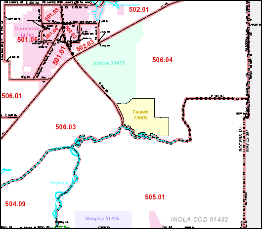
Detail of map made by the US Census Bureau and is in the public domain.
390:
Listă de comunități desemnate pentru recensământ din statul
Oklahoma
303:
Click on a date/time to view the file as it appeared at that time.
172:
61:
237:
279:
105:
85:
Commons is a freely licensed media file repository.
257:https://creativecommons.org/publicdomain/mark/1.0/
282:. All following user names refer to en.wikipedia.
51:(530 × 464 pixels, file size: 29 KB, MIME type:
66:
8:
372:List of census-designated places in Oklahoma
121:Detail of map made by the US Census Bureau
305:
152:
382:The following other wikis use this file:
369:
263:Creative Commons Public Domain Mark 1.0
190:in the United States because it is a
177:
7:
367:The following page uses this file:
278:The original description page was
277:
183:
115:
98:
44:
197:Title 17, Chapter 1, Section 105
176:
65:
31:
21:
348:File Upload Bot (Magnus Manske)
116:
41:No higher resolution available.
14:
26:
1:
219:United States Postal Service
124:and is in the public domain.
408:
386:Usage on ro.wikipedia.org
355:en:Category:Oklahoma maps
247:
16:
290:530×464×8 (30151 bytes)
230:The US Mint Terms of Use
72:This is a file from the
352:
137:
129:
108:
76:. Information from its
242:
79:description page there
241:
331:22:14, 20 April 2008
184:This work is in the
274:Original upload log
194:under the terms of
243:
111:Tiawah CDP map.png
47:Tiawah_CDP_map.png
378:Global file usage
360:
286:2007-02-02 21:55
254:
253:
233:
171:
170:
145:
144:
94:
93:
74:Wikimedia Commons
32:Global file usage
399:
343:
270:
267:
264:
261:
258:
240:
205:
180:
179:
173:
167:
164:
161:
158:
153:
120:
112:
106:
90:
69:
68:
62:
56:
54:
407:
406:
402:
401:
400:
398:
397:
396:
376:
361:
349:
341:
297:
296:
283:
276:
268:
265:
262:
259:
256:
238:
234:
165:
162:
159:
156:
151:
146:
125:
110:
103:
96:
95:
84:
83:
82:is shown below.
58:
52:
50:
43:
42:
12:
11:
5:
405:
403:
395:
394:
393:
392:
380:
379:
375:
374:
365:
364:
359:
358:
351:
347:
344:
338:
333:
328:
324:
323:
320:
317:
314:
311:
308:
301:
300:
295:
294:
275:
272:
252:
251:
245:
244:
235:
181:
169:
168:
150:
147:
143:
142:
139:
135:
134:
131:
127:
126:
113:
104:
102:
99:
97:
92:
91:
70:
60:
59:
40:
36:
35:
34:
29:
24:
19:
13:
10:
9:
6:
4:
3:
2:
404:
391:
388:
387:
385:
384:
383:
377:
373:
370:
368:
362:
356:
350:
345:
339:
337:
334:
332:
329:
326:
325:
321:
318:
315:
312:
309:
307:
306:
304:
298:
293:
289:
285:
284:
281:
273:
271:
250:
246:
236:
231:
227:
223:
220:
216:
212:
208:
203:
202:
198:
193:
189:
188:
187:public domain
182:
175:
174:
160:Public domain
157:Public domain
155:
154:
148:
140:
136:
132:
128:
123:
119:
114:
107:
100:
88:
81:
80:
75:
71:
64:
63:
57:
48:
39:
33:
30:
28:
25:
23:
20:
18:
15:
381:
366:
302:
299:File history
291:
255:
206:
195:
185:
117:
87:You can help
77:
45:
22:File history
226:313.6(C)(1)
109:Description
363:File usage
340:530 × 464
316:Dimensions
222:since 1978
211:U.S. state
27:File usage
313:Thumbnail
310:Date/Time
224:. (See §
215:territory
149:Licensing
118:English:
53:image/png
342:(29 KB)
327:current
322:Comment
201:US Code
199:of the
101:Summary
49:
141:US gov
138:Author
133:US gov
130:Source
288:OKtag
269:false
266:false
166:false
163:false
319:User
280:here
207:Note
17:File
260:PDM
357:}}
213:,
204:.
232:.
89:.
55:)
Text is available under the Creative Commons Attribution-ShareAlike License. Additional terms may apply.