363:
296:
246:
288:
238:
310:
260:
331:
369:
374:
62:
839:"}},"text\/plain":{"en":{"":"heading"}}},"{\"value\":{\"amount\":\"+270\",\"unit\":\"http:\\\/\\\/www.wikidata.org\\\/entity\\\/Q28390\"},\"type\":\"quantity\"}":{"text\/html":{"en":{"P7787":"270
775:"}},"text\/plain":{"en":{"":"heading"}}},"{\"value\":{\"amount\":\"+270\",\"unit\":\"http:\\\/\\\/www.wikidata.org\\\/entity\\\/Q28390\"},\"type\":\"quantity\"}":{"text\/html":{"en":{"P7787":"270
975:
771:
33:
229:
421:– You must give appropriate credit, provide a link to the license, and indicate if changes were made. You may do so in any reasonable manner, but not in any way that suggests the licensor endorses you or your use.
41:
73:
836:
772:
166:
974:
969:
32:
673:
637:
601:
303:
253:
693:
338:
428:
985:
564:
1010:
906:
877:
850:
813:
786:
716:
657:
585:
557:
544:
529:
744:
701:
686:
621:
502:
485:
325:
116:
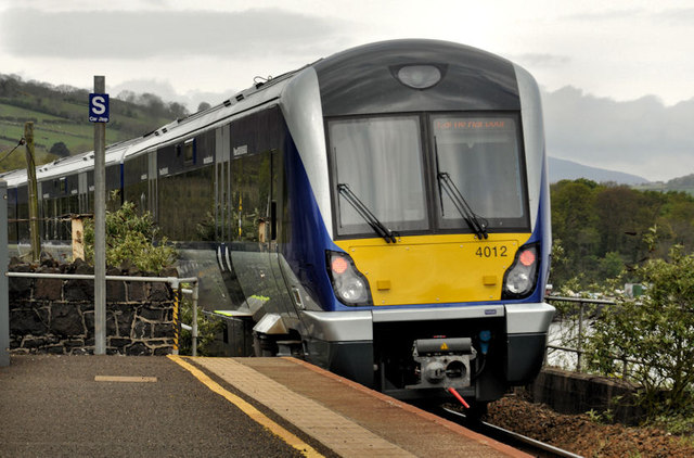
Train, Magheramorne (2012-1). C4K set 4012 departing
Magheramorne with the 10.42 Belfast Central to Larne Harbour.
384:
1005:
427:– If you remix, transform, or build upon the material, you must distribute your contributions under the
345:
on the
Geograph website for the photographer's contact details. The copyright on this image is owned by
381:
843:"}},"text\/plain":{"en":{"P7787":"270 degree"}}}}": -->
779:"}},"text\/plain":{"en":{"P7787":"270 degree"}}}}": -->
81:
198:
723:
708:
536:
182:
140:
1015:
309:
259:
350:
68:
243:
125:
293:
136:
155:
330:
342:
942:
Click on a date/time to view the file as it appeared at that time.
295:
245:
144:
270:
230:
54° 48′ 55.7″ N, 5° 46′ 03.72″ W
220:
56:
106:
Train, Magheramorne (2012-1) - geograph.org.uk - 2923273.jpg
42:
Train,_Magheramorne_(2012-1)_-_geograph.org.uk_-_2923273.jpg
280:
54° 48′ 56″ N, 5° 46′ 03″ W
469:
Add a one-line explanation of what this file represents
173:
Creative
Commons Attribution Share-alike license 2.0
100:
80:
Commons is a freely licensed media file repository.
638:
Creative
Commons Attribution-ShareAlike 2.0 Generic
46:(640 × 422 pixels, file size: 82 KB, MIME type:
438:https://creativecommons.org/licenses/by-sa/2.0
61:
444:Creative Commons Attribution-Share Alike 2.0
362:
8:
840:
776:
404:– to copy, distribute and transmit the work
944:
465:
709:https://www.geograph.org.uk/photo/2923273
537:https://www.geograph.org.uk/profile/5835
1003:
920:
904:
864:
848:
800:
784:
758:
742:
671:
655:
635:
619:
599:
583:
516:
500:
483:
480:
461:
454:
273:
223:
302:View this and other nearby images on:
252:View this and other nearby images on:
1001:The following 3 pages use this file:
7:
349:and is licensed for reuse under the
933:
385:Attribution-Share Alike 2.0 Generic
373:
368:
353:Attribution-ShareAlike 2.0 license.
474:
468:
359:
336:
110:
93:
39:
473:
787:coordinates of the point of view
459:
415:Under the following conditions:
380:This file is licensed under the
372:
367:
361:
329:
308:
294:
286:
258:
244:
236:
60:
21:
987:File Upload Bot (Magnus Manske)
456:
111:
36:No higher resolution available.
14:
674:file available on the internet
455:
337:This image was taken from the
26:
1:
851:coordinates of depicted place
1011:Magheramorne railway station
802:54°48'55.696"N, 5°46'3.724"W
694:Geograph Britain and Ireland
558:object of statement has role
481:Items portrayed in this file
285:
235:
213:Train, Magheramorne (2012-1)
194:Train, Magheramorne (2012-1)
1032:
866:54°48'55.84"N, 5°46'3.36"W
429:same or compatible license
211:Albert Bridge /
192:Albert Bridge /
934:
16:
717:geograph.org.uk image ID
458:
395:
67:This is a file from the
991:
183:required by the license
161:
151:
131:
124:
121:
103:
71:. Information from its
343:this photograph's page
314:54.815510; -5.767600
264:54.815471; -5.767701
74:description page there
145:geograph_org2commons
410:– to adapt the work
1006:Belfast–Larne line
545:author name string
141:User:andrewrabbott
994:
970:18:34, 8 May 2012
842:
778:
622:copyright license
467:
358:
357:
341:collection. See
319:
318:
269:
268:
218:
217:
186:
170:
167:Reusing this file
139:; transferred by
89:
88:
69:Wikimedia Commons
1023:
982:
888:
887:
882:
824:
823:
818:
726:
721:
711:
706:
702:described at URL
696:
691:
586:copyright status
567:
562:
552:
549:
539:
534:
451:
448:
445:
442:
439:
431:as the original.
393:
382:Creative Commons
376:
375:
371:
370:
365:
364:
351:Creative Commons
339:Geograph project
333:
326:
315:
312:
298:
297:
291:
290:
289:
283:
282:
271:
265:
262:
248:
247:
241:
240:
239:
233:
232:
221:
180:
164:
127:
115:
107:
101:
85:
64:
63:
57:
51:
49:
1031:
1030:
1026:
1025:
1024:
1022:
1021:
1020:
995:
988:
980:
936:
935:
932:
931:
930:
929:
928:
927:
926:
925:
923:
913:
912:
911:
909:
898:
897:
896:
895:
894:
893:
892:
891:
890:
889:
885:
883:
880:
871:
870:
869:
867:
857:
856:
855:
853:
834:
833:
832:
831:
830:
829:
828:
827:
826:
825:
821:
819:
816:
807:
806:
805:
803:
793:
792:
791:
789:
770:
769:
768:
767:
766:
765:
764:
763:
761:
751:
750:
749:
747:
736:
735:
734:
733:
732:
731:
730:
729:
728:
727:
722:
719:
713:
712:
707:
704:
698:
697:
692:
689:
680:
679:
678:
676:
664:
663:
662:
660:
649:
648:
647:
646:
645:
644:
643:
642:
640:
628:
627:
626:
624:
613:
612:
611:
610:
609:
608:
607:
606:
604:
592:
591:
590:
588:
577:
576:
575:
574:
573:
572:
571:
570:
569:
568:
563:
560:
554:
553:
550:
547:
541:
540:
535:
532:
523:
522:
521:
519:
509:
508:
507:
505:
494:
493:
492:
491:
490:
488:
472:
471:
470:
453:
452:
449:
446:
443:
440:
437:
436:
394:
391:
388:
377:
354:
324:
313:
287:
278:
277:
274:Object location
263:
237:
228:
227:
224:Camera location
219:
208:
201:
189:
137:geograph.org.uk
117:
105:
98:
91:
90:
79:
78:
77:is shown below.
53:
47:
45:
38:
37:
12:
11:
5:
1029:
1027:
1019:
1018:
1016:NIR Class 4000
1013:
1008:
999:
998:
993:
992:
990:
986:
983:
977:
972:
967:
963:
962:
959:
956:
953:
950:
947:
940:
939:
924:
921:
919:
918:
917:
916:
915:
914:
910:
905:
903:
902:
901:
900:
899:
876:
875:
874:
873:
872:
868:
865:
863:
862:
861:
860:
859:
858:
854:
849:
847:
846:
845:
844:
838:
812:
811:
810:
809:
808:
804:
801:
799:
798:
797:
796:
795:
794:
790:
785:
783:
782:
781:
780:
774:
762:
759:
757:
756:
755:
754:
753:
752:
748:
743:
741:
740:
739:
738:
737:
715:
714:
700:
699:
685:
684:
683:
682:
681:
677:
672:
670:
669:
668:
667:
666:
665:
661:
658:source of file
656:
654:
653:
652:
651:
650:
641:
636:
634:
633:
632:
631:
630:
629:
625:
620:
618:
617:
616:
615:
614:
605:
600:
598:
597:
596:
595:
594:
593:
589:
584:
582:
581:
580:
579:
578:
556:
555:
543:
542:
528:
527:
526:
525:
524:
520:
517:
515:
514:
513:
512:
511:
510:
506:
501:
499:
498:
497:
496:
495:
489:
484:
482:
479:
478:
477:
476:
475:
464:
463:
460:
457:
435:
434:
433:
432:
422:
413:
412:
411:
405:
398:You are free:
389:
379:
378:
360:
356:
355:
334:
323:
320:
317:
316:
306:
300:
275:
267:
266:
256:
250:
225:
216:
215:
209:
206:
203:
202:
197:
190:
187:
175:
174:
171:
159:
158:
153:
149:
148:
133:
129:
128:
123:
119:
118:
108:
99:
97:
94:
92:
87:
86:
65:
55:
54:
35:
31:
30:
29:
24:
19:
13:
10:
9:
6:
4:
3:
2:
1028:
1017:
1014:
1012:
1009:
1007:
1004:
1002:
996:
989:
984:
978:
976:
973:
971:
968:
965:
964:
960:
957:
954:
951:
948:
946:
945:
943:
937:
908:
879:
852:
815:
788:
760:30 April 2012
746:
725:
718:
710:
703:
695:
688:
675:
659:
639:
623:
603:
587:
566:
559:
551:Albert Bridge
546:
538:
531:
504:
487:
441:CC BY-SA 2.0
430:
426:
423:
420:
417:
416:
414:
409:
406:
403:
400:
399:
397:
396:
392:Albert Bridge
390:Attribution:
386:
383:
366:
352:
348:
347:Albert Bridge
344:
340:
335:
332:
328:
327:
321:
311:
307:
305:
304:OpenStreetMap
301:
299:
281:
276:
272:
261:
257:
255:
254:OpenStreetMap
251:
249:
231:
226:
222:
214:
210:
205:
204:
200:
196: /
195:
191:
184:
179:
177:
176:
172:
168:
163:
160:
157:
156:Albert Bridge
154:
150:
146:
142:
138:
134:
130:
126:30 April 2012
120:
114:
109:
102:
95:
83:
76:
75:
70:
66:
59:
58:
52:
43:
34:
28:
25:
23:
20:
18:
15:
1000:
941:
938:File history
565:photographer
424:
418:
407:
401:
346:
284:
234:
212:
199:CC BY-SA 2.0
193:
112:
82:You can help
72:
40:
22:File history
602:copyrighted
425:share alike
419:attribution
178:Attribution
104:Description
997:File usage
979:640 × 422
955:Dimensions
922:image/jpeg
907:media type
518:some value
162:Permission
48:image/jpeg
27:File usage
952:Thumbnail
949:Date/Time
745:inception
322:Licensing
207:InfoField
188:InfoField
113:English:
687:operator
462:Captions
408:to remix
402:to share
387:license.
981:(82 KB)
966:current
961:Comment
878:heading
837:heading
814:heading
773:heading
724:2923273
503:creator
486:depicts
466:English
96:Summary
44:
886:degree
841:degree
822:degree
777:degree
292:
242:
152:Author
143:using
132:Source
135:From
958:User
884:270
820:270
450:true
447:true
122:Date
17:File
530:URL
881::
817::
720::
705::
690::
561::
548::
533::
185:)
181:(
169:)
165:(
147:.
84:.
50:)
Text is available under the Creative Commons Attribution-ShareAlike License. Additional terms may apply.
_-_geograph.org.uk_-_2923273.jpg)
_-_geograph.org.uk_-_2923273.jpg¶ms=054.815471_N_-005.767701_E_globe:Earth_type:camera_heading:270.00_source:geograph&language=en)
_-_geograph.org.uk_-_2923273.jpg¶ms=054.815510_N_-005.767600_E_globe:Earth_class:object_type:object_source:geograph-irishgrid(J43559869)_region:GB-NIR_heading:270.00&language=en)
