262:
216:
268:
273:
90:
38:
567:
584:{{OpenStreetMap | name = Tualatin_OR | location = Tualatin_OR | description = Map of Tualatin Oregon. | top = 45.4007 | bottom = 45.3486 | left = -122.8162 | right = -122.7266 | date =...
314:– You must give appropriate credit, provide a link to the license, and indicate if changes were made. You may do so in any reasonable manner, but not in any way that suggests the licensor endorses you or your use.
235:
The ODbL does not require any particular license for maps produced from ODbL data. Prior to 1 August 2020, map tiles produced by the OpenStreetMap
Foundation were licensed under the
373:
618:
613:
608:
56:
52:
48:
42:
101:
69:
192:
512:
476:
321:
460:
641:
496:
443:
283:
594:
The following pages on the
English Knowledge (XXG) use this file (pages on other projects are not listed):
372:
208:). Map tiles are licensed under the Creative Commons Attribution-ShareAlike 2.0 license (CC-BY-SA 2.0).
320:– If you remix, transform, or build upon the material, you must distribute your contributions under the
280:
636:
566:
561:
109:
60:
37:
210:
656:
603:
577:
143:
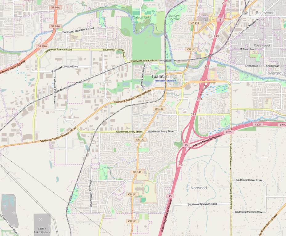
This map may be incomplete, and may contain errors. Don't rely solely on it for navigation.
651:
96:
396:
236:
228:
153:
138:
201:
168:
205:
598:
215:
123:
534:
Click on a date/time to view the file as it appeared at that time.
239:. Maps produced by other people may be subject to other licences.
224:
84:
427:
Add a one-line explanation of what this file represents
405:
If inappropriate please set warp_status = skip to hide.
108:
Commons is a freely licensed media file repository.
513:
Creative
Commons Attribution-ShareAlike 2.0 Generic
74:(1,029 × 851 pixels, file size: 759 KB, MIME type:
657:Module:Location map/data/USA Oregon Tualatin/doc
619:Module:Location map/data/USA Oregon Tualatin/doc
331:https://creativecommons.org/licenses/by-sa/2.0
89:
337:Creative Commons Attribution-Share Alike 2.0
261:
248:http://opendatacommons.org/licenses/odbl/1.0/
8:
652:Module:Location map/data/USA Oregon Tualatin
614:Module:Location map/data/USA Oregon Tualatin
609:Knowledge (XXG):WikiProject Oregon/Graphics
297:– to copy, distribute and transmit the work
536:
423:
200:OpenStreetMap data is available under the
141:project data, collected by the community.
629:The following other wikis use this file:
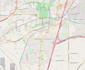
137:This map of Tualatin_OR was created from
596:
510:
494:
474:
458:
441:
438:
419:
412:
399:Georeference the map in Wikimaps Warper
169:OpenStreetMap wiki page for Tualatin_OR
642:وحدة:Location map/data/Tualatin OR/شرح
7:
227:, which is made available under the
223:This work contains information from
525:
284:Attribution-Share Alike 2.0 Generic
272:
267:
637:وحدة:Location map/data/Tualatin OR
432:
426:
258:
121:
67:
431:
417:
371:
308:Under the following conditions:
279:This file is licensed under the
271:
266:
260:
214:
88:
31:
21:
414:
129:Tualatin OR - OpenStreetMap.png
14:
413:
26:
1:
397:
439:Items portrayed in this file
229:Open Database License (ODbL)
213:
675:
648:Usage on si.wikipedia.org
633:Usage on ar.wikipedia.org
359:
322:same or compatible license
182:OpenStreetMap contributors
180:OpenStreetMap contributors
526:
382:
362:
350:
16:
416:
288:
95:This is a file from the
583:
391:
355:
187:
174:
159:
149:
135:Map of Tualatin Oregon.
126:
99:. Information from its
351: Geotemporal data
102:description page there
41:Size of this preview:
242:Open Database License
202:Open Database License
562:23:06, 14 April 2016
237:CC-BY-SA-2.0 license
303:– to adapt the work
167:find a page on the
47:Other resolutions:
61:1,029 × 851 pixels
625:Global file usage
587:
497:copyright license
425:
410:
409:
406:
387:
386:
257:
256:
240:
196:
193:Reusing this file
144:
117:
116:
97:Wikimedia Commons
32:Global file usage
666:
604:John Sweek House
574:
461:copyright status
404:
403:
401:
400:
375:
360:
344:
341:
338:
335:
332:
324:as the original.
281:Creative Commons
275:
274:
270:
269:
264:
263:
252:
249:
246:
243:
234:
218:
211:
190:
155:
142:
130:
124:
113:
92:
91:
85:
79:
77:
64:
57:929 × 768 pixels
53:581 × 480 pixels
49:290 × 240 pixels
43:725 × 600 pixels
674:
673:
669:
668:
667:
665:
664:
663:
623:
595:
588:
580:
572:
528:
527:
524:
523:
522:
521:
520:
519:
518:
517:
515:
503:
502:
501:
499:
488:
487:
486:
485:
484:
483:
482:
481:
479:
467:
466:
465:
463:
452:
451:
450:
449:
448:
446:
430:
429:
428:
411:
398:
395:
346:
345:
342:
339:
336:
333:
330:
329:
287:
276:
250:
247:
244:
241:
183:
181:
145:
136:
128:
119:
118:
107:
106:
105:is shown below.
81:
75:
73:
66:
65:
46:
12:
11:
5:
672:
670:
662:
661:
660:
659:
654:
646:
645:
644:
639:
627:
626:
622:
621:
616:
611:
606:
601:
593:
592:
591:
586:
585:
582:
578:
575:
569:
564:
559:
555:
554:
551:
548:
545:
542:
539:
532:
531:
516:
511:
509:
508:
507:
506:
505:
504:
500:
495:
493:
492:
491:
490:
489:
480:
475:
473:
472:
471:
470:
469:
468:
464:
459:
457:
456:
455:
454:
453:
447:
442:
440:
437:
436:
435:
434:
433:
422:
421:
418:
415:
408:
407:
393:
392:Georeferencing
389:
388:
385:
384:
380:
379:
376:
369:
365:
364:
357:
353:
352:
348:
347:
328:
327:
326:
325:
315:
306:
305:
304:
298:
291:You are free:
278:
277:
259:
255:
254:
221:
219:
197:
185:
184:
179:
178:
176:
172:
171:
161:
157:
156:
151:
147:
146:
134:
133:
131:
122:
120:
115:
114:
93:
83:
82:
40:
36:
35:
34:
29:
24:
19:
13:
10:
9:
6:
4:
3:
2:
671:
658:
655:
653:
650:
649:
647:
643:
640:
638:
635:
634:
632:
631:
630:
624:
620:
617:
615:
612:
610:
607:
605:
602:
600:
597:
589:
581:
576:
570:
568:
565:
563:
560:
557:
556:
552:
549:
546:
543:
540:
538:
537:
535:
529:
514:
498:
478:
462:
445:
402:
394:
390:
381:
378:E: 122.7266°W
377:
374:
370:
368:W: 122.8162°W
367:
366:
361:
358:
354:
349:
334:CC BY-SA 2.0
323:
319:
316:
313:
310:
309:
307:
302:
299:
296:
293:
292:
290:
289:
285:
282:
265:
253:
238:
232:
230:
226:
225:OpenStreetMap
222:
220:
217:
212:
209:
207:
203:
198:
194:
189:
186:
177:
173:
170:
166:
162:
158:
154:14 April 2016
152:
148:
140:
139:OpenStreetMap
132:
125:
111:
104:
103:
98:
94:
87:
86:
80:
71:
70:Original file
62:
58:
54:
50:
44:
39:
33:
30:
28:
25:
23:
20:
18:
15:
628:
571:1,029 × 851
533:
530:File history
383:S: 45.3486°N
363:N: 45.4007°N
356:Bounding box
317:
311:
300:
294:
233:
199:
164:
110:You can help
100:
68:
22:File history
579:Tagishsimon
477:copyrighted
318:share alike
312:attribution
127:Description
590:File usage
547:Dimensions
188:Permission
27:File usage
544:Thumbnail
541:Date/Time
76:image/png
573:(759 KB)
420:Captions
301:to remix
295:to share
286:license.
599:Jiggles
558:current
553:Comment
444:depicts
424:English
206:details
175:Creator
72:
160:Source
550:User
343:true
340:true
251:true
245:ODbL
163:You
150:Date
17:File
165:may
231:.
59:|
55:|
51:|
45:.
204:(
195:)
191:(
112:.
78:)
63:.
Text is available under the Creative Commons Attribution-ShareAlike License. Additional terms may apply.
