313:
246:
238:
412:
260:
281:
319:
324:
43:
87:
841:"}},"text\/plain":{"en":{"":"heading"}}},"{\"value\":{\"amount\":\"+225\",\"unit\":\"http:\\\/\\\/www.wikidata.org\\\/entity\\\/Q28390\"},\"type\":\"quantity\"}":{"text\/html":{"en":{"P7787":"225
837:
229:
371:– You must give appropriate credit, provide a link to the license, and indicate if changes were made. You may do so in any reasonable manner, but not in any way that suggests the licensor endorses you or your use.
960:== {{int:filedesc}} == {{Information |description={{en|1=Tullich Hill Looking over Tullich Hill to Cruach an t-Sidhein}} |date=2000-02-19 |source=From |author=[http://www.geograph.org.uk/profile/75
838:
53:
47:
437:
98:
420:
66:
773:
703:
667:
253:
793:
288:
1025:
This file contains additional information, probably added from the digital camera or scanner used to create or digitize it.
378:
630:
879:
852:
801:
757:
651:
623:
610:
595:
513:
452:
816:
786:
723:
687:
568:
551:
460:
275:
334:
942:
937:
57:
42:
1028:
If the file has been modified from its original state, some details may not fully reflect the modified file.
979:
433:
377:– If you remix, transform, or build upon the material, you must distribute your contributions under the
295:
on the
Geograph website for the photographer's contact details. The copyright on this image is owned by
953:
331:
970:
The following pages on the
English Knowledge use this file (pages on other projects are not listed):
845:"}},"text\/plain":{"en":{"P7787":"225 degree"}}}}": -->
441:
106:
198:
974:
426:
Remove redundant categories and try to put this image in the most specific category/categories
823:
808:
602:
182:
504:
508:
500:
496:
492:
488:
484:
480:
476:
472:
468:
259:
300:
93:
150:
243:
171:
161:
280:
292:
910:
Click on a date/time to view the file as it appeared at that time.
245:
220:
81:
141:
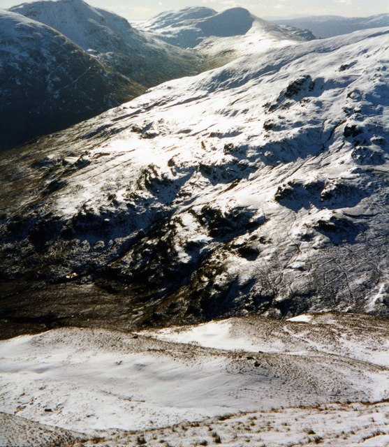
Tullich Hill
Looking over Tullich Hill to Cruach an t-Sidhein
997:
230:
56° 10′ 45″ N, 4° 43′ 30″ W
535:
Add a one-line explanation of what this file represents
1012:
440:
combined with a database. You can also have a look at
432:
The location categories are based on information from
1007:
125:
105:
Commons is a freely licensed media file repository.
704:
Creative
Commons Attribution-ShareAlike 2.0 Generic
71:(557 × 640 pixels, file size: 127 KB, MIME type:
417:The categories of this image should be checked.
388:https://creativecommons.org/licenses/by-sa/2.0
86:
394:Creative Commons Attribution-Share Alike 2.0
312:
8:
842:
354:– to copy, distribute and transmit the work
131:Tullich Hill - geograph.org.uk - 297198.jpg
1030:
912:
531:
512:
990:The following other wikis use this file:
824:https://www.geograph.org.uk/photo/297198
603:https://www.geograph.org.uk/profile/7544
1032:
972:
866:
850:
771:
755:
737:
721:
701:
685:
665:
649:
582:
566:
549:
546:
527:
520:
459:This image was uploaded as part of the
223:
252:View this and other nearby images on:
447:The topic category from Geograph was
7:
299:and is licensed for reuse under the
901:
335:Attribution-Share Alike 2.0 Generic
323:
318:
303:Attribution-ShareAlike 2.0 license.
1023:
540:
534:
309:
286:
135:
118:
64:
539:
853:coordinates of the point of view
525:
410:
365:Under the following conditions:
330:This file is licensed under the
322:
317:
311:
279:
258:
244:
236:
85:
31:
21:
522:
136:
14:
774:file available on the internet
521:
287:This image was taken from the
26:
1:
36:
794:Geograph Britain and Ireland
624:object of statement has role
547:Items portrayed in this file
235:
1054:
1004:Usage on www.wikidata.org
994:Usage on cy.wikipedia.org
379:same or compatible license
902:
868:56°10'45.1"N, 4°43'30.0"W
16:
802:geograph.org.uk image ID
524:
442:this tool from mysociety
408:
407:
345:
92:This is a file from the
980:Ewen Cameron of Lochiel
959:
938:22:13, 14 December 2010
438:this OpenStreetMap tool
183:required by the license
167:
156:
149:
146:
128:
96:. Information from its
293:this photograph's page
264:56.179200; -4.725000
99:description page there
46:Size of this preview:
461:Geograph batch upload
451:(find similar images
211:wfmillar /
192:wfmillar /
429:Remove this template
505:português do Brasil
360:– to adapt the work
52:Other resolutions:
611:author name string
434:this geonames tool
1041:
1040:
986:Global file usage
975:Battle of Tullich
963:
844:
688:copyright license
533:
516:
463:
308:
307:
291:collection. See
269:
268:
218:
217:
186:
114:
113:
94:Wikimedia Commons
32:Global file usage
1045:
1031:
950:
890:
889:
884:
826:
821:
817:described at URL
811:
806:
796:
791:
739:19 February 2000
652:copyright status
633:
628:
618:
615:
605:
600:
517:
458:
415:
414:
413:
401:
398:
395:
392:
389:
381:as the original.
343:
332:Creative Commons
326:
325:
321:
320:
315:
314:
301:Creative Commons
289:Geograph project
283:
276:
265:
262:
248:
247:
241:
240:
239:
233:
232:
221:
180:
152:
151:19 February 2000
140:
132:
126:
110:
89:
88:
82:
76:
74:
61:
58:557 × 640 pixels
54:209 × 240 pixels
48:522 × 600 pixels
1053:
1052:
1048:
1047:
1046:
1044:
1043:
1042:
1019:
984:
971:
964:
956:
948:
904:
903:
900:
899:
898:
897:
896:
895:
894:
893:
892:
891:
887:
885:
882:
873:
872:
871:
869:
859:
858:
857:
855:
836:
835:
834:
833:
832:
831:
830:
829:
828:
827:
822:
819:
813:
812:
807:
804:
798:
797:
792:
789:
780:
779:
778:
776:
764:
763:
762:
760:
749:
748:
747:
746:
745:
744:
743:
742:
740:
730:
729:
728:
726:
715:
714:
713:
712:
711:
710:
709:
708:
706:
694:
693:
692:
690:
679:
678:
677:
676:
675:
674:
673:
672:
670:
658:
657:
656:
654:
643:
642:
641:
640:
639:
638:
637:
636:
635:
634:
629:
626:
620:
619:
616:
613:
607:
606:
601:
598:
589:
588:
587:
585:
575:
574:
573:
571:
560:
559:
558:
557:
556:
554:
538:
537:
536:
519:
467:
464:
421:Check them now!
411:
409:
403:
402:
399:
396:
393:
390:
387:
386:
344:
341:
338:
327:
304:
274:
263:
237:
228:
227:
224:Camera location
219:
208:
201:
189:
162:geograph.org.uk
142:
130:
123:
116:
115:
104:
103:
102:is shown below.
78:
72:
70:
63:
62:
51:
12:
11:
5:
1051:
1049:
1039:
1038:
1035:
1022:
1018:
1017:
1016:
1015:
1010:
1002:
1001:
1000:
988:
987:
983:
982:
977:
969:
968:
967:
962:
961:
958:
954:
951:
945:
940:
935:
931:
930:
927:
924:
921:
918:
915:
908:
907:
878:
877:
876:
875:
874:
870:
867:
865:
864:
863:
862:
861:
860:
856:
851:
849:
848:
847:
846:
840:
815:
814:
800:
799:
785:
784:
783:
782:
781:
777:
772:
770:
769:
768:
767:
766:
765:
761:
758:source of file
756:
754:
753:
752:
751:
750:
741:
738:
736:
735:
734:
733:
732:
731:
727:
722:
720:
719:
718:
717:
716:
707:
702:
700:
699:
698:
697:
696:
695:
691:
686:
684:
683:
682:
681:
680:
671:
666:
664:
663:
662:
661:
660:
659:
655:
650:
648:
647:
646:
645:
644:
622:
621:
609:
608:
594:
593:
592:
591:
590:
586:
583:
581:
580:
579:
578:
577:
576:
572:
567:
565:
564:
563:
562:
561:
555:
550:
548:
545:
544:
543:
542:
541:
530:
529:
526:
523:
457:
456:
445:
430:
427:
385:
384:
383:
382:
372:
363:
362:
361:
355:
348:You are free:
339:
329:
328:
310:
306:
305:
284:
273:
270:
267:
266:
256:
250:
225:
216:
215:
209:
206:
203:
202:
197:
190:
187:
175:
174:
169:
165:
164:
158:
154:
153:
148:
144:
143:
133:
124:
122:
119:
117:
112:
111:
90:
80:
79:
45:
41:
40:
39:
34:
29:
24:
19:
13:
10:
9:
6:
4:
3:
2:
1050:
1036:
1033:
1029:
1026:
1020:
1014:
1011:
1009:
1006:
1005:
1003:
999:
996:
995:
993:
992:
991:
985:
981:
978:
976:
973:
965:
957:
952:
946:
944:
941:
939:
936:
933:
932:
928:
925:
922:
919:
916:
914:
913:
911:
905:
881:
854:
825:
818:
810:
803:
795:
788:
775:
759:
725:
705:
689:
669:
653:
632:
625:
612:
604:
597:
570:
553:
518:
515:
510:
506:
502:
498:
494:
490:
486:
482:
478:
474:
470:
465:
462:
454:
450:
446:
443:
439:
435:
431:
428:
425:
424:
423:
422:
418:
406:
405:
391:CC BY-SA 2.0
380:
376:
373:
370:
367:
366:
364:
359:
356:
353:
350:
349:
347:
346:
340:Attribution:
336:
333:
316:
302:
298:
294:
290:
285:
282:
278:
277:
271:
261:
257:
255:
254:OpenStreetMap
251:
249:
231:
226:
222:
214:
210:
205:
204:
200:
196: /
195:
191:
184:
179:
177:
176:
173:
170:
166:
163:
159:
155:
145:
139:
134:
127:
120:
108:
101:
100:
95:
91:
84:
83:
77:
68:
67:Original file
59:
55:
49:
44:
38:
35:
33:
30:
28:
25:
23:
20:
18:
15:
1027:
1024:
998:Tullich Hill
989:
909:
906:File history
631:photographer
466:
449:Mountainside
448:
419:
416:
404:
374:
368:
357:
351:
296:
234:
213:Tullich Hill
212:
199:CC BY-SA 2.0
194:Tullich Hill
193:
137:
107:You can help
97:
65:
22:File history
955:GeographBot
668:copyrighted
453:at Geograph
375:share alike
369:attribution
178:Attribution
129:Description
1034:_error
966:File usage
947:557 × 640
923:Dimensions
584:some value
493:македонски
73:image/jpeg
27:File usage
1013:Q13132055
920:Thumbnail
917:Date/Time
724:inception
501:português
272:Licensing
207:InfoField
188:InfoField
138:English:
1021:Metadata
1008:Q4872603
949:(127 KB)
787:operator
617:wfmillar
528:Captions
511: |
507: |
503: |
499: |
495: |
491: |
487: |
483: |
479: |
477:français
475: |
471: |
358:to remix
352:to share
342:wfmillar
337:license.
297:wfmillar
172:wfmillar
37:Metadata
934:current
929:Comment
880:heading
839:heading
569:creator
552:depicts
532:English
469:English
121:Summary
69:
888:degree
843:degree
809:297198
509:Türkçe
497:മലയാളം
489:magyar
481:galego
242:
168:Author
157:Source
485:עברית
473:suomi
160:From
926:User
886:225
436:and
400:true
397:true
147:Date
17:File
596:URL
514:+/−
883::
820::
805::
790::
627::
614::
599::
56:|
50:.
1037:0
455:)
444:.
185:)
181:(
109:.
75:)
60:.
Text is available under the Creative Commons Attribution-ShareAlike License. Additional terms may apply.
_heading:225.00&language=en)
