332:
265:
223:
279:
237:
300:
338:
343:
72:
850:
256:
214:
43:
390:– You must give appropriate credit, provide a link to the license, and indicate if changes were made. You may do so in any reasonable manner, but not in any way that suggests the licensor endorses you or your use.
83:
51:
881:
867:== {{int:filedesc}} == {{Information |description={{en|1=Upper Pond, Ashtead Park.}} |date=2005-10-09 |source=From |author= |permission= |other_
676:
606:
570:
272:
230:
696:
1054:
307:
917:
This file contains additional information, probably added from the digital camera or scanner used to create or digitize it.
397:
849:
844:
533:
42:
1023:
781:
747:
704:
660:
554:
526:
513:
498:
719:
689:
626:
590:
471:
454:
294:
353:
920:
If the file has been modified from its original state, some details may not fully reflect the modified file.
1107:
886:
396:– If you remix, transform, or build upon the material, you must distribute your contributions under the
314:
on the
Geograph website for the photographer's contact details. The copyright on this image is owned by
860:
350:
877:
The following pages on the
English Knowledge use this file (pages on other projects are not listed):
1143:
939:
91:
183:
505:
167:
726:
711:
904:
278:
236:
1211:
1125:
1081:
946:
319:
78:
986:
1153:
135:
966:
262:
220:
156:
146:
1229:
956:
929:
299:
311:
817:
Click on a date/time to view the file as it appeared at that time.
264:
222:
247:
205:
66:
774:
740:
257:
51° 18′ 39″ N, 0° 17′ 31″ W
215:
51° 18′ 39″ N, 0° 17′ 31″ W
438:
Add a one-line explanation of what this file represents
116:
Upper Pond, Ashtead Park - geograph.org.uk - 62946.jpg
52:
Upper_Pond,_Ashtead_Park_-_geograph.org.uk_-_62946.jpg
110:
90:
Commons is a freely licensed media file repository.
607:
Creative
Commons Attribution-ShareAlike 2.0 Generic
56:(640 × 480 pixels, file size: 103 KB, MIME type:
1148:Flash did not fire, compulsory flash suppression
407:https://creativecommons.org/licenses/by-sa/2.0
71:
413:Creative Commons Attribution-Share Alike 2.0
331:
8:
373:– to copy, distribute and transmit the work
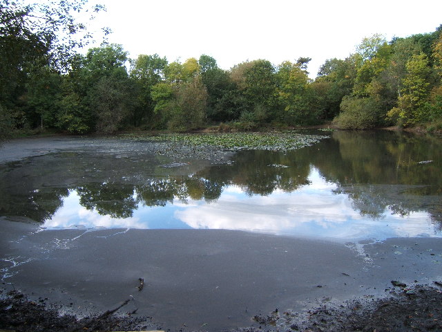
922:
819:
434:
897:The following other wikis use this file:
506:https://www.geograph.org.uk/profile/1110
1237:
1227:
1219:
1209:
1201:
1193:
1185:
1177:
1169:
1161:
1151:
1141:
1133:
1123:
1115:
1105:
1097:
1089:
1079:
1071:
1063:
1052:
1044:
1036:
1028:
1018:
1010:
1002:
994:
983:
975:
964:
954:
944:
934:
882:List of local nature reserves in Surrey
879:
795:
779:
761:
745:
727:https://www.geograph.org.uk/photo/62946
674:
658:
640:
624:
604:
588:
568:
552:
485:
469:
452:
449:
430:
423:
250:
208:
1024:Digital Camera FinePix E510 Ver1.00
271:View this and other nearby images on:
229:View this and other nearby images on:
924:
7:
318:and is licensed for reuse under the
808:
354:Attribution-Share Alike 2.0 Generic
342:
337:
322:Attribution-ShareAlike 2.0 license.
915:
443:
437:
328:
305:
120:
103:
49:
442:
977:Date and time of data generation
748:coordinates of the point of view
428:
384:Under the following conditions:
349:This file is licensed under the
341:
336:
330:
298:
277:
263:
235:
221:
70:
31:
21:
425:
121:
46:No higher resolution available.
14:
951:1/120 sec (0.0083333333333333)
677:file available on the internet
424:
306:This image was taken from the
26:
1:
782:coordinates of depicted place
36:
697:Geograph Britain and Ireland
527:object of statement has role
450:Items portrayed in this file
1179:Focal plane resolution unit
1065:Date and time of digitizing
901:Usage on azb.wikipedia.org
1259:
1190:One-chip color area sensor
398:same or compatible license
1030:File change date and time
809:
797:51°18'39.2"N, 0°17'31.2"W
763:51°18'39.2"N, 0°17'31.2"W
196:Roger Miller /
177:Roger Miller /
126:Upper Pond, Ashtead Park.
16:
1171:Focal plane Y resolution
1163:Focal plane X resolution
705:geograph.org.uk image ID
427:
364:
198:Upper Pond, Ashtead Park
179:Upper Pond, Ashtead Park
77:This is a file from the
1195:Custom image processing
866:
168:required by the license
152:
141:
134:
131:
113:
81:. Information from its
1239:Subject distance range
1073:Image compression mode
845:20:23, 30 January 2010
312:this photograph's page
283:51.310900; -0.292000
241:51.310900; -0.292000
84:description page there
1117:Maximum land aperture
1068:15:00, 9 October 2005
1033:15:00, 9 October 2005
1004:Horizontal resolution
980:15:00, 9 October 2005
887:Surrey Wildlife Trust
1038:Y and C positioning
1012:Vertical resolution
926:Camera manufacturer
379:– to adapt the work
1221:Scene capture type
1216:Auto white balance
514:author name string
1246:
1245:
1120:3.1 APEX (f/2.93)
893:Global file usage
870:
591:copyright license
436:
327:
326:
310:collection. See
288:
287:
246:
245:
203:
202:
171:
99:
98:
79:Wikimedia Commons
32:Global file usage
1250:
1046:Exposure Program
923:
857:
729:
724:
720:described at URL
714:
709:
699:
694:
555:copyright status
536:
531:
521:
518:
508:
503:
420:
417:
414:
411:
408:
400:as the original.
362:
351:Creative Commons
345:
344:
340:
339:
334:
333:
320:Creative Commons
308:Geograph project
302:
295:
284:
281:
267:
266:
260:
259:
248:
242:
239:
225:
224:
218:
217:
206:
165:
137:
125:
117:
111:
95:
74:
73:
67:
61:
59:
1258:
1257:
1253:
1252:
1251:
1249:
1248:
1247:
1099:APEX brightness
940:FinePix E510
911:
891:
878:
871:
863:
855:
811:
810:
807:
806:
805:
804:
803:
802:
801:
800:
798:
788:
787:
786:
784:
773:
772:
771:
770:
769:
768:
767:
766:
764:
754:
753:
752:
750:
739:
738:
737:
736:
735:
734:
733:
732:
731:
730:
725:
722:
716:
715:
710:
707:
701:
700:
695:
692:
683:
682:
681:
679:
667:
666:
665:
663:
652:
651:
650:
649:
648:
647:
646:
645:
643:
633:
632:
631:
629:
618:
617:
616:
615:
614:
613:
612:
611:
609:
597:
596:
595:
593:
582:
581:
580:
579:
578:
577:
576:
575:
573:
561:
560:
559:
557:
546:
545:
544:
543:
542:
541:
540:
539:
538:
537:
532:
529:
523:
522:
519:
516:
510:
509:
504:
501:
492:
491:
490:
488:
478:
477:
476:
474:
463:
462:
461:
460:
459:
457:
441:
440:
439:
422:
421:
418:
415:
412:
409:
406:
405:
363:
360:
357:
346:
323:
293:
282:
255:
254:
251:Object location
240:
213:
212:
209:Camera location
204:
193:
186:
174:
147:geograph.org.uk
127:
115:
108:
101:
100:
89:
88:
87:is shown below.
63:
57:
55:
48:
47:
12:
11:
5:
1256:
1254:
1244:
1243:
1240:
1236:
1235:
1232:
1226:
1225:
1222:
1218:
1217:
1214:
1208:
1207:
1204:
1200:
1199:
1198:Normal process
1196:
1192:
1191:
1188:
1187:Sensing method
1184:
1183:
1180:
1176:
1175:
1172:
1168:
1167:
1164:
1160:
1159:
1156:
1150:
1149:
1146:
1140:
1139:
1136:
1132:
1131:
1128:
1122:
1121:
1118:
1114:
1113:
1110:
1104:
1103:
1100:
1096:
1095:
1092:
1088:
1087:
1084:
1078:
1077:
1074:
1070:
1069:
1066:
1062:
1061:
1058:
1051:
1050:
1049:Normal program
1047:
1043:
1042:
1039:
1035:
1034:
1031:
1027:
1026:
1021:
1017:
1016:
1013:
1009:
1008:
1005:
1001:
1000:
997:
993:
992:
989:
982:
981:
978:
974:
973:
970:
963:
962:
959:
953:
952:
949:
943:
942:
937:
933:
932:
927:
914:
910:
909:
908:
907:
895:
894:
890:
889:
884:
876:
875:
874:
869:
868:
865:
861:
858:
852:
847:
842:
838:
837:
834:
831:
828:
825:
822:
815:
814:
799:
796:
794:
793:
792:
791:
790:
789:
785:
780:
778:
777:
776:
775:
765:
762:
760:
759:
758:
757:
756:
755:
751:
746:
744:
743:
742:
741:
718:
717:
703:
702:
688:
687:
686:
685:
684:
680:
675:
673:
672:
671:
670:
669:
668:
664:
661:source of file
659:
657:
656:
655:
654:
653:
644:
642:9 October 2005
641:
639:
638:
637:
636:
635:
634:
630:
625:
623:
622:
621:
620:
619:
610:
605:
603:
602:
601:
600:
599:
598:
594:
589:
587:
586:
585:
584:
583:
574:
569:
567:
566:
565:
564:
563:
562:
558:
553:
551:
550:
549:
548:
547:
525:
524:
512:
511:
497:
496:
495:
494:
493:
489:
486:
484:
483:
482:
481:
480:
479:
475:
470:
468:
467:
466:
465:
464:
458:
453:
451:
448:
447:
446:
445:
444:
433:
432:
429:
426:
404:
403:
402:
401:
391:
382:
381:
380:
374:
367:You are free:
358:
348:
347:
329:
325:
324:
303:
292:
289:
286:
285:
275:
269:
252:
244:
243:
233:
227:
210:
201:
200:
194:
191:
188:
187:
182:
175:
172:
160:
159:
154:
150:
149:
143:
139:
138:
136:9 October 2005
133:
129:
128:
118:
109:
107:
104:
102:
97:
96:
75:
65:
64:
45:
41:
40:
39:
34:
29:
24:
19:
13:
10:
9:
6:
4:
3:
2:
1255:
1241:
1238:
1233:
1231:
1228:
1223:
1220:
1215:
1213:
1212:White balance
1210:
1206:Auto exposure
1205:
1203:Exposure mode
1202:
1197:
1194:
1189:
1186:
1181:
1178:
1173:
1170:
1165:
1162:
1157:
1155:
1152:
1147:
1145:
1142:
1137:
1134:
1129:
1127:
1126:Metering mode
1124:
1119:
1116:
1111:
1109:
1108:Exposure bias
1106:
1101:
1098:
1093:
1091:APEX aperture
1090:
1085:
1083:
1082:Shutter speed
1080:
1075:
1072:
1067:
1064:
1059:
1056:
1053:
1048:
1045:
1040:
1037:
1032:
1029:
1025:
1022:
1020:Software used
1019:
1014:
1011:
1006:
1003:
998:
995:
990:
988:
984:
979:
976:
971:
968:
965:
960:
958:
955:
950:
948:
947:Exposure time
945:
941:
938:
935:
931:
928:
925:
921:
918:
912:
906:
903:
902:
900:
899:
898:
892:
888:
885:
883:
880:
872:
864:
859:
853:
851:
848:
846:
843:
840:
839:
835:
832:
829:
826:
823:
821:
820:
818:
812:
783:
749:
728:
721:
713:
706:
698:
691:
678:
662:
628:
608:
592:
572:
556:
535:
528:
515:
507:
500:
473:
456:
410:CC BY-SA 2.0
399:
395:
392:
389:
386:
385:
383:
378:
375:
372:
369:
368:
366:
365:
359:Attribution:
355:
352:
335:
321:
317:
313:
309:
304:
301:
297:
296:
290:
280:
276:
274:
273:OpenStreetMap
270:
268:
258:
253:
249:
238:
234:
232:
231:OpenStreetMap
228:
226:
216:
211:
207:
199:
195:
190:
189:
185:
181: /
180:
176:
169:
164:
162:
161:
158:
155:
151:
148:
144:
140:
130:
124:
119:
112:
105:
93:
86:
85:
80:
76:
69:
68:
62:
53:
44:
38:
35:
33:
30:
28:
25:
23:
20:
18:
15:
1135:Light source
987:focal length
936:Camera model
919:
916:
896:
816:
813:File history
534:photographer
520:Roger Miller
393:
387:
376:
370:
361:Roger Miller
316:Roger Miller
315:
197:
184:CC BY-SA 2.0
178:
157:Roger Miller
122:
92:You can help
82:
50:
22:File history
1154:Color space
996:Orientation
862:GeographBot
571:copyrighted
394:share alike
388:attribution
163:Attribution
114:Description
873:File usage
854:640 × 480
830:Dimensions
487:some value
58:image/jpeg
27:File usage
1230:Sharpness
967:ISO speed
827:Thumbnail
824:Date/Time
627:inception
291:Licensing
192:InfoField
173:InfoField
123:English:
1224:Standard
1041:Co-sited
957:F-number
930:FUJIFILM
913:Metadata
856:(103 KB)
690:operator
431:Captions
377:to remix
371:to share
356:license.
37:Metadata
1242:Unknown
1138:Unknown
1130:Pattern
1057:version
905:وورتینق
841:current
836:Comment
472:creator
455:depicts
435:English
106:Summary
54:
1015:72 dpi
1007:72 dpi
999:Normal
991:4.7 mm
969:rating
261:
219:
153:Author
142:Source
1174:4,545
1166:4,545
1144:Flash
985:Lens
961:f/4.5
712:62946
145:From
1158:sRGB
1055:Exif
833:User
419:true
416:true
132:Date
17:File
1102:6.3
1094:4.3
1086:6.9
1060:2.2
972:100
499:URL
723::
708::
693::
530::
517::
502::
1234:3
1182:3
1112:0
1076:2
170:)
166:(
94:.
60:)
Text is available under the Creative Commons Attribution-ShareAlike License. Additional terms may apply.
_&language=en)
_&language=en)
