343:
276:
226:
440:
268:
218:
290:
240:
311:
349:
354:
67:
850:"}},"text\/plain":{"en":{"":"heading"}}},"{\"value\":{\"amount\":\"+0\",\"unit\":\"http:\\\/\\\/www.wikidata.org\\\/entity\\\/Q28390\"},\"type\":\"quantity\"}":{"text\/html":{"en":{"P7787":"0
665:"}},"text\/plain":{"en":{"":"heading"}}},"{\"value\":{\"amount\":\"+0\",\"unit\":\"http:\\\/\\\/www.wikidata.org\\\/entity\\\/Q28390\"},\"type\":\"quantity\"}":{"text\/html":{"en":{"P7787":"0
1016:
846:
259:
209:
38:
401:– You must give appropriate credit, provide a link to the license, and indicate if changes were made. You may do so in any reasonable manner, but not in any way that suggests the licensor endorses you or your use.
1003:
rotated and cropped image, straightened converging verticals, repaired R margin after perspective compensation, adjusted colours/brightness/contrast, removed a couple of background flecks, slight sharpen
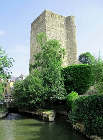
1033:== {{int:filedesc}} == {{Information |description={{en|1=Upstream to the tower View upstream towards the tower at the gaol. The millstream is to the right}} |date=2009-06-30 |source=From |author=[
78:
46:
847:
662:
1015:
1010:
782:
648:
612:
283:
233:
832:
318:
408:
547:
917:
888:
861:
795:
766:
703:
676:
596:
568:
555:
540:
985:
980:
37:
825:
810:
732:
632:
513:
496:
305:
364:
451:
1043:
The following pages on the
English Knowledge (XXG) use this file (pages on other projects are not listed):
1057:
407:– If you remix, transform, or build upon the material, you must distribute your contributions under the
325:
on the
Geograph website for the photographer's contact details. The copyright on this image is owned by
1026:
361:
854:"}},"text\/plain":{"en":{"P7787":"0 degree"}}}}": -->
669:"}},"text\/plain":{"en":{"P7787":"0 degree"}}}}": -->
1052:
86:
817:
802:
575:
162:
996:
289:
239:
1047:
330:
73:
459:, who confirmed that it was available there under the stated license on that date.
178:
1110:
455:
130:
273:
223:
1085:
447:
151:
141:
310:
121:
View up Castle Mill Stream to St George's Tower of Oxford Castle, England
322:
1100:
953:
Click on a date/time to view the file as it appeared at that time.
1095:
275:
225:
250:
200:
61:
1075:
260:
51° 45′ 07″ N, 1° 15′ 53″ W
210:
51° 45′ 07″ N, 1° 15′ 53″ W
480:
Add a one-line explanation of what this file represents
111:
Upstream to the tower - geograph.org.uk - 1387392.jpg
47:
Upstream_to_the_tower_-_geograph.org.uk_-_1387392.jpg
434:
105:
85:
Commons is a freely licensed media file repository.
649:
Creative
Commons Attribution-ShareAlike 2.0 Generic
51:(350 × 473 pixels, file size: 43 KB, MIME type:
446:This file, which was originally posted to From
418:https://creativecommons.org/licenses/by-sa/2.0
66:
424:Creative Commons Attribution-Share Alike 2.0
342:
8:
851:
666:
384:– to copy, distribute and transmit the work
955:
476:
1068:The following other wikis use this file:
818:https://www.geograph.org.uk/photo/1387392
576:https://www.geograph.org.uk/profile/21460
1045:
931:
915:
875:
859:
780:
764:
746:
730:
690:
674:
646:
630:
610:
594:
527:
511:
494:
491:
472:
465:
253:
203:
282:View this and other nearby images on:
232:View this and other nearby images on:
7:
329:and is licensed for reuse under the
944:
365:Attribution-Share Alike 2.0 Generic
353:
348:
333:Attribution-ShareAlike 2.0 license.
485:
479:
450:, was reviewed on 11 June 2018 by
445:
339:
316:
115:
98:
44:
484:
677:coordinates of the point of view
470:
438:
395:Under the following conditions:
360:This file is licensed under the
352:
347:
341:
309:
288:
274:
266:
238:
224:
216:
65:
31:
21:
467:
116:
41:No higher resolution available.
14:
783:file available on the internet
466:
317:This image was taken from the
26:
1:
862:coordinates of depicted place
833:Geograph Britain and Ireland
541:object of statement has role
492:Items portrayed in this file
1086:Arte románico en Inglaterra
1129:
1107:Usage on zh.wikipedia.org
1092:Usage on fr.wikipedia.org
1082:Usage on es.wikipedia.org
1072:Usage on da.wikipedia.org
877:51°45'7.42"N, 1°15'53.28"W
692:51°45'7.09"N, 1°15'53.28"W
409:same or compatible license
265:
215:
191:Bill Nicholls /
172:Bill Nicholls /
945:
16:
796:geograph.org.uk image ID
469:
375:
72:This is a file from the
1101:Art roman en Angleterre
1032:
1011:20:07, 28 February 2011
1002:
163:required by the license
147:
136:
129:
126:
108:
76:. Information from its
323:this photograph's page
294:51.752060; -1.264800
244:51.751970; -1.264800
79:description page there
1058:User:Moonraker/Oxford
193:Upstream to the tower
174:Upstream to the tower
1096:Architecture romane
981:23:50, 10 June 2018
390:– to adapt the work
1053:Talk:Oxford Castle
556:author name string
1064:Global file usage
1036:
853:
668:
633:copyright license
478:
464:
463:
338:
337:
321:collection. See
299:
298:
249:
248:
198:
197:
166:
94:
93:
74:Wikimedia Commons
32:Global file usage
1120:
1023:
993:
899:
898:
893:
835:
830:
820:
815:
811:described at URL
805:
800:
714:
713:
708:
597:copyright status
578:
573:
563:
560:
550:
545:
442:
441:
435:
431:
428:
425:
422:
419:
411:as the original.
373:
362:Creative Commons
356:
355:
351:
350:
345:
344:
331:Creative Commons
319:Geograph project
313:
306:
295:
292:
278:
277:
271:
270:
269:
263:
262:
251:
245:
242:
228:
227:
221:
220:
219:
213:
212:
201:
160:
132:
120:
112:
106:
90:
69:
68:
62:
56:
54:
1128:
1127:
1123:
1122:
1121:
1119:
1118:
1117:
1062:
1044:
1037:
1029:
1021:
999:
991:
947:
946:
943:
942:
941:
940:
939:
938:
937:
936:
934:
924:
923:
922:
920:
909:
908:
907:
906:
905:
904:
903:
902:
901:
900:
896:
894:
891:
882:
881:
880:
878:
868:
867:
866:
864:
845:
844:
843:
842:
841:
840:
839:
838:
837:
836:
831:
828:
822:
821:
816:
813:
807:
806:
801:
798:
789:
788:
787:
785:
773:
772:
771:
769:
758:
757:
756:
755:
754:
753:
752:
751:
749:
739:
738:
737:
735:
724:
723:
722:
721:
720:
719:
718:
717:
716:
715:
711:
709:
706:
697:
696:
695:
693:
683:
682:
681:
679:
660:
659:
658:
657:
656:
655:
654:
653:
651:
639:
638:
637:
635:
624:
623:
622:
621:
620:
619:
618:
617:
615:
603:
602:
601:
599:
588:
587:
586:
585:
584:
583:
582:
581:
580:
579:
574:
571:
565:
564:
561:
558:
552:
551:
546:
543:
534:
533:
532:
530:
520:
519:
518:
516:
505:
504:
503:
502:
501:
499:
483:
482:
481:
460:
448:geograph.org.uk
439:
433:
432:
429:
426:
423:
420:
417:
416:
374:
371:
368:
357:
334:
304:
293:
267:
258:
257:
254:Object location
243:
217:
208:
207:
204:Camera location
199:
188:
181:
169:
142:geograph.org.uk
122:
110:
103:
96:
95:
84:
83:
82:is shown below.
58:
52:
50:
43:
42:
12:
11:
5:
1126:
1124:
1116:
1115:
1114:
1113:
1105:
1104:
1103:
1098:
1090:
1089:
1088:
1080:
1079:
1078:
1066:
1065:
1061:
1060:
1055:
1050:
1042:
1041:
1040:
1035:
1034:
1031:
1027:
1024:
1018:
1013:
1008:
1005:
1004:
1001:
997:
994:
988:
983:
978:
974:
973:
970:
967:
964:
961:
958:
951:
950:
935:
932:
930:
929:
928:
927:
926:
925:
921:
916:
914:
913:
912:
911:
910:
887:
886:
885:
884:
883:
879:
876:
874:
873:
872:
871:
870:
869:
865:
860:
858:
857:
856:
855:
849:
824:
823:
809:
808:
794:
793:
792:
791:
790:
786:
781:
779:
778:
777:
776:
775:
774:
770:
767:source of file
765:
763:
762:
761:
760:
759:
750:
747:
745:
744:
743:
742:
741:
740:
736:
731:
729:
728:
727:
726:
725:
702:
701:
700:
699:
698:
694:
691:
689:
688:
687:
686:
685:
684:
680:
675:
673:
672:
671:
670:
664:
652:
647:
645:
644:
643:
642:
641:
640:
636:
631:
629:
628:
627:
626:
625:
616:
611:
609:
608:
607:
606:
605:
604:
600:
595:
593:
592:
591:
590:
589:
567:
566:
554:
553:
539:
538:
537:
536:
535:
531:
528:
526:
525:
524:
523:
522:
521:
517:
512:
510:
509:
508:
507:
506:
500:
495:
493:
490:
489:
488:
487:
486:
475:
474:
471:
468:
462:
461:
443:
415:
414:
413:
412:
402:
393:
392:
391:
385:
378:You are free:
369:
359:
358:
340:
336:
335:
314:
303:
300:
297:
296:
286:
280:
255:
247:
246:
236:
230:
205:
196:
195:
189:
186:
183:
182:
177:
170:
167:
155:
154:
149:
145:
144:
138:
134:
133:
128:
124:
123:
113:
104:
102:
99:
97:
92:
91:
70:
60:
59:
40:
36:
35:
34:
29:
24:
19:
13:
10:
9:
6:
4:
3:
2:
1125:
1112:
1109:
1108:
1106:
1102:
1099:
1097:
1094:
1093:
1091:
1087:
1084:
1083:
1081:
1077:
1076:Oxford Castle
1074:
1073:
1071:
1070:
1069:
1063:
1059:
1056:
1054:
1051:
1049:
1048:Oxford Castle
1046:
1038:
1030:
1025:
1019:
1017:
1014:
1012:
1009:
1007:
1006:
1000:
995:
989:
987:
984:
982:
979:
976:
975:
971:
968:
965:
962:
959:
957:
956:
954:
948:
919:
890:
863:
834:
827:
819:
812:
804:
797:
784:
768:
734:
705:
678:
650:
634:
614:
598:
577:
570:
562:Bill Nicholls
557:
549:
542:
515:
498:
458:
457:
453:
449:
444:
437:
436:
421:CC BY-SA 2.0
410:
406:
403:
400:
397:
396:
394:
389:
386:
383:
380:
379:
377:
376:
372:Bill Nicholls
370:Attribution:
366:
363:
346:
332:
328:
327:Bill Nicholls
324:
320:
315:
312:
308:
307:
301:
291:
287:
285:
284:OpenStreetMap
281:
279:
261:
256:
252:
241:
237:
235:
234:OpenStreetMap
231:
229:
211:
206:
202:
194:
190:
185:
184:
180:
176: /
175:
171:
164:
159:
157:
156:
153:
152:Bill Nicholls
150:
146:
143:
139:
135:
125:
119:
114:
107:
100:
88:
81:
80:
75:
71:
64:
63:
57:
48:
39:
33:
30:
28:
25:
23:
20:
18:
15:
1067:
952:
949:File history
748:30 June 2009
548:photographer
454:
404:
398:
387:
381:
326:
264:
214:
192:
179:CC BY-SA 2.0
173:
131:30 June 2009
117:
87:You can help
77:
45:
22:File history
1028:GeographBot
613:copyrighted
405:share alike
399:attribution
158:Attribution
109:Description
1039:File usage
1020:450 × 600
990:350 × 473
966:Dimensions
933:image/jpeg
918:media type
529:some value
53:image/jpeg
27:File usage
998:Tony 1212
963:Thumbnail
960:Date/Time
733:inception
302:Licensing
187:InfoField
168:InfoField
118:English:
826:operator
473:Captions
456:Leoboudv
452:reviewer
388:to remix
382:to share
367:license.
1022:(64 KB)
992:(43 KB)
977:current
972:Comment
889:heading
848:heading
803:1387392
704:heading
663:heading
514:creator
497:depicts
477:English
101:Summary
49:
897:degree
852:degree
712:degree
667:degree
272:
222:
148:Author
137:Source
140:From
1111:牛津城堡
969:User
430:true
427:true
127:Date
17:File
569:URL
895:0
892::
829::
814::
799::
710:0
707::
572::
559::
544::
165:)
161:(
89:.
55:)
Text is available under the Creative Commons Attribution-ShareAlike License. Additional terms may apply.
_heading:0.00&language=en)
_heading:0.00&language=en)
