328:
261:
219:
275:
233:
296:
334:
339:
67:
846:
121:
Valley Park - Iron Age
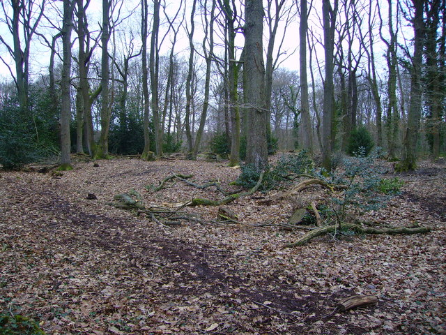
Settlement This area of Zionshill Copse was an Iron age settlement about 2300 years ago. Evidence has been found of three round houses as well other smaller buildings. It is believed that the site was in use for around 300 years and was abandoned around shortly after 43AD when
252:
38:
863:== {{int:filedesc}} == {{Information |description={{en|1=Valley Park - Iron Age Settlement This area of Zionshill Copse was an Iron age settlement about 2300 years ago. Evidence has been found of three round houses as well other smaller buildings. It is b
210:
386:– You must give appropriate credit, provide a link to the license, and indicate if changes were made. You may do so in any reasonable manner, but not in any way that suggests the licensor endorses you or your use.
78:
46:
845:
840:
37:
638:
602:
566:
268:
226:
673:
303:
888:
This file contains additional information, probably added from the digital camera or scanner used to create or digitize it.
393:
529:
777:
743:
651:
622:
550:
522:
507:
494:
709:
681:
666:
586:
467:
450:
290:
349:
891:
If the file has been modified from its original state, some details may not fully reflect the modified file.
877:
392:– If you remix, transform, or build upon the material, you must distribute your contributions under the
310:
on the
Geograph website for the photographer's contact details. The copyright on this image is owned by
856:
346:
873:
The following pages on the
English Knowledge use this file (pages on other projects are not listed):
86:
179:
688:
658:
514:
163:
274:
232:
315:
73:
131:
258:
216:
152:
142:
295:
307:
813:
Click on a date/time to view the file as it appeared at that time.
260:
218:
111:
Valley Park - Iron Age
Settlement - geograph.org.uk - 677865.jpg
47:
Valley_Park_-_Iron_Age_Settlement_-_geograph.org.uk_-_677865.jpg
243:
201:
61:
770:
736:
253:
50° 58′ 55″ N, 1° 24′ 14″ W
211:
50° 58′ 55″ N, 1° 24′ 14″ W
434:
Add a one-line explanation of what this file represents
105:
85:
Commons is a freely licensed media file repository.
603:
Creative
Commons Attribution-ShareAlike 2.0 Generic
51:(640 × 480 pixels, file size: 159 KB, MIME type:
403:https://creativecommons.org/licenses/by-sa/2.0
66:
409:Creative Commons Attribution-Share Alike 2.0
327:
8:
369:– to copy, distribute and transmit the work
893:
815:
430:
689:https://www.geograph.org.uk/photo/677865
515:https://www.geograph.org.uk/profile/1249
895:
875:
791:
775:
757:
741:
723:
707:
636:
620:
600:
584:
564:
548:
481:
465:
448:
445:
426:
419:
246:
204:
267:View this and other nearby images on:
225:View this and other nearby images on:
7:
314:and is licensed for reuse under the
804:
350:Attribution-Share Alike 2.0 Generic
338:
333:
318:Attribution-ShareAlike 2.0 license.
886:
439:
433:
324:
301:
115:
98:
44:
438:
194:Valley Park - Iron Age Settlement
175:Valley Park - Iron Age Settlement
744:coordinates of the point of view
424:
380:Under the following conditions:
345:This file is licensed under the
337:
332:
326:
294:
273:
259:
231:
217:
65:
21:
421:
116:
41:No higher resolution available.
14:
639:file available on the internet
420:
302:This image was taken from the
26:
1:
778:coordinates of depicted place
31:
674:Geograph Britain and Ireland
523:object of statement has role
446:Items portrayed in this file
917:
394:same or compatible license
805:
793:50°58'54.8"N, 1°24'14.4"W
759:50°58'54.8"N, 1°24'14.4"W
192:Chris Talbot /
173:Chris Talbot /
16:
652:geograph.org.uk image ID
423:
360:
72:This is a file from the
862:
164:required by the license
148:
137:
130:
127:
108:
76:. Information from its
841:23:48, 7 February 2011
308:this photograph's page
279:50.981900; -1.404000
237:50.981900; -1.404000
79:description page there
878:Valley Park Woodlands
375:– to adapt the work
122:the Romans invaded.
495:author name string
904:
903:
866:
587:copyright license
432:
323:
322:
306:collection. See
284:
283:
242:
241:
199:
198:
167:
94:
93:
74:Wikimedia Commons
908:
894:
853:
691:
686:
682:described at URL
676:
671:
661:
656:
551:copyright status
532:
527:
517:
512:
502:
499:
416:
413:
410:
407:
404:
396:as the original.
358:
347:Creative Commons
341:
340:
336:
335:
330:
329:
316:Creative Commons
304:Geograph project
298:
291:
280:
277:
263:
262:
256:
255:
244:
238:
235:
221:
220:
214:
213:
202:
161:
133:
120:
112:
106:
90:
69:
68:
62:
56:
54:
916:
915:
911:
910:
909:
907:
906:
905:
882:
874:
867:
859:
851:
807:
806:
803:
802:
801:
800:
799:
798:
797:
796:
794:
784:
783:
782:
780:
769:
768:
767:
766:
765:
764:
763:
762:
760:
750:
749:
748:
746:
735:
734:
733:
732:
731:
730:
729:
728:
726:
725:4 February 2008
716:
715:
714:
712:
701:
700:
699:
698:
697:
696:
695:
694:
693:
692:
687:
684:
678:
677:
672:
669:
663:
662:
657:
654:
645:
644:
643:
641:
629:
628:
627:
625:
614:
613:
612:
611:
610:
609:
608:
607:
605:
593:
592:
591:
589:
578:
577:
576:
575:
574:
573:
572:
571:
569:
557:
556:
555:
553:
542:
541:
540:
539:
538:
537:
536:
535:
534:
533:
528:
525:
519:
518:
513:
510:
504:
503:
500:
497:
488:
487:
486:
484:
474:
473:
472:
470:
459:
458:
457:
456:
455:
453:
437:
436:
435:
418:
417:
414:
411:
408:
405:
402:
401:
359:
356:
353:
342:
319:
289:
278:
251:
250:
247:Object location
236:
209:
208:
205:Camera location
200:
189:
182:
170:
143:geograph.org.uk
132:4 February 2008
123:
110:
103:
96:
95:
84:
83:
82:is shown below.
58:
52:
50:
43:
42:
12:
11:
5:
914:
912:
902:
901:
898:
885:
881:
880:
872:
871:
870:
865:
864:
861:
857:
854:
848:
843:
838:
834:
833:
830:
827:
824:
821:
818:
811:
810:
795:
792:
790:
789:
788:
787:
786:
785:
781:
776:
774:
773:
772:
771:
761:
758:
756:
755:
754:
753:
752:
751:
747:
742:
740:
739:
738:
737:
727:
724:
722:
721:
720:
719:
718:
717:
713:
708:
706:
705:
704:
703:
702:
680:
679:
665:
664:
650:
649:
648:
647:
646:
642:
637:
635:
634:
633:
632:
631:
630:
626:
623:source of file
621:
619:
618:
617:
616:
615:
606:
601:
599:
598:
597:
596:
595:
594:
590:
585:
583:
582:
581:
580:
579:
570:
565:
563:
562:
561:
560:
559:
558:
554:
549:
547:
546:
545:
544:
543:
521:
520:
506:
505:
493:
492:
491:
490:
489:
485:
482:
480:
479:
478:
477:
476:
475:
471:
466:
464:
463:
462:
461:
460:
454:
449:
447:
444:
443:
442:
441:
440:
429:
428:
425:
422:
400:
399:
398:
397:
387:
378:
377:
376:
370:
363:You are free:
354:
344:
343:
325:
321:
320:
299:
288:
285:
282:
281:
271:
265:
248:
240:
239:
229:
223:
206:
197:
196:
190:
187:
184:
183:
178:
171:
168:
156:
155:
150:
146:
145:
139:
135:
134:
129:
125:
124:
113:
104:
102:
99:
97:
92:
91:
70:
60:
59:
40:
36:
35:
34:
29:
24:
19:
13:
10:
9:
6:
4:
3:
2:
913:
899:
896:
892:
889:
883:
879:
876:
868:
860:
855:
849:
847:
844:
842:
839:
836:
835:
831:
828:
825:
822:
819:
817:
816:
814:
808:
779:
745:
711:
690:
683:
675:
668:
660:
653:
640:
624:
604:
588:
568:
552:
531:
524:
516:
509:
496:
469:
452:
406:CC BY-SA 2.0
395:
391:
388:
385:
382:
381:
379:
374:
371:
368:
365:
364:
362:
361:
355:Attribution:
351:
348:
331:
317:
313:
309:
305:
300:
297:
293:
292:
286:
276:
272:
270:
269:OpenStreetMap
266:
264:
254:
249:
245:
234:
230:
228:
227:OpenStreetMap
224:
222:
212:
207:
203:
195:
191:
186:
185:
181:
177: /
176:
172:
165:
160:
158:
157:
154:
151:
147:
144:
140:
136:
126:
119:
114:
107:
100:
88:
81:
80:
75:
71:
64:
63:
57:
48:
39:
33:
30:
28:
25:
23:
20:
18:
15:
890:
887:
812:
809:File history
530:photographer
501:Chris Talbot
389:
383:
372:
366:
357:Chris Talbot
312:Chris Talbot
311:
193:
180:CC BY-SA 2.0
174:
153:Chris Talbot
117:
87:You can help
77:
45:
22:File history
858:GeographBot
567:copyrighted
390:share alike
384:attribution
159:Attribution
109:Description
897:_error
869:File usage
850:640 × 480
826:Dimensions
483:some value
53:image/jpeg
27:File usage
823:Thumbnail
820:Date/Time
710:inception
287:Licensing
188:InfoField
169:InfoField
118:English:
884:Metadata
852:(159 KB)
667:operator
427:Captions
373:to remix
367:to share
352:license.
32:Metadata
837:current
832:Comment
468:creator
451:depicts
431:English
101:Summary
49:
659:677865
257:
215:
149:Author
138:Source
141:From
829:User
415:true
412:true
128:Date
17:File
508:URL
685::
670::
655::
526::
511::
498::
900:0
166:)
162:(
89:.
55:)
Text is available under the Creative Commons Attribution-ShareAlike License. Additional terms may apply.
_&language=en)
_&language=en)
