163:
43:
282:
243:
257:
288:
293:
99:
729:
765:
760:
334:– You must give appropriate credit, provide a link to the license, and indicate if changes were made. You may do so in any reasonable manner, but not in any way that suggests the licensor endorses you or your use.
234:
65:
61:
57:
53:
47:
110:
78:
170:
415:
674:
570:
534:
250:
796:
This file contains additional information, probably added from the digital camera or scanner used to create or digitize it.
341:
658:
624:
518:
492:
477:
462:
590:
554:
435:
399:
469:
303:
728:
723:
69:
42:
799:
If the file has been modified from its original state, some details may not fully reflect the modified file.
340:– If you remix, transform, or build upon the material, you must distribute your contributions under the
300:
756:
The following pages on the
English Knowledge use this file (pages on other projects are not listed):
739:
484:
118:
153:
256:
179:
217:
105:
275:
I, the copyright holder of this work, hereby publish it under the following license:
240:
197:
157:
766:
National
Register of Historic Places listings in San Miguel County, New Mexico
761:
List of bridges on the
National Register of Historic Places in New Mexico
696:
Click on a date/time to view the file as it appeared at that time.
617:
174:
242:
225:
169:
This is an image of a place or building that is listed on the
93:
235:
35° 23′ 21″ N, 104° 27′ 33″ W
571:
Creative
Commons Attribution-ShareAlike 4.0 International
783:
383:
Add a one-line explanation of what this file represents
83:(2,048 × 1,365 pixels, file size: 904 KB, MIME type:
137:
117:
Commons is a freely licensed media file repository.
485:https://commons.wikimedia.org/user:UltraSparky
351:https://creativecommons.org/licenses/by-sa/4.0
98:
357:Creative Commons Attribution-Share Alike 4.0
281:
8:
317:– to copy, distribute and transmit the work
143:VariaderoBridgeSanMiguelCountyNewMexico.jpg
801:
698:
379:
776:The following other wikis use this file:
304:Attribution-Share Alike 4.0 International
811:
803:
758:
672:
656:
638:
622:
604:
588:
568:
552:
532:
516:
449:
433:
413:
397:
394:
375:
368:
228:
249:View this and other nearby images on:
7:
171:National Register of Historic Places
746:User created page with UploadWizard
687:
292:
287:
794:
388:
382:
278:
274:
147:
130:
76:
808:David A. Bell
All Rights Reserved
387:
625:coordinates of the point of view
373:
328:Under the following conditions:
299:This file is licensed under the
291:
286:
280:
255:
241:
161:
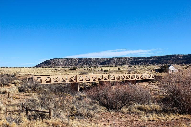
97:
31:
21:
640:35°23'21.001"N, 104°27'33.001"W
370:
148:
14:
369:
26:
1:
675:original creation by uploader
36:
395:Items portrayed in this file
833:
780:Usage on www.wikidata.org
342:same or compatible license
177:. Its reference number is
688:
207:
16:
372:
308:
175:United States of America
104:This is a file from the
745:
213:
203:
196:
193:
140:
108:. Information from its
261:35.389167; -104.459167
111:description page there
46:Size of this preview:
724:21:50, 3 January 2017
70:2,048 × 1,365 pixels
323:– to adapt the work
52:Other resolutions:
493:author name string
463:Wikimedia username
66:1,280 × 853 pixels
62:1,024 × 683 pixels
820:
819:
772:Global file usage
749:
555:copyright license
381:
266:
265:
223:
222:
189:
188:
126:
125:
106:Wikimedia Commons
32:Global file usage
824:
805:Copyright holder
802:
736:
519:copyright status
500:
497:
487:
482:
472:
467:
416:Variadero Bridge
364:
361:
358:
355:
352:
344:as the original.
301:Creative Commons
295:
294:
290:
289:
284:
283:
262:
259:
245:
244:
238:
237:
226:
209:
199:
182:
165:
164:
158:
154:Variadero Bridge
152:
144:
138:
122:
101:
100:
94:
88:
86:
73:
58:640 × 427 pixels
54:320 × 213 pixels
48:800 × 533 pixels
832:
831:
827:
826:
825:
823:
822:
821:
790:
770:
757:
750:
742:
734:
690:
689:
686:
685:
684:
683:
682:
681:
680:
679:
677:
665:
664:
663:
661:
650:
649:
648:
647:
646:
645:
644:
643:
641:
631:
630:
629:
627:
616:
615:
614:
613:
612:
611:
610:
609:
607:
597:
596:
595:
593:
582:
581:
580:
579:
578:
577:
576:
575:
573:
561:
560:
559:
557:
546:
545:
544:
543:
542:
541:
540:
539:
537:
525:
524:
523:
521:
510:
509:
508:
507:
506:
505:
504:
503:
502:
501:
498:
495:
489:
488:
483:
480:
474:
473:
468:
465:
456:
455:
454:
452:
442:
441:
440:
438:
427:
426:
425:
424:
423:
422:
421:
420:
418:
406:
405:
404:
402:
386:
385:
384:
367:
366:
365:
362:
359:
356:
353:
350:
349:
307:
296:
277:
276:
271:
260:
233:
232:
229:Camera location
224:
178:
162:
156:
142:
135:
128:
127:
116:
115:
114:is shown below.
90:
84:
82:
75:
74:
51:
12:
11:
5:
830:
828:
818:
817:
814:
810:
809:
806:
793:
789:
788:
787:
786:
774:
773:
769:
768:
763:
755:
754:
753:
748:
747:
744:
741:DavidAllenBell
740:
737:
733:2,048 × 1,365
731:
726:
721:
717:
716:
713:
710:
707:
704:
701:
694:
693:
678:
673:
671:
670:
669:
668:
667:
666:
662:
659:source of file
657:
655:
654:
653:
652:
651:
642:
639:
637:
636:
635:
634:
633:
632:
628:
623:
621:
620:
619:
618:
608:
606:3 January 2017
605:
603:
602:
601:
600:
599:
598:
594:
589:
587:
586:
585:
584:
583:
574:
569:
567:
566:
565:
564:
563:
562:
558:
553:
551:
550:
549:
548:
547:
538:
533:
531:
530:
529:
528:
527:
526:
522:
517:
515:
514:
513:
512:
511:
491:
490:
476:
475:
461:
460:
459:
458:
457:
453:
450:
448:
447:
446:
445:
444:
443:
439:
434:
432:
431:
430:
429:
428:
419:
414:
412:
411:
410:
409:
408:
407:
403:
398:
396:
393:
392:
391:
390:
389:
378:
377:
374:
371:
348:
347:
346:
345:
335:
326:
325:
324:
318:
311:You are free:
298:
297:
279:
273:
272:
270:
267:
264:
263:
253:
247:
230:
221:
220:
215:
211:
210:
205:
201:
200:
198:3 January 2017
195:
191:
190:
187:
186:
166:
145:
136:
134:
131:
129:
124:
123:
102:
92:
91:
45:
41:
40:
39:
34:
29:
24:
19:
13:
10:
9:
6:
4:
3:
2:
829:
815:
812:
807:
804:
800:
797:
791:
785:
782:
781:
779:
778:
777:
771:
767:
764:
762:
759:
751:
743:
738:
732:
730:
727:
725:
722:
719:
718:
714:
711:
708:
705:
702:
700:
699:
697:
691:
676:
660:
626:
592:
572:
556:
536:
520:
494:
486:
479:
471:
464:
437:
417:
401:
354:CC BY-SA 4.0
343:
339:
336:
333:
330:
329:
327:
322:
319:
316:
313:
312:
310:
309:
305:
302:
285:
268:
258:
254:
252:
251:OpenStreetMap
248:
246:
236:
231:
227:
219:
216:
212:
206:
202:
192:
185:
184:
181:
176:
172:
167:
160:
159:
155:
151:
146:
139:
132:
120:
113:
112:
107:
103:
96:
95:
89:
80:
79:Original file
71:
67:
63:
59:
55:
49:
44:
38:
35:
33:
30:
28:
25:
23:
20:
18:
15:
798:
795:
775:
695:
692:File history
337:
331:
320:
314:
168:
149:
119:You can help
109:
77:
22:File history
813:IIM version
535:copyrighted
499:UltraSparky
470:UltraSparky
338:share alike
332:attribution
218:UltraSparky
141:Description
784:Q112269904
752:File usage
709:Dimensions
451:some value
85:image/jpeg
27:File usage
706:Thumbnail
703:Date/Time
591:inception
269:Licensing
150:English:
792:Metadata
735:(904 KB)
376:Captions
321:to remix
315:to share
306:license.
208:Own work
180:97000736
37:Metadata
720:current
715:Comment
436:creator
400:depicts
380:English
173:in the
133:Summary
81:
239:
214:Author
204:Source
712:User
363:true
360:true
194:Date
17:File
478:URL
496::
481::
466::
68:|
64:|
60:|
56:|
50:.
816:4
183:.
121:.
87:)
72:.
Text is available under the Creative Commons Attribution-ShareAlike License. Additional terms may apply.
