105:
270:
224:
238:
276:
67:
687:{{BotMoveToCommons|en.wikipedia|year={{subst:CURRENTYEAR}}|month={{subst:CURRENTMONTHNAME}}|day={{subst:CURRENTDAY}}}} == {{int:filedesc}} == {{Information |description={{en|1=Victorian Square in LEXKY}} |date=March 2008 |source=I created this work entir
670:
706:
329:– You must give appropriate credit, provide a link to the license, and indicate if changes were made. You may do so in any reasonable manner, but not in any way that suggests the licensor endorses you or your use.
215:
38:
769:
759:
373:{{Information |Description=Victorian Square in LEXKY |Source=I created this work entirely by myself. |Date= March 2008 |Author=~~~ |other_versions= }}
112:
701:
513:
477:
441:
231:
78:
601:
567:
497:
425:
46:
533:
461:
408:
286:
197:
283:
294:
256:
680:
86:
368:
193:
711:
669:
664:
37:
237:
121:
263:, the copyright holder of this work, hereby publishes it under the following license:
73:
99:
221:
163:
707:
National
Register of Historic Places listings in Fayette County, Kentucky
637:
Click on a date/time to view the file as it appeared at that time.
779:
739:
560:
298:
260:
116:
789:
729:
223:
206:
111:
This is an image of a place or building that is listed on the
61:
749:
216:
38° 02′ 58″ N, 84° 30′ 00″ W
392:
Add a one-line explanation of what this file represents
360:
138:
85:
Commons is a freely licensed media file repository.
363:. All following user names refer to en.wikipedia.
51:(500 × 375 pixels, file size: 75 KB, MIME type:
66:
269:
8:
336:https://creativecommons.org/licenses/by/3.0
312:– to copy, distribute and transmit the work
639:
388:
722:The following other wikis use this file:
478:Creative Commons Attribution 3.0 Unported
699:
615:
599:
581:
565:
547:
531:
511:
495:
475:
459:
439:
423:
406:
403:
384:
377:
209:
181:I created this work entirely by myself.
230:View this and other nearby images on:
697:The following 3 pages use this file:
7:
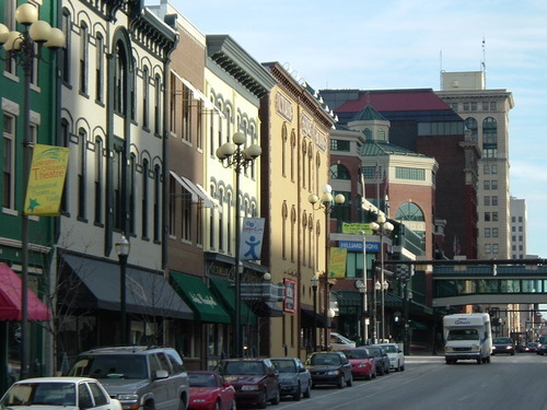
113:National Register of Historic Places
628:
275:
177:
397:
391:
359:The original description page was
358:
303:
266:
255:
148:
98:
44:
396:
342:Creative Commons Attribution 3.0
702:Cityscape of Lexington, Kentucky
382:
323:Under the following conditions:
282:This file is licensed under the
274:
268:
236:
222:
103:
65:
31:
21:
379:
149:
41:No higher resolution available.
14:
378:
26:
1:
568:coordinates of depicted place
514:original creation by uploader
583:38°2'57.998"N, 84°30'0.000"W
404:Items portrayed in this file
776:Usage on szl.wikipedia.org
746:Usage on eml.wikipedia.org
808:
786:Usage on tr.wikipedia.org
766:Usage on ru.wikipedia.org
756:Usage on hy.wikipedia.org
736:Usage on br.wikipedia.org
726:Usage on af.wikipedia.org
119:. Its reference number is
629:
173:
154:Victorian Square in LEXKY
16:
381:
287:Attribution 3.0 Unported
117:United States of America
72:This is a file from the
686:
189:
169:
162:
159:
141:
76:. Information from its
371:500×375 (76382 bytes)
242:38.049444; -84.500000
180:
144:VictorianSquareJBM.jpg
79:description page there
47:VictorianSquareJBM.jpg
770:Лексингтон (Кентукки)
760:Լեքսինգթոն (Կենտուկի)
665:04:17, 9 January 2012
780:Lexington (Kentucky)
740:Lexington (Kentucky)
790:Lexington, Kentucky
730:Lexington, Kentucky
355:Original upload log
318:– to adapt the work
718:Global file usage
690:
462:copyright license
390:
367:2008-09-15 02:27
299:English Knowledge
261:English Knowledge
247:
246:
204:
203:
131:
130:
94:
93:
74:Wikimedia Commons
32:Global file usage
799:
677:
426:copyright status
349:
346:
343:
340:
337:
301:
284:Creative Commons
278:
277:
272:
271:
243:
240:
226:
225:
219:
218:
207:
184:
175:
165:
153:
145:
139:
124:
107:
106:
100:
90:
69:
68:
62:
56:
54:
807:
806:
802:
801:
800:
798:
797:
796:
716:
712:User:Censusdata
691:
683:
675:
631:
630:
627:
626:
625:
624:
623:
622:
621:
620:
618:
608:
607:
606:
604:
593:
592:
591:
590:
589:
588:
587:
586:
584:
574:
573:
572:
570:
559:
558:
557:
556:
555:
554:
553:
552:
550:
540:
539:
538:
536:
525:
524:
523:
522:
521:
520:
519:
518:
516:
504:
503:
502:
500:
489:
488:
487:
486:
485:
484:
483:
482:
480:
468:
467:
466:
464:
453:
452:
451:
450:
449:
448:
447:
446:
444:
432:
431:
430:
428:
417:
416:
415:
414:
413:
411:
395:
394:
393:
364:
357:
352:
351:
350:
347:
344:
341:
338:
335:
334:
302:
293:
290:
279:
265:
264:
252:
241:
214:
213:
210:Object location
205:
182:
178:Original text:
155:
143:
136:
120:
104:
96:
95:
84:
83:
82:is shown below.
58:
52:
50:
43:
42:
12:
11:
5:
805:
803:
795:
794:
793:
792:
784:
783:
782:
774:
773:
772:
764:
763:
762:
754:
753:
752:
744:
743:
742:
734:
733:
732:
720:
719:
715:
714:
709:
704:
695:
694:
689:
688:
685:
682:BotMultichillT
681:
678:
672:
667:
662:
658:
657:
654:
651:
648:
645:
642:
635:
634:
619:
616:
614:
613:
612:
611:
610:
609:
605:
600:
598:
597:
596:
595:
594:
585:
582:
580:
579:
578:
577:
576:
575:
571:
566:
564:
563:
562:
561:
551:
548:
546:
545:
544:
543:
542:
541:
537:
532:
530:
529:
528:
527:
526:
517:
512:
510:
509:
508:
507:
506:
505:
501:
498:source of file
496:
494:
493:
492:
491:
490:
481:
476:
474:
473:
472:
471:
470:
469:
465:
460:
458:
457:
456:
455:
454:
445:
440:
438:
437:
436:
435:
434:
433:
429:
424:
422:
421:
420:
419:
418:
412:
407:
405:
402:
401:
400:
399:
398:
387:
386:
383:
380:
376:
375:
356:
353:
333:
332:
331:
330:
321:
320:
319:
313:
306:You are free:
291:
281:
280:
267:
254:
253:
251:
248:
245:
244:
234:
228:
211:
202:
201:
191:
187:
186:
171:
167:
166:
161:
157:
156:
146:
137:
135:
132:
129:
128:
108:
97:
92:
91:
70:
60:
59:
40:
36:
35:
34:
29:
24:
19:
13:
10:
9:
6:
4:
3:
2:
804:
791:
788:
787:
785:
781:
778:
777:
775:
771:
768:
767:
765:
761:
758:
757:
755:
751:
748:
747:
745:
741:
738:
737:
735:
731:
728:
727:
725:
724:
723:
717:
713:
710:
708:
705:
703:
700:
698:
692:
684:
679:
673:
671:
668:
666:
663:
660:
659:
655:
652:
649:
646:
643:
641:
640:
638:
632:
603:
569:
535:
515:
499:
479:
463:
443:
427:
410:
374:
370:
366:
365:
362:
354:
328:
325:
324:
322:
317:
314:
311:
308:
307:
305:
304:
300:
296:
292:Attribution:
288:
285:
273:
262:
258:
249:
239:
235:
233:
232:OpenStreetMap
229:
227:
217:
212:
208:
199:
195:
192:
188:
183:
172:
168:
158:
152:
147:
140:
133:
127:
126:
123:
118:
114:
109:
102:
101:
88:
81:
80:
75:
71:
64:
63:
57:
48:
39:
33:
30:
28:
25:
23:
20:
18:
15:
721:
696:
636:
633:File history
372:
326:
315:
309:
179:
150:
110:
87:You can help
77:
45:
22:File history
442:copyrighted
327:attribution
142:Description
693:File usage
674:500 × 375
650:Dimensions
617:image/jpeg
602:media type
549:March 2008
369:Censusdata
339:CC BY 3.0
295:Censusdata
257:Censusdata
194:Censusdata
164:March 2008
53:image/jpeg
27:File usage
647:Thumbnail
644:Date/Time
534:inception
250:Licensing
151:English:
750:Stat Unî
385:Captions
316:to remix
310:to share
289:license.
174:Own work
122:78001325
676:(75 KB)
661:current
656:Comment
409:depicts
389:English
134:Summary
115:in the
49:
220:
190:Author
170:Source
653:User
361:here
348:true
345:true
198:talk
160:Date
17:File
297:at
259:at
200:)
196:(
185:)
176:(
125:.
89:.
55:)
Text is available under the Creative Commons Attribution-ShareAlike License. Additional terms may apply.