343:
276:
226:
268:
218:
290:
240:
311:
349:
354:
67:
855:"}},"text\/plain":{"en":{"":"heading"}}},"{\"value\":{\"amount\":\"+90\",\"unit\":\"http:\\\/\\\/www.wikidata.org\\\/entity\\\/Q28390\"},\"type\":\"quantity\"}":{"text\/html":{"en":{"P7787":"90
634:"}},"text\/plain":{"en":{"":"heading"}}},"{\"value\":{\"amount\":\"+90\",\"unit\":\"http:\\\/\\\/www.wikidata.org\\\/entity\\\/Q28390\"},\"type\":\"quantity\"}":{"text\/html":{"en":{"P7787":"90
851:
259:
209:
974:== {{int:filedesc}} == {{Information |description={{en|1=View across Poole Harbour Taken from near to Shipstal Point on the RSPB Arne reserve and looking towards Brownsea Island.}} |date=2009-08-09 |source=From [http://www.geograph.org.uk/photo/1442326 ge
38:
401:– You must give appropriate credit, provide a link to the license, and indicate if changes were made. You may do so in any reasonable manner, but not in any way that suggests the licensor endorses you or your use.
78:
46:
852:
631:
751:
617:
581:
283:
233:
838:
801:
1136:
318:
999:
This file contains additional information, probably added from the digital camera or scanner used to create or digitize it.
956:
951:
408:
37:
516:
121:
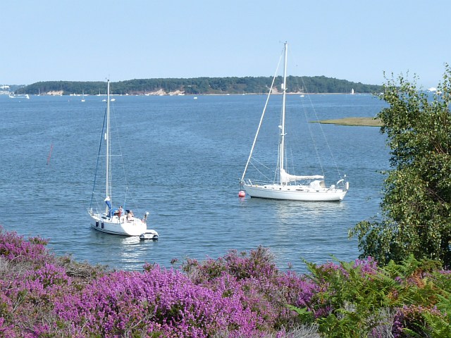
View across Poole
Harbour. Taken from near to Shipstal Point on the RSPB Arne reserve and looking towards Brownsea Island.
893:
866:
822:
764:
735:
672:
645:
565:
537:
524:
509:
794:
779:
701:
601:
482:
465:
305:
364:
1002:
If the file has been modified from its original state, some details may not fully reflect the modified file.
984:
The following pages on the
English Knowledge (XXG) use this file (pages on other projects are not listed):
1163:
407:– If you remix, transform, or build upon the material, you must distribute your contributions under the
325:
on the
Geograph website for the photographer's contact details. The copyright on this image is owned by
967:
361:
1199:
859:"}},"text\/plain":{"en":{"P7787":"90 degree"}}}}": -->
638:"}},"text\/plain":{"en":{"P7787":"90 degree"}}}}": -->
86:
1280:
1105:
786:
771:
544:
162:
289:
239:
1243:
1181:
1028:
988:
330:
73:
1290:
1253:
1068:
178:
1209:
130:
1048:
223:
273:
1011:
151:
141:
1300:
1038:
1021:
310:
322:
924:
Click on a date/time to view the file as it appeared at that time.
1131:
Landscape mode (for landscape photos with the background in focus)
275:
225:
250:
200:
61:
260:
50° 41′ 42″ N, 2° 01′ 23″ W
210:
50° 41′ 42″ N, 2° 01′ 29″ W
111:
View across Poole
Harbour - geograph.org.uk - 1442326.jpg
47:
View_across_Poole_Harbour_-_geograph.org.uk_-_1442326.jpg
449:
Add a one-line explanation of what this file represents
105:
85:
Commons is a freely licensed media file repository.
618:
Creative
Commons Attribution-ShareAlike 2.0 Generic
51:(640 × 480 pixels, file size: 130 KB, MIME type:
1204:Flash did not fire, compulsory flash suppression
418:https://creativecommons.org/licenses/by-sa/2.0
66:
424:Creative Commons Attribution-Share Alike 2.0
342:
8:
856:
635:
384:– to copy, distribute and transmit the work
1004:
926:
445:
787:https://www.geograph.org.uk/photo/1442326
545:https://www.geograph.org.uk/profile/15303
1298:
1288:
1278:
1270:
1262:
1251:
1241:
1233:
1225:
1217:
1207:
1197:
1189:
1179:
1171:
1161:
1153:
1145:
1134:
1126:
1118:
1110:
1100:
1092:
1084:
1076:
1065:
1057:
1046:
1036:
1026:
1016:
986:
880:
864:
836:
820:
749:
733:
715:
699:
659:
643:
615:
599:
579:
563:
496:
480:
463:
460:
441:
434:
253:
203:
282:View this and other nearby images on:
232:View this and other nearby images on:
1006:
7:
329:and is licensed for reuse under the
915:
365:Attribution-Share Alike 2.0 Generic
353:
348:
333:Attribution-ShareAlike 2.0 license.
997:
454:
448:
339:
316:
115:
98:
44:
453:
1059:Date and time of data generation
646:coordinates of the point of view
439:
395:Under the following conditions:
360:This file is licensed under the
352:
347:
341:
309:
288:
274:
266:
238:
224:
216:
65:
21:
436:
116:
41:No higher resolution available.
14:
752:file available on the internet
435:
317:This image was taken from the
26:
1:
867:coordinates of depicted place
31:
802:Geograph Britain and Ireland
510:object of statement has role
461:Items portrayed in this file
1147:Date and time of digitizing
265:
215:
1322:
1264:Focal length in 35 mm film
1222:One-chip color area sensor
882:50°41'42.07"N, 2°1'22.80"W
661:50°41'42.40"N, 2°1'29.28"W
409:same or compatible license
191:Robin Drayton /
172:Robin Drayton /
1112:File change date and time
916:
193:View across Poole Harbour
174:View across Poole Harbour
16:
839:Panasonic Lumix DMC-FZ28
765:geograph.org.uk image ID
438:
375:
72:This is a file from the
1227:Custom image processing
973:
163:required by the license
147:
136:
129:
126:
108:
76:. Information from its
1155:Image compression mode
323:this photograph's page
294:50.695020; -2.023000
244:50.695110; -2.024800
79:description page there
1173:Maximum land aperture
1086:Horizontal resolution
1150:14:53, 9 August 2009
1115:14:53, 9 August 2009
1062:14:53, 9 August 2009
1033:1/320 sec (0.003125)
1120:Y and C positioning
1094:Vertical resolution
1008:Camera manufacturer
952:03:35, 2 March 2011
390:– to adapt the work
1272:Scene capture type
1248:Auto white balance
525:author name string
1309:
1308:
977:
858:
637:
602:copyright license
447:
338:
337:
321:collection. See
299:
298:
249:
248:
198:
197:
166:
94:
93:
74:Wikimedia Commons
1313:
1128:Exposure Program
1005:
964:
904:
903:
898:
804:
799:
789:
784:
780:described at URL
774:
769:
683:
682:
677:
566:copyright status
547:
542:
532:
529:
519:
514:
431:
428:
425:
422:
419:
411:as the original.
373:
362:Creative Commons
356:
355:
351:
350:
345:
344:
331:Creative Commons
319:Geograph project
313:
306:
295:
292:
278:
277:
271:
270:
269:
263:
262:
251:
245:
242:
228:
227:
221:
220:
219:
213:
212:
201:
160:
132:
120:
112:
106:
90:
69:
68:
62:
56:
54:
1321:
1320:
1316:
1315:
1314:
1312:
1311:
1310:
1176:3 APEX (f/2.83)
993:
985:
978:
970:
962:
918:
917:
914:
913:
912:
911:
910:
909:
908:
907:
906:
905:
901:
899:
896:
887:
886:
885:
883:
873:
872:
871:
869:
850:
849:
848:
847:
846:
845:
844:
843:
841:
829:
828:
827:
825:
814:
813:
812:
811:
810:
809:
808:
807:
806:
805:
800:
797:
791:
790:
785:
782:
776:
775:
770:
767:
758:
757:
756:
754:
742:
741:
740:
738:
727:
726:
725:
724:
723:
722:
721:
720:
718:
708:
707:
706:
704:
693:
692:
691:
690:
689:
688:
687:
686:
685:
684:
680:
678:
675:
666:
665:
664:
662:
652:
651:
650:
648:
629:
628:
627:
626:
625:
624:
623:
622:
620:
608:
607:
606:
604:
593:
592:
591:
590:
589:
588:
587:
586:
584:
572:
571:
570:
568:
557:
556:
555:
554:
553:
552:
551:
550:
549:
548:
543:
540:
534:
533:
530:
527:
521:
520:
515:
512:
503:
502:
501:
499:
489:
488:
487:
485:
474:
473:
472:
471:
470:
468:
452:
451:
450:
433:
432:
429:
426:
423:
420:
417:
416:
374:
371:
368:
357:
334:
304:
293:
267:
258:
257:
254:Object location
243:
217:
208:
207:
204:Camera location
199:
188:
181:
169:
142:geograph.org.uk
122:
110:
103:
96:
95:
84:
83:
82:is shown below.
58:
52:
50:
43:
42:
12:
11:
5:
1319:
1317:
1307:
1306:
1303:
1297:
1296:
1293:
1287:
1286:
1283:
1277:
1276:
1273:
1269:
1268:
1265:
1261:
1260:
1257:
1250:
1249:
1246:
1240:
1239:
1236:
1232:
1231:
1230:Normal process
1228:
1224:
1223:
1220:
1219:Sensing method
1216:
1215:
1212:
1206:
1205:
1202:
1196:
1195:
1192:
1188:
1187:
1184:
1178:
1177:
1174:
1170:
1169:
1166:
1160:
1159:
1156:
1152:
1151:
1148:
1144:
1143:
1140:
1133:
1132:
1129:
1125:
1124:
1121:
1117:
1116:
1113:
1109:
1108:
1103:
1099:
1098:
1095:
1091:
1090:
1087:
1083:
1082:
1079:
1075:
1074:
1071:
1064:
1063:
1060:
1056:
1055:
1052:
1045:
1044:
1041:
1035:
1034:
1031:
1025:
1024:
1019:
1015:
1014:
1009:
996:
992:
991:
983:
982:
981:
976:
975:
972:
968:
965:
959:
954:
949:
945:
944:
941:
938:
935:
932:
929:
922:
921:
892:
891:
890:
889:
888:
884:
881:
879:
878:
877:
876:
875:
874:
870:
865:
863:
862:
861:
860:
854:
842:
837:
835:
834:
833:
832:
831:
830:
826:
821:
819:
818:
817:
816:
815:
793:
792:
778:
777:
763:
762:
761:
760:
759:
755:
750:
748:
747:
746:
745:
744:
743:
739:
736:source of file
734:
732:
731:
730:
729:
728:
719:
716:
714:
713:
712:
711:
710:
709:
705:
700:
698:
697:
696:
695:
694:
671:
670:
669:
668:
667:
663:
660:
658:
657:
656:
655:
654:
653:
649:
644:
642:
641:
640:
639:
633:
621:
616:
614:
613:
612:
611:
610:
609:
605:
600:
598:
597:
596:
595:
594:
585:
580:
578:
577:
576:
575:
574:
573:
569:
564:
562:
561:
560:
559:
558:
536:
535:
523:
522:
508:
507:
506:
505:
504:
500:
497:
495:
494:
493:
492:
491:
490:
486:
481:
479:
478:
477:
476:
475:
469:
464:
462:
459:
458:
457:
456:
455:
444:
443:
440:
437:
415:
414:
413:
412:
402:
393:
392:
391:
385:
378:You are free:
369:
359:
358:
340:
336:
335:
314:
303:
300:
297:
296:
286:
280:
255:
247:
246:
236:
230:
205:
196:
195:
189:
186:
183:
182:
177:
170:
167:
155:
154:
149:
145:
144:
138:
134:
133:
128:
124:
123:
113:
104:
102:
99:
97:
92:
91:
70:
60:
59:
40:
36:
35:
34:
29:
24:
19:
13:
10:
9:
6:
4:
3:
2:
1318:
1304:
1302:
1299:
1294:
1292:
1289:
1284:
1282:
1279:
1274:
1271:
1266:
1263:
1258:
1255:
1252:
1247:
1245:
1244:White balance
1242:
1238:Auto exposure
1237:
1235:Exposure mode
1234:
1229:
1226:
1221:
1218:
1213:
1211:
1208:
1203:
1201:
1198:
1193:
1190:
1185:
1183:
1182:Metering mode
1180:
1175:
1172:
1167:
1165:
1164:Exposure bias
1162:
1157:
1154:
1149:
1146:
1141:
1138:
1135:
1130:
1127:
1122:
1119:
1114:
1111:
1107:
1104:
1102:Software used
1101:
1096:
1093:
1088:
1085:
1080:
1077:
1072:
1070:
1066:
1061:
1058:
1053:
1050:
1047:
1042:
1040:
1037:
1032:
1030:
1029:Exposure time
1027:
1023:
1020:
1017:
1013:
1010:
1007:
1003:
1000:
994:
990:
989:Dorset Heaths
987:
979:
971:
966:
960:
958:
955:
953:
950:
947:
946:
942:
939:
936:
933:
930:
928:
927:
925:
919:
895:
868:
840:
824:
823:captured with
803:
796:
788:
781:
773:
766:
753:
737:
717:9 August 2009
703:
674:
647:
619:
603:
583:
567:
546:
539:
531:Robin Drayton
526:
518:
511:
484:
467:
421:CC BY-SA 2.0
410:
406:
403:
400:
397:
396:
394:
389:
386:
383:
380:
379:
377:
376:
372:Robin Drayton
370:Attribution:
366:
363:
346:
332:
328:
327:Robin Drayton
324:
320:
315:
312:
308:
307:
301:
291:
287:
285:
284:OpenStreetMap
281:
279:
261:
256:
252:
241:
237:
235:
234:OpenStreetMap
231:
229:
211:
206:
202:
194:
190:
185:
184:
180:
176: /
175:
171:
164:
159:
157:
156:
153:
152:Robin Drayton
150:
146:
143:
139:
135:
131:9 August 2009
125:
119:
114:
107:
100:
88:
81:
80:
75:
71:
64:
63:
57:
48:
39:
33:
30:
28:
25:
23:
20:
18:
15:
1254:Digital zoom
1191:Light source
1069:focal length
1018:Camera model
1001:
998:
923:
920:File history
517:photographer
404:
398:
387:
381:
326:
264:
214:
192:
179:CC BY-SA 2.0
173:
117:
87:You can help
77:
45:
22:File history
1210:Color space
1078:Orientation
969:GeographBot
582:copyrighted
405:share alike
399:attribution
158:Attribution
109:Description
1291:Saturation
980:File usage
961:640 × 480
937:Dimensions
498:some value
53:image/jpeg
27:File usage
1301:Sharpness
1106:Ver.1.0
1049:ISO speed
1012:Panasonic
934:Thumbnail
931:Date/Time
702:inception
302:Licensing
187:InfoField
168:InfoField
118:English:
1281:Contrast
1275:Standard
1123:Co-sited
1039:F-number
1022:DMC-FZ28
995:Metadata
963:(130 KB)
795:operator
442:Captions
388:to remix
382:to share
367:license.
32:Metadata
1194:Unknown
1186:Pattern
1139:version
1097:180 dpi
1089:180 dpi
948:current
943:Comment
894:heading
853:heading
772:1442326
673:heading
632:heading
483:creator
466:depicts
446:English
101:Summary
49:
1305:Normal
1295:Normal
1285:Normal
1081:Normal
1073:9.2 mm
1051:rating
902:degree
857:degree
681:degree
636:degree
272:
222:
148:Author
137:Source
1267:52 mm
1256:ratio
1200:Flash
1067:Lens
1043:f/5.6
140:From
1214:sRGB
1142:2.21
1137:Exif
940:User
430:true
427:true
127:Date
17:File
1054:100
900:90
679:90
538:URL
897::
798::
783::
768::
676::
541::
528::
513::
1259:0
1168:0
1158:4
165:)
161:(
89:.
55:)
Text is available under the Creative Commons Attribution-ShareAlike License. Additional terms may apply.
_heading:90.00&language=en)
_heading:90.00&language=en)
