43:
204:
210:
215:
99:
562:
532:
502:
256:– You must give appropriate credit, provide a link to the license, and indicate if changes were made. You may do so in any reasonable manner, but not in any way that suggests the licensor endorses you or your use.
1313:
981:
976:
671:
73:
69:
65:
61:
57:
53:
47:
110:
82:
1284:
1184:
1164:
1189:
1104:
636:
188:
831:
746:
1304:
1274:
561:
556:
531:
526:
413:
377:
846:
1169:
761:
741:
666:
611:
580:
1324:
This file contains additional information, probably added from the digital camera or scanner used to create or digitize it.
1259:
1229:
263:
433:
361:
1234:
816:
397:
344:
1269:
1264:
1244:
1049:
999:
676:
225:
1039:
1327:
If the file has been modified from its original state, some details may not fully reflect the modified file.
1139:
1014:
1084:
592:
The following pages on the
English Knowledge (XXG) use this file (pages on other projects are not listed):
1209:
1204:
501:
496:
42:
262:– If you remix, transform, or build upon the material, you must distribute your contributions under the
1154:
1079:
916:
696:
222:
1219:
1179:
1149:
512:
1024:
1124:
118:
966:
941:
841:
836:
826:
776:
726:
716:
656:
1289:
1239:
931:
811:
691:
149:
This map may be incomplete, and may contain errors. Don't rely solely on it for navigation.
881:
641:
626:
596:
1294:
1279:
1254:
1114:
876:
871:
781:
751:
701:
661:
601:
911:
771:
196:
105:
606:
297:
961:
956:
951:
886:
766:
1249:
1224:
1214:
1199:
1174:
851:
646:
1009:
144:
971:
946:
926:
891:
821:
791:
731:
651:
631:
572:
542:
1299:
801:
921:
901:
896:
856:
756:
736:
706:
686:
681:
936:
906:
861:
796:
721:
1194:
806:
786:
616:
132:
469:
Click on a date/time to view the file as it appeared at that time.
1134:
1069:
1059:
866:
621:
711:
167:
93:
87:(SVG file, nominally 2,488 × 2,029 pixels, file size: 24.9 MB)
1064:
1040:
Plantilla:Mapa de localización de
Condado de Vukovar-Srijem
143:
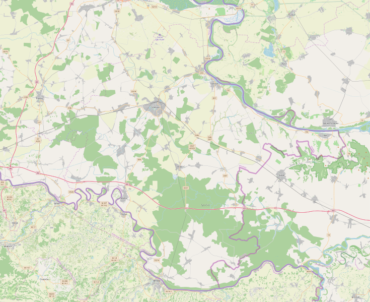
This map of
Vukovarsko-srijemska županija was created from
1155:
Module:Location map/data/Croatia
Vukovar-Srijem County/doc
982:
Module:Location map/data/Croatia
Vukovar-Srijem County/doc
1085:
Modul:Location map/data/Vukovarsko-srijemska županija/doc
1094:
328:
Add a one-line explanation of what this file represents
306:
If inappropriate please set warp_status = skip to hide.
1150:
Module:Location map/data/Croatia
Vukovar-Srijem County
977:
Module:Location map/data/Croatia
Vukovar-Srijem County
1140:Šablon:Lokacijska karta Vukovarsko-srijemska županija
1080:
Modul:Location map/data/Vukovarsko-srijemska županija
1015:Šablon:Lokacijska karta Vukovarsko-srijemska županija
1034:
1025:
Plantilya:Location map
Croatia Vukovar-Srijem County
117:
Commons is a freely licensed media file repository.
1125:
Template:Location map
Croatia Vukovar-Srijem County
1074:
414:
Creative
Commons Attribution-ShareAlike 2.0 Generic
199:Attribution-ShareAlike 2.0 license (CC-BY-SA 2.0).
195:OpenStreetMap data and maps are licensed under the
1050:الگو:Location map Croatia Vukovar-Srijem County
1000:قالب:Location map Croatia Vukovar-Syrmia County
672:Church of the Nativity of the Theotokos, Gaboš
273:https://creativecommons.org/licenses/by-sa/2.0
98:
279:Creative Commons Attribution-Share Alike 2.0
203:
8:
239:– to copy, distribute and transmit the work
46:Size of this PNG preview of this SVG file:
1329:
471:
324:
147:project data, collected by the community.
992:The following other wikis use this file:
1339:
1331:
594:
447:
431:
411:
395:
375:
359:
342:
339:
320:
313:
300:Georeference the map in Wikimaps Warper
138:Vukovar-Srijem County OpenStreetMap.svg
7:
460:
226:Attribution-Share Alike 2.0 Generic
214:
209:
1322:
333:
327:
200:
130:
80:
332:
318:
250:Under the following conditions:
221:This file is licensed under the
213:
208:
202:
97:
31:
21:
847:Privlaka, Vukovar-Syrmia County
832:Podgrađe, Vukovar-Syrmia County
747:Lipovača, Vukovar-Syrmia County
315:
14:
762:Marinci, Vukovar-Syrmia County
742:Lipovac, Vukovar-Syrmia County
667:Church of Saint Anne, Slakovci
612:Banovci, Vukovar-Syrmia County
581:Category:Vukovar-Syrmia County
314:
26:
1:
1010:Vukovarsko-srijemska županija
637:Bokšić, Vukovar-Srijem County
298:
36:
340:Items portrayed in this file
1121:Usage on sco.wikipedia.org
1101:Usage on rue.wikipedia.org
1021:Usage on ceb.wikipedia.org
817:Otok, Vukovar-Syrmia County
1361:
1161:Usage on sr.wikipedia.org
1146:Usage on si.wikipedia.org
1131:Usage on sh.wikipedia.org
1111:Usage on ru.wikipedia.org
1091:Usage on id.wikipedia.org
1056:Usage on hr.wikipedia.org
1046:Usage on fa.wikipedia.org
1031:Usage on es.wikipedia.org
1006:Usage on bs.wikipedia.org
996:Usage on ar.wikipedia.org
264:same or compatible license
178:OpenStreetMap contributors
461:
16:
677:Donje Novo Selo, Croatia
317:
230:
104:This is a file from the
578:
548:
518:
292:
183:
173:
163:
155:
135:
108:. Information from its
497:20:00, 20 October 2019
111:description page there
1070:Vukovarski vodotoranj
74:2,488 × 2,029 pixels
70:2,511 × 2,048 pixels
66:1,256 × 1,024 pixels
1285:Градиште (Хрватска)
1185:Дреновци (Хрватска)
1165:Мирковци (Винковци)
557:18:34, 6 March 2010
527:19:24, 6 March 2010
245:– to adapt the work
52:Other resolutions:
917:Vinkovački Banovci
579:{{OpenStreetMap}}
159:(see file history)
1348:
1347:
1314:more global usage
1305:Нијемци (општина)
1275:Бошњаци (општина)
1190:Посавски Подгајци
1105:Жупа Вуковар-Срѣм
988:Global file usage
842:Posavski Podgajci
837:Podrinje, Croatia
827:Petrovci, Croatia
777:Mirkovci, Croatia
717:Ivankovo, Croatia
697:Gradište, Croatia
585:
398:copyright license
326:
311:
310:
307:
192:
189:Reusing this file
168:openstreetmap.org
150:
126:
125:
106:Wikimedia Commons
32:Global file usage
1352:
1330:
1170:Врбања (општина)
1135:Masakr na Ovčari
1060:Šarengradska ada
932:Vrbanja, Croatia
812:Ostrovo, Croatia
692:Grabovo, Croatia
569:
539:
509:
362:copyright status
305:
304:
302:
301:
286:
283:
280:
277:
274:
266:as the original.
223:Creative Commons
217:
216:
212:
211:
206:
205:
197:Creative Commons
186:
148:
139:
133:
122:
101:
100:
94:
88:
77:
62:942 × 768 pixels
58:589 × 480 pixels
54:294 × 240 pixels
48:735 × 599 pixels
1360:
1359:
1355:
1354:
1353:
1351:
1350:
1349:
1318:
986:
967:Štitar, Croatia
942:Ćelije, Croatia
882:Stari Mikanovci
642:Borovo, Croatia
627:Bobota, Croatia
593:
586:
575:
567:
545:
537:
519:Update of a map
515:
507:
463:
462:
459:
458:
457:
456:
455:
454:
453:
452:
450:
440:
439:
438:
436:
425:
424:
423:
422:
421:
420:
419:
418:
416:
404:
403:
402:
400:
389:
388:
387:
386:
385:
384:
383:
382:
380:
368:
367:
366:
364:
353:
352:
351:
350:
349:
347:
331:
330:
329:
312:
299:
296:
288:
287:
284:
281:
278:
275:
272:
271:
229:
218:
179:
151:
137:
128:
127:
116:
115:
114:is shown below.
90:
86:
79:
78:
51:
12:
11:
5:
1358:
1356:
1346:
1345:
1342:
1338:
1337:
1334:
1321:
1316:of this file.
1310:
1309:
1308:
1307:
1302:
1297:
1292:
1287:
1282:
1277:
1272:
1267:
1262:
1260:Шидски Бановци
1257:
1252:
1247:
1242:
1237:
1232:
1230:Стари Јанковци
1227:
1222:
1217:
1212:
1207:
1202:
1197:
1192:
1187:
1182:
1177:
1172:
1167:
1159:
1158:
1157:
1152:
1144:
1143:
1142:
1137:
1129:
1128:
1127:
1119:
1118:
1117:
1109:
1108:
1107:
1099:
1098:
1097:
1089:
1088:
1087:
1082:
1077:
1072:
1067:
1065:Vukovarska ada
1062:
1054:
1053:
1052:
1044:
1043:
1042:
1037:
1029:
1028:
1027:
1019:
1018:
1017:
1012:
1004:
1003:
1002:
990:
989:
985:
984:
979:
974:
969:
964:
959:
954:
949:
944:
939:
934:
929:
924:
919:
914:
909:
904:
899:
894:
889:
884:
879:
877:Stari Jankovci
874:
872:Srijemske Laze
869:
864:
859:
854:
849:
844:
839:
834:
829:
824:
819:
814:
809:
804:
799:
794:
789:
784:
782:Mlaka Antinska
779:
774:
769:
764:
759:
754:
752:Lovas, Croatia
749:
744:
739:
734:
729:
724:
719:
714:
709:
704:
702:Gunja, Croatia
699:
694:
689:
684:
679:
674:
669:
664:
662:Cerna, Croatia
659:
657:Cerić, Croatia
654:
649:
644:
639:
634:
629:
624:
619:
614:
609:
604:
602:Antin, Croatia
599:
591:
590:
589:
584:
583:
577:
573:
570:
564:
559:
554:
551:
550:
547:
543:
540:
534:
529:
524:
521:
520:
517:
513:
510:
506:2,488 × 2,029
504:
499:
494:
490:
489:
486:
483:
480:
477:
474:
467:
466:
451:
448:
446:
445:
444:
443:
442:
441:
437:
432:
430:
429:
428:
427:
426:
417:
412:
410:
409:
408:
407:
406:
405:
401:
396:
394:
393:
392:
391:
390:
381:
376:
374:
373:
372:
371:
370:
369:
365:
360:
358:
357:
356:
355:
354:
348:
343:
341:
338:
337:
336:
335:
334:
323:
322:
319:
316:
309:
308:
294:
293:Georeferencing
290:
289:
270:
269:
268:
267:
257:
248:
247:
246:
240:
233:You are free:
220:
219:
201:
193:
181:
180:
177:
175:
171:
170:
165:
161:
160:
157:
153:
152:
142:
140:
131:
129:
124:
123:
102:
92:
91:
45:
41:
40:
39:
34:
29:
24:
19:
13:
10:
9:
6:
4:
3:
2:
1357:
1343:
1340:
1335:
1332:
1328:
1325:
1319:
1317:
1315:
1306:
1303:
1301:
1298:
1296:
1293:
1291:
1288:
1286:
1283:
1281:
1278:
1276:
1273:
1271:
1268:
1266:
1263:
1261:
1258:
1256:
1253:
1251:
1248:
1246:
1243:
1241:
1238:
1236:
1235:Нови Јанковци
1233:
1231:
1228:
1226:
1223:
1221:
1218:
1216:
1213:
1211:
1208:
1206:
1203:
1201:
1198:
1196:
1193:
1191:
1188:
1186:
1183:
1181:
1178:
1176:
1173:
1171:
1168:
1166:
1163:
1162:
1160:
1156:
1153:
1151:
1148:
1147:
1145:
1141:
1138:
1136:
1133:
1132:
1130:
1126:
1123:
1122:
1120:
1116:
1113:
1112:
1110:
1106:
1103:
1102:
1100:
1096:
1093:
1092:
1090:
1086:
1083:
1081:
1078:
1076:
1073:
1071:
1068:
1066:
1063:
1061:
1058:
1057:
1055:
1051:
1048:
1047:
1045:
1041:
1038:
1036:
1033:
1032:
1030:
1026:
1023:
1022:
1020:
1016:
1013:
1011:
1008:
1007:
1005:
1001:
998:
997:
995:
994:
993:
987:
983:
980:
978:
975:
973:
970:
968:
965:
963:
960:
958:
955:
953:
950:
948:
945:
943:
940:
938:
935:
933:
930:
928:
925:
923:
920:
918:
915:
913:
912:Vera, Croatia
910:
908:
905:
903:
900:
898:
895:
893:
890:
888:
885:
883:
880:
878:
875:
873:
870:
868:
865:
863:
860:
858:
855:
853:
850:
848:
845:
843:
840:
838:
835:
833:
830:
828:
825:
823:
820:
818:
815:
813:
810:
808:
805:
803:
800:
798:
795:
793:
790:
788:
785:
783:
780:
778:
775:
773:
770:
768:
765:
763:
760:
758:
755:
753:
750:
748:
745:
743:
740:
738:
735:
733:
730:
728:
725:
723:
720:
718:
715:
713:
710:
708:
705:
703:
700:
698:
695:
693:
690:
688:
685:
683:
680:
678:
675:
673:
670:
668:
665:
663:
660:
658:
655:
653:
650:
648:
645:
643:
640:
638:
635:
633:
630:
628:
625:
623:
620:
618:
615:
613:
610:
608:
605:
603:
600:
598:
595:
587:
582:
576:
571:
565:
563:
560:
558:
555:
553:
552:
546:
541:
535:
533:
530:
528:
525:
523:
522:
516:
511:
505:
503:
500:
498:
495:
492:
491:
487:
484:
481:
478:
475:
473:
472:
470:
464:
449:image/svg+xml
435:
415:
399:
379:
363:
346:
303:
295:
291:
276:CC BY-SA 2.0
265:
261:
258:
255:
252:
251:
249:
244:
241:
238:
235:
234:
232:
231:
227:
224:
207:
198:
194:
190:
185:
182:
176:
172:
169:
166:
162:
158:
154:
146:
145:OpenStreetMap
141:
134:
120:
113:
112:
107:
103:
96:
95:
89:
84:
83:Original file
75:
71:
67:
63:
59:
55:
49:
44:
38:
35:
33:
30:
28:
25:
23:
20:
18:
15:
1326:
1323:
1311:
1270:Андријашевци
1265:Бабина Греда
1245:Сремске Лазе
991:
607:Babina Greda
597:Andrijaševci
468:
465:File history
259:
253:
242:
236:
119:You can help
109:
81:
22:File history
852:Rajevo Selo
727:Karadžićevo
378:copyrighted
260:share alike
254:attribution
136:Description
1210:Богдановци
1205:Негославци
1095:Negoslavci
892:Tompojevci
792:Negoslavci
772:Mikluševci
732:Komletinci
632:Bogdanovci
588:File usage
566:564 × 534
536:555 × 536
482:Dimensions
434:media type
184:Permission
27:File usage
1220:Маркушица
1180:Строшинци
962:Šarengrad
952:Đeletovci
887:Strošinci
767:Markušica
508:(24.9 MB)
479:Thumbnail
476:Date/Time
1320:Metadata
1290:Иванково
1240:Слаковци
922:Vinkovci
902:Tovarnik
897:Tordinci
857:Slakovci
757:Ludvinci
682:Drenovci
647:Bošnjaci
568:(442 KB)
538:(418 KB)
514:Vedran V
321:Captions
243:to remix
237:to share
228:license.
37:Metadata
1295:Јармина
1280:Вођинци
1255:Бршадин
1115:Трпинья
1035:Vukovar
972:Županja
947:Čakovci
937:Vukovar
927:Vođinci
907:Trpinja
862:Soljani
822:Pačetin
797:Nijemci
722:Jarmina
652:Bršadin
493:current
488:Comment
345:depicts
325:English
174:Creator
85:
1344:1623pt
1341:Height
1336:1990pt
1250:Нуштар
1225:Оролик
1215:Борово
1200:Трпиња
1175:Сољани
1075:Smogva
957:Đurići
807:Orolik
802:Nuštar
787:Mohovo
617:Bapska
164:Source
1333:Width
1312:View
1300:Ловас
867:Sotin
737:Korođ
707:Ilača
687:Gaboš
622:Berak
1195:Гуња
712:Ilok
574:Ex13
544:Ex13
485:User
285:true
282:true
156:Date
17:File
549:new
72:|
68:|
64:|
60:|
56:|
50:.
191:)
187:(
121:.
76:.
Text is available under the Creative Commons Attribution-ShareAlike License. Additional terms may apply.
