332:
265:
215:
257:
207:
279:
229:
300:
338:
343:
72:
827:"}},"text\/plain":{"en":{"":"heading"}}},"{\"value\":{\"amount\":\"+22\",\"unit\":\"http:\\\/\\\/www.wikidata.org\\\/entity\\\/Q28390\"},\"type\":\"quantity\"}":{"text\/html":{"en":{"P7787":"22
763:"}},"text\/plain":{"en":{"":"heading"}}},"{\"value\":{\"amount\":\"+22\",\"unit\":\"http:\\\/\\\/www.wikidata.org\\\/entity\\\/Q28390\"},\"type\":\"quantity\"}":{"text\/html":{"en":{"P7787":"22
759:
963:
390:– You must give appropriate credit, provide a link to the license, and indicate if changes were made. You may do so in any reasonable manner, but not in any way that suggests the licensor endorses you or your use.
984:|Source=Geograph http://www.geograph.org.uk/photo/211281 |Date=Sunday, 30 July, 2006 |Author=DS Pugh |Permission=see below |other_versions= }} {{geograph|211281|DS Pugh}} [[Category:East Riding of
198:
824:
760:
43:
176:
695:
625:
589:
272:
222:
715:
1191:
307:
1054:
This file contains additional information, probably added from the digital camera or scanner used to create or digitize it.
470:
397:
552:
894:
865:
838:
801:
774:
723:
679:
573:
545:
532:
517:
738:
708:
645:
609:
490:
454:
294:
130:
353:
1057:
If the file has been modified from its original state, some details may not fully reflect the modified file.
994:
The following pages on the
English Knowledge (XXG) use this file (pages on other projects are not listed):
83:
1239:
396:– If you remix, transform, or build upon the material, you must distribute your contributions under the
314:
on the
Geograph website for the photographer's contact details. The copyright on this image is owned by
51:
350:
1275:
831:"}},"text\/plain":{"en":{"P7787":"22 degree"}}}}": -->
767:"}},"text\/plain":{"en":{"P7787":"22 degree"}}}}": -->
973:
91:
1160:
745:
730:
524:
278:
228:
1257:
1083:
319:
78:
1123:
212:
126:
1293:
962:
957:
42:
144:
1103:
998:
981:
262:
165:
155:
1093:
299:
1026:
311:
135:
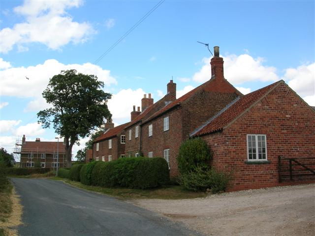
The hamlet of
Youlthorpe, between Bishop Wilton and Stamford Bridge.
930:
Click on a date/time to view the file as it appeared at that time.
1076:
1066:
264:
214:
239:
199:
53° 59′ 23.5″ N, 0° 49′ 54.03″ W
189:
66:
249:
53° 59′ 28″ N, 0° 49′ 52″ W
1041:
1016:
438:
Add a one-line explanation of what this file represents
1036:
183:
Creative
Commons Attribution Share-alike license 2.0
110:
90:
Commons is a freely licensed media file repository.
626:
Creative
Commons Attribution-ShareAlike 2.0 Generic
1280:Flash did not fire, compulsory flash suppression
56:(640 × 479 pixels, file size: 53 KB, MIME type:
407:https://creativecommons.org/licenses/by-sa/2.0
71:
413:Creative Commons Attribution-Share Alike 2.0
331:
8:
828:
764:
373:– to copy, distribute and transmit the work
1059:
932:
434:
1009:The following other wikis use this file:
746:https://www.geograph.org.uk/photo/211281
525:https://www.geograph.org.uk/profile/1469
1309:
1301:
1291:
1283:
1273:
1265:
1255:
1247:
1237:
1229:
1208:
1200:
1189:
1181:
1173:
1165:
1155:
1147:
1139:
1131:
1120:
1112:
1101:
1091:
1081:
1071:
996:
908:
892:
852:
836:
788:
772:
693:
677:
659:
643:
623:
607:
587:
571:
504:
488:
468:
452:
449:
430:
423:
242:
192:
271:View this and other nearby images on:
221:View this and other nearby images on:
1061:
7:
318:and is licensed for reuse under the
921:
354:Attribution-Share Alike 2.0 Generic
342:
337:
322:Attribution-ShareAlike 2.0 license.
1052:
443:
437:
328:
305:
120:
103:
49:
442:
1114:Date and time of data generation
775:coordinates of the point of view
428:
384:Under the following conditions:
349:This file is licensed under the
341:
336:
330:
298:
277:
263:
255:
227:
213:
205:
70:
31:
21:
425:
121:
46:No higher resolution available.
14:
1088:2/377 sec (0.0053050397877984)
696:file available on the internet
424:
306:This image was taken from the
26:
1:
1314:A directly photographed image
839:coordinates of depicted place
790:53°59'23.503"N, 0°49'54.034"W
36:
716:Geograph Britain and Ireland
546:object of statement has role
450:Items portrayed in this file
1202:Date and time of digitizing
980:{{Information |Description=
254:
204:
1331:
1285:Supported Flashpix version
1033:Usage on www.wikidata.org
1023:Usage on sv.wikipedia.org
1013:Usage on pl.wikipedia.org
398:same or compatible license
1210:Meaning of each component
1167:File change date and time
1027:Youlthorpe with Gowthorpe
922:
854:53°59'28.3"N, 0°49'51.6"W
16:
724:geograph.org.uk image ID
427:
364:
131:East Riding of Yorkshire
77:This is a file from the
979:
171:
161:
150:
143:
140:
113:
81:. Information from its
1231:Image compression mode
958:13:55, 2 November 2007
312:this photograph's page
283:53.991200; -0.831000
233:53.989862; -0.831676
84:description page there
1249:Maximum land aperture
1141:Horizontal resolution
1306:Digital still camera
1205:12:48, 30 July 2006
1175:Y and C positioning
1170:12:48, 30 July 2006
1149:Vertical resolution
1117:12:48, 30 July 2006
1063:Camera manufacturer
379:– to adapt the work
533:author name string
1318:
1317:
1005:Global file usage
987:
830:
766:
610:copyright license
436:
327:
326:
310:collection. See
288:
287:
238:
237:
187:
186:
180:
177:Reusing this file
99:
98:
79:Wikimedia Commons
32:Global file usage
1322:
1183:Exposure Program
1060:
970:
876:
875:
870:
812:
811:
806:
748:
743:
739:described at URL
733:
728:
718:
713:
574:copyright status
555:
550:
540:
537:
527:
522:
420:
417:
414:
411:
408:
400:as the original.
362:
351:Creative Commons
345:
344:
340:
339:
334:
333:
320:Creative Commons
308:Geograph project
302:
295:
284:
281:
267:
266:
260:
259:
258:
252:
251:
240:
234:
231:
217:
216:
210:
209:
208:
202:
201:
190:
174:
146:
125:
117:
111:
95:
74:
73:
67:
61:
59:
1330:
1329:
1325:
1324:
1323:
1321:
1320:
1319:
1252:3 APEX (f/2.83)
1048:
1003:
995:
988:
976:
968:
924:
923:
920:
919:
918:
917:
916:
915:
914:
913:
911:
901:
900:
899:
897:
886:
885:
884:
883:
882:
881:
880:
879:
878:
877:
873:
871:
868:
859:
858:
857:
855:
845:
844:
843:
841:
822:
821:
820:
819:
818:
817:
816:
815:
814:
813:
809:
807:
804:
795:
794:
793:
791:
781:
780:
779:
777:
758:
757:
756:
755:
754:
753:
752:
751:
750:
749:
744:
741:
735:
734:
729:
726:
720:
719:
714:
711:
702:
701:
700:
698:
686:
685:
684:
682:
671:
670:
669:
668:
667:
666:
665:
664:
662:
652:
651:
650:
648:
637:
636:
635:
634:
633:
632:
631:
630:
628:
616:
615:
614:
612:
601:
600:
599:
598:
597:
596:
595:
594:
592:
580:
579:
578:
576:
565:
564:
563:
562:
561:
560:
559:
558:
557:
556:
551:
548:
542:
541:
538:
535:
529:
528:
523:
520:
511:
510:
509:
507:
497:
496:
495:
493:
482:
481:
480:
479:
478:
477:
476:
475:
473:
461:
460:
459:
457:
441:
440:
439:
422:
421:
418:
415:
412:
409:
406:
405:
363:
360:
357:
346:
323:
293:
282:
256:
247:
246:
243:Object location
232:
206:
197:
196:
193:Camera location
188:
156:geograph.org.uk
136:
115:
108:
101:
100:
89:
88:
87:is shown below.
63:
57:
55:
48:
47:
12:
11:
5:
1328:
1326:
1316:
1315:
1312:
1308:
1307:
1304:
1300:
1299:
1296:
1290:
1289:
1286:
1282:
1281:
1278:
1272:
1271:
1268:
1264:
1263:
1260:
1254:
1253:
1250:
1246:
1245:
1242:
1236:
1235:
1232:
1228:
1227:
1226:
1225:
1224:does not exist
1222:
1219:
1216:
1211:
1207:
1206:
1203:
1199:
1198:
1195:
1188:
1187:
1186:Normal program
1184:
1180:
1179:
1176:
1172:
1171:
1168:
1164:
1163:
1158:
1154:
1153:
1150:
1146:
1145:
1142:
1138:
1137:
1134:
1130:
1129:
1126:
1119:
1118:
1115:
1111:
1110:
1107:
1100:
1099:
1096:
1090:
1089:
1086:
1080:
1079:
1074:
1070:
1069:
1064:
1051:
1047:
1046:
1045:
1044:
1039:
1031:
1030:
1029:
1021:
1020:
1019:
1007:
1006:
1002:
1001:
993:
992:
991:
986:
985:
978:
974:
971:
965:
960:
955:
951:
950:
947:
944:
941:
938:
935:
928:
927:
912:
909:
907:
906:
905:
904:
903:
902:
898:
893:
891:
890:
889:
888:
887:
864:
863:
862:
861:
860:
856:
853:
851:
850:
849:
848:
847:
846:
842:
837:
835:
834:
833:
832:
826:
800:
799:
798:
797:
796:
792:
789:
787:
786:
785:
784:
783:
782:
778:
773:
771:
770:
769:
768:
762:
737:
736:
722:
721:
707:
706:
705:
704:
703:
699:
694:
692:
691:
690:
689:
688:
687:
683:
680:source of file
678:
676:
675:
674:
673:
672:
663:
660:
658:
657:
656:
655:
654:
653:
649:
644:
642:
641:
640:
639:
638:
629:
624:
622:
621:
620:
619:
618:
617:
613:
608:
606:
605:
604:
603:
602:
593:
588:
586:
585:
584:
583:
582:
581:
577:
572:
570:
569:
568:
567:
566:
544:
543:
531:
530:
516:
515:
514:
513:
512:
508:
505:
503:
502:
501:
500:
499:
498:
494:
489:
487:
486:
485:
484:
483:
474:
469:
467:
466:
465:
464:
463:
462:
458:
453:
451:
448:
447:
446:
445:
444:
433:
432:
429:
426:
404:
403:
402:
401:
391:
382:
381:
380:
374:
367:You are free:
358:
348:
347:
329:
325:
324:
303:
292:
289:
286:
285:
275:
269:
244:
236:
235:
225:
219:
194:
185:
184:
181:
169:
168:
163:
159:
158:
152:
148:
147:
142:
138:
137:
118:
116:Youlthorpe.jpg
109:
107:
104:
102:
97:
96:
75:
65:
64:
52:Youlthorpe.jpg
45:
41:
40:
39:
34:
29:
24:
19:
13:
10:
9:
6:
4:
3:
2:
1327:
1313:
1310:
1305:
1302:
1297:
1295:
1292:
1287:
1284:
1279:
1277:
1274:
1269:
1266:
1261:
1259:
1258:Metering mode
1256:
1251:
1248:
1243:
1241:
1240:Exposure bias
1238:
1233:
1230:
1223:
1220:
1217:
1214:
1213:
1212:
1209:
1204:
1201:
1196:
1193:
1190:
1185:
1182:
1177:
1174:
1169:
1166:
1162:
1159:
1157:Software used
1156:
1151:
1148:
1143:
1140:
1135:
1132:
1127:
1125:
1121:
1116:
1113:
1108:
1105:
1102:
1097:
1095:
1092:
1087:
1085:
1084:Exposure time
1082:
1078:
1075:
1072:
1068:
1065:
1062:
1058:
1055:
1049:
1043:
1040:
1038:
1035:
1034:
1032:
1028:
1025:
1024:
1022:
1018:
1015:
1014:
1012:
1011:
1010:
1004:
1000:
997:
989:
983:
977:
975:Angusmclellan
972:
966:
964:
961:
959:
956:
953:
952:
948:
945:
942:
939:
936:
934:
933:
931:
925:
896:
867:
840:
803:
776:
747:
740:
732:
725:
717:
710:
697:
681:
647:
627:
611:
591:
575:
554:
547:
534:
526:
519:
492:
472:
456:
410:CC BY-SA 2.0
399:
395:
392:
389:
386:
385:
383:
378:
375:
372:
369:
368:
366:
365:
359:Attribution:
355:
352:
335:
321:
317:
313:
309:
304:
301:
297:
296:
290:
280:
276:
274:
273:OpenStreetMap
270:
268:
250:
245:
241:
230:
226:
224:
223:OpenStreetMap
220:
218:
200:
195:
191:
182:
178:
173:
170:
167:
164:
160:
157:
153:
149:
139:
134:
132:
128:
124:
119:
112:
105:
93:
86:
85:
80:
76:
69:
68:
62:
53:
44:
38:
35:
33:
30:
28:
25:
23:
20:
18:
15:
1267:Light source
1124:focal length
1073:Camera model
1056:
1053:
1008:
929:
926:File history
661:30 July 2006
553:photographer
393:
387:
376:
370:
315:
253:
203:
145:30 July 2006
122:
92:You can help
82:
50:
22:File history
1303:File source
1294:Color space
1133:Orientation
590:copyrighted
394:share alike
388:attribution
114:Description
1311:Scene type
1042:Q128709845
1017:Youlthorpe
999:Youlthorpe
990:File usage
982:Youlthorpe
967:640 × 479
943:Dimensions
910:image/jpeg
895:media type
506:some value
172:Permission
133:, England.
127:Youlthorpe
58:image/jpeg
27:File usage
1161:E4100v1.0
1104:ISO speed
940:Thumbnail
937:Date/Time
646:inception
291:Licensing
123:English:
1178:Co-sited
1094:F-number
1050:Metadata
1037:Q8057781
709:operator
471:scaffold
431:Captions
377:to remix
371:to share
356:license.
37:Metadata
1270:Unknown
1262:Pattern
1194:version
1152:300 dpi
1144:300 dpi
969:(53 KB)
954:current
949:Comment
866:heading
825:heading
802:heading
761:heading
539:DS Pugh
491:creator
455:depicts
435:English
361:DS Pugh
316:DS Pugh
166:DS Pugh
106:Summary
54:
1136:Normal
1128:5.8 mm
1106:rating
874:degree
829:degree
810:degree
765:degree
731:211281
261:
211:
162:Author
151:Source
1276:Flash
1122:Lens
1098:f/5.6
1077:E4100
1067:NIKON
154:From
1298:sRGB
1192:Exif
946:User
419:true
416:true
141:Date
17:File
1197:2.2
872:22
808:22
518:URL
1221:Cr
1218:Cb
1109:50
869::
805::
742::
727::
712::
549::
536::
521::
129:,
1288:1
1244:0
1234:2
1215:Y
179:)
175:(
94:.
60:)
Text is available under the Creative Commons Attribution-ShareAlike License. Additional terms may apply.
_region:GB-ENG_heading:22.00&language=en)
