246:
207:
221:
252:
38:
257:
98:
812:
298:– You must give appropriate credit, provide a link to the license, and indicate if changes were made. You may do so in any reasonable manner, but not in any way that suggests the licensor endorses you or your use.
198:
843:
757:
619:
583:
379:
214:
430:
1200:
859:
This file contains additional information, probably added from the digital camera or scanner used to create or digitize it.
305:
464:
396:
741:
707:
673:
567:
539:
524:
511:
413:
639:
603:
484:
447:
363:
64:
60:
56:
52:
48:
42:
109:
77:
531:
267:
862:
If the file has been modified from its original state, some details may not fully reflect the modified file.
848:
839:
The following pages on the
English Knowledge (XXG) use this file (pages on other projects are not listed):
304:– If you remix, transform, or build upon the material, you must distribute your contributions under the
1300:
264:
1174:
947:
117:
1138:
546:
220:
1156:
1022:
895:
811:
806:
104:
68:
37:
239:
I, the copyright holder of this work, hereby publish it under the following license:
1012:
906:
822:
204:
161:
868:
181:
1211:
916:
779:
Click on a date/time to view the file as it appeared at that time.
937:
666:
206:
199:
33° 08′ 33.83″ N, 116° 21′ 41.4″ W
189:
92:
620:
Creative
Commons Attribution-ShareAlike 4.0 International
82:(5,568 × 4,176 pixels, file size: 24.54 MB, MIME type:
136:
116:
Commons is a freely licensed media file repository.
315:https://creativecommons.org/licenses/by-sa/4.0
97:
321:Creative Commons Attribution-Share Alike 4.0
245:
8:
281:– to copy, distribute and transmit the work
864:
781:
547:https://commons.wikimedia.org/User:Oratzes
343:
268:Attribution-Share Alike 4.0 International
1313:
1305:
1295:
1287:
1279:
1219:
1209:
1198:
1190:
1182:
1172:
1164:
1154:
1146:
1136:
1128:
1120:
1112:
1104:
1096:
1088:
1080:
1062:
1054:
1046:
1038:
1030:
1020:
1010:
1002:
993:
988:
979:
974:
965:
960:
952:
942:
924:
914:
903:
893:
885:
877:
866:
841:
755:
739:
721:
705:
687:
671:
653:
637:
617:
601:
581:
565:
498:
482:
462:
445:
428:
411:
394:
377:
361:
358:
339:
332:
192:
213:View this and other nearby images on:
1179:Flash did not fire, No flash function
932:
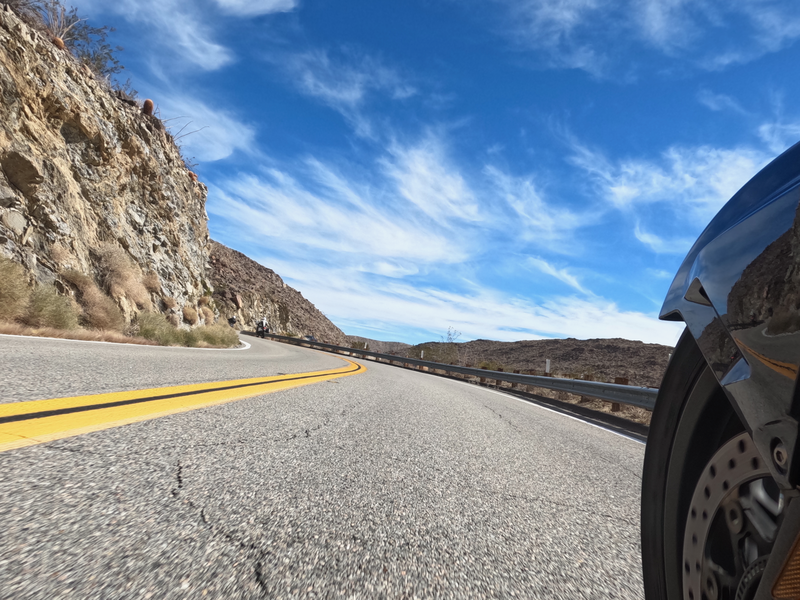
347:Yaqui Pass Road S3 west of Yaqui Pass
152:Yaqui Pass Road S3 west of Yaqui Pass
7:
829:Uploaded own work with UploadWizard
770:
256:
251:
857:
844:California county routes in zone S
352:
346:
242:
238:
146:
129:
75:
900:1/1,094 sec (0.00091407678244973)
351:
1226:Orientation: Horizontal (normal)
1004:Date and time of data generation
674:coordinates of the point of view
337:
292:Under the following conditions:
263:This file is licensed under the
255:
250:
244:
219:
205:
96:
21:
334:
147:
14:
929:472.821 meters above sea level
333:
26:
1:
1169:A directly photographed image
758:original creation by uploader
31:
689:33°8'33.83"N, 116°21'41.40"W
359:Items portrayed in this file
1289:Date and time of digitizing
1265:SceneCaptureType: Landscape
1335:
1151:One-chip color area sensor
996:DCIM\100GOPRO\GOPR1613.JPG
306:same or compatible license
1281:File change date and time
1250:Camera: GoPro_Hero10_8034
1241:Software: H21.01.01.10.00
1064:Meaning of each component
771:
171:
16:
336:
272:
103:This is a file from the
1082:Custom image processing
828:
177:
167:
160:
157:
139:
107:. Information from its
1292:10:50, 22 October 2021
1284:10:50, 22 October 2021
1106:Image compression mode
1007:03:50, 22 October 2021
849:Yaqui Pass, California
225:33.142730; -116.361500
110:description page there
41:Size of this preview:
1307:Horizontal resolution
1238:MeteringMode: Average
1048:Maximum land aperture
1253:Camera: GoPro_Hero10
1093:Digital still camera
69:5,568 × 4,176 pixels
65:2,560 × 1,920 pixels
1315:Vertical resolution
968:Oliver Ratzesberger
957:Oliver Ratzesberger
934:Camera manufacturer
807:22:44, 26 June 2022
518:Oliver Ratzesberger
287:– to adapt the work
182:Oliver Ratzesberger
142:Yaqui Pass Road.png
47:Other resolutions:
1232:Saturation: Normal
1229:WhiteBalance: AUTO
1114:Scene capture type
1027:Auto white balance
525:Wikimedia username
512:author name string
61:1,280 × 960 pixels
57:1,024 × 768 pixels
1322:
1321:
1259:GainControl: None
1256:HDRSetting: S_HDR
1051:2.5 APEX (f/2.38)
890:116° 21′ 41.42″ W
832:
604:copyright license
345:
230:
229:
187:
186:
125:
124:
105:Wikimedia Commons
1326:
1268:AutoRotation: Up
1244:Contrast: Normal
1130:Exposure Program
997:
983:
969:
962:Copyright holder
865:
819:
568:copyright status
549:
544:
534:
529:
519:
516:
328:
325:
322:
319:
316:
308:as the original.
265:Creative Commons
259:
258:
254:
253:
248:
247:
226:
223:
209:
208:
202:
201:
190:
173:
163:
151:
143:
137:
121:
100:
99:
93:
87:
85:
72:
53:640 × 480 pixels
49:320 × 240 pixels
43:800 × 600 pixels
1334:
1333:
1329:
1328:
1327:
1325:
1324:
1323:
1301:H21.01.01.10.00
1262:Knowledge (XXG)
1195:1.0667304896642
995:
982:Yaqui Pass Road
981:
967:
882:33° 8′ 33.84″ N
853:
840:
833:
825:
817:
773:
772:
769:
768:
767:
766:
765:
764:
763:
762:
760:
748:
747:
746:
744:
733:
732:
731:
730:
729:
728:
727:
726:
724:
714:
713:
712:
710:
699:
698:
697:
696:
695:
694:
693:
692:
690:
680:
679:
678:
676:
665:
664:
663:
662:
661:
660:
659:
658:
656:
655:22 October 2021
646:
645:
644:
642:
631:
630:
629:
628:
627:
626:
625:
624:
622:
610:
609:
608:
606:
595:
594:
593:
592:
591:
590:
589:
588:
586:
574:
573:
572:
570:
559:
558:
557:
556:
555:
554:
553:
552:
551:
550:
545:
542:
536:
535:
530:
527:
521:
520:
517:
514:
505:
504:
503:
501:
491:
490:
489:
487:
476:
475:
474:
473:
472:
471:
470:
469:
467:
456:
455:
454:
453:
452:
450:
439:
438:
437:
436:
435:
433:
422:
421:
420:
419:
418:
416:
405:
404:
403:
402:
401:
399:
388:
387:
386:
385:
384:
382:
370:
369:
368:
366:
350:
349:
348:
331:
330:
329:
326:
323:
320:
317:
314:
313:
271:
260:
241:
240:
235:
224:
197:
196:
193:Camera location
188:
162:22 October 2021
153:
141:
134:
127:
126:
115:
114:
113:is shown below.
89:
83:
81:
74:
73:
46:
12:
11:
5:
1332:
1330:
1320:
1319:
1316:
1312:
1311:
1308:
1304:
1303:
1298:
1294:
1293:
1290:
1286:
1285:
1282:
1278:
1277:
1276:
1275:
1272:
1271:Sharpness: MED
1269:
1266:
1263:
1260:
1257:
1254:
1251:
1248:
1245:
1242:
1239:
1236:
1233:
1230:
1227:
1222:
1218:
1217:
1214:
1208:
1207:
1204:
1197:
1196:
1193:
1192:Exposure index
1189:
1188:
1185:
1181:
1180:
1177:
1171:
1170:
1167:
1163:
1162:
1159:
1153:
1152:
1149:
1148:Sensing method
1145:
1144:
1141:
1135:
1134:
1133:Normal program
1131:
1127:
1126:
1123:
1119:
1118:
1115:
1111:
1110:
1107:
1103:
1102:
1099:
1095:
1094:
1091:
1087:
1086:
1085:Normal process
1083:
1079:
1078:
1077:
1076:
1073:
1070:
1065:
1061:
1060:
1057:
1053:
1052:
1049:
1045:
1044:
1041:
1037:
1036:
1033:
1029:
1028:
1025:
1019:
1018:
1015:
1009:
1008:
1005:
1001:
1000:
999:
998:
991:
987:
986:
985:
984:
977:
973:
972:
971:
970:
963:
959:
958:
955:
951:
950:
945:
941:
940:
935:
931:
930:
927:
923:
922:
919:
913:
912:
909:
902:
901:
898:
892:
891:
888:
884:
883:
880:
876:
875:
872:
856:
852:
851:
846:
838:
837:
836:
831:
830:
827:
823:
820:
816:5,568 × 4,176
814:
809:
804:
800:
799:
796:
793:
790:
787:
784:
777:
776:
761:
756:
754:
753:
752:
751:
750:
749:
745:
742:source of file
740:
738:
737:
736:
735:
734:
725:
722:
720:
719:
718:
717:
716:
715:
711:
706:
704:
703:
702:
701:
700:
691:
688:
686:
685:
684:
683:
682:
681:
677:
672:
670:
669:
668:
667:
657:
654:
652:
651:
650:
649:
648:
647:
643:
638:
636:
635:
634:
633:
632:
623:
618:
616:
615:
614:
613:
612:
611:
607:
602:
600:
599:
598:
597:
596:
587:
582:
580:
579:
578:
577:
576:
575:
571:
566:
564:
563:
562:
561:
560:
538:
537:
523:
522:
510:
509:
508:
507:
506:
502:
499:
497:
496:
495:
494:
493:
492:
488:
483:
481:
480:
479:
478:
477:
468:
463:
461:
460:
459:
458:
457:
451:
446:
444:
443:
442:
441:
440:
434:
429:
427:
426:
425:
424:
423:
417:
412:
410:
409:
408:
407:
406:
400:
395:
393:
392:
391:
390:
389:
383:
378:
376:
375:
374:
373:
372:
371:
367:
362:
360:
357:
356:
355:
354:
353:
342:
341:
338:
335:
312:
311:
310:
309:
299:
290:
289:
288:
282:
275:You are free:
262:
261:
243:
237:
236:
234:
231:
228:
227:
217:
211:
194:
185:
184:
179:
175:
174:
169:
165:
164:
159:
155:
154:
144:
135:
133:
130:
128:
123:
122:
101:
91:
90:
40:
36:
35:
34:
29:
24:
19:
13:
10:
9:
6:
4:
3:
2:
1331:
1317:
1314:
1309:
1306:
1302:
1299:
1297:Software used
1296:
1291:
1288:
1283:
1280:
1273:
1270:
1267:
1264:
1261:
1258:
1255:
1252:
1249:
1246:
1243:
1240:
1237:
1234:
1231:
1228:
1225:
1224:
1223:
1220:
1215:
1213:
1210:
1205:
1202:
1199:
1194:
1191:
1186:
1183:
1178:
1176:
1173:
1168:
1165:
1160:
1158:
1157:Metering mode
1155:
1150:
1147:
1142:
1140:
1137:
1132:
1129:
1124:
1122:Scene control
1121:
1116:
1113:
1108:
1105:
1100:
1097:
1092:
1089:
1084:
1081:
1074:
1071:
1068:
1067:
1066:
1063:
1058:
1056:APEX aperture
1055:
1050:
1047:
1042:
1039:
1035:Auto exposure
1034:
1032:Exposure mode
1031:
1026:
1024:
1023:White balance
1021:
1016:
1014:
1011:
1006:
1003:
994:
992:
989:
980:
978:
975:
966:
964:
961:
956:
953:
949:
946:
943:
939:
936:
933:
928:
925:
920:
918:
915:
910:
908:
904:
899:
897:
896:Exposure time
894:
889:
886:
881:
878:
873:
870:
867:
863:
860:
854:
850:
847:
845:
842:
834:
826:
821:
815:
813:
810:
808:
805:
802:
801:
797:
794:
791:
788:
785:
783:
782:
780:
774:
759:
743:
709:
675:
641:
621:
605:
585:
569:
548:
541:
533:
526:
513:
486:
466:
449:
432:
415:
398:
381:
380:Mountain pass
365:
318:CC BY-SA 4.0
307:
303:
300:
297:
294:
293:
291:
286:
283:
280:
277:
276:
274:
273:
269:
266:
249:
232:
222:
218:
216:
215:OpenStreetMap
212:
210:
200:
195:
191:
183:
180:
176:
170:
166:
156:
150:
145:
138:
131:
119:
112:
111:
106:
102:
95:
94:
88:
79:
78:Original file
70:
66:
62:
58:
54:
50:
44:
39:
33:
30:
28:
25:
23:
20:
18:
15:
1098:Light source
1040:Image height
948:HERO10 Black
944:Camera model
907:focal length
861:
858:
778:
775:File history
301:
295:
284:
278:
148:
118:You can help
108:
76:
22:File history
1274:Make: GoPro
1247:ProTune: On
1184:Image width
1090:File source
990:Image title
976:Short title
584:copyrighted
302:share alike
296:attribution
140:Description
1166:Scene type
1013:Saturation
835:File usage
818:(24.54 MB)
792:Dimensions
708:media type
500:some value
465:motorcycle
27:File usage
1318:28.35 dpi
1310:28.35 dpi
1212:Sharpness
1117:Landscape
887:Longitude
869:ISO speed
789:Thumbnail
786:Date/Time
723:image/png
640:inception
233:Licensing
149:English:
84:image/png
1221:Keywords
1187:5,568 px
1139:Contrast
1101:Daylight
1043:4,176 px
926:Altitude
917:F-number
879:Latitude
855:Metadata
340:Captions
285:to remix
279:to share
270:license.
172:Own work
32:Metadata
1203:version
1161:Average
824:Oratzes
803:current
798:Comment
532:Oratzes
485:creator
364:depicts
344:English
132:Summary
80:
1143:Normal
1017:Normal
954:Author
871:rating
431:tarmac
203:
178:Author
168:Source
1175:Flash
1109:0.004
938:GoPro
921:f/2.5
905:Lens
1235:CAMP
1216:Soft
1206:2.21
1201:Exif
1125:None
911:3 mm
795:User
414:rock
397:road
327:true
324:true
158:Date
17:File
1059:2.5
874:100
540:URL
448:sky
1075:Cr
1072:Cb
543::
528::
515::
67:|
63:|
59:|
55:|
51:|
45:.
1069:Y
120:.
86:)
71:.
Text is available under the Creative Commons Attribution-ShareAlike License. Additional terms may apply.
