398:
515:
536:
38:
55:
527:
85:
210:
573:
561:
115:
545:
592:
222:
122:
92:
62:
499:
Ownership of the remaining acres of land were under legal dispute, until they were finally transferred to the
Department of Sports and Recreation and opened to the public as the Isla de Cabras Recreational Park, which is equipped with several gazebos and includes a beach for swimming and fishing.
709:
417:, set the first stone of the official building to house lepers, which was completed in 1883. However, it is believed that the colony was established prior to construction of the building.
514:
397:
54:
704:
694:
544:
84:
535:
168:
439:) next to a church, and the residents of the colony were moved there. However, the original building still stands on Isla de Cabras.
572:
114:
296:
261:
699:
495:
In recent years, the grounds that belonged to Fort
Amezquita were converted into a shooting range and training area by the
37:
496:
464:
311:
304:
560:
479:; two of these guns were mounted in the fort as Battery Reed with the third as a spare. They were on long-range M1917
330:
436:
428:
troops in 1898, management of the building was handed over to the government of the island. According to the 1910
673:
The Bio-political
History of Isla de Cabras Leper Colony and the Problematics of the Memorialization of Suffering
643:
382:
689:
414:
526:
256:
378:
300:
249:
152:
452:
597:
468:
386:
273:
385:
to prevent incoming ships from entering. It also provided defenses for the entrance of the
318:
288:
683:
605:
472:
456:
448:
425:
372:
348:
215:
671:
460:
326:
322:
284:
459:. The fort was initially called the "Cabras Island Military Reservation". During
625:
421:
410:
334:
292:
239:
227:
156:
381:
Bay, Isla de Cabras provided a strategic point for an effective crossfire with
587:
17:
183:
170:
429:
409:
colony was established on the island. On
December 17, 1876, the governor of
484:
480:
476:
551:
406:
396:
467:. In November 1940 the US Army transferred the barrels of three
278:
432:, there were 35 people living on the island at that time.
676:
by
Adriana María Garriga López, Columbia UniversityJuan
435:
In 1926, a leper asylum was built on the main island (
710:
Medical and health organizations based in Puerto Rico
463:
this fort served as a "concrete gun battery" for the
401:
Ruins of the building housing the "lepers", in 2012
255:
245:
235:
199:
162:
148:
143:
377:Due to its strategic location at the entrance of
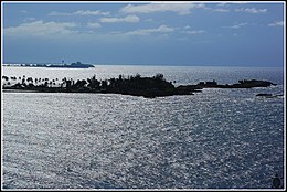
520:Isla de Cabras with El Morro in the background
8:
30:
340:Isla de Cabras is the current location of:
554:at Isla de Cabras Recreational Park (2005)
36:
29:
283:) is an islet located at the entrance of
27:Island peninsula in Toa Baja, Puerto Rico
617:
510:
491:Shooting Range & Recreational Park
121:
91:
61:
325:, the harbor of the historic city of
7:
508:Places and views of Isla de Cabras:
483:carriages and protected by concrete
705:Tourist attractions in Puerto Rico
695:Uninhabited islands of Puerto Rico
405:At the end of the 19th century, a
25:
644:"Parque Nacional Isla de Cabras"
590:
571:
559:
543:
534:
525:
513:
451:built Fort Amezquita (named for
389:on the other side of the islet.
220:
208:
120:
113:
90:
83:
60:
53:
1:
578:Aerial view of Isla de Cabras
465:US Army Coast Artillery Corps
357:A local police firing range.
42:Isla de Cabras from El Morro
455:), a few hundred feet from
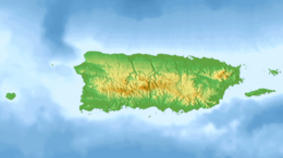
104:Show map of Lesser Antilles
726:
370:
345:Fortín San Juan de la Cruz
287:, immediately across from
383:Fort San Felipe del Morro
204:
47:
35:
303:. The island is home to
184:18.4723639°N 66.136750°W
420:Upon the occupation of
299:of the municipality of
74:Show map of Puerto Rico
443:American Fortification
415:Segundo de la Portilla
402:
189:18.4723639; -66.136750
700:Toa Baja, Puerto Rico
400:
367:Spanish Fortification
134:Show map of Caribbean
648:Discover Puerto Rico
469:12-inch coastal guns
354:A recreational park.
295:. It is part of the
180: /
32:
598:Puerto Rico portal
447:In the 1940s, the
403:
310:, which alongside
453:Juan de Amézqueta
329:, from competing
267:
266:
16:(Redirected from
717:
659:
658:
656:
654:
640:
634:
633:
622:
600:
595:
594:
593:
575:
563:
550:One of the main
547:
538:
529:
517:
347:, also known as
297:Palo Seco barrio
226:
224:
223:
214:
212:
211:
195:
194:
192:
191:
190:
185:
181:
178:
177:
176:
173:
135:
124:
123:
117:
105:
94:
93:
87:
75:
64:
63:
57:
40:
33:
21:
725:
724:
720:
719:
718:
716:
715:
714:
680:
679:
668:
663:
662:
652:
650:
642:
641:
637:
624:
623:
619:
614:
596:
591:
589:
586:
579:
576:
567:
564:
555:
548:
539:
530:
521:
518:
506:
493:
445:
395:
375:
369:
364:
231:
221:
219:
218:
209:
207:
188:
186:
182:
179:
174:
171:
169:
167:
166:
139:
138:
137:
136:
133:
132:
131:
130:
129:
125:
108:
107:
106:
103:
102:
101:
100:
99:
95:
78:
77:
76:
73:
72:
71:
70:
69:
65:
43:
28:
23:
22:
15:
12:
11:
5:
723:
721:
713:
712:
707:
702:
697:
692:
690:Leper colonies
682:
681:
678:
677:
667:
666:External links
664:
661:
660:
635:
616:
615:
613:
610:
609:
608:
602:
601:
585:
582:
581:
580:
577:
570:
568:
566:Isla de Cabras
565:
558:
556:
549:
542:
540:
533:
531:
524:
522:
519:
512:
505:
502:
492:
489:
444:
441:
394:
391:
371:Main article:
368:
365:
363:
360:
359:
358:
355:
352:
319:San Juan Islet
289:San Juan Islet
270:Isla de Cabras
265:
264:
259:
253:
252:
247:
243:
242:
237:
233:
232:
205:
202:
201:
200:Administration
197:
196:
164:
160:
159:
150:
146:
145:
141:
140:
128:Isla de Cabras
127:
126:
119:
118:
112:
111:
110:
109:
98:Isla de Cabras
97:
96:
89:
88:
82:
81:
80:
79:
68:Isla de Cabras
67:
66:
59:
58:
52:
51:
50:
49:
48:
45:
44:
41:
31:Isla de Cabras
26:
24:
18:Fort Amezquita
14:
13:
10:
9:
6:
4:
3:
2:
722:
711:
708:
706:
703:
701:
698:
696:
693:
691:
688:
687:
685:
675:
674:
670:
669:
665:
649:
645:
639:
636:
631:
630:Atlas Obscura
627:
621:
618:
611:
607:
604:
603:
599:
588:
583:
574:
569:
562:
557:
553:
546:
541:
537:
532:
528:
523:
516:
511:
509:
503:
501:
498:
490:
488:
486:
482:
478:
474:
473:Fort Delaware
470:
466:
462:
458:
454:
450:
449:United States
442:
440:
438:
437:Trujillo Alto
433:
431:
427:
423:
418:
416:
412:
408:
399:
392:
390:
388:
387:Bayamón River
384:
380:
374:
366:
361:
356:
353:
350:
346:
343:
342:
341:
338:
336:
332:
328:
324:
320:
316:
314:
309:
307:
302:
298:
294:
290:
286:
282:
280:
275:
271:
263:
260:
258:
254:
251:
248:
244:
241:
238:
234:
230:
229:
217:
216:United States
203:
198:
193:
172:18°28′20.51″N
165:
161:
158:
154:
151:
147:
142:
116:
86:
56:
46:
39:
34:
19:
672:
651:. Retrieved
647:
638:
629:
626:"El Cañuelo"
620:
507:
494:
461:World War II
446:
434:
419:
404:
393:Leper Colony
376:
344:
339:
331:world powers
327:Old San Juan
323:San Juan Bay
321:, protected
312:
305:
285:San Juan Bay
277:
269:
268:
246:Municipality
236:Commonwealth
206:
422:Puerto Rico
411:Puerto Rico
335:Age of Sail
333:during the
293:Puerto Rico
240:Puerto Rico
228:Puerto Rico
187: /
175:66°8′12.3″W
163:Coordinates
157:Puerto Rico
684:Categories
612:References
606:El Cañuelo
457:El Cañuelo
373:El Cañuelo
349:El Cañuelo
306:El Cañuelo
485:casemates
430:US Census
262:Palo Seco
144:Geography
584:See also
497:P.R.P.D.
481:barbette
477:Delaware
426:American
379:San Juan
313:El Morro
301:Toa Baja
250:Toa Baja
153:San Juan
149:Location
653:May 27,
552:gazebos
504:Gallery
362:History
274:Spanish
315:castle
281:island
257:Barrio
225:
213:
471:from
407:leper
155:bay,
655:2022
308:fort
279:goat
276:for
424:by
317:on
291:in
686::
646:.
628:.
487:.
475:,
413:,
337:.
657:.
632:.
351:.
272:(
20:)
Text is available under the Creative Commons Attribution-ShareAlike License. Additional terms may apply.