64:
1071:
88:
118:
148:
726:
49:
155:
125:
95:
741:
In the CDP, the population was spread out, with 24.8% under the age of 18, 2.8% from 18 to 24, 23.2% from 25 to 44, 30.1% from 45 to 64, and 19.1% who were 65 years of age or older. The median age was 45 years. For every 100 females, there were 94.4 males. For every 100 females age 18 and over, there
737:
living together, 5.6% had a female householder with no husband present, and 21.4% were non-families. 17.9% of all households were made up of individuals, and 9.4% had someone living alone who was 65 years of age or older. The average household size was 2.58 and the average family size was 2.94.
690:, there were 12,923 people, 4,974 households, and 3,909 families residing in the CDP. The population density was 2,538.9 inhabitants per square mile (980.3/km). There were 5,050 housing units at an average density of 992.2 per square mile (383.1/km). The racial makeup of the CDP was 92.83%
63:
567:
During the war and after, neighborhoods such as
Waynewood and Snowden began arising in the area around the fort, and the commercial center for the community, Hollin Hall shopping center, was constructed on Fort Hunt Road.
421:, including the neighborhoods of Riverside Gardens, Tauxemont, Herbert Springs, Waynewood, Plymouth Haven, Potomac Valley – River Bend, Collingwood, Stratford Landing, Stratford on the Potomac, Hollin Hall, Wellington,
397:
from naval attack and is now a public park. The area is also notable for its high population of senior citizens and for being one of the first suburbs in wealthy
Fairfax County. The population was 17,231 at the
1766:
628:
Of the family households, 72.6% were married couples, 9.1% were a male householder with no spouse, and 16.8% were a female householder with no spouse. The average family household had 3.09 people.
1781:
745:
The median income for a household in the CDP was $ 102,259, and the median income for a family was $ 111,935. Males had a median income of $ 79,828 versus $ 53,654 for females. The
518:, the Fort Hunt CDP has a total area of 6.3 square miles (16.2 km), of which 5.9 square miles (15.2 km) is land and 0.42 square miles (1.1 km), or 6.59%, is water.
441:
999:
593:
was 2,748.2 inhabitants per square mile (1,061.7/km). The average housing unit density was 982.8 per square mile (379.7/km). The racial makeup of the CDP was 84.01%
631:
The median age was 46.2, 25.6% of people were under the age of 18, and 20.8% were 65 years of age or older. Of the residents the largest ancestry is, 21.6% who had
1771:
1747:
1663:
87:
640:
348:
180:
992:
1776:
1703:
1275:
1100:
663:
495:
437:
1495:
646:
The median income for a household in the CDP was $ 209,135, and the median income for a family was $ 234,343. 15.2% of the population were
48:
1725:
1395:
1355:
1160:
358:
147:
884:
1545:
1420:
1415:
1220:
1110:
414:
985:
458:
117:
1095:
801:
1656:
1205:
707:
695:
610:
598:
977:
908:
699:
602:
1450:
1365:
1175:
232:
425:
and (in ZIP code 22307) Villamay and Marlan Forest. As of the 2010 census, Fort Hunt also includes the neighborhood of
1400:
1330:
912:
776:
711:
614:
515:
1672:
1575:
1405:
1325:
560:
where captive German officers were kept and questioned. Fort Hunt is the site of the death of
Lieutenant Commander
937:
1649:
1470:
1250:
1165:
687:
586:
582:
399:
538:
1550:
1540:
1009:
378:
237:
69:
733:
There were 4,974 households, out of which 33.0% had children under the age of 18 living with them, 71.2% were
859:
662:, including 1.1% of those under age 18 and 2.7% of those age 65 or over, with 1.8% of the population without
1621:
1570:
1360:
1260:
1190:
1140:
1082:
537:
The site of present-day Fort Hunt Park was used as an asset for the United States military beginning in the
374:
39:
1708:
1693:
1608:
1490:
1380:
1340:
1310:
1235:
1195:
1120:
715:
618:
507:
503:
1590:
1585:
1530:
1500:
1460:
1455:
1375:
1345:
1265:
1200:
1150:
1145:
1135:
1125:
526:
1735:
1698:
1628:
1535:
1520:
1515:
1505:
1465:
1390:
1305:
1290:
1255:
1245:
1225:
1210:
1155:
823:
719:
651:
622:
546:
511:
434:
426:
410:
321:
1730:
1683:
1580:
1565:
1485:
1430:
1410:
1370:
1320:
1270:
1230:
1185:
1130:
1090:
828:
703:
691:
606:
594:
1688:
1475:
1445:
1440:
1240:
1215:
1105:
590:
564:, the highest-ranking German officer to be shot while in American captivity during World War II.
499:
422:
725:
1560:
1525:
1480:
1055:
1050:
1031:
746:
632:
589:) there were 17,231 people, 6,162 housing units and 5,874 households residing in the CDP. The
542:
311:
1555:
1385:
1350:
1335:
1300:
1295:
1285:
1280:
1170:
1060:
636:
394:
749:
for the CDP was $ 46,957. About 1.0% of families and 1.8% of the population were below the
1115:
1042:
541:. The fort had been completed on land that used to belong to the River Farm plantation of
413:, composed of much of the most affluent section of southeast Fairfax County, close to the
972:
1315:
958:
938:"Geographic Identifiers: 2010 Demographic Profile Data (G001): Fort Hunt CDP, Virginia"
557:
522:
444:
386:
54:
17:
1760:
655:
487:
418:
390:
1718:
1510:
750:
659:
561:
430:
1024:
553:, but it was not involved in an actual battle during the Spanish–American War.
1600:
220:
1641:
473:
460:
328:
307:
195:
182:
302:
753:, including 1.6% of those under age 18 and 1.5% of those age 65 or over.
734:
556:
During World War II, the fort was used as an interrogation center called
550:
491:
406:
382:
336:
225:
73:
639:
at home, and 8% were born outside the United States, 76.4% of whom were
647:
683:
486:(38.732814, −77.058066). It is bordered to the south and east by the
1070:
973:
A site with pictures and information about Fort Hunt neighborhoods
724:
824:"Coming of Age Part Two: Life in Fort Hunt (washingtonpost.com)"
1645:
981:
1069:
797:
772:
529:, with a history of military activity dating from 1676.
455:
Fort Hunt is located in southeastern
Fairfax County at
1767:
Census-designated places in
Fairfax County, Virginia
885:"2010 CENSUS - CENSUS BLOCK MAP: Fairfax County, VA"
1599:
1429:
1081:
1041:
357:
347:
335:
318:
301:
293:
285:
280:
272:
264:
256:
248:
243:
231:
219:
211:
30:
658:. In the CDP 1.8% of the population was below the
25:Census-designated place in Virginia, United States
433:in 22307. Prominent Fort Hunt residents include
1782:Virginia populated places on the Potomac River
674:The population was 16,045 at the 2010 census.
1748:List of neighborhoods in Alexandria, Virginia
1657:
993:
932:
930:
8:
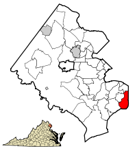
1074:Map of Virginia highlighting Fairfax County
1664:
1650:
1642:
1000:
986:
978:
909:"US Gazetteer files: 2010, 2000, and 1990"
722:of any race were 2.65% of the population.
494:state line. Neighboring Virginia CDPs are
27:
940:. U.S. Census Bureau, American Factfinder
625:of any race was 6.80% of the population.
385:, United States. The area is named after
761:
346:
334:
300:
279:
271:
242:
210:
175:
79:
60:
45:
53:Houses along Fort Hunt Rd., seen from
767:
765:
389:, which was built on the bank of the
356:
317:
292:
284:
263:
255:
247:
230:
218:
7:
1772:Census-designated places in Virginia
854:
852:
850:
848:
846:
714:, and 1.53% from two or more races.
635:, 10.7% spoke a language other than
617:, and 9.05% from two or more races.
260:5.85 sq mi (15.16 km)
252:6.27 sq mi (16.23 km)
268:0.41 sq mi (1.07 km)
1008:Municipalities and communities of
545:. The fort was used to complement
415:George Washington Memorial Parkway
16:For the former military base, see
14:
154:
124:
94:
405:Fort Hunt encompasses the 22308
153:
146:
123:
116:
93:
86:
62:
47:
802:United States Geological Survey
297:2,748.2/sq mi (1,061.7/km)
798:"US Board on Geographic Names"
587:2022 American Community Survey
429:in ZIP code 22306 and much of
1:
167:Show map of the United States
107:Show map of Northern Virginia
1777:Washington metropolitan area
525:, currently operated by the
521:Located within Fort Hunt is
913:United States Census Bureau
777:United States Census Bureau
585:(some information from the
516:United States Census Bureau
1798:
1673:South Alexandria, Virginia
15:
1744:
1679:
1617:
1067:
1022:
860:"Fort Hunt CDP, Virginia"
176:
80:
68:Location of Fort Hunt in
61:
46:
37:
1011:Fairfax County, Virginia
510:to the southwest across
375:census-designated place
40:Census-designated place
1075:
730:
276:33 ft (10 m)
1073:
773:"U.S. Census website"
728:
527:National Park Service
474:38.73278°N 77.05806°W
320: • Summer (
196:38.73278°N 77.05806°W
1630:United States portal
1206:Great Falls Crossing
641:naturalized citizens
549:across the river in
539:Spanish–American War
512:Little Hunting Creek
294: • Density
137:Show map of Virginia
1096:Bailey's Crossroads
915:. February 12, 2011
829:The Washington Post
729:Houses in Fort Hunt
514:. According to the
479:38.73278; -77.05806
470: /
201:38.73278; -77.05806
192: /
32:Fort Hunt, Virginia
1451:Barkers Crossroads
1366:South Falls Church
1076:
804:. October 25, 2007
731:
652:batchelor's degree
591:population density
502:to the northwest,
490:, which forms the
393:in 1897 to defend
286: • Total
265: • Water
249: • Total
1754:
1753:
1639:
1638:
1401:West Falls Church
1331:North Springfield
747:per capita income
742:were 90.6 males.
648:military veterans
543:George Washington
506:to the west, and
368:
367:
257: • Land
1789:
1666:
1659:
1652:
1643:
1631:
1624:
1576:South Alexandria
1406:West Springfield
1326:Newington Forest
1072:
1034:
1027:
1017:
1012:
1002:
995:
988:
979:
961:
956:
950:
949:
947:
945:
934:
925:
924:
922:
920:
905:
899:
898:
896:
894:
889:
881:
875:
874:
872:
870:
856:
841:
840:
838:
836:
820:
814:
813:
811:
809:
794:
788:
787:
785:
783:
769:
708:Pacific Islander
696:African American
664:health insurance
650:, and 79% had a
633:English ancestry
611:Pacific Islander
599:African American
485:
484:
482:
481:
480:
475:
471:
468:
467:
466:
463:
395:Washington, D.C.
325:
207:
206:
204:
203:
202:
197:
193:
190:
189:
188:
185:
168:
157:
156:
150:
138:
127:
126:
120:
108:
97:
96:
90:
66:
51:
28:
1797:
1796:
1792:
1791:
1790:
1788:
1787:
1786:
1757:
1756:
1755:
1750:
1740:
1675:
1670:
1640:
1635:
1629:
1623:Virginia portal
1622:
1613:
1595:
1471:Colchester Hunt
1432:
1425:
1251:Kings Park West
1166:Fairfax Station
1077:
1065:
1037:
1032:
1025:
1018:
1015:
1010:
1006:
969:
964:
957:
953:
943:
941:
936:
935:
928:
918:
916:
907:
906:
902:
892:
890:
887:
883:
882:
878:
868:
866:
864:data.census.gov
858:
857:
844:
834:
832:
822:
821:
817:
807:
805:
796:
795:
791:
781:
779:
771:
770:
763:
759:
735:married couples
700:Native American
680:
672:
603:Native American
579:
574:
547:Fort Washington
535:
478:
476:
472:
469:
464:
461:
459:
457:
456:
453:
343:
319:
200:
198:
194:
191:
186:
183:
181:
179:
178:
172:
171:
170:
169:
166:
165:
164:
163:
162:
158:
141:
140:
139:
136:
135:
134:
133:
132:
128:
111:
110:
109:
106:
105:
104:
103:
102:
98:
76:
57:
42:
33:
26:
21:
12:
11:
5:
1795:
1793:
1785:
1784:
1779:
1774:
1769:
1759:
1758:
1752:
1751:
1745:
1742:
1741:
1739:
1738:
1733:
1728:
1723:
1722:
1721:
1711:
1706:
1701:
1696:
1691:
1686:
1680:
1677:
1676:
1671:
1669:
1668:
1661:
1654:
1646:
1637:
1636:
1634:
1633:
1626:
1618:
1615:
1614:
1612:
1611:
1605:
1603:
1597:
1596:
1594:
1593:
1588:
1583:
1578:
1573:
1568:
1563:
1558:
1553:
1551:Odricks Corner
1548:
1543:
1541:New Alexandria
1538:
1533:
1528:
1523:
1518:
1513:
1508:
1503:
1498:
1493:
1488:
1483:
1478:
1473:
1468:
1463:
1458:
1453:
1448:
1443:
1437:
1435:
1427:
1426:
1424:
1423:
1418:
1413:
1408:
1403:
1398:
1393:
1388:
1383:
1378:
1373:
1368:
1363:
1358:
1353:
1348:
1343:
1338:
1333:
1328:
1323:
1318:
1313:
1308:
1303:
1298:
1293:
1288:
1283:
1278:
1273:
1268:
1263:
1258:
1253:
1248:
1243:
1238:
1233:
1228:
1223:
1218:
1213:
1208:
1203:
1198:
1193:
1188:
1183:
1178:
1173:
1168:
1163:
1158:
1153:
1148:
1143:
1138:
1133:
1128:
1123:
1118:
1113:
1108:
1103:
1098:
1093:
1087:
1085:
1079:
1078:
1068:
1066:
1064:
1063:
1058:
1053:
1047:
1045:
1039:
1038:
1023:
1020:
1019:
1007:
1005:
1004:
997:
990:
982:
976:
975:
968:
967:External links
965:
963:
962:
959:Fort Hunt Park
951:
926:
900:
876:
842:
815:
789:
760:
758:
755:
679:
676:
671:
668:
578:
575:
573:
570:
558:P. O. Box 1142
534:
531:
523:Fort Hunt Park
498:to the north,
452:
449:
445:Bob Livingston
379:Fairfax County
366:
365:
362:
355:
354:
351:
345:
344:
341:
339:
333:
332:
326:
316:
315:
305:
299:
298:
295:
291:
290:
287:
283:
282:
278:
277:
274:
270:
269:
266:
262:
261:
258:
254:
253:
250:
246:
245:
241:
240:
235:
229:
228:
223:
217:
216:
213:
209:
208:
174:
173:
160:
159:
152:
151:
145:
144:
143:
142:
130:
129:
122:
121:
115:
114:
113:
112:
100:
99:
92:
91:
85:
84:
83:
82:
81:
78:
77:
70:Fairfax County
67:
59:
58:
55:Fort Hunt Park
52:
44:
43:
38:
35:
34:
31:
24:
18:Fort Hunt Park
13:
10:
9:
6:
4:
3:
2:
1794:
1783:
1780:
1778:
1775:
1773:
1770:
1768:
1765:
1764:
1762:
1749:
1743:
1737:
1734:
1732:
1729:
1727:
1724:
1720:
1717:
1716:
1715:
1712:
1710:
1707:
1705:
1702:
1700:
1697:
1695:
1692:
1690:
1687:
1685:
1682:
1681:
1678:
1674:
1667:
1662:
1660:
1655:
1653:
1648:
1647:
1644:
1632:
1627:
1625:
1620:
1619:
1616:
1610:
1607:
1606:
1604:
1602:
1601:Ghost town(s)
1598:
1592:
1589:
1587:
1584:
1582:
1579:
1577:
1574:
1572:
1571:Sleepy Hollow
1569:
1567:
1564:
1562:
1559:
1557:
1554:
1552:
1549:
1547:
1544:
1542:
1539:
1537:
1534:
1532:
1529:
1527:
1524:
1522:
1519:
1517:
1514:
1512:
1509:
1507:
1504:
1502:
1499:
1497:
1494:
1492:
1489:
1487:
1484:
1482:
1479:
1477:
1474:
1472:
1469:
1467:
1464:
1462:
1459:
1457:
1454:
1452:
1449:
1447:
1444:
1442:
1439:
1438:
1436:
1434:
1428:
1422:
1419:
1417:
1414:
1412:
1409:
1407:
1404:
1402:
1399:
1397:
1394:
1392:
1389:
1387:
1384:
1382:
1379:
1377:
1374:
1372:
1369:
1367:
1364:
1362:
1361:Seven Corners
1359:
1357:
1354:
1352:
1349:
1347:
1344:
1342:
1339:
1337:
1334:
1332:
1329:
1327:
1324:
1322:
1319:
1317:
1314:
1312:
1309:
1307:
1304:
1302:
1299:
1297:
1294:
1292:
1289:
1287:
1284:
1282:
1279:
1277:
1274:
1272:
1269:
1267:
1264:
1262:
1261:Lake Barcroft
1259:
1257:
1254:
1252:
1249:
1247:
1244:
1242:
1239:
1237:
1234:
1232:
1229:
1227:
1224:
1222:
1219:
1217:
1214:
1212:
1209:
1207:
1204:
1202:
1199:
1197:
1194:
1192:
1191:Franklin Farm
1189:
1187:
1184:
1182:
1179:
1177:
1174:
1172:
1169:
1167:
1164:
1162:
1159:
1157:
1154:
1152:
1149:
1147:
1144:
1142:
1141:Difficult Run
1139:
1137:
1134:
1132:
1129:
1127:
1124:
1122:
1119:
1117:
1114:
1112:
1109:
1107:
1104:
1102:
1099:
1097:
1094:
1092:
1089:
1088:
1086:
1084:
1080:
1062:
1059:
1057:
1054:
1052:
1049:
1048:
1046:
1044:
1040:
1036:
1035:
1028:
1021:
1016:United States
1013:
1003:
998:
996:
991:
989:
984:
983:
980:
974:
971:
970:
966:
960:
955:
952:
939:
933:
931:
927:
914:
910:
904:
901:
886:
880:
877:
865:
861:
855:
853:
851:
849:
847:
843:
831:
830:
825:
819:
816:
803:
799:
793:
790:
778:
774:
768:
766:
762:
756:
754:
752:
748:
743:
739:
736:
727:
723:
721:
717:
713:
710:, 0.49% from
709:
705:
701:
697:
693:
689:
685:
677:
675:
669:
667:
665:
661:
657:
653:
649:
644:
642:
638:
634:
629:
626:
624:
620:
616:
613:, 1.51% from
612:
608:
604:
600:
596:
592:
588:
584:
576:
571:
569:
565:
563:
559:
554:
552:
548:
544:
540:
532:
530:
528:
524:
519:
517:
513:
509:
505:
501:
497:
493:
489:
488:Potomac River
483:
450:
448:
446:
443:
442:House Speaker
439:
436:
432:
428:
424:
420:
419:Potomac River
416:
412:
408:
403:
401:
396:
392:
391:Potomac River
388:
384:
380:
376:
372:
363:
360:
352:
350:
340:
338:
330:
327:
323:
313:
312:Eastern (EST)
309:
306:
304:
296:
288:
275:
267:
259:
251:
239:
236:
234:
227:
224:
222:
215:United States
214:
205:
177:Coordinates:
149:
119:
89:
75:
71:
65:
56:
50:
41:
36:
29:
23:
19:
1719:Hollin Hills
1713:
1709:Mount Vernon
1694:Hybla Valley
1609:Matildaville
1511:Hollin Hills
1491:Farrs Corner
1381:Sully Square
1341:Pimmit Hills
1311:Mount Vernon
1236:Hybla Valley
1196:George Mason
1180:
1176:Fort Belvoir
1121:Burke Centre
1030:
954:
942:. Retrieved
917:. Retrieved
903:
891:. Retrieved
879:
867:. Retrieved
863:
833:. Retrieved
827:
818:
806:. Retrieved
792:
780:. Retrieved
751:poverty line
744:
740:
732:
681:
673:
660:poverty line
645:
630:
627:
580:
572:Demographics
566:
562:Werner Henke
555:
536:
520:
508:Mount Vernon
504:Hybla Valley
454:
435:U.S. Senator
431:Hollin Hills
404:
370:
369:
22:
1704:Belle Haven
1591:West McLean
1586:Westhampton
1531:Lewinsville
1501:Gum Springs
1461:Browns Mill
1456:Blevinstown
1433:communities
1376:Springfield
1346:Ravensworth
1276:Long Branch
1266:Laurel Hill
1201:Great Falls
1151:Dunn Loring
1146:Dranesville
1136:Crosspointe
1126:Centreville
1101:Belle Haven
1026:County seat
869:January 26,
808:January 31,
782:January 31,
712:other races
678:2000 Census
670:2010 Census
615:other races
583:2020 census
577:2020 Census
496:Belle Haven
477: /
440:and former
438:Tim Johnson
400:2020 census
329:UTC−4
308:UTC−5
199: /
1761:Categories
1736:Kingstowne
1699:Huntington
1536:Lewis Park
1521:Jermantown
1516:Hollindale
1506:Hattontown
1496:Five Forks
1466:Colchester
1391:Union Mill
1306:Merrifield
1291:Mason Neck
1256:Kingstowne
1246:Kings Park
1226:Huntington
1211:Greenbriar
1156:Fair Lakes
944:October 4,
757:References
682:As of the
462:38°43′58″N
427:Hollindale
411:Alexandria
361:feature ID
281:Population
184:38°43′58″N
1746:See also
1731:Lincolnia
1726:Rose Hill
1714:Fort Hunt
1684:Franconia
1581:Uniontown
1566:Shady Oak
1486:Doveville
1411:Wolf Trap
1396:Wakefield
1371:South Run
1356:Rose Hill
1321:Newington
1271:Lincolnia
1231:Hutchison
1186:Franconia
1181:Fort Hunt
1161:Fair Oaks
1131:Chantilly
1091:Annandale
919:April 23,
465:77°3′29″W
451:Geography
387:Fort Hunt
377:(CDP) in
371:Fort Hunt
349:FIPS code
303:Time zone
273:Elevation
187:77°3′29″W
161:Fort Hunt
131:Fort Hunt
101:Fort Hunt
1689:Groveton
1546:Oak Hill
1476:Cooktown
1446:Arcturus
1441:Accotink
1421:Woodlawn
1416:Woodburn
1241:Idylwood
1221:Hayfield
1216:Groveton
1111:Bull Run
1106:Braddock
716:Hispanic
706:, 0.05%
702:, 2.56%
698:, 0.17%
694:, 2.37%
619:Hispanic
609:, 0.08%
605:, 3.07%
601:, 0.18%
597:, 2.11%
551:Maryland
500:Groveton
492:Maryland
423:Arcturus
407:ZIP code
383:Virginia
353:51-29136
337:ZIP code
226:Virginia
74:Virginia
1561:Rainbow
1526:Langley
1481:Culmore
1056:Herndon
1051:Clifton
1033:Fairfax
893:June 9,
835:June 9,
637:English
581:At the
533:History
364:1867588
238:Fairfax
212:Country
1556:Pohick
1386:Tysons
1351:Reston
1336:Oakton
1301:McNair
1296:McLean
1286:Mantua
1281:Lorton
1171:Floris
1061:Vienna
720:Latino
684:census
656:higher
623:Latino
289:17,231
233:County
1431:Other
1116:Burke
1043:Towns
888:(PDF)
704:Asian
692:White
607:Asian
595:White
373:is a
342:22308
331:(EDT)
221:State
1316:Navy
1083:CDPs
946:2016
921:2011
895:2016
871:2024
837:2016
810:2008
784:2008
688:2000
417:and
359:GNIS
244:Area
718:or
686:of
654:or
621:or
409:of
322:DST
1763::
1029::
1014:,
929:^
911:.
862:.
845:^
826:.
800:.
775:.
764:^
666:.
643:.
447:.
402:.
381:,
72:,
1665:e
1658:t
1651:v
1001:e
994:t
987:v
948:.
923:.
897:.
873:.
839:.
812:.
786:.
324:)
314:)
310:(
20:.
Text is available under the Creative Commons Attribution-ShareAlike License. Additional terms may apply.