59:
1084:
820:
516:
In the CDP, the population was spread out, with 29.3% under the age of 18, 36.4% from 18 to 24, 33.6% from 25 to 44, 0.6% from 45 to 64, and 0.1% who were 65 years of age or older. The median age was 22 years. For every 100 females, there were 194.5 males. For every 100 females age 18 and over, there
512:
living together, 7.0% had a female householder with no husband present, and 2.1% were non-families. 1.9% of all households were made up of individuals, and 0.3% had someone living alone who was 65 years of age or older. The average household size was 3.79 and the average family size was 3.82.
58:
1257:
1252:
520:
The median income for a household in the CDP was $ 29,225, and the median income for a family was $ 28,952. Males had a median income of $ 17,439 versus $ 17,243 for females. The
1001:
748:
365:, the CDP has a total area of 5.1 square miles (13.1 km), of which 0.01 square miles (0.02 km), or 0.17%, is water. It is 6 miles (10 km) north of
931:
936:
911:
601:
79:
255:
926:
916:
906:
901:
473:
was 613.1/km (1,586.7/mi). There were 1,335 housing units at an average density of 100.9/km (261.1/mi). The racial makeup of the CDP was 60.0%
333:
921:
592:
265:
621:
994:
741:
558:
597:
490:
478:
987:
734:
721:
715:
643:
482:
243:
979:
726:
673:
647:
494:
362:
361:(39.088222, -96.814092). A small portion of the CDP crosses the county line south into Geary County. According to the
311:
135:
437:
422:
407:
304:
111:
587:
508:
There were 1,305 households, out of which 84.9% had children under the age of 18 living with them, 89.0% were
1095:
831:
799:
280:
49:
498:
1222:
959:
804:
780:
366:
1229:
1052:
1011:
966:
758:
703:
697:
537:
502:
288:
284:
228:
144:
140:
64:
1129:
850:
486:
474:
553:
470:
469:
of 2000, there were 8,114 people, 1,305 households, and 1,277 families residing in the CDP. The
452:
1057:
1033:
521:
370:
308:
218:
524:
for the CDP was $ 11,171. About 10.5% of families and 12.5% of the population were below the
1149:
1119:
1068:
617:
1154:
1144:
860:
809:
17:
1164:
1139:
893:
883:
1246:
1114:
1073:
1063:
878:
248:
116:
1103:
549:
525:
1026:
773:
870:
300:
292:
123:
348:
335:
94:
81:
209:
528:, including 16.2% of those under age 18 and none of those age 65 or over.
950:‡This populated place also has portions in an adjacent county or counties
509:
466:
296:
128:
68:
330:
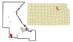
The Fort Riley CDP is located primarily in southern Riley County at
235:
214:
1044:
791:
322:
Historically, the area is more commonly known as "Custer Hill".
1083:
983:
819:
730:
27:
Unincorporated community in Geary and Riley
Counties of Kansas
1082:
818:
669:
307:, the population was 9,230. Fort Riley is part of the
612:
610:
1163:
1128:
1094:
1043:
945:
892:
869:
849:
830:
790:
264:
254:
242:
225:
208:
200:
192:
187:
179:
171:
163:
155:
150:
134:
122:
110:
37:
1258:Census-designated places in Riley County, Kansas
1253:Census-designated places in Geary County, Kansas
995:
742:
618:"Profile of Fort Riley, Kansas (CDP) in 2020"
8:
1002:
988:
980:
749:
735:
727:
644:"US Gazetteer files: 2010, 2000, and 1990"
505:of any race were 13.0% of the population.
380:
34:
704:List of books about Riley County, Kansas
698:List of books about Geary County, Kansas
602:United States Department of the Interior
1087:Map of Kansas highlighting Riley County
823:Map of Kansas highlighting Geary County
570:
369:and 16 miles (26 km) southwest of
253:
241:
207:
186:
178:
149:
109:
74:
55:
624:from the original on November 15, 2021
582:
580:
578:
576:
574:
400:
263:
224:
199:
191:
170:
162:
154:
133:
121:
7:
175:0.008 sq mi (0.02 km)
167:5.03 sq mi (13.04 km)
159:5.05 sq mi (13.07 km)
593:Geographic Names Information System
497:, and 5.2% from two or more races.
1010:Municipalities and communities of
757:Municipalities and communities of
390:
25:
559:Fort Riley-Camp Whiteside, Kansas
57:
620:. United States Census Bureau.
598:United States Geological Survey
1:
312:Metropolitan Statistical Area
32:CDP in Kansas, United States
674:United States Census Bureau
648:United States Census Bureau
536:The community is served by
363:United States Census Bureau
1274:
701:
695:
588:"Fort Riley (CDP), Kansas"
183:1,309 ft (399 m)
1218:
1080:
1024:
955:
816:
771:
451:
436:
421:
406:
399:
394:
389:
386:
204:1,800/sq mi (710/km)
75:
56:
47:
540:public school district.
18:Fort Riley North, Kansas
281:census-designated place
1088:
824:
1086:
822:
670:"U.S. Census website"
453:U.S. Decennial Census
382:Historical population
349:39.08833°N 96.81417°W
227: • Summer (
95:39.08833°N 96.81417°W
1231:United States portal
1013:Riley County, Kansas
968:United States portal
760:Geary County, Kansas
538:Geary County USD 475
299:, on the grounds of
201: • Density
720:Riley County maps:
714:Geary County maps:
650:. February 12, 2011
383:
354:39.08833; -96.81417
345: /
100:39.08833; -96.81417
91: /
1089:
825:
554:Milford State Park
517:were 260.7 males.
471:population density
381:
193: • Total
172: • Water
156: • Total
39:Fort Riley, Kansas
1240:
1239:
977:
976:
522:per capita income
458:
457:
371:Manhattan, Kansas
309:Manhattan, Kansas
274:
273:
164: • Land
16:(Redirected from
1265:
1232:
1225:
1085:
1036:
1029:
1019:
1014:
1004:
997:
990:
981:
969:
962:
821:
783:
776:
766:
761:
751:
744:
737:
728:
685:
684:
682:
680:
666:
660:
659:
657:
655:
640:
634:
633:
631:
629:
614:
605:
604:
584:
491:Pacific Islander
479:African American
402:
397:
392:
384:
360:
359:
357:
356:
355:
350:
346:
343:
342:
341:
338:
291:counties in the
232:
106:
105:
103:
102:
101:
96:
92:
89:
88:
87:
84:
63:Location within
61:
42:Fort Riley North
35:
21:
1273:
1272:
1268:
1267:
1266:
1264:
1263:
1262:
1243:
1242:
1241:
1236:
1230:
1223:
1214:
1159:
1131:
1124:
1090:
1078:
1039:
1034:
1027:
1020:
1017:
1012:
1008:
978:
973:
967:
960:
951:
941:
888:
865:
852:
845:
826:
814:
800:Grandview Plaza
786:
781:
774:
767:
764:
759:
755:
711:
706:
700:
694:
692:Further reading
689:
688:
678:
676:
668:
667:
663:
653:
651:
642:
641:
637:
627:
625:
616:
615:
608:
586:
585:
572:
567:
546:
534:
510:married couples
483:Native American
463:
395:
379:
353:
351:
347:
344:
339:
336:
334:
332:
331:
328:
320:
226:
99:
97:
93:
90:
85:
82:
80:
78:
77:
71:
52:
43:
40:
33:
28:
23:
22:
15:
12:
11:
5:
1271:
1269:
1261:
1260:
1255:
1245:
1244:
1238:
1237:
1235:
1234:
1227:
1219:
1216:
1215:
1213:
1212:
1209:
1206:
1203:
1200:
1197:
1194:
1191:
1188:
1185:
1182:
1179:
1176:
1173:
1169:
1167:
1161:
1160:
1158:
1157:
1152:
1147:
1142:
1136:
1134:
1130:Unincorporated
1126:
1125:
1123:
1122:
1117:
1112:
1106:
1100:
1098:
1092:
1091:
1081:
1079:
1077:
1076:
1071:
1066:
1061:
1055:
1049:
1047:
1041:
1040:
1025:
1022:
1021:
1009:
1007:
1006:
999:
992:
984:
975:
974:
972:
971:
964:
956:
953:
952:
949:
947:
943:
942:
940:
939:
934:
929:
924:
919:
914:
909:
904:
898:
896:
890:
889:
887:
886:
881:
875:
873:
867:
866:
864:
863:
857:
855:
851:Unincorporated
847:
846:
844:
843:
836:
834:
828:
827:
817:
815:
813:
812:
807:
802:
796:
794:
788:
787:
772:
769:
768:
756:
754:
753:
746:
739:
731:
725:
724:
718:
710:
709:External links
707:
693:
690:
687:
686:
661:
635:
606:
569:
568:
566:
563:
562:
561:
556:
545:
542:
533:
530:
462:
459:
456:
455:
449:
448:
445:
443:
440:
434:
433:
430:
428:
425:
419:
418:
415:
413:
410:
404:
403:
398:
393:
388:
378:
375:
327:
324:
319:
316:
272:
271:
268:
262:
261:
258:
252:
251:
246:
240:
239:
233:
223:
222:
212:
206:
205:
202:
198:
197:
194:
190:
189:
185:
184:
181:
177:
176:
173:
169:
168:
165:
161:
160:
157:
153:
152:
148:
147:
138:
132:
131:
126:
120:
119:
114:
108:
107:
73:
72:
62:
54:
53:
48:
45:
44:
41:
38:
31:
26:
24:
14:
13:
10:
9:
6:
4:
3:
2:
1270:
1259:
1256:
1254:
1251:
1250:
1248:
1233:
1228:
1226:
1224:Kansas portal
1221:
1220:
1217:
1210:
1207:
1204:
1201:
1198:
1195:
1192:
1189:
1186:
1183:
1180:
1177:
1174:
1171:
1170:
1168:
1166:
1162:
1156:
1153:
1151:
1148:
1146:
1143:
1141:
1138:
1137:
1135:
1133:
1127:
1121:
1118:
1116:
1113:
1110:
1107:
1105:
1102:
1101:
1099:
1097:
1093:
1075:
1072:
1070:
1067:
1065:
1062:
1059:
1056:
1054:
1051:
1050:
1048:
1046:
1042:
1038:
1037:
1030:
1023:
1018:United States
1015:
1005:
1000:
998:
993:
991:
986:
985:
982:
970:
965:
963:
961:Kansas portal
958:
957:
954:
948:
944:
938:
935:
933:
930:
928:
925:
923:
920:
918:
915:
913:
910:
908:
905:
903:
900:
899:
897:
895:
891:
885:
882:
880:
877:
876:
874:
872:
868:
862:
859:
858:
856:
854:
848:
841:
838:
837:
835:
833:
829:
811:
808:
806:
805:Junction City
803:
801:
798:
797:
795:
793:
789:
785:
784:
782:Junction City
777:
770:
765:United States
762:
752:
747:
745:
740:
738:
733:
732:
729:
723:
719:
717:
713:
712:
708:
705:
699:
691:
675:
671:
665:
662:
649:
645:
639:
636:
623:
619:
613:
611:
607:
603:
599:
595:
594:
589:
583:
581:
579:
577:
575:
571:
564:
560:
557:
555:
551:
548:
547:
543:
541:
539:
531:
529:
527:
523:
518:
514:
511:
506:
504:
500:
496:
492:
488:
484:
480:
476:
472:
468:
460:
454:
450:
446:
444:
441:
439:
435:
431:
429:
426:
424:
420:
416:
414:
411:
409:
405:
385:
376:
374:
372:
368:
367:Junction City
364:
358:
325:
323:
317:
315:
313:
310:
306:
303:. As of the
302:
298:
294:
290:
286:
282:
278:
269:
267:
259:
257:
250:
247:
245:
237:
234:
230:
220:
216:
213:
211:
203:
195:
182:
174:
166:
158:
146:
142:
139:
137:
130:
127:
125:
118:
117:United States
115:
113:
104:
76:Coordinates:
70:
66:
60:
51:
46:
36:
30:
19:
1108:
1053:Leonardville
1032:
839:
779:
677:. Retrieved
664:
652:. Retrieved
638:
628:November 15,
626:. Retrieved
591:
550:Milford Lake
535:
526:poverty line
519:
515:
507:
493:, 6.3% from
464:
377:Demographics
329:
321:
276:
275:
65:Riley County
29:
1205:Swede Creek
1181:Fancy Creek
1132:communities
1028:County seat
871:Ghost towns
853:communities
775:County seat
679:January 31,
495:other races
461:2000 census
352: /
305:2020 census
98: /
1247:Categories
1109:Fort Riley
932:Smoky Hill
840:Fort Riley
702:See also:
696:See also:
565:References
465:As of the
340:96°48′51″W
301:Fort Riley
293:U.S. state
277:Fort Riley
188:Population
86:96°48′51″W
1193:Manhattan
1165:Townships
1058:Manhattan
1035:Manhattan
946:Footnotes
937:Wingfield
912:Jefferson
894:Townships
654:April 23,
532:Education
337:39°5′18″N
326:Geography
283:(CDP) in
260:20-23975
256:FIPS code
244:Area code
210:Time zone
180:Elevation
83:39°5′18″N
1211:Zeandale
1150:Walsburg
1120:Zeandale
1069:Randolph
622:Archived
544:See also
499:Hispanic
477:, 24.6%
270:2393004
136:Counties
1208:Wildcat
1202:Sherman
1196:May Day
1190:Madison
1187:Jackson
1172:Ashland
1155:Winkler
1145:May Day
927:Milford
917:Liberty
907:Jackson
902:Blakely
861:Wreford
810:Milford
722:Current
716:Current
489:, 0.6%
485:, 2.1%
481:, 1.2%
318:History
266:GNIS ID
112:Country
1178:Center
1140:Lasita
1045:Cities
884:Pawnee
792:Cities
503:Latino
467:census
387:Census
297:Kansas
129:Kansas
69:Kansas
1199:Ogden
1184:Grant
1115:Keats
1074:Riley
1064:Ogden
879:Alida
487:Asian
475:White
447:18.9%
442:9,230
432:−4.4%
427:7,761
412:8,114
289:Riley
285:Geary
279:is a
238:(CDT)
236:UTC-5
215:UTC-6
196:9,230
145:Geary
141:Riley
124:State
1175:Bala
1104:Bala
1096:CDPs
922:Lyon
681:2008
656:2011
630:2021
552:and
438:2020
423:2010
408:2000
396:Note
391:Pop.
287:and
151:Area
67:and
832:CDP
501:or
295:of
249:785
229:DST
219:CST
50:CDP
1249::
1031::
1016:,
778::
763:,
672:.
646:.
609:^
600:,
596:,
590:,
573:^
401:%±
373:.
314:.
143:,
1111:‡
1060:‡
1003:e
996:t
989:v
842:‡
750:e
743:t
736:v
683:.
658:.
632:.
417:—
231:)
221:)
217:(
20:)
Text is available under the Creative Commons Attribution-ShareAlike License. Additional terms may apply.