908:
54:
42:
532:
564:
552:
542:
360:
The township is governed by a three-member board of trustees, who are elected in
November of odd-numbered years to a four-year term beginning on the following January 1. Two are elected in the year after the presidential election and one is elected in the year before it. There is also an elected
361:
township fiscal officer, who serves a four-year term beginning on April 1 of the year after the election, which is held in
November of the year before the presidential election. Vacancies in the fiscal officership or on the board of trustees are filled by the remaining trustees.
67:
846:
713:
318:
1196:
1021:
334:
225:
1016:
53:
981:
300:
1006:
1001:
996:
306:
282:
986:
971:
382:
294:
235:
41:
1026:
1011:
344:
line, is located in the township. Michigan once considered the northern part of Ohio, a difference of about eight miles known as the
839:
200:
1079:
616:
594:
799:
780:
475:
447:
387:
694:
832:
399:
345:
824:
976:
670:
642:
288:
710:
663:
348:, as its own. Ohio and Michigan came to blows in an 1835-1836 confrontation between the state militias known as the
1201:
263:
121:
99:
1036:
555:
545:
1173:
312:
210:
1166:
1064:
856:
567:
515:
341:
255:
126:
467:
439:
267:
1049:
753:
741:
1074:
425:
803:
784:
717:
698:
375:
720:
by David Swain, from the
January 2014 issue, AnnArborObserver.com Retrieved 29 March 2016
1110:
963:
947:
927:
919:
443:
407:
251:
32:
1190:
1120:
1115:
952:
937:
897:
878:
535:
526:
Ohio
Turnpike Exit 25 intersects Ohio State Route 66 that runs through the township.
419:
413:
1099:
1089:
1084:
1054:
796:
777:
1143:
1130:
1104:
1094:
942:
932:
889:
871:
511:
471:
266:
found 695 people in the township. The
Township Hall is located at the hamlet of
765:
470:, which is served by UTO (United Telephone Company of Ohio,) doing business as
278:
Located in the western part of the county, it borders the following townships:
1138:
691:
349:
109:
82:
69:
191:
531:
1157:‡This populated place also has portions in an adjacent county or counties
1044:
374:
Students from the township are served by the following public local
737:
733:
729:
217:
196:
819:
617:"Franklin township, Fulton County, Ohio - Census Bureau Profile"
466:
A smaller eastern portion of the township is within the
Wauseon
259:
114:
828:
907:
906:
590:
352:
over the location of the state line between the two states.
692:
Ohio-Michigan
Rivalry Began With A Border Dispute In 1835
638:
340:
Part of the "Old State Line," originally surveyed as the
325:
No municipalities are located in
Franklin Township.
1152:
1129:
1063:
1035:
962:
918:
888:
398:Mail is delivered in the township by the following
234:
224:
207:
190:
182:
174:
169:
161:
153:
145:
137:
132:
120:
108:
98:
23:
701:themirrornewspaper.com Retrieved 29 March 2016
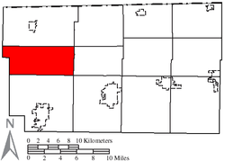
58:Location of Franklin Township in Fulton County
840:
474:, with telephone numbers using the following
446:, with telephone numbers using the following
438:Most of the township lies within the Fayette
8:
847:
833:
825:
20:
756:GreatSchools.org. Retrieved 29 March 2016
579:
223:
189:
168:
160:
131:
97:
62:
50:
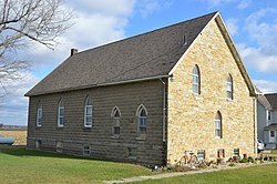
46:Former Ambrose Baptist Church on Road L
38:
911:Map of Ohio highlighting Fulton County
518:serves the township with electricity.
25:Franklin Township, Fulton County, Ohio
585:
583:
233:
206:
181:
173:
152:
144:
136:
119:
107:
7:
797:PUCO: Electric Service Areas of Ohio
319:Mill Creek Township, Williams County
778:PUCO: Ohio Telephone Exchange Areas
383:Archbold Area Local School District
149:28.7 sq mi (74.5 km)
141:28.8 sq mi (74.6 km)
855:Municipalities and communities of
14:
157:0.1 sq mi (0.2 km)
1197:Townships in Fulton County, Ohio
562:
550:
540:
530:
52:
40:
595:United States Geological Survey
313:Brady Township, Williams County
18:Township in Ohio, United States
591:"US Board on Geographic Names"
1:
754:School District Boundary Maps
619:. United States Census Bureau
388:Fayette Local School District
335:Franklin Townships statewide
711:Take Back the Toledo Strip!
671:United States Census Bureau
643:United States Census Bureau
1218:
1162:
904:
869:
63:
51:
39:
30:
333:It is one of twenty-one
165:725 ft (221 m)
912:
766:Zip Map: Fulton County
664:"Detailed map of Ohio"
262:, United States. The
186:24/sq mi (9.3/km)
910:
744:. Accessed 4/30/2009.
639:"U.S. Census website"
442:, which is served by
289:Chesterfield Township
250:is one of the twelve
209: • Summer (
83:41.61472°N 84.31250°W
1175:United States portal
183: • Density
858:Fulton County, Ohio
514:and Midwest Energy
88:41.61472; -84.31250
79: /
913:
802:2016-04-06 at the
783:2016-04-07 at the
716:2016-04-12 at the
697:2016-04-10 at the
597:. October 25, 2007
468:telephone exchange
440:telephone exchange
303:- southeast corner
291:- northeast corner
175: • Total
154: • Water
138: • Total
1202:Townships in Ohio
1184:
1183:
742:Ohio Revised Code
248:Franklin Township
245:
244:
146: • Land
1209:
1176:
1169:
909:
881:
874:
864:
859:
849:
842:
835:
826:
807:
794:
788:
775:
769:
763:
757:
751:
745:
727:
721:
708:
702:
689:
683:
682:
680:
678:
668:
660:
654:
653:
651:
649:
635:
629:
628:
626:
624:
613:
607:
606:
604:
602:
587:
566:
565:
554:
553:
544:
543:
534:
426:West Unity, Ohio
400:U.S. Post Office
376:school districts
329:Name and history
301:Clinton Township
214:
94:
93:
91:
90:
89:
84:
80:
77:
76:
75:
72:
56:
44:
21:
1217:
1216:
1212:
1211:
1210:
1208:
1207:
1206:
1187:
1186:
1185:
1180:
1174:
1167:
1158:
1148:
1125:
1066:
1059:
1031:
958:
914:
902:
884:
879:
872:
865:
862:
857:
853:
816:
811:
810:
804:Wayback Machine
795:
791:
785:Wayback Machine
776:
772:
764:
760:
752:
748:
728:
724:
718:Wayback Machine
709:
705:
699:Wayback Machine
690:
686:
676:
674:
666:
662:
661:
657:
647:
645:
637:
636:
632:
622:
620:
615:
614:
610:
600:
598:
589:
588:
581:
576:
563:
551:
541:
524:
509:
504:
464:
436:
431:
396:
372:
367:
365:Public services
358:
331:
307:German Township
283:Gorham Township
276:
208:
87:
85:
81:
78:
73:
70:
68:
66:
65:
59:
47:
35:
26:
19:
12:
11:
5:
1215:
1213:
1205:
1204:
1199:
1189:
1188:
1182:
1181:
1179:
1178:
1171:
1163:
1160:
1159:
1156:
1154:
1150:
1149:
1147:
1146:
1141:
1135:
1133:
1127:
1126:
1124:
1123:
1118:
1113:
1108:
1102:
1097:
1092:
1087:
1082:
1077:
1071:
1069:
1061:
1060:
1058:
1057:
1052:
1047:
1041:
1039:
1033:
1032:
1030:
1029:
1024:
1019:
1014:
1009:
1004:
999:
994:
989:
984:
979:
974:
968:
966:
960:
959:
957:
956:
950:
945:
940:
935:
930:
924:
922:
916:
915:
905:
903:
901:
900:
894:
892:
886:
885:
870:
867:
866:
854:
852:
851:
844:
837:
829:
823:
822:
820:County website
815:
814:External links
812:
809:
808:
789:
770:
758:
746:
722:
703:
684:
655:
630:
608:
578:
577:
575:
572:
571:
570:
560:
559:
558:
548:
523:
520:
508:
505:
503:
502:
499:
496:
493:
490:
487:
484:
480:
476:Numbering Plan
463:
462:
459:
456:
452:
448:Numbering Plan
444:Frontier North
435:
432:
430:
429:
423:
417:
411:
408:Archbold, Ohio
404:
395:
392:
391:
390:
385:
371:
370:Public Schools
368:
366:
363:
357:
354:
330:
327:
323:
322:
316:
310:
304:
298:
295:Dover Township
292:
286:
275:
272:
243:
242:
239:
232:
231:
228:
222:
221:
215:
205:
204:
194:
188:
187:
184:
180:
179:
176:
172:
171:
167:
166:
163:
159:
158:
155:
151:
150:
147:
143:
142:
139:
135:
134:
130:
129:
124:
118:
117:
112:
106:
105:
102:
96:
95:
61:
60:
57:
49:
48:
45:
37:
36:
31:
28:
27:
24:
17:
13:
10:
9:
6:
4:
3:
2:
1214:
1203:
1200:
1198:
1195:
1194:
1192:
1177:
1172:
1170:
1165:
1164:
1161:
1155:
1151:
1145:
1142:
1140:
1137:
1136:
1134:
1132:
1128:
1122:
1119:
1117:
1114:
1112:
1109:
1106:
1103:
1101:
1098:
1096:
1093:
1091:
1088:
1086:
1083:
1081:
1078:
1076:
1073:
1072:
1070:
1068:
1062:
1056:
1053:
1051:
1048:
1046:
1043:
1042:
1040:
1038:
1034:
1028:
1025:
1023:
1020:
1018:
1015:
1013:
1010:
1008:
1005:
1003:
1000:
998:
995:
993:
990:
988:
985:
983:
980:
978:
975:
973:
970:
969:
967:
965:
961:
954:
951:
949:
946:
944:
941:
939:
936:
934:
931:
929:
926:
925:
923:
921:
917:
899:
896:
895:
893:
891:
887:
883:
882:
875:
868:
863:United States
860:
850:
845:
843:
838:
836:
831:
830:
827:
821:
818:
817:
813:
805:
801:
798:
793:
790:
786:
782:
779:
774:
771:
767:
762:
759:
755:
750:
747:
743:
739:
735:
731:
726:
723:
719:
715:
712:
707:
704:
700:
696:
693:
688:
685:
672:
665:
659:
656:
644:
640:
634:
631:
618:
612:
609:
596:
592:
586:
584:
580:
573:
569:
561:
557:
549:
547:
539:
538:
537:
536:Ohio Turnpike
533:
529:
528:
527:
521:
519:
517:
513:
512:Toledo Edison
506:
500:
497:
494:
491:
488:
485:
482:
481:
479:
477:
473:
469:
460:
457:
454:
453:
451:
449:
445:
441:
433:
427:
424:
421:
420:Wauseon, Ohio
418:
415:
414:Fayette, Ohio
412:
409:
406:
405:
403:
401:
393:
389:
386:
384:
381:
380:
379:
377:
369:
364:
362:
355:
353:
351:
347:
343:
338:
336:
328:
326:
320:
317:
314:
311:
308:
305:
302:
299:
296:
293:
290:
287:
284:
281:
280:
279:
273:
271:
269:
265:
261:
257:
256:Fulton County
253:
249:
240:
237:
229:
227:
219:
216:
212:
202:
201:Eastern (EST)
198:
195:
193:
185:
177:
164:
156:
148:
140:
128:
125:
123:
116:
113:
111:
104:United States
103:
101:
92:
64:Coordinates:
55:
43:
34:
29:
22:
16:
991:
977:Chesterfield
877:
792:
773:
761:
749:
725:
706:
687:
677:February 16,
675:. Retrieved
658:
646:. Retrieved
633:
621:. Retrieved
611:
599:. Retrieved
525:
510:
465:
437:
397:
373:
359:
346:Toledo Strip
339:
332:
324:
277:
247:
246:
15:
1168:Ohio portal
1131:Ghost towns
1067:communities
1050:Pettisville
873:County seat
648:January 31,
601:January 31,
516:Cooperative
472:CenturyLink
402:locations:
321:- northwest
264:2020 census
86: /
1191:Categories
1080:Burlington
1075:Assumption
1022:Swan Creek
768:ZipMap.net
574:References
568:SR 66
356:Government
350:Toledo War
238:feature ID
170:Population
74:84°18′45″W
71:41°36′53″N
1153:Footnotes
964:Townships
434:Telephone
342:Ordinance
274:Geography
252:townships
226:FIPS code
192:Time zone
162:Elevation
1111:Oakshade
1017:Royalton
992:Franklin
948:Metamora
928:Archbold
920:Villages
806:puco.gov
800:Archived
787:puco.gov
781:Archived
714:Archived
695:Archived
522:Highways
507:Electric
230:39-28294
33:Township
1121:Winameg
1116:Ottokee
982:Clinton
953:Swanton
938:Fayette
898:Wauseon
880:Wauseon
740:of the
738:§507.01
734:§505.01
730:§503.24
623:July 2,
501:419-590
498:419-583
495:419-404
492:419-388
489:419-337
486:419-335
483:419-330
478:Codes:
461:567-404
458:419-500
455:419-237
450:Codes:
309:- south
285:- north
241:1086124
100:Country
1100:Lytton
1090:Elmira
1085:Denson
1055:Tedrow
1007:Gorham
1002:German
997:Fulton
736:, and
673:. 2000
315:- west
297:- east
127:Fulton
122:County
1144:Emery
1105:Naomi
1095:Inlet
1065:Other
987:Dover
972:Amboy
943:Lyons
933:Delta
667:(PDF)
428:43570
422:43567
416:43521
410:43502
220:(EDT)
218:UTC-4
197:UTC-5
110:State
1139:Beta
1037:CDPs
1027:York
1012:Pike
890:City
679:2007
650:2008
625:2023
603:2008
556:I-90
546:I-80
394:Mail
268:Zone
260:Ohio
236:GNIS
133:Area
115:Ohio
254:of
211:DST
178:695
1193::
1045:Ai
876::
861:,
732:,
669:.
641:.
593:.
582:^
378::
337:.
270:.
258:,
1107:‡
955:‡
848:e
841:t
834:v
681:.
652:.
627:.
605:.
213:)
203:)
199:(
Text is available under the Creative Commons Attribution-ShareAlike License. Additional terms may apply.